Academic Profile
Statistics
Similar Authors
Papers on arXiv
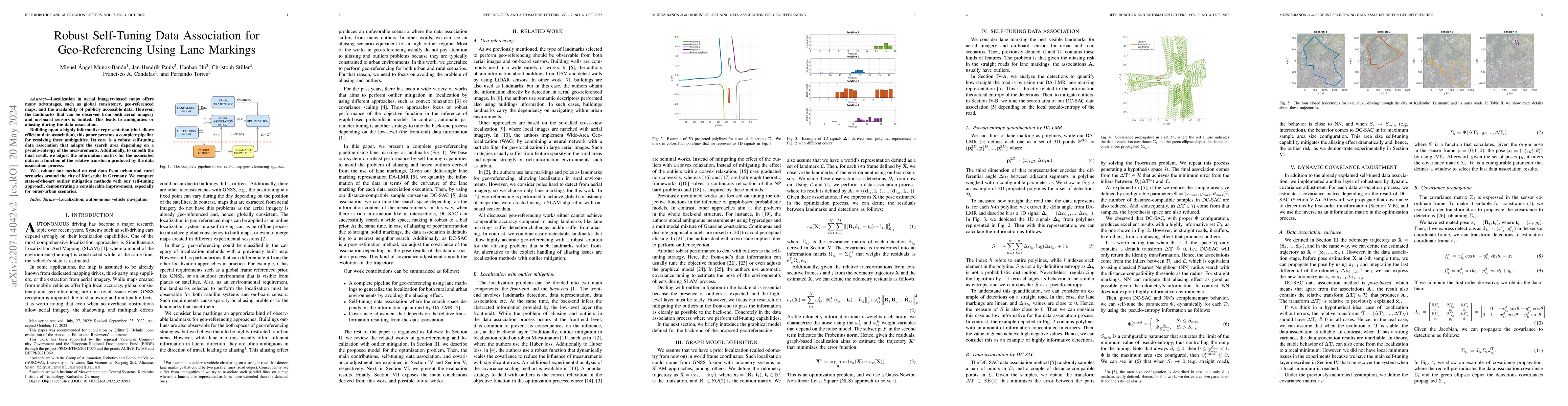
Localization in aerial imagery-based maps offers many advantages, such as global consistency, geo-referenced maps, and the availability of publicly accessible data. However, the landmarks that can b...
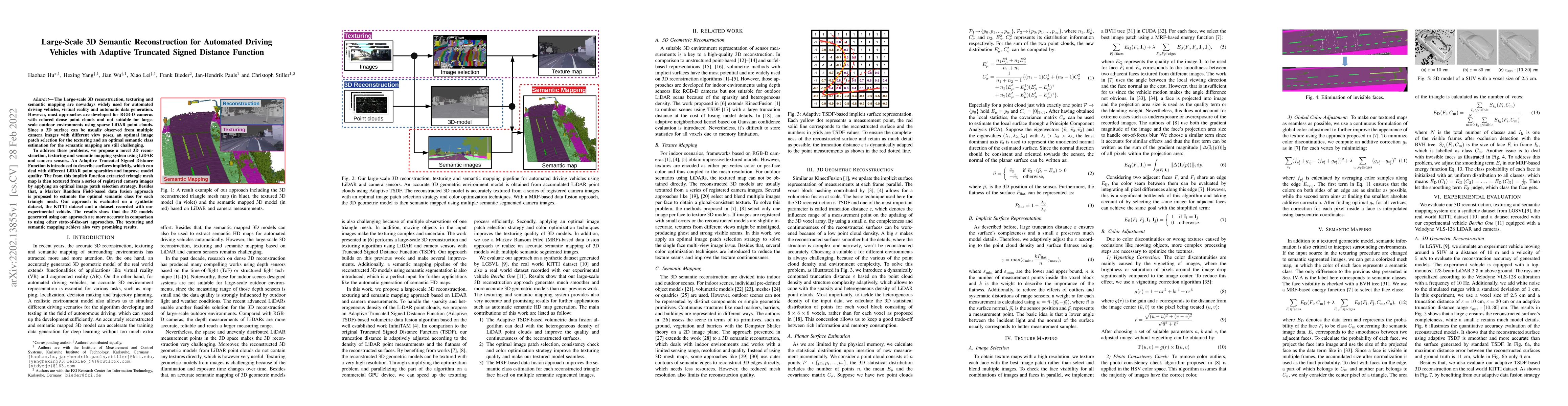
The Large-scale 3D reconstruction, texturing and semantic mapping are nowadays widely used for automated driving vehicles, virtual reality and automatic data generation. However, most approaches are...
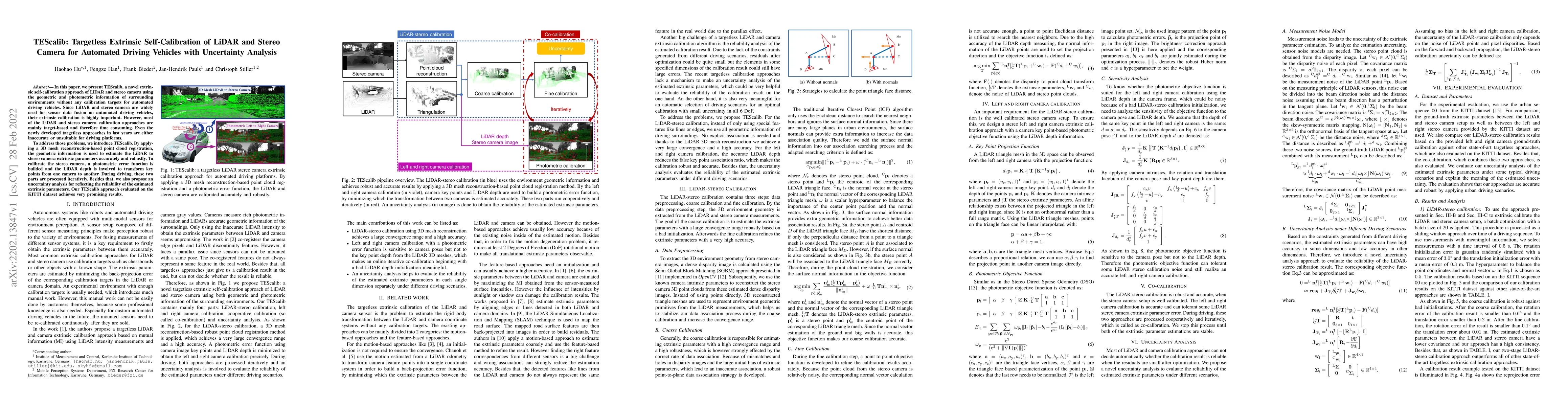
In this paper, we present TEScalib, a novel extrinsic self-calibration approach of LiDAR and stereo camera using the geometric and photometric information of surrounding environments without any cal...
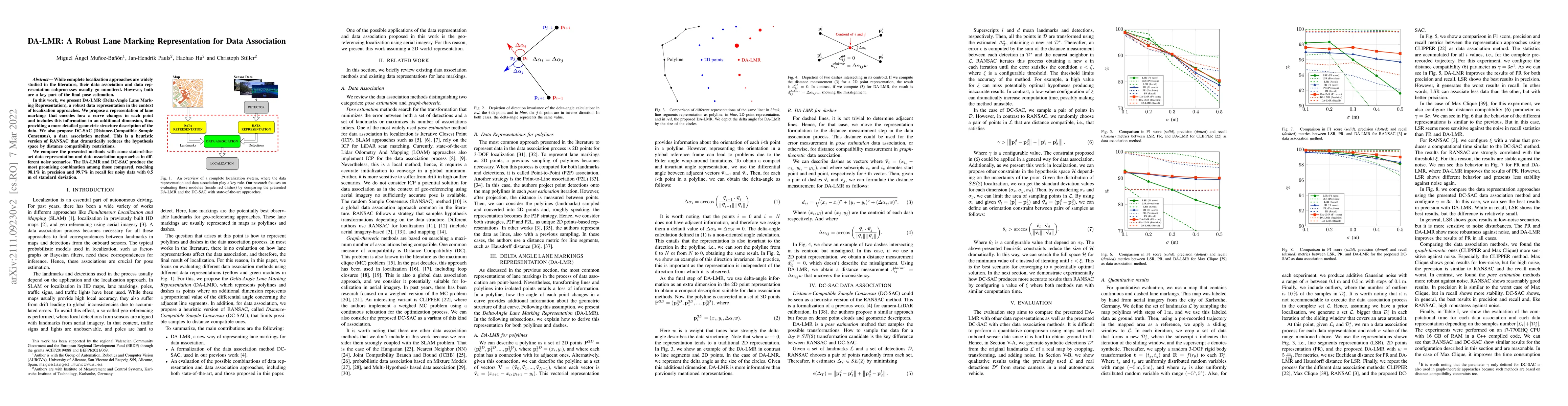
While complete localization approaches are widely studied in the literature, their data association and data representation subprocesses usually go unnoticed. However, both are a key part of the fin...
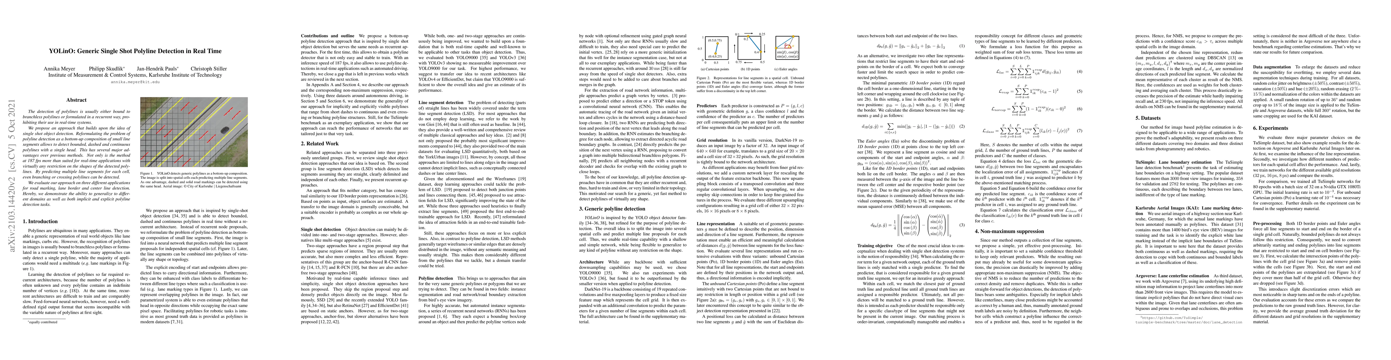
The detection of polylines is usually either bound to branchless polylines or formulated in a recurrent way, prohibiting their use in real-time systems. We propose an approach that builds upon the...
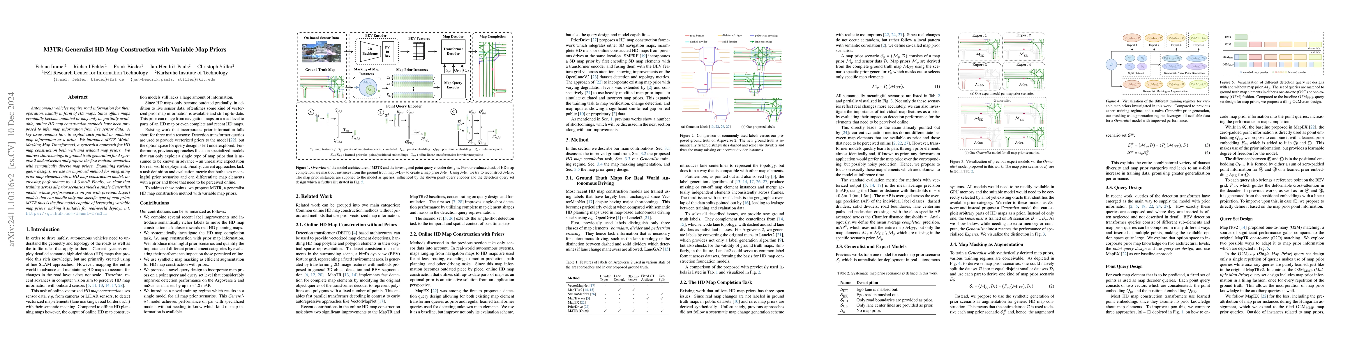
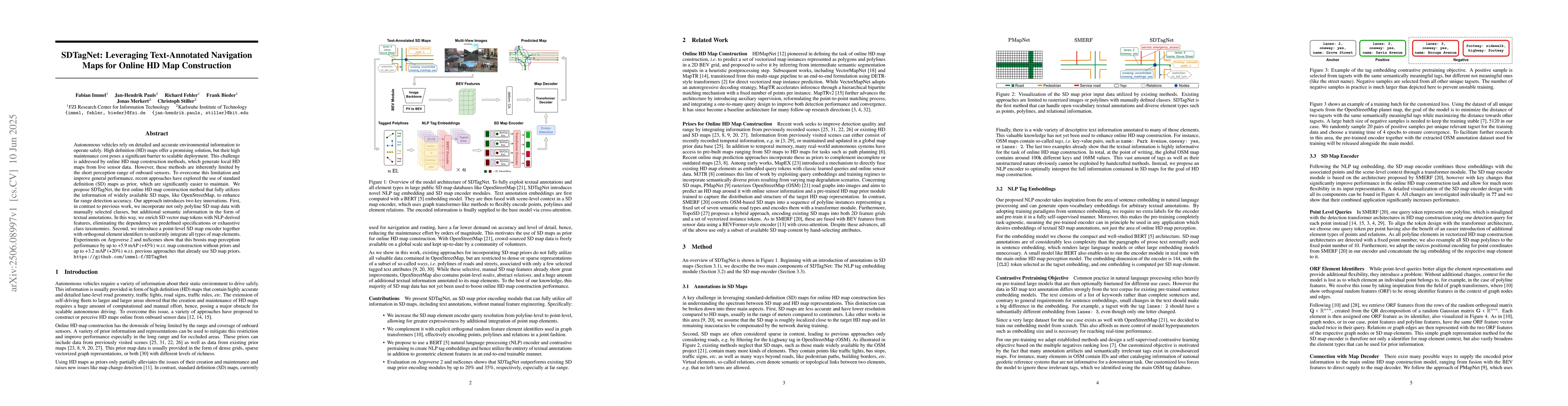
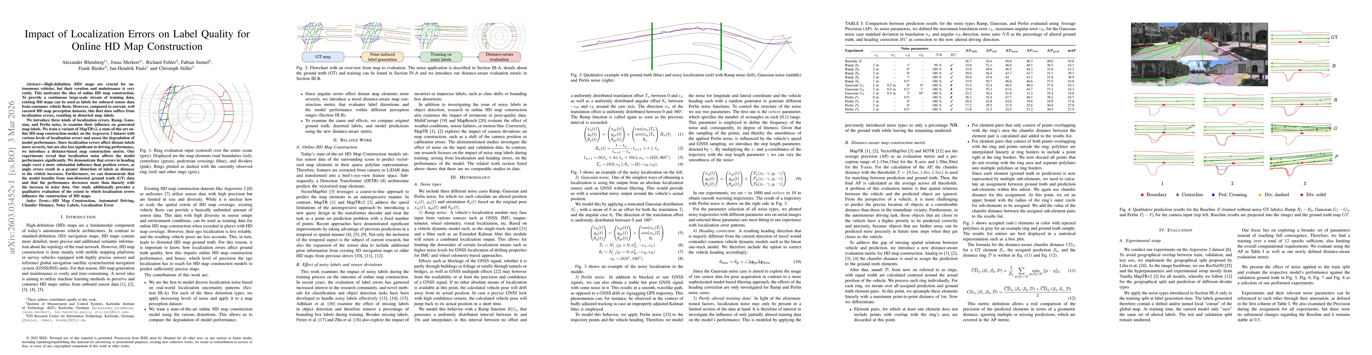
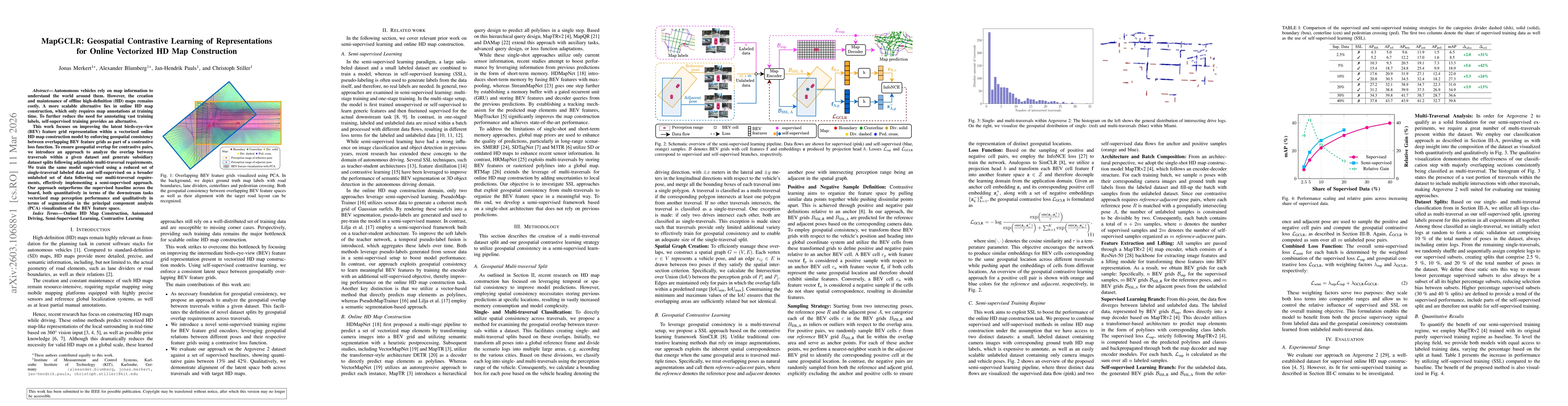
Autonomous vehicles require road information for their operation, usually in form of HD maps. Since offline maps eventually become outdated or may only be partially available, online HD map constructi...
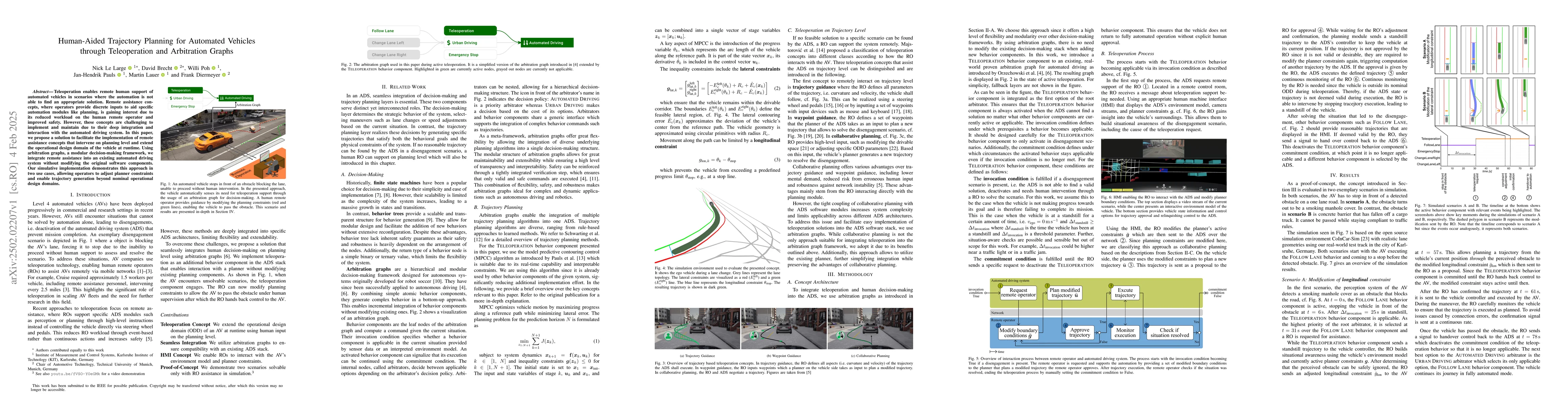
Teleoperation enables remote human support of automated vehicles in scenarios where the automation is not able to find an appropriate solution. Remote assistance concepts, where operators provide disc...
Autonomous vehicles rely on detailed and accurate environmental information to operate safely. High definition (HD) maps offer a promising solution, but their high maintenance cost poses a significant...
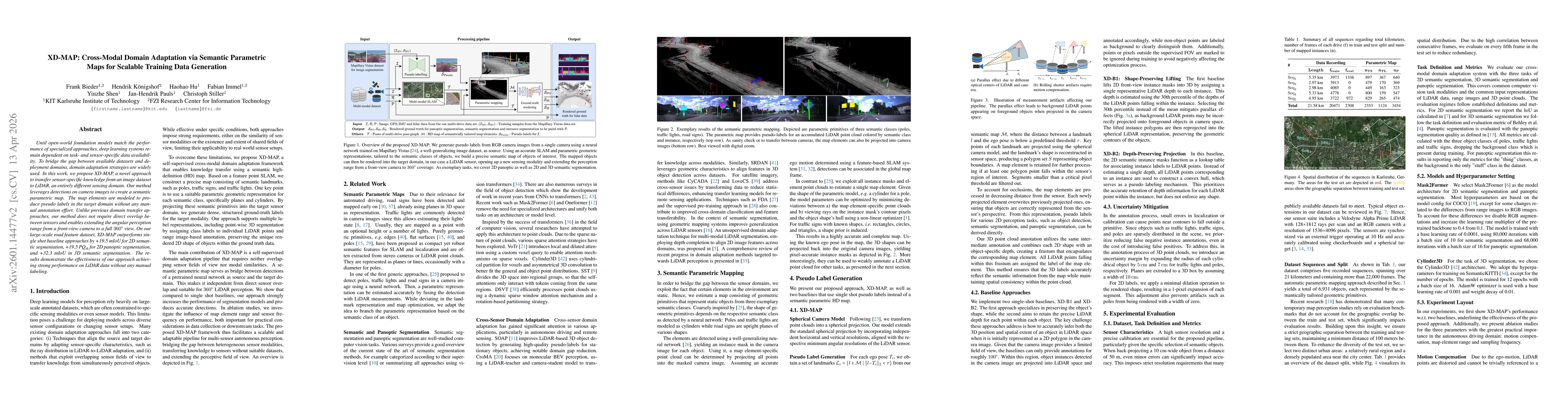
Until open-world foundation models match the performance of specialized approaches, the effectiveness of deep learning models remains heavily dependent on dataset availability. Training data must alig...
High-definition (HD) maps are crucial for autonomous vehicles, but their creation and maintenance is very costly. This motivates the idea of online HD map construction. To provide a continuous large-s...
Autonomous vehicles rely on map information to understand the world around them. However, the creation and maintenance of offline high-definition (HD) maps remains costly. A more scalable alternative ...
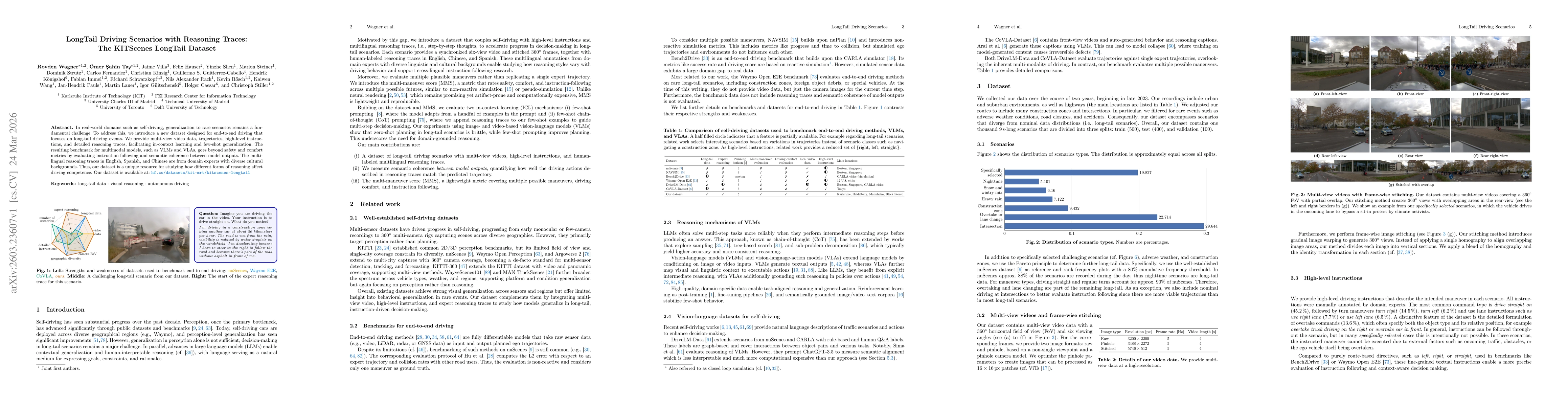
In real-world domains such as self-driving, generalization to rare scenarios remains a fundamental challenge. To address this, we introduce a new dataset designed for end-to-end driving that focuses o...
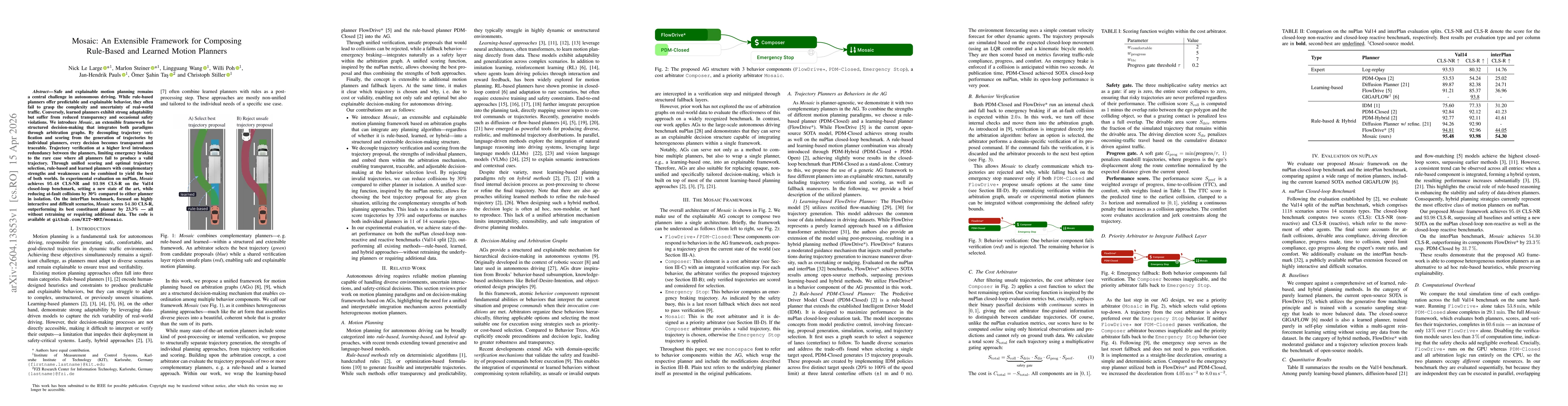
Safe and explainable motion planning remains a central challenge in autonomous driving. While rule-based planners offer predictable and explainable behavior, they often fail to grasp the complexity an...

Existing autonomous driving datasets have enabled major progress, but fall short in sensor fidelity, map completeness, or geographic diversity. We present KITScenes Multimodal, a European dataset buil...
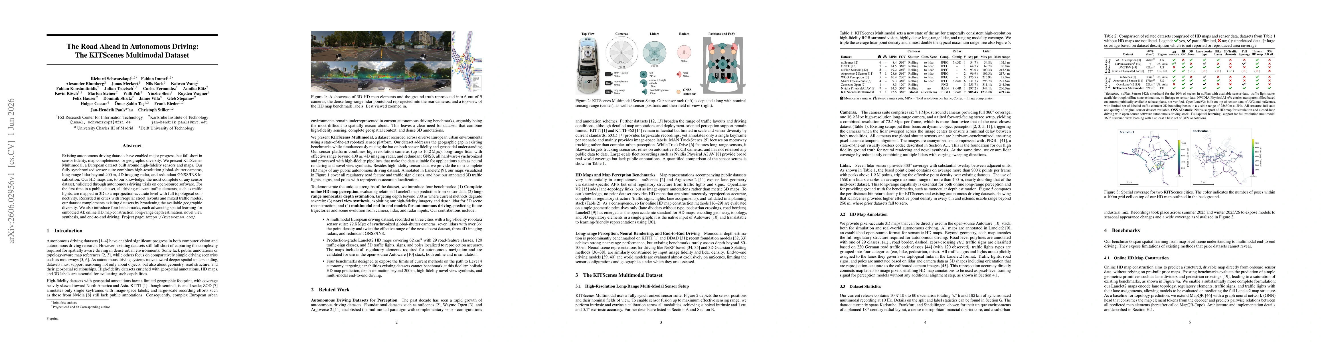
Existing autonomous driving datasets have enabled major progress, but fall short in sensor fidelity, map completeness, or geographic diversity. We present KITScenes Multimodal, a European dataset buil...
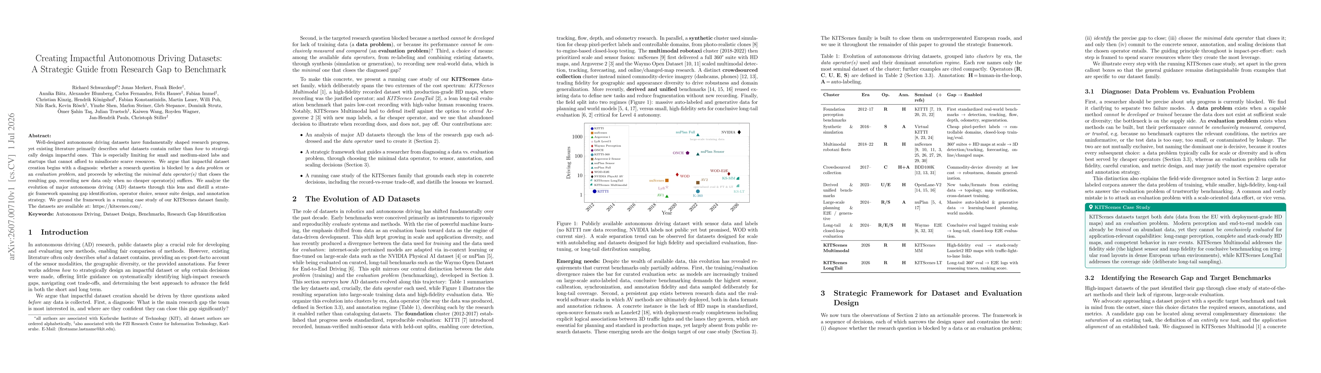
Well-designed autonomous driving datasets have fundamentally shaped research progress, yet existing literature primarily describes what datasets contain rather than how to strategically design impactf...