Academic Profile
Statistics
Similar Authors
Papers on arXiv
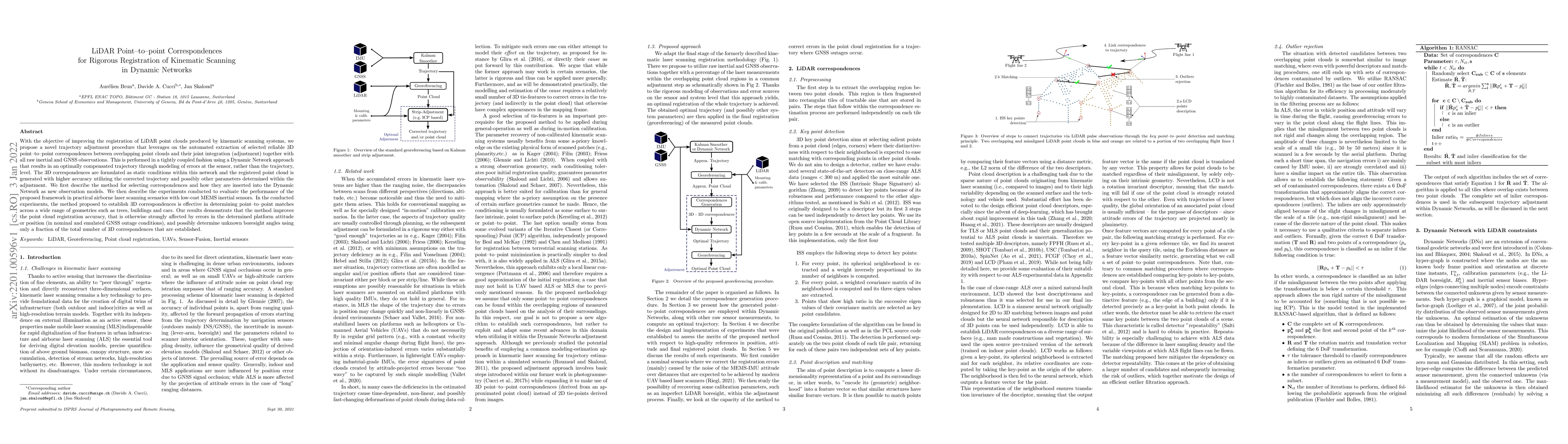
With the objective of improving the registration of LiDAR point clouds produced by kinematic scanning systems, we propose a novel trajectory adjustment procedure that leverages on the automated extr...
The task of inertial sensor calibration has required the development of various techniques to take into account the sources of measurement error coming from such devices. The calibration of the stoc...
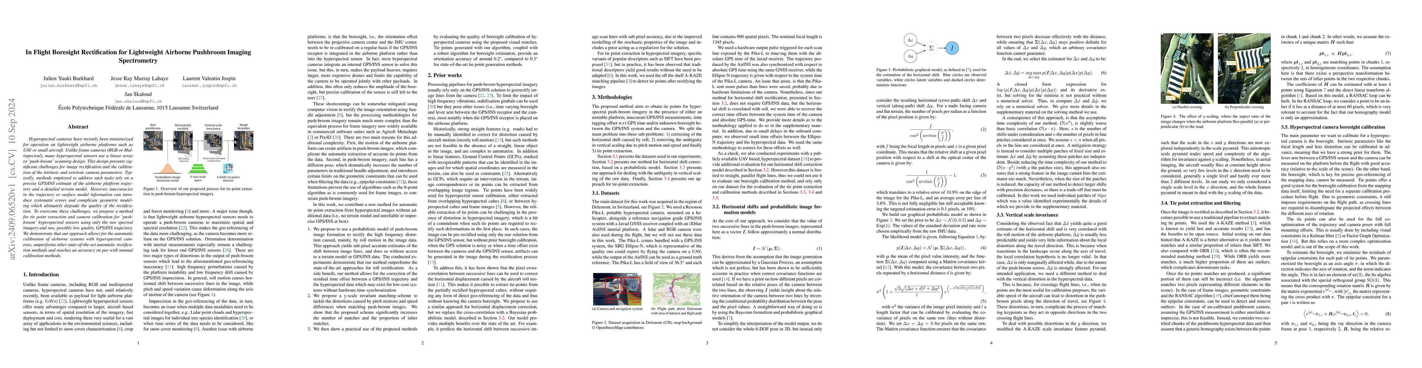
Hyperspectral cameras have recently been miniaturized for operation on lightweight airborne platforms such as UAV or small aircraft. Unlike frame cameras (RGB or Multispectral), many hyperspectral sen...
LiDAR-based semantic segmentation is critical for autonomous trains, requiring accurate predictions across varying distances. This paper introduces two targeted data augmentation methods designed to i...
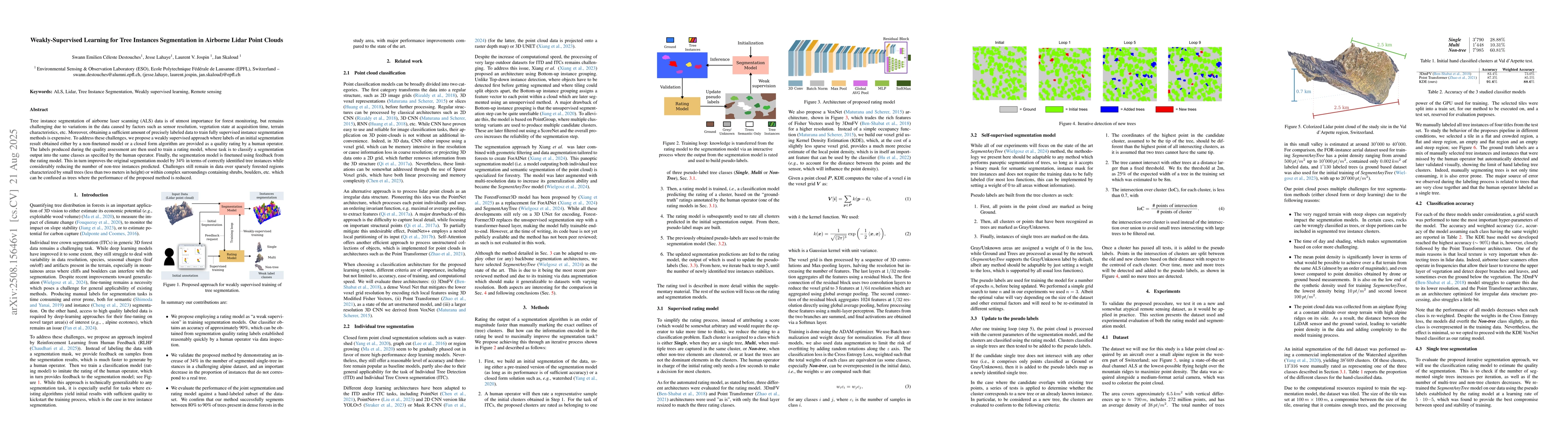
Tree instance segmentation of airborne laser scanning (ALS) data is of utmost importance for forest monitoring, but remains challenging due to variations in the data caused by factors such as sensor r...

Semantic ultra high resolution image (UHR) segmentation is essential in remote sensing applications such as aerial mapping and environmental monitoring. Transformer-based models struggle in this setti...
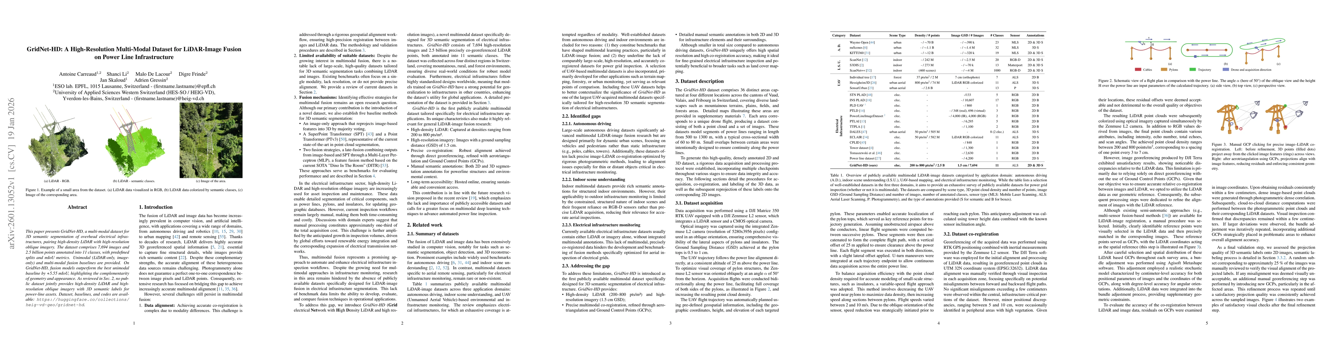
This paper presents GridNet-HD, a multi-modal dataset for 3D semantic segmentation of overhead electrical infrastructures, pairing high-density LiDAR with high-resolution oblique imagery. The dataset ...
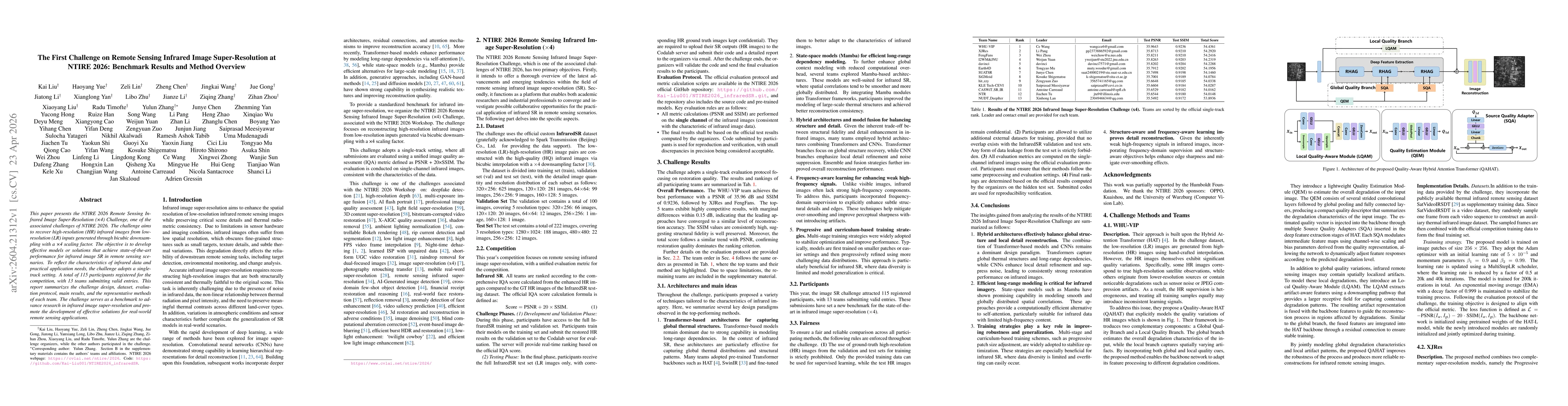
This paper presents the NTIRE 2026 Remote Sensing Infrared Image Super-Resolution (x4) Challenge, one of the associated challenges of NTIRE 2026. The challenge aims to recover high-resolution (HR) inf...
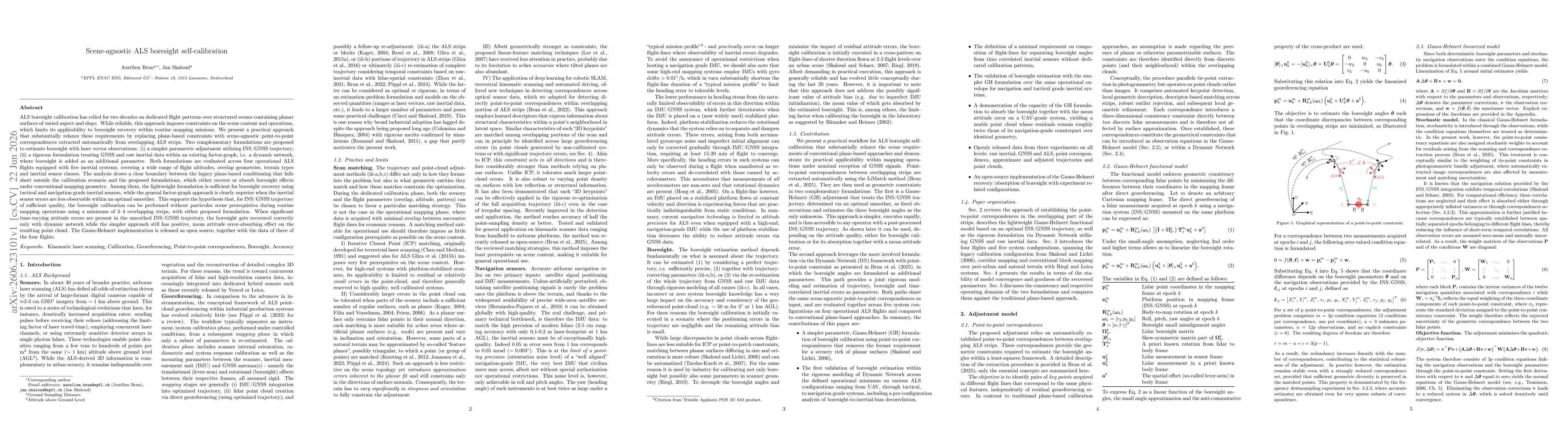
ALS boresight calibration has relied for two decades on dedicated flight patterns over structured scenes containing planar surfaces of varied aspect and slope. While reliable, this approach imposes co...