Academic Profile
Statistics
Similar Authors
Papers on arXiv
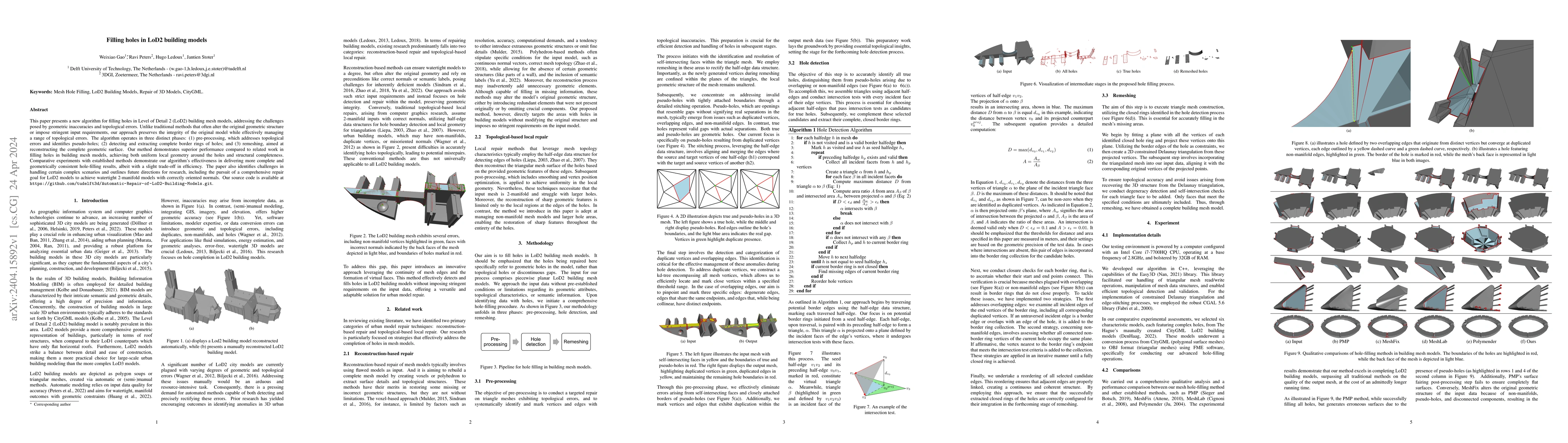
This paper presents a new algorithm for filling holes in Level of Detail 2 (LoD2) building mesh models, addressing the challenges posed by geometric inaccuracies and topological errors. Unlike tradi...
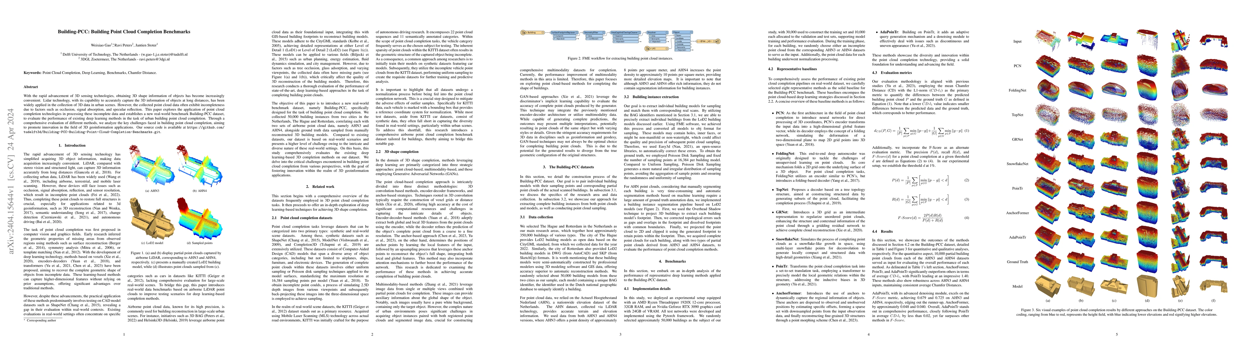
With the rapid advancement of 3D sensing technologies, obtaining 3D shape information of objects has become increasingly convenient. Lidar technology, with its capability to accurately capture the 3...
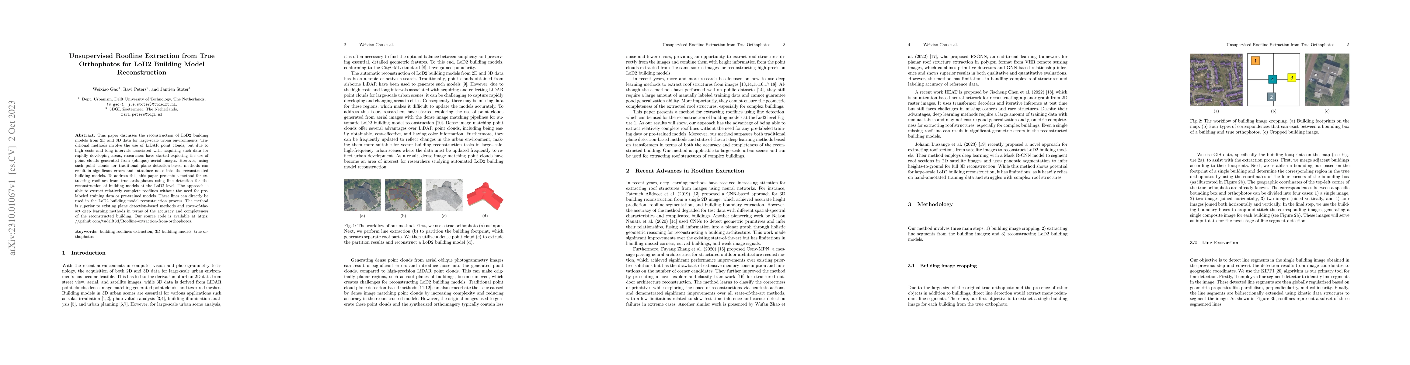
This paper discusses the reconstruction of LoD2 building models from 2D and 3D data for large-scale urban environments. Traditional methods involve the use of LiDAR point clouds, but due to high cos...
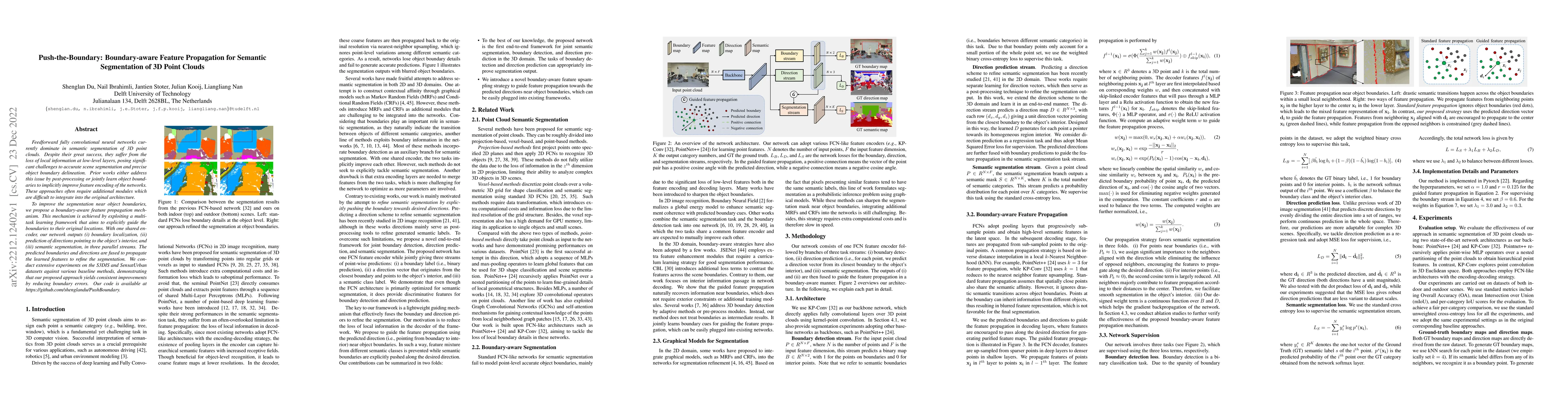
Feedforward fully convolutional neural networks currently dominate in semantic segmentation of 3D point clouds. Despite their great success, they suffer from the loss of local information at low-lev...
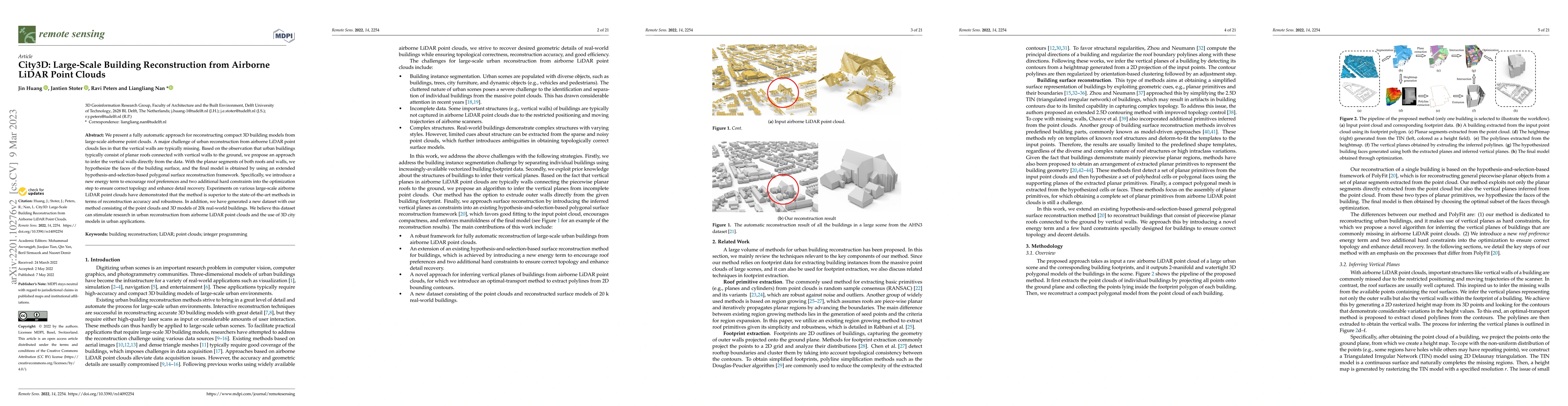
We present a fully automatic approach for reconstructing compact 3D building models from large-scale airborne point clouds. A major challenge of urban reconstruction from airborne LiDAR point clouds...
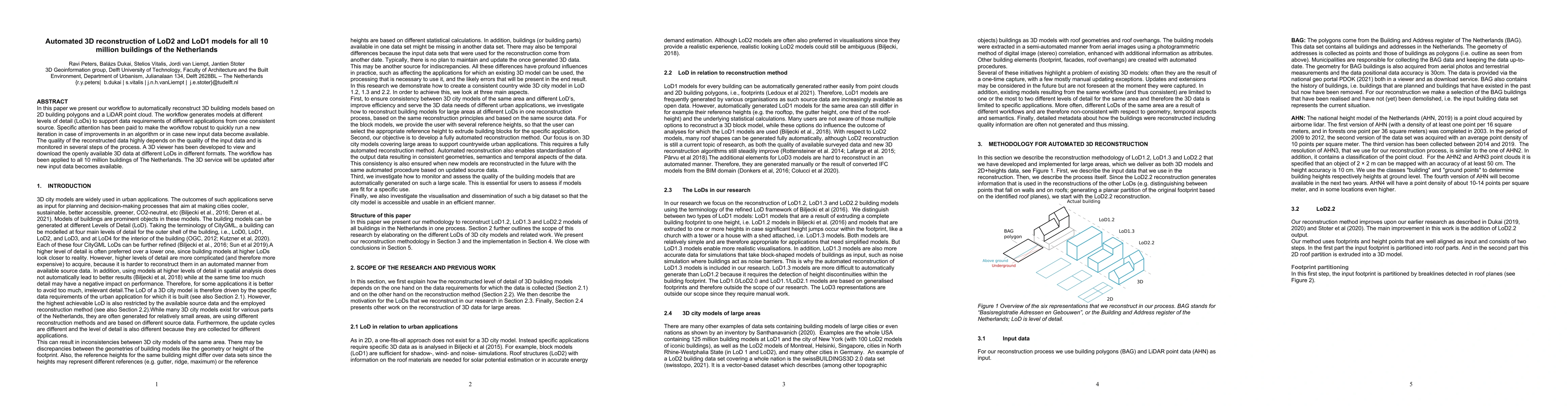
In this paper we present our workflow to automatically reconstruct 3D building models based on 2D building polygons and a LiDAR point cloud. The workflow generates models at different levels of deta...
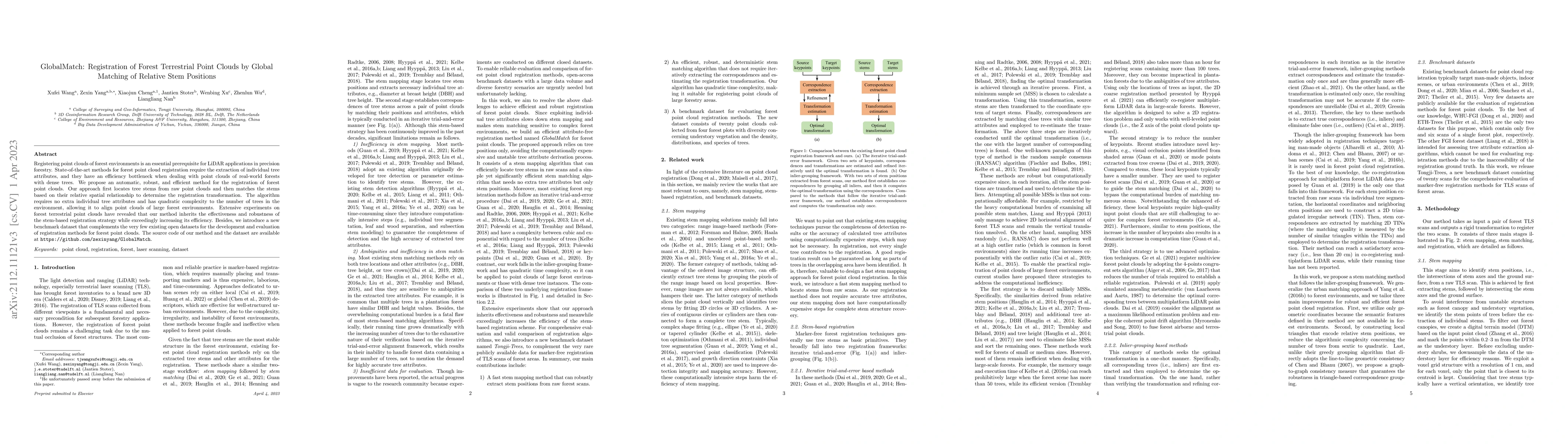
Registering point clouds of forest environments is an essential prerequisite for LiDAR applications in precision forestry. State-of-the-art methods for forest point cloud registration require the ex...
To support building permit issuing with automatic digital tools, the reuse of models produced by designers would make the process quicker and more objective. However, current studies and pilots ofte...