Academic Profile
Statistics
Similar Authors
Papers on arXiv
Trajectory data combines the complexities of time series, spatial data, and (sometimes irrational) movement behavior. As data availability and computing power have increased, so has the popularity o...
Knowledge about historic landslide event occurrence is important for supporting disaster risk reduction strategies. Building upon findings from 2022 Landslide4Sense Competition, we propose a deep ne...
In this paper, we present a high-performance and light-weight deep learning model for Remote Sensing Image Classification (RSIC), the task of identifying the aerial scene of a remote sensing image. ...
The task of remote sensing image scene classification (RSISC), which aims at classifying remote sensing images into groups of semantic categories based on their contents, has taken the important rol...
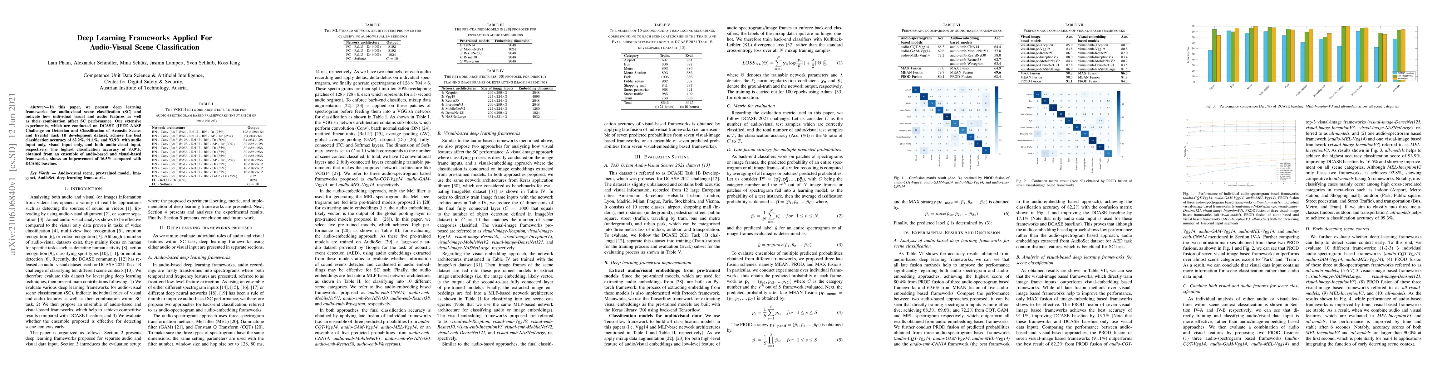
In this paper, we present deep learning frameworks for audio-visual scene classification (SC) and indicate how individual visual and audio features as well as their combination affect SC performance...
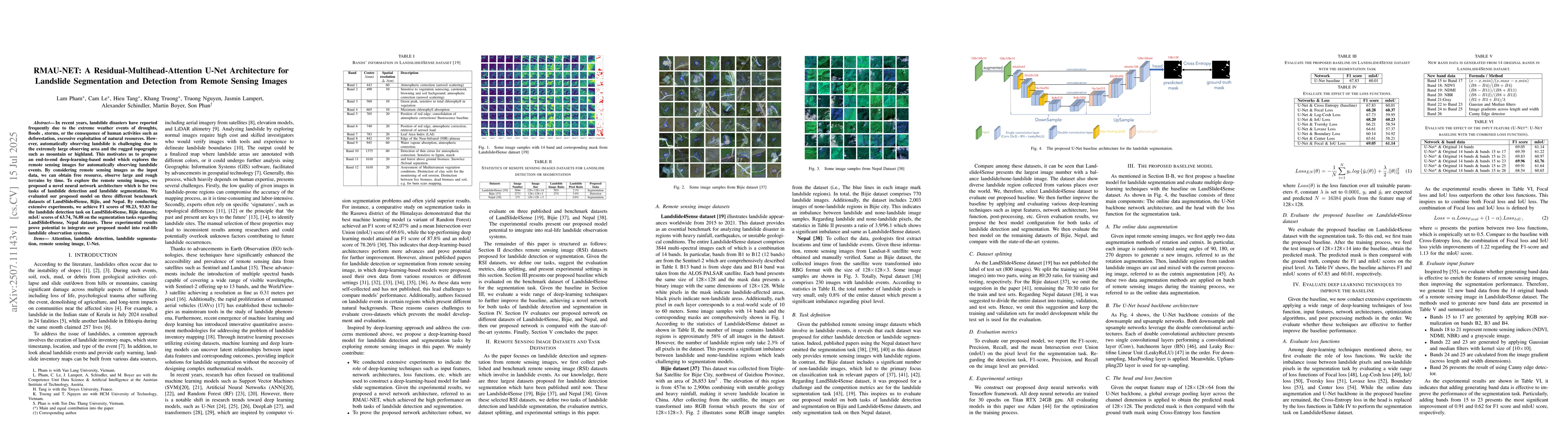
In recent years, landslide disasters have reported frequently due to the extreme weather events of droughts, floods , storms, or the consequence of human activities such as deforestation, excessive ex...
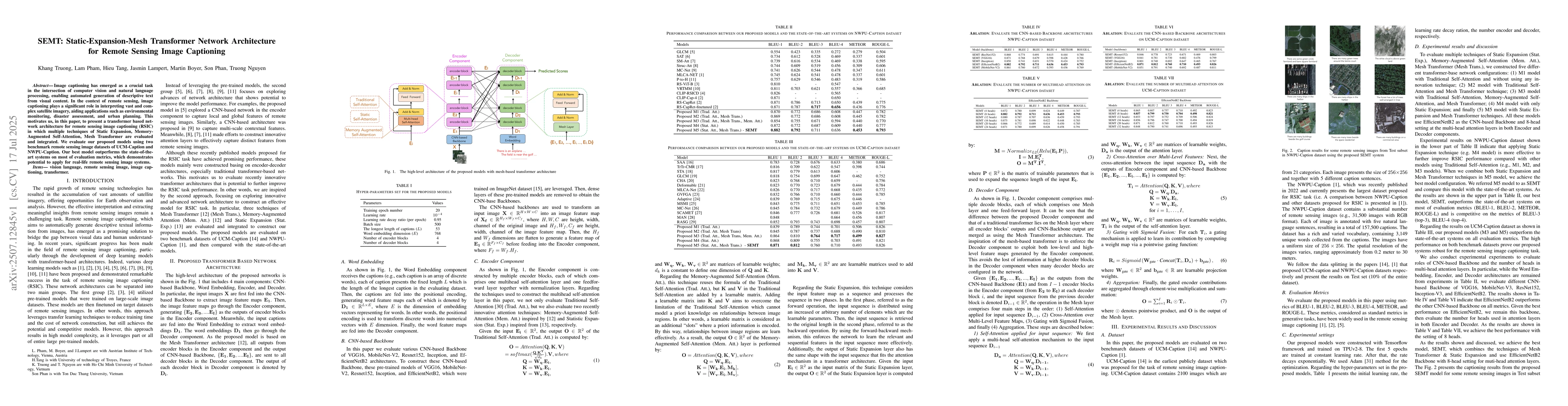
Image captioning has emerged as a crucial task in the intersection of computer vision and natural language processing, enabling automated generation of descriptive text from visual content. In the con...
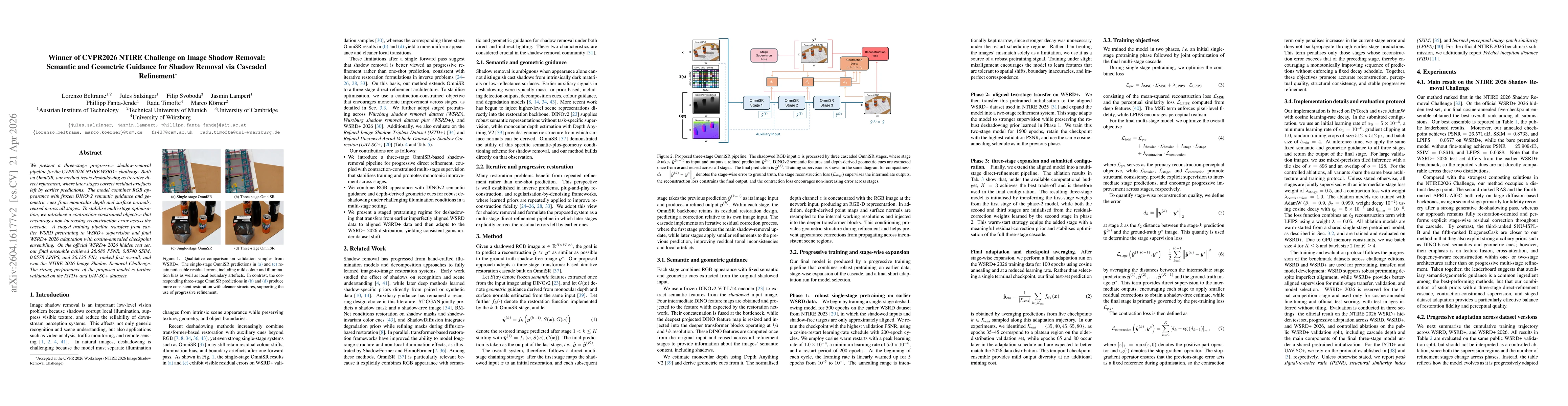
We present a three-stage progressive shadow-removal pipeline for the CVPR2026 NTIRE WSRD+ challenge. Built on OmniSR, our method treats deshadowing as iterative direct refinement, where later stages c...
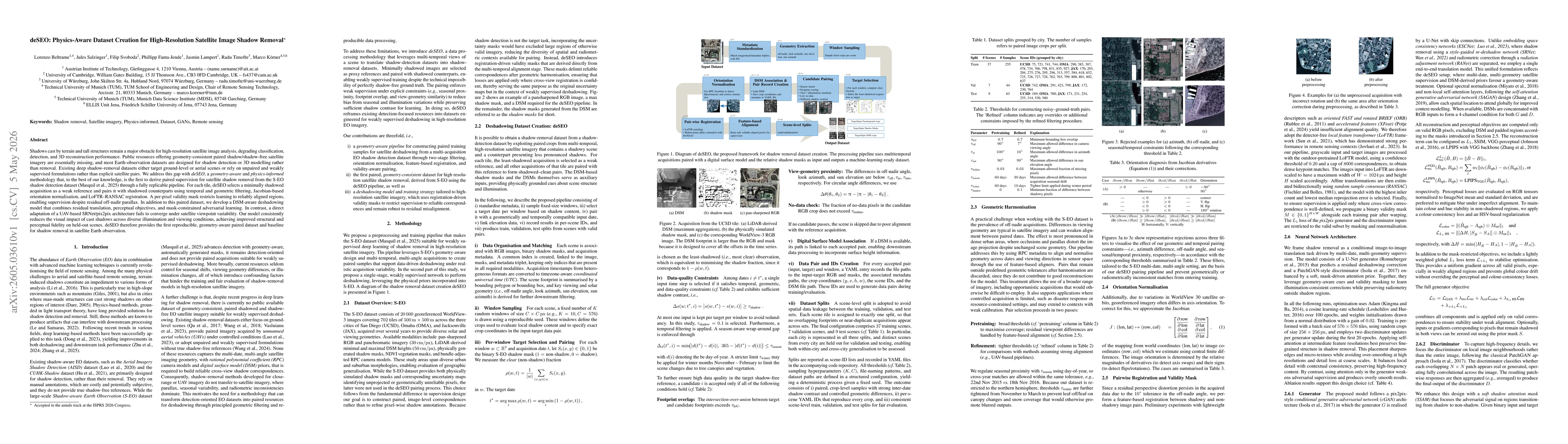
Shadows cast by terrain and tall structures remain a major obstacle for high-resolution satellite image analysis, degrading classification, detection, and 3D reconstruction performance. Public resourc...