Jason Thompson

8 papers on arXiv

Academic Profile

Name: Jason Thompson
Total Papers: 105

Statistics

arXiv Papers 8
Total Publications 105

Papers on arXiv

Thumbnail for Scalable Label-efficient Footpath Network Generation Using Remote
  Sensing Data and Self-supervised Learning

Scalable Label-efficient Footpath Network Generation Using Remote Sensing Data and Self-supervised Learning

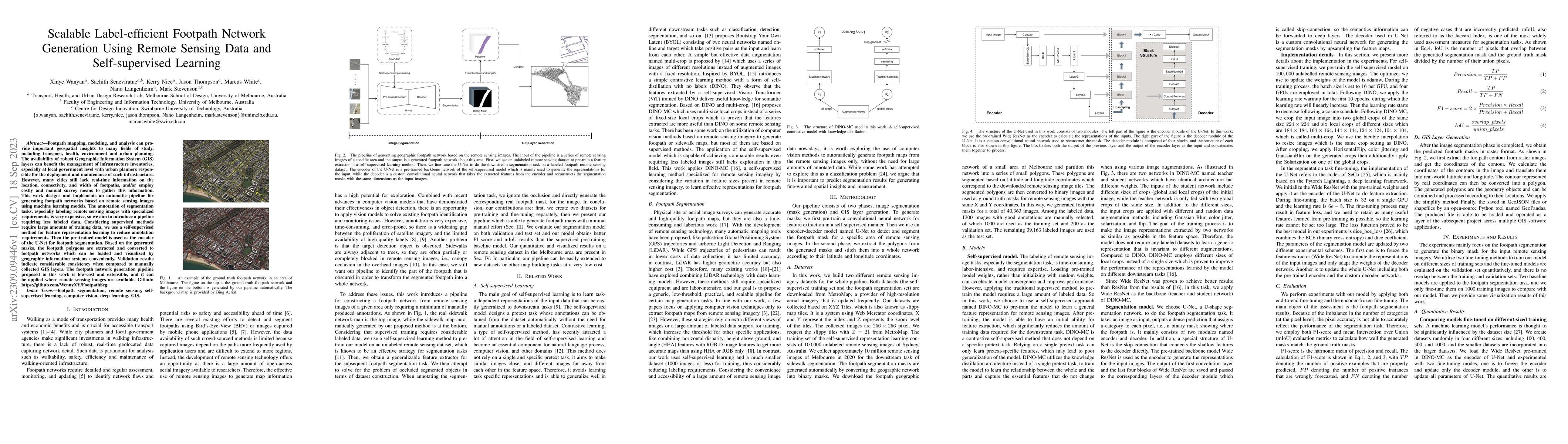
Footpath mapping, modeling, and analysis can provide important geospatial insights to many fields of study, including transport, health, environment and urban planning. The availability of robust Ge...

Thumbnail for Urban feature analysis from aerial remote sensing imagery using
  self-supervised and semi-supervised computer vision

Urban feature analysis from aerial remote sensing imagery using self-supervised and semi-supervised computer vision

Analysis of overhead imagery using computer vision is a problem that has received considerable attention in academic literature. Most techniques that operate in this space are both highly specialise...

Thumbnail for DALLE-URBAN: Capturing the urban design expertise of large text to image
  transformers

DALLE-URBAN: Capturing the urban design expertise of large text to image transformers

Automatically converting text descriptions into images using transformer architectures has recently received considerable attention. Such advances have implications for many applied design disciplin...

Thumbnail for Self-Supervision, Remote Sensing and Abstraction: Representation
  Learning Across 3 Million Locations

Self-Supervision, Remote Sensing and Abstraction: Representation Learning Across 3 Million Locations

Self-supervision based deep learning classification approaches have received considerable attention in academic literature. However, the performance of such methods on remote sensing imagery domains...

Thumbnail for Identifying safe intersection design through unsupervised feature
  extraction from satellite imagery

Identifying safe intersection design through unsupervised feature extraction from satellite imagery

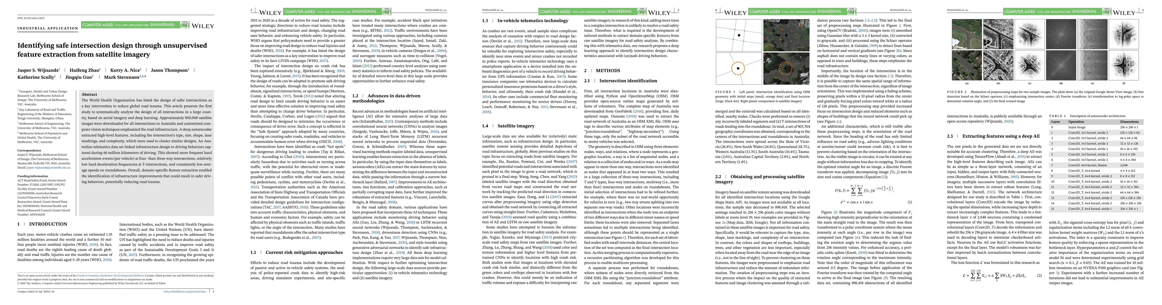
The World Health Organization has listed the design of safer intersections as a key intervention to reduce global road trauma. This article presents the first study to systematically analyze the des...

Thumbnail for Real-time monitoring of driver drowsiness on mobile platforms using 3D
  neural networks

Real-time monitoring of driver drowsiness on mobile platforms using 3D neural networks

Driver drowsiness increases crash risk, leading to substantial road trauma each year. Drowsiness detection methods have received considerable attention, but few studies have investigated the impleme...

Thumbnail for The 'Paris-end' of town? Urban typology through machine learning

The 'Paris-end' of town? Urban typology through machine learning

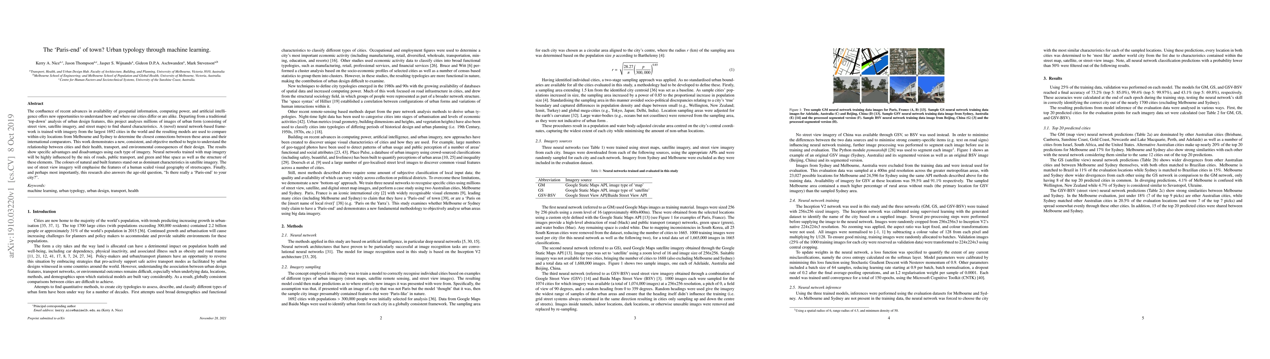
The confluence of recent advances in availability of geospatial information, computing power, and artificial intelligence offers new opportunities to understand how and where our cities differ or ar...

Thumbnail for The Nature of Human Settlement: Building an understanding of high
  performance city design

The Nature of Human Settlement: Building an understanding of high performance city design

In an impending urban age where the majority of the world's population will live in cities, it is critical that we improve our understanding of the strengths and limitations of existing city designs...

This website uses cookies to ensure you get the best experience. Learn more