2
arXiv Papers
3
Total Publications
Profile
Academic Profile
Metrics
Statistics
2
arXiv Papers
3
Total Publications
Network
Similar Authors
Publications
Papers on arXiv
arXiv
How reliable are remote sensing maps calibrated over large areas? A
matter of scale?
Remote sensing data are increasingly available and frequently used to produce forest attributes maps. The sampling strategy of the calibration plots may directly affect predictions and map qualities. ...
arXiv
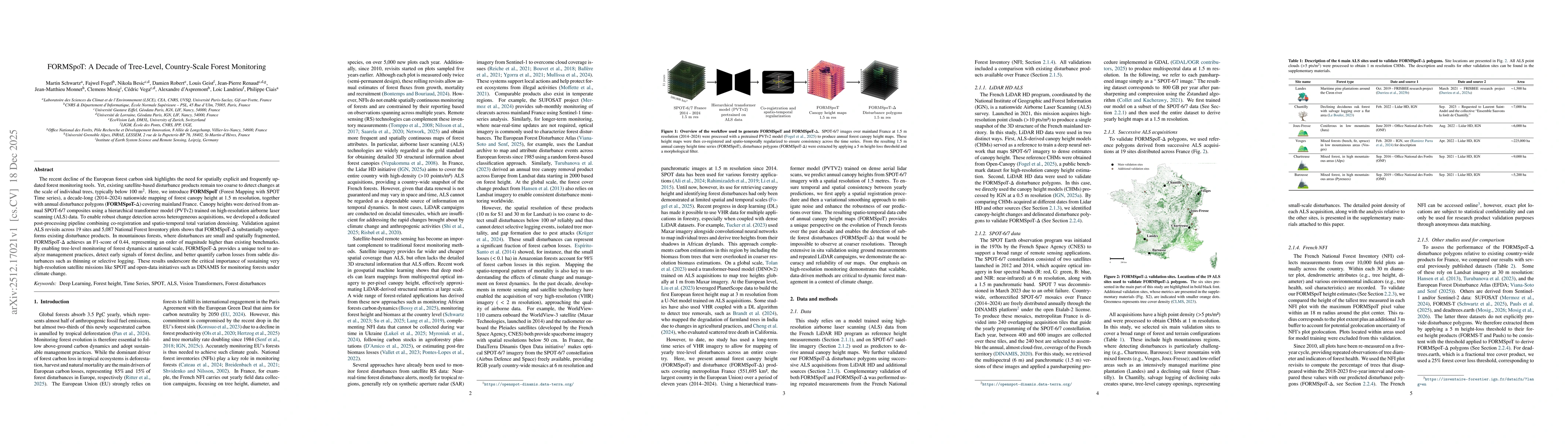
FORMSpoT: A Decade of Tree-Level, Country-Scale Forest Monitoring
The recent decline of the European forest carbon sink highlights the need for spatially explicit and frequently updated forest monitoring tools. Yet, existing satellite-based disturbance products rema...