Academic Profile
Statistics
Similar Authors
Papers on arXiv
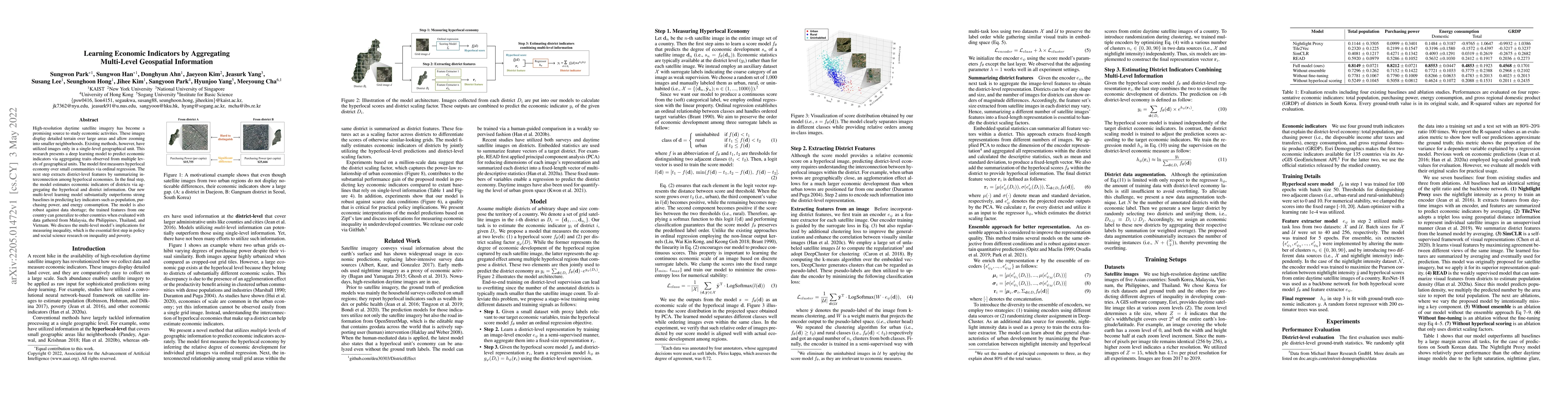
High-resolution daytime satellite imagery has become a promising source to study economic activities. These images display detailed terrain over large areas and allow zooming into smaller neighborho...
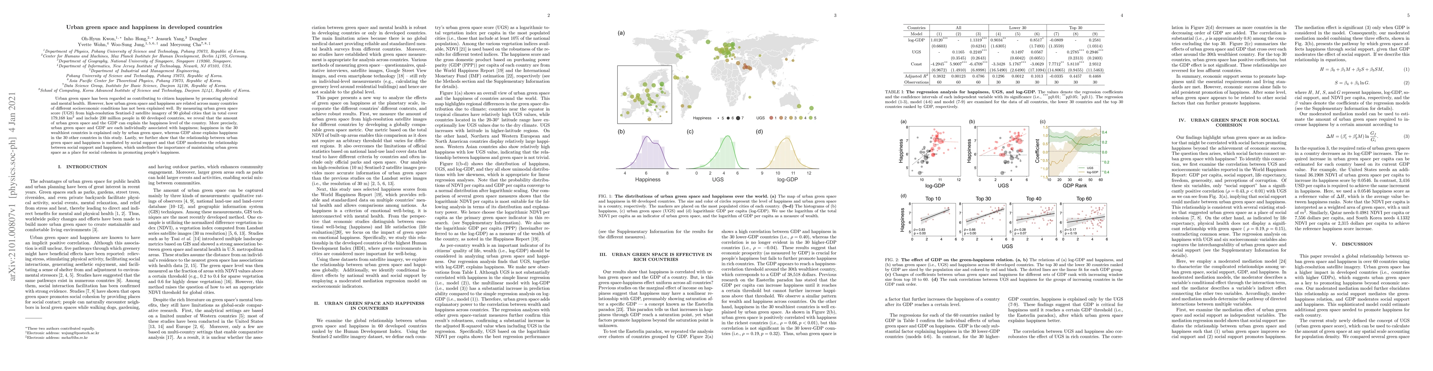
Urban green space has been regarded as contributing to citizen happiness by promoting physical and mental health. However, how urban green space and happiness are related across many countries of di...
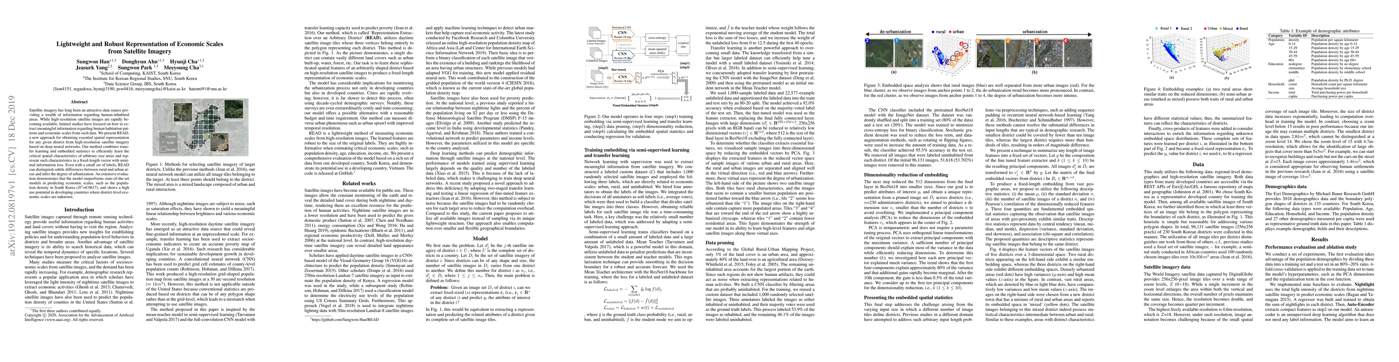
Satellite imagery has long been an attractive data source that provides a wealth of information on human-inhabited areas. While super resolution satellite images are rapidly becoming available, litt...
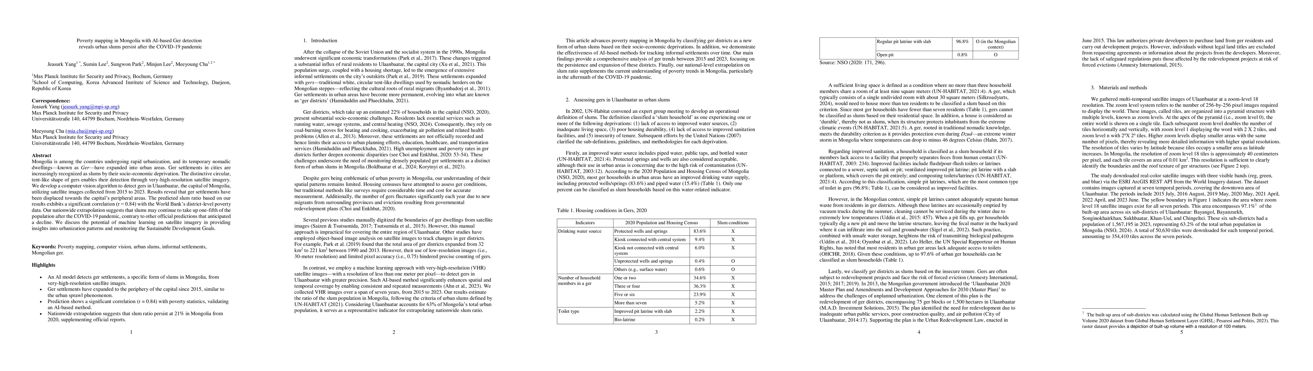
Mongolia is among the countries undergoing rapid urbanization, and its temporary nomadic dwellings-known as Ger-have expanded into urban areas. Ger settlements in cities are increasingly recognized as...
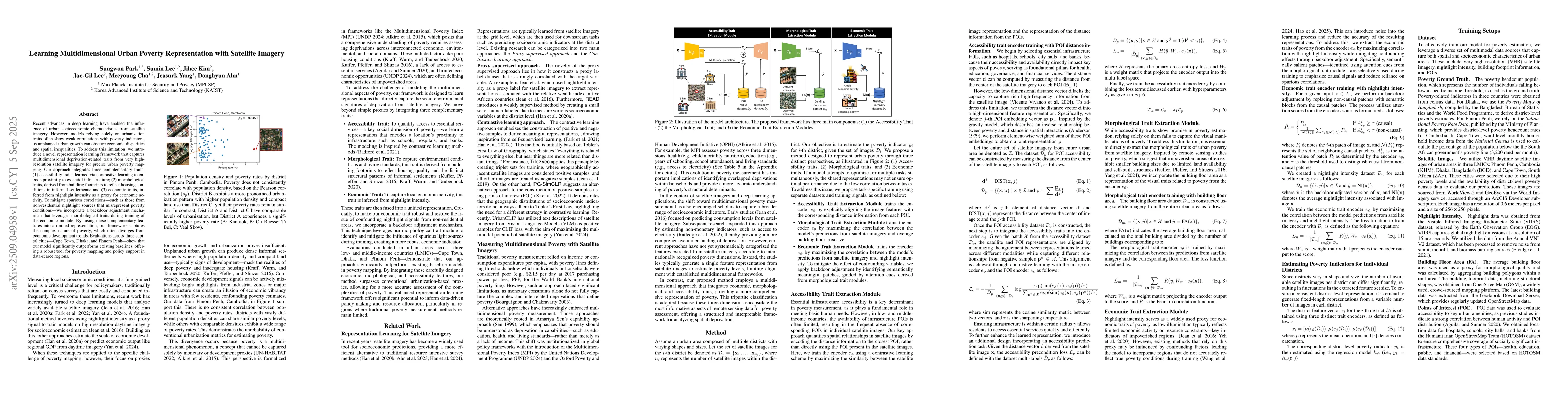
Recent advances in deep learning have enabled the inference of urban socioeconomic characteristics from satellite imagery. However, models relying solely on urbanization traits often show weak correla...
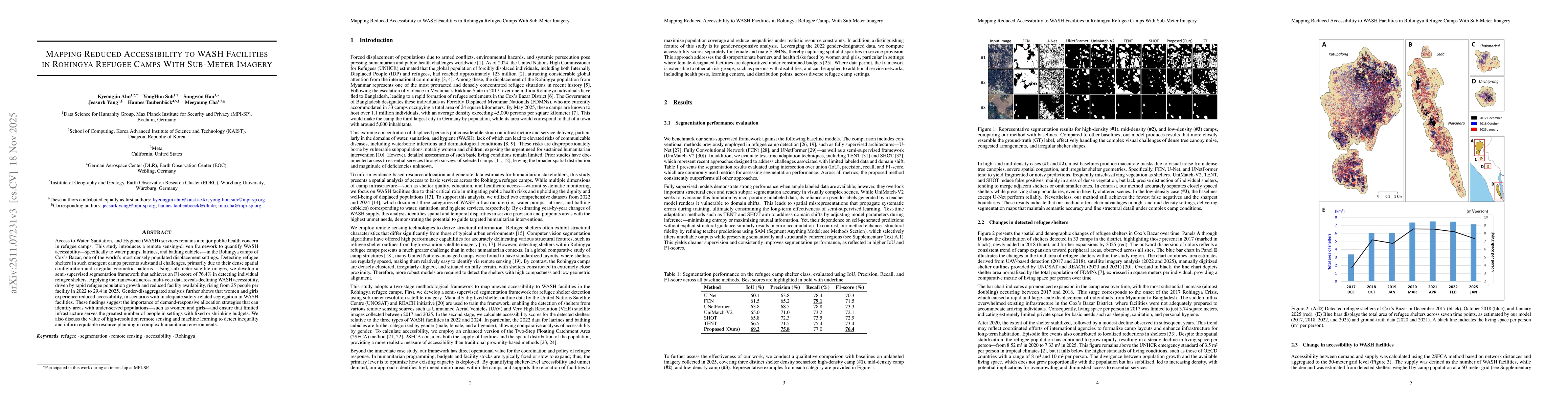
Access to Water, Sanitation, and Hygiene (WASH) services remains a major public health concern in refugee camps. This study introduces a remote sensing-driven framework to quantify WASH accessibility-...
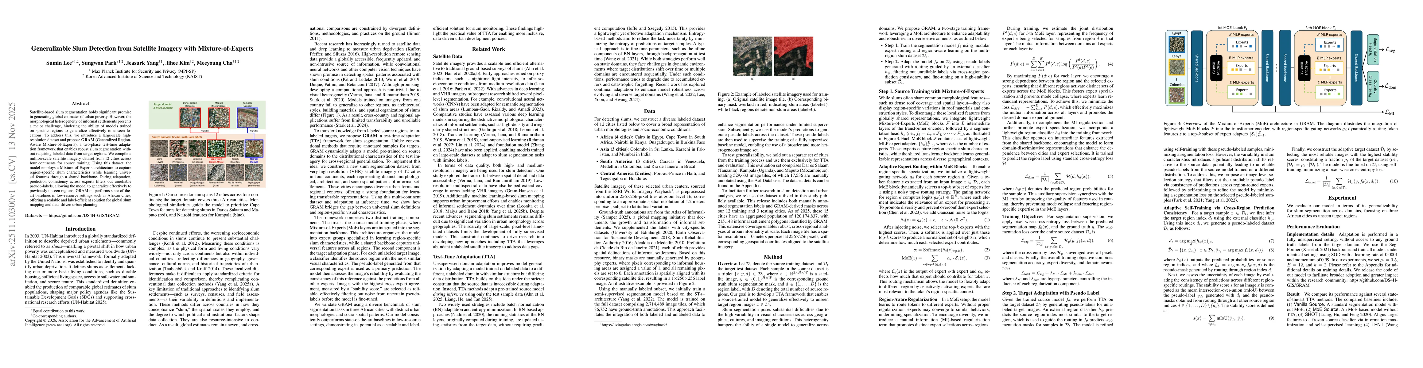
Satellite-based slum segmentation holds significant promise in generating global estimates of urban poverty. However, the morphological heterogeneity of informal settlements presents a major challenge...