1
arXiv Papers
Metrics
Statistics
1
arXiv Papers
Network
Similar Authors
Publications
Papers on arXiv
arXiv
Portraying the Need for Temporal Data in Flood Detection via Sentinel-1
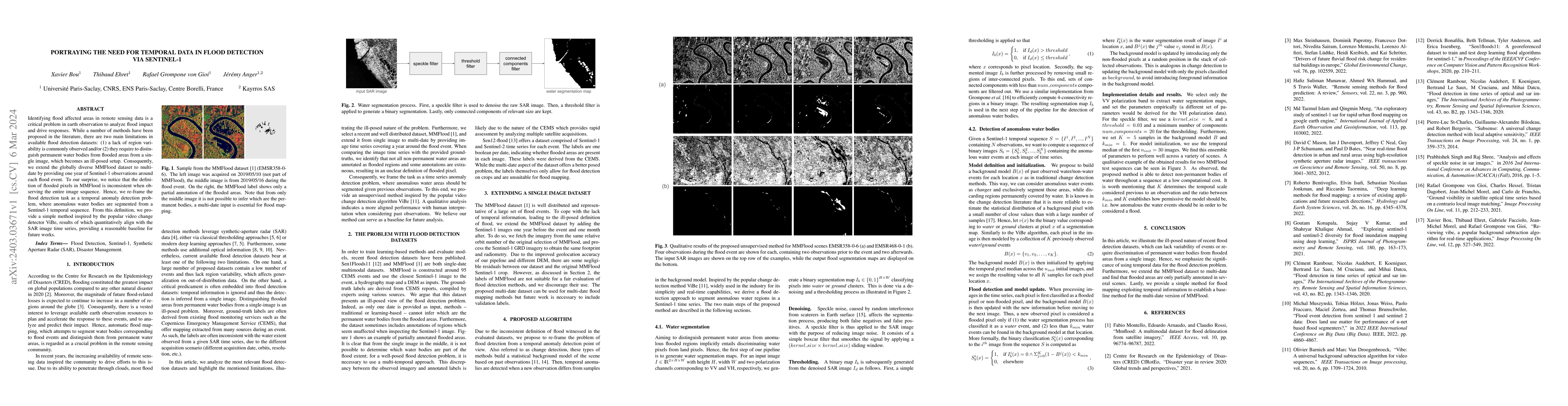
Identifying flood affected areas in remote sensing data is a critical problem in earth observation to analyze flood impact and drive responses. While a number of methods have been proposed in the li...