Academic Profile
Statistics
Similar Authors
Papers on arXiv
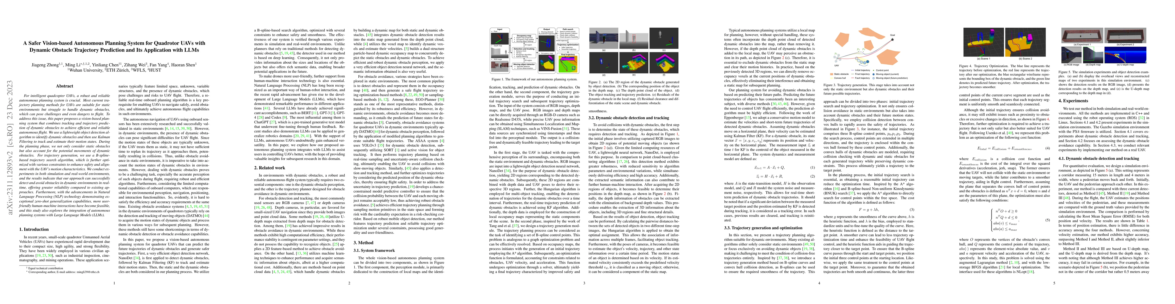
For intelligent quadcopter UAVs, a robust and reliable autonomous planning system is crucial. Most current trajectory planning methods for UAVs are suitable for static environments but struggle to h...
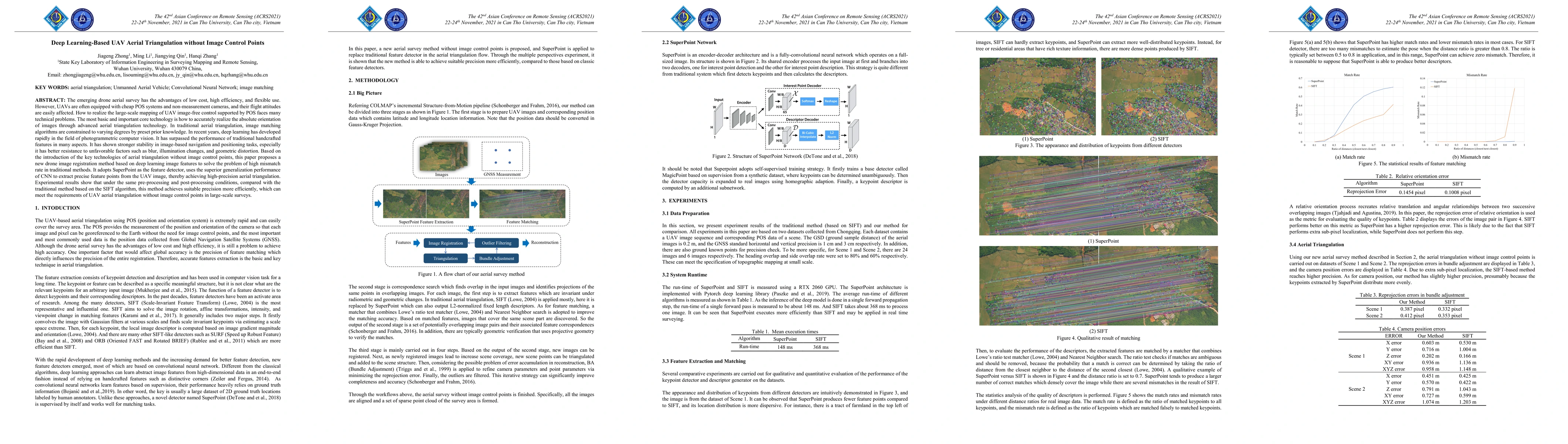
The emerging drone aerial survey has the advantages of low cost, high efficiency, and flexible use. However, UAVs are often equipped with cheap POS systems and non-measurement cameras, and their fli...
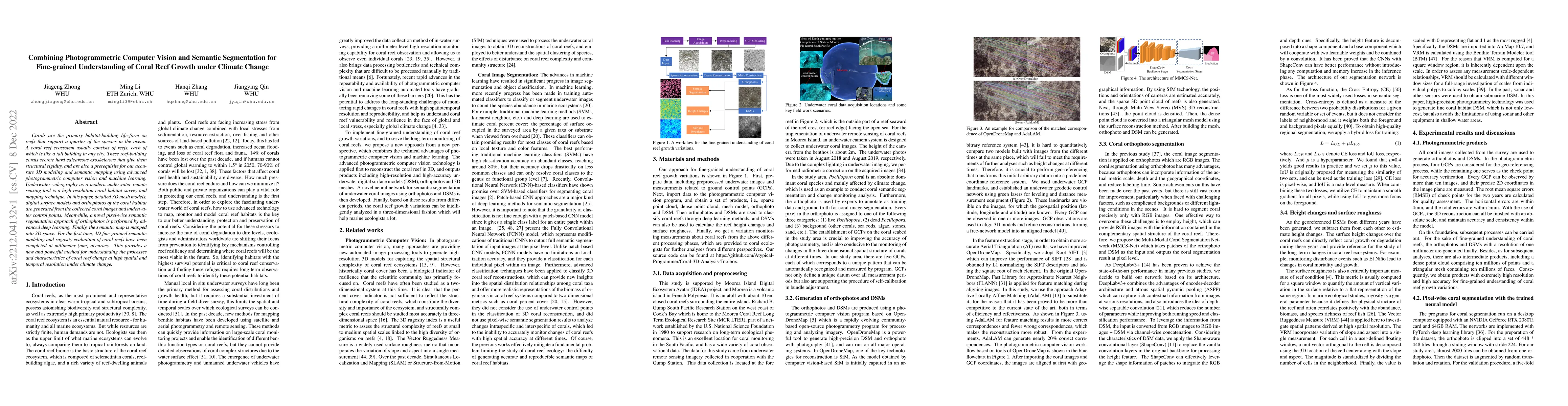
Corals are the primary habitat-building life-form on reefs that support a quarter of the species in the ocean. A coral reef ecosystem usually consists of reefs, each of which is like a tall building...
Corals serve as the foundational habitat-building organisms within reef ecosystems, constructing extensive structures that extend over vast distances. However, their inherent fragility and vulnerabili...
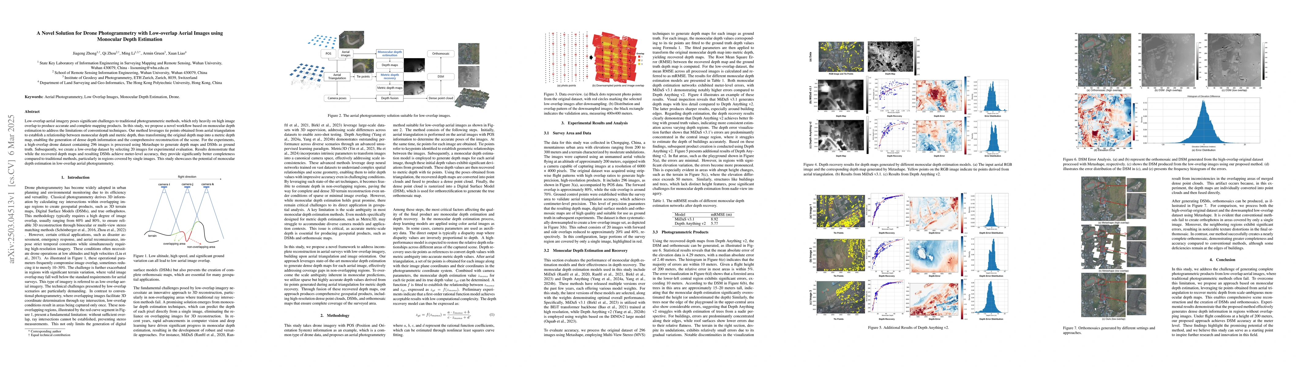
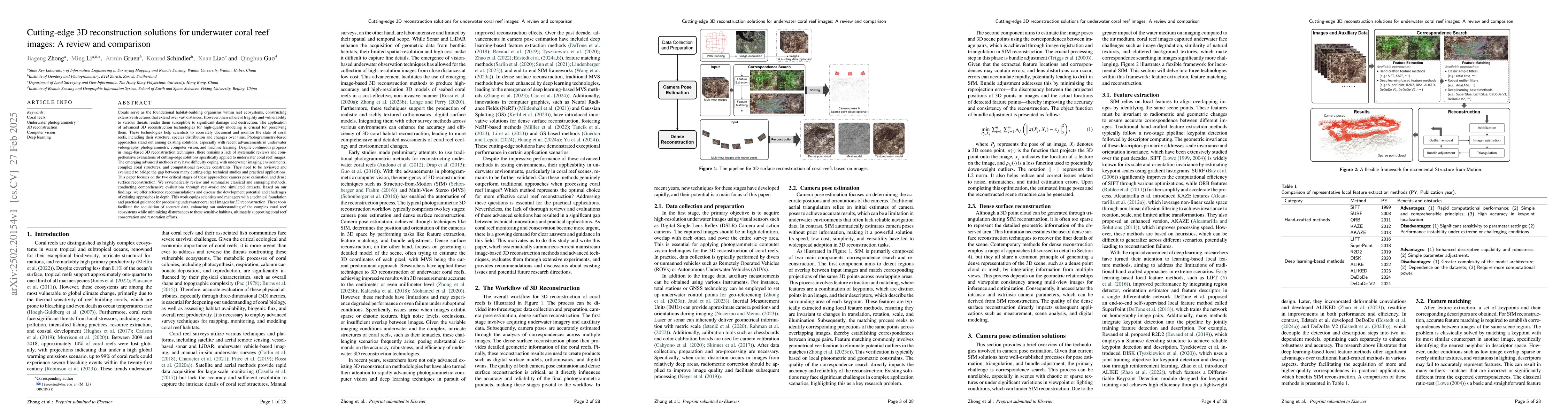
Low-overlap aerial imagery poses significant challenges to traditional photogrammetric methods, which rely heavily on high image overlap to produce accurate and complete mapping products. In this stud...
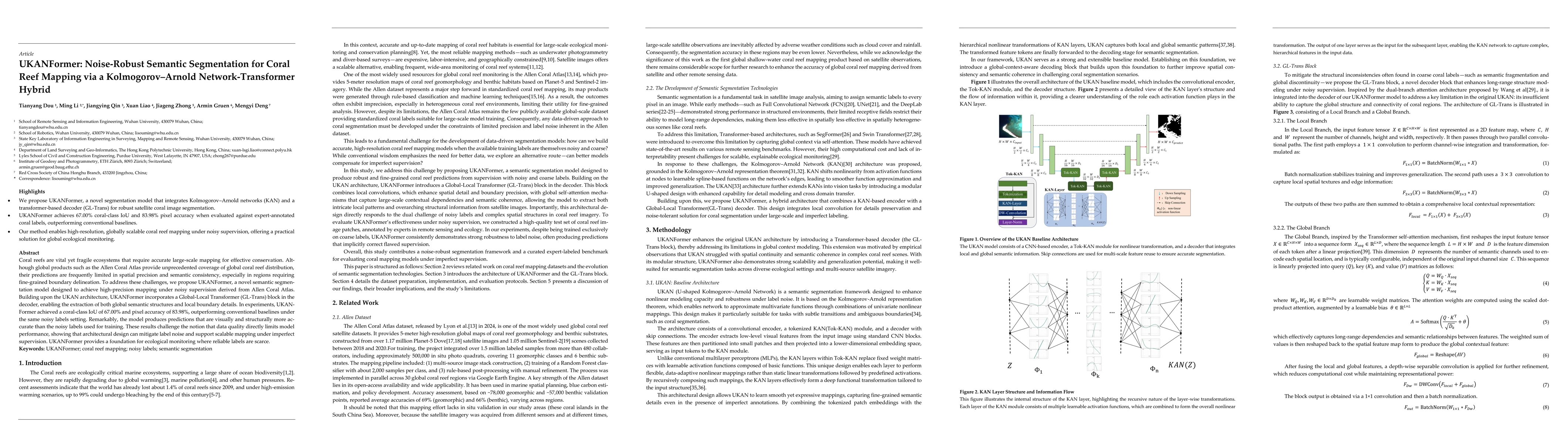
Coral reefs are vital yet fragile ecosystems that require accurate large-scale mapping for effective conservation. Although global products such as the Allen Coral Atlas provide unprecedented coverage...