Academic Profile
Statistics
Similar Authors
Papers on arXiv
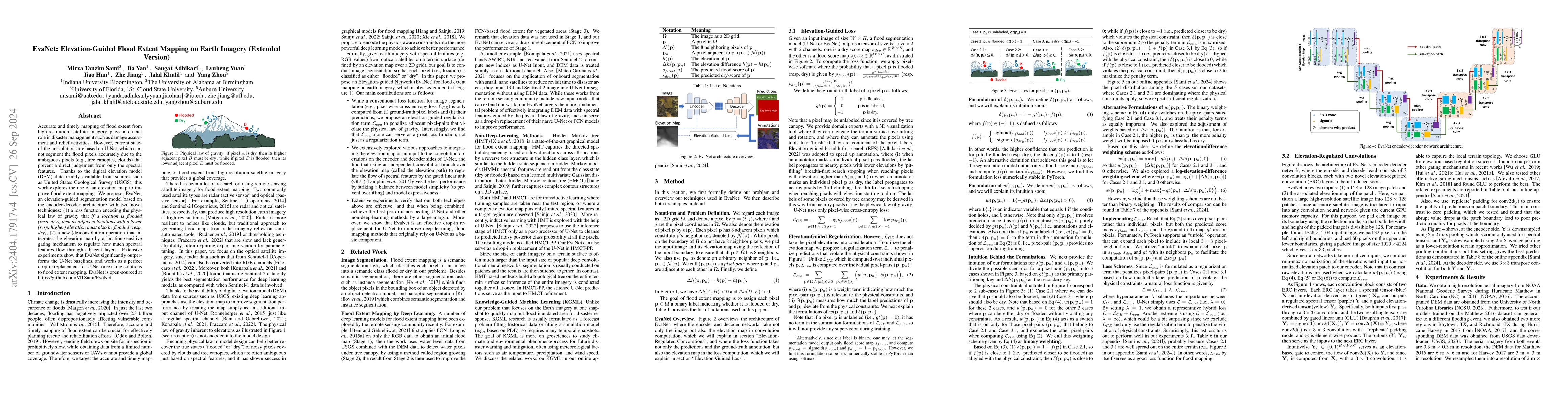
Accurate and timely mapping of flood extent from high-resolution satellite imagery plays a crucial role in disaster management such as damage assessment and relief activities. However, current state...
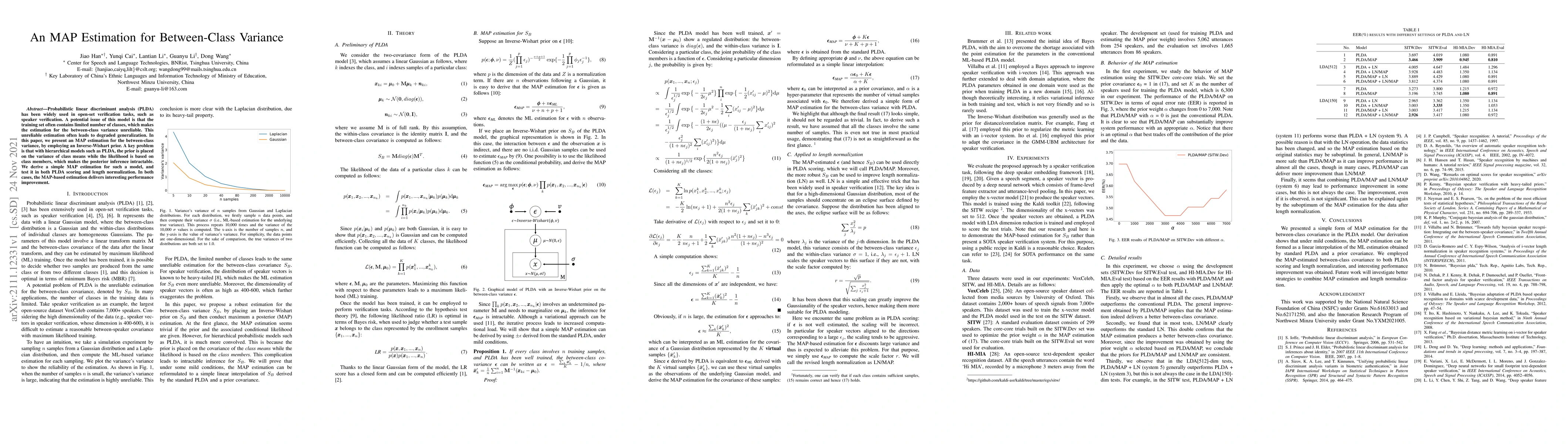
Probabilistic linear discriminant analysis (PLDA) has been widely used in open-set verification tasks, such as speaker verification. A potential issue of this model is that the training set often co...
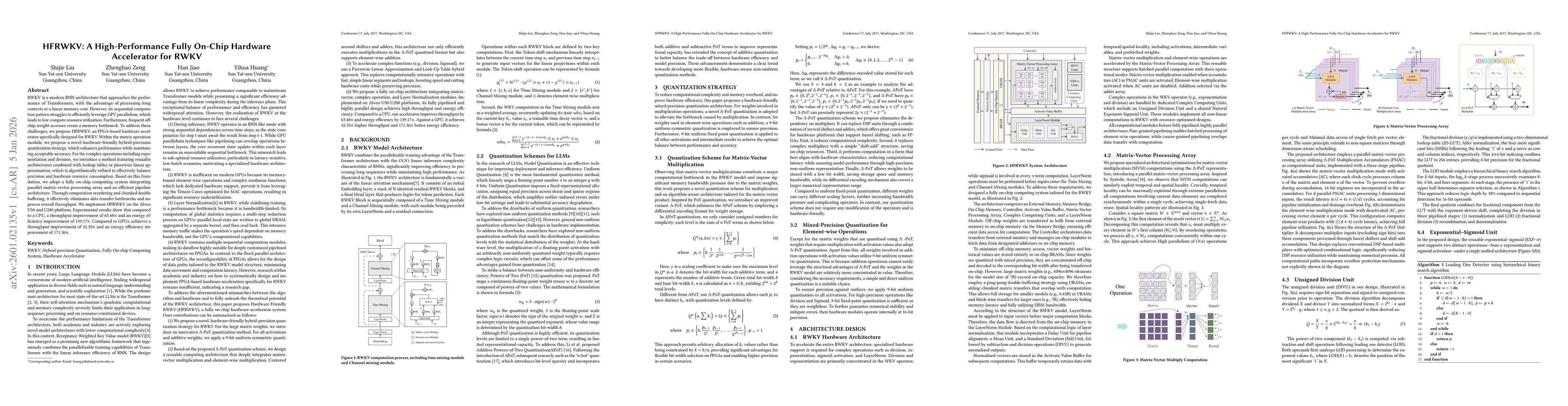
RWKV is a modern RNN architecture that approaches the performance of Transformers, with the advantage of processing long contexts at a linear memory cost. However, its sequential computation pattern s...