Academic Profile
Statistics
Similar Authors
Papers on arXiv
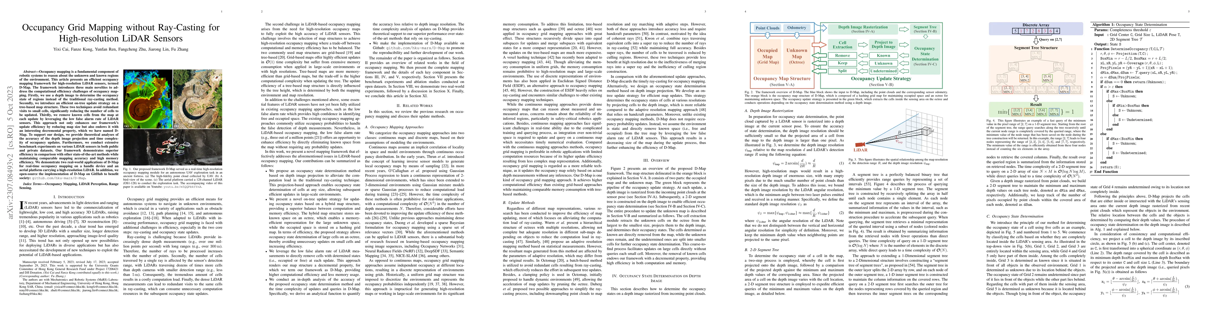
Occupancy mapping is a fundamental component of robotic systems to reason about the unknown and known regions of the environment. This article presents an efficient occupancy mapping framework for h...
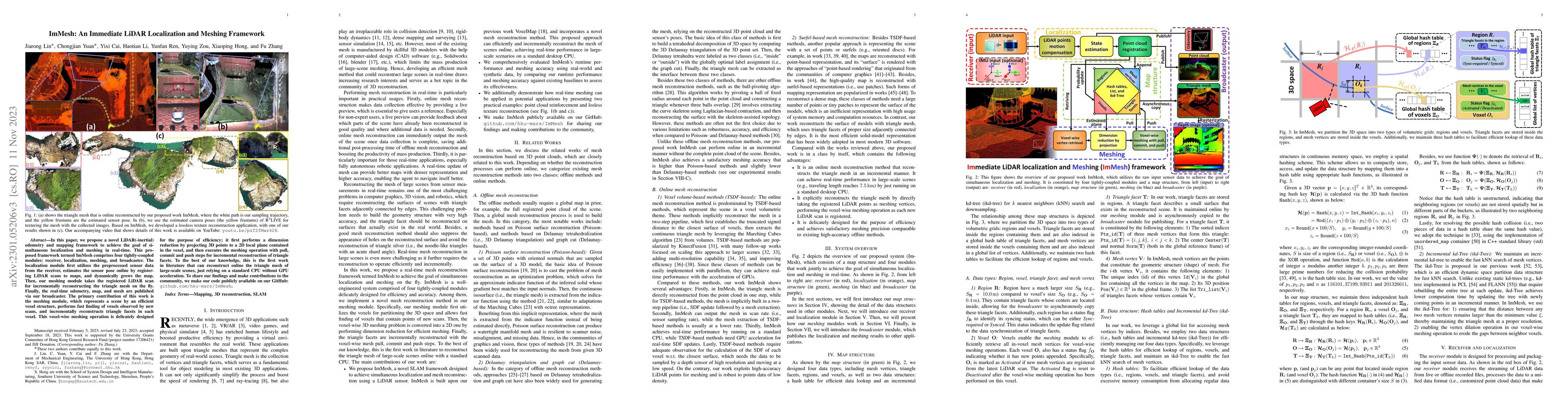
In this paper, we propose a novel LiDAR(-inertial) odometry and mapping framework to achieve the goal of simultaneous localization and meshing in real-time. This proposed framework termed ImMesh com...
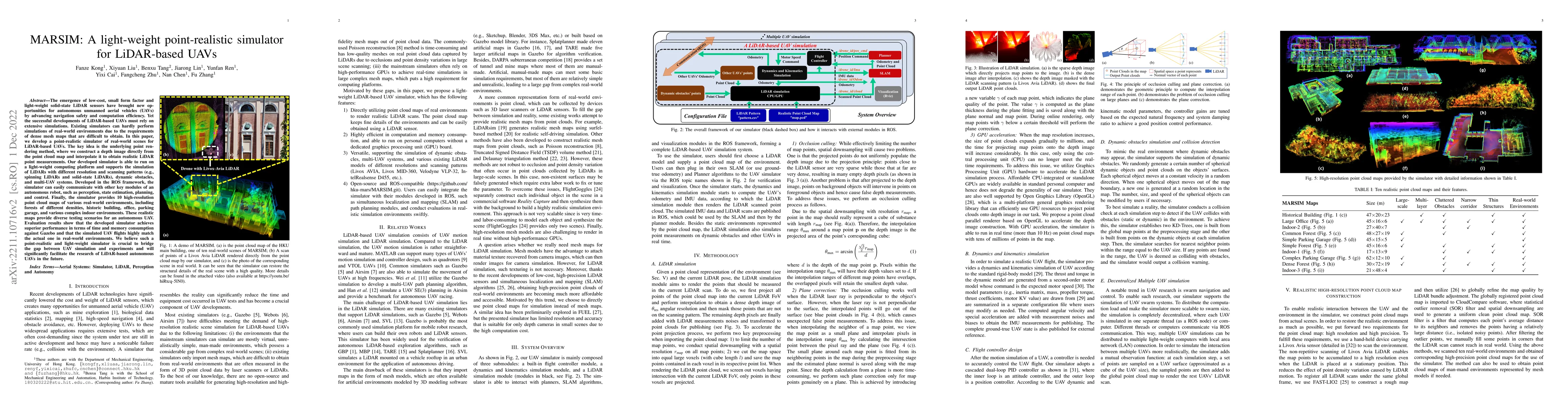
The emergence of low-cost, small form factor and light-weight solid-state LiDAR sensors have brought new opportunities for autonomous unmanned aerial vehicles (UAVs) by advancing navigation safety a...
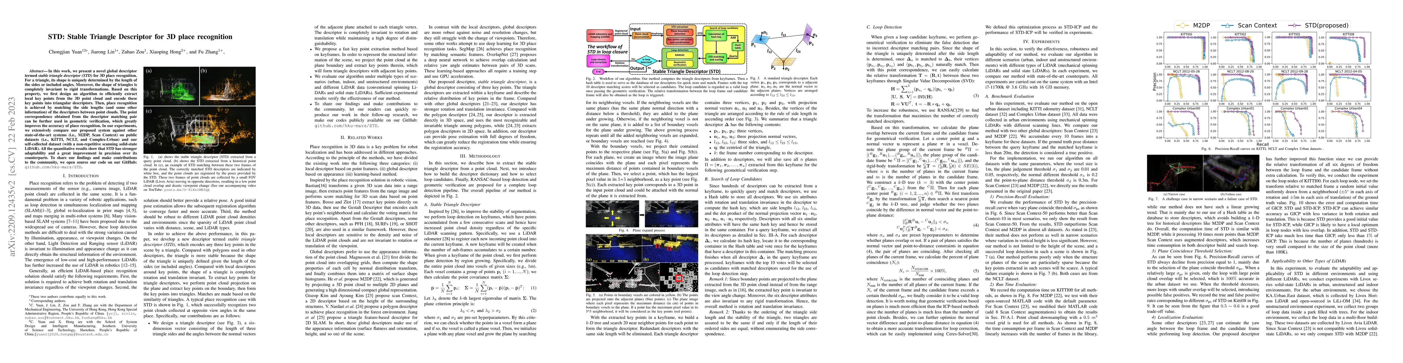
In this work, we present a novel global descriptor termed stable triangle descriptor (STD) for 3D place recognition. For a triangle, its shape is uniquely determined by the length of the sides or in...
Simultaneous localization and mapping (SLAM) are crucial for autonomous robots (e.g., self-driving cars, autonomous drones), 3D mapping systems, and AR/VR applications. This work proposed a novel Li...
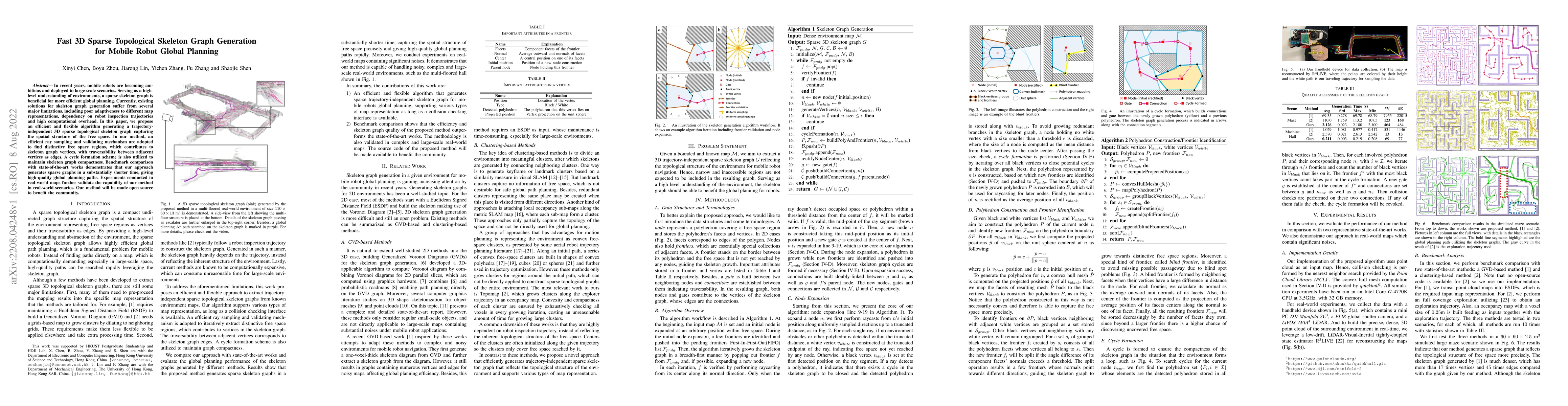
In recent years, mobile robots are becoming ambitious and deployed in large-scale scenarios. Serving as a high-level understanding of environments, a sparse skeleton graph is beneficial for more eff...
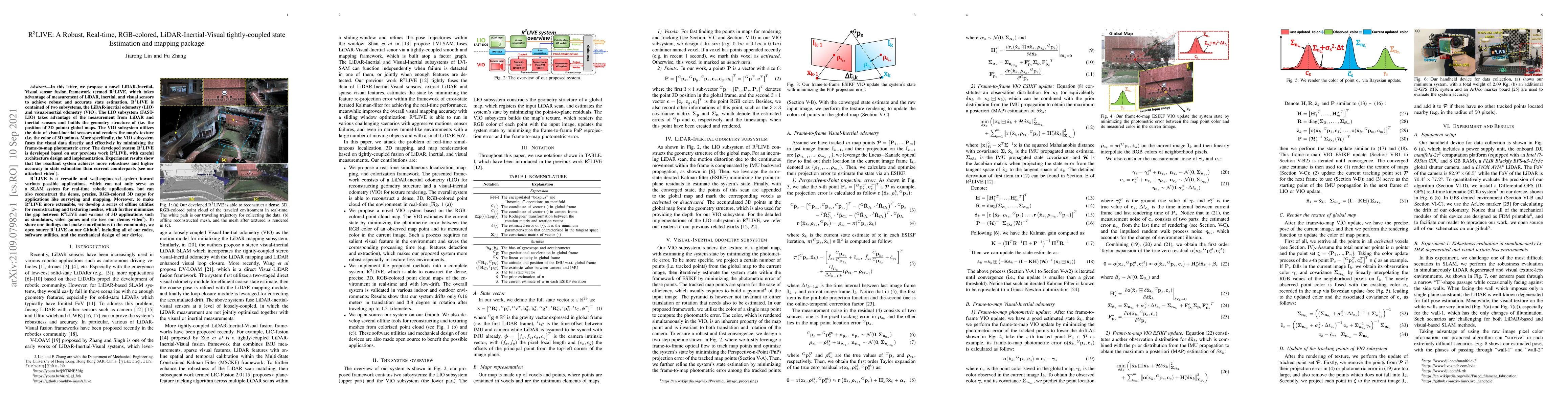
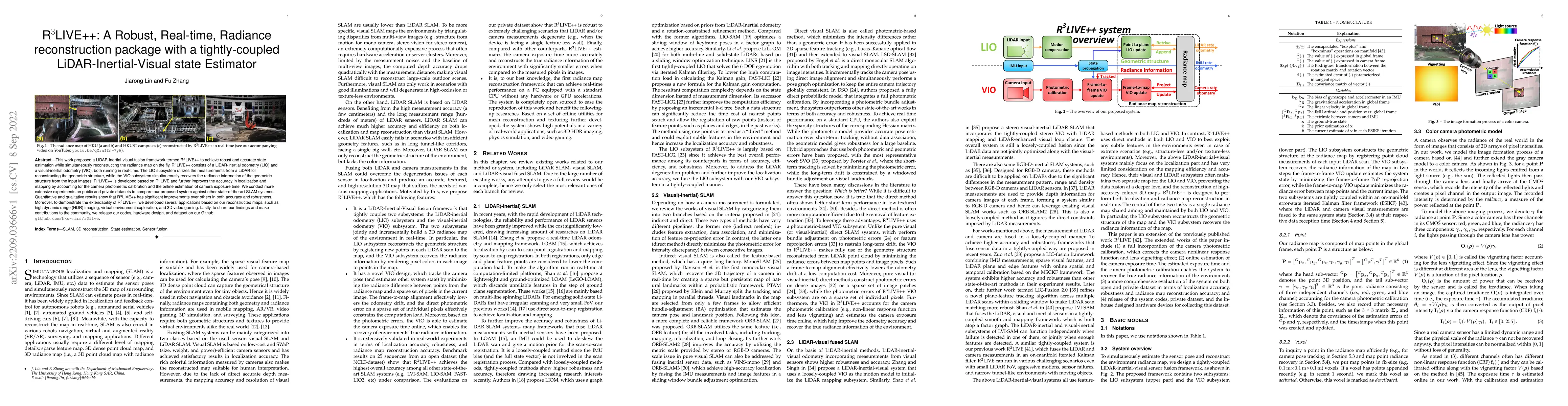
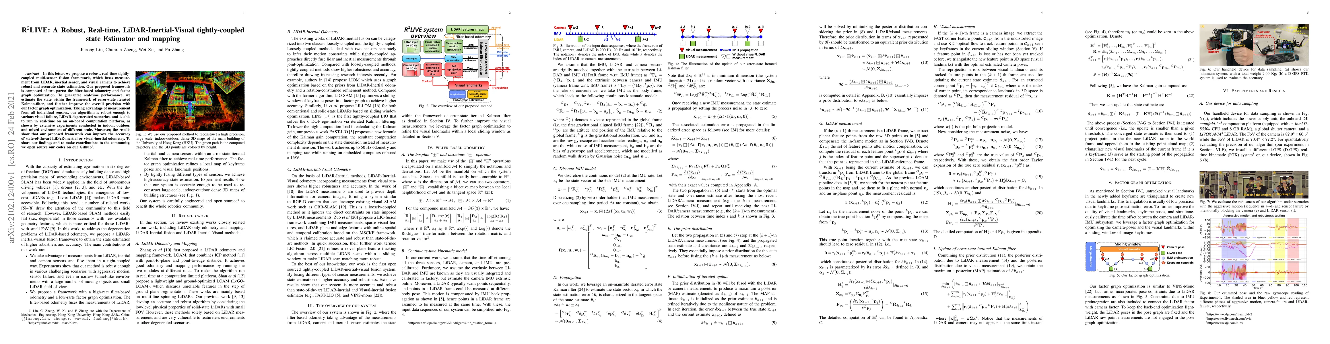
In this letter, we propose a novel LiDAR-Inertial-Visual sensor fusion framework termed R3LIVE, which takes advantage of measurement of LiDAR, inertial, and visual sensors to achieve robust and accu...
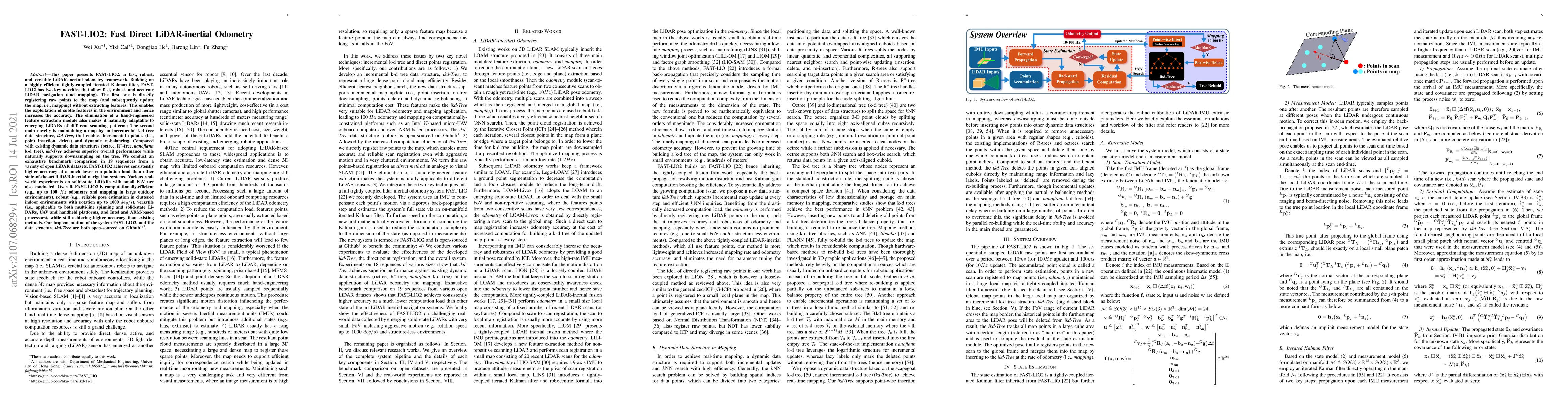
This paper presents FAST-LIO2: a fast, robust, and versatile LiDAR-inertial odometry framework. Building on a highly efficient tightly-coupled iterated Kalman filter, FAST-LIO2 has two key novelties...
In this letter, we propose a robust, real-time tightly-coupled multi-sensor fusion framework, which fuses measurement from LiDAR, inertial sensor, and visual camera to achieve robust and accurate st...
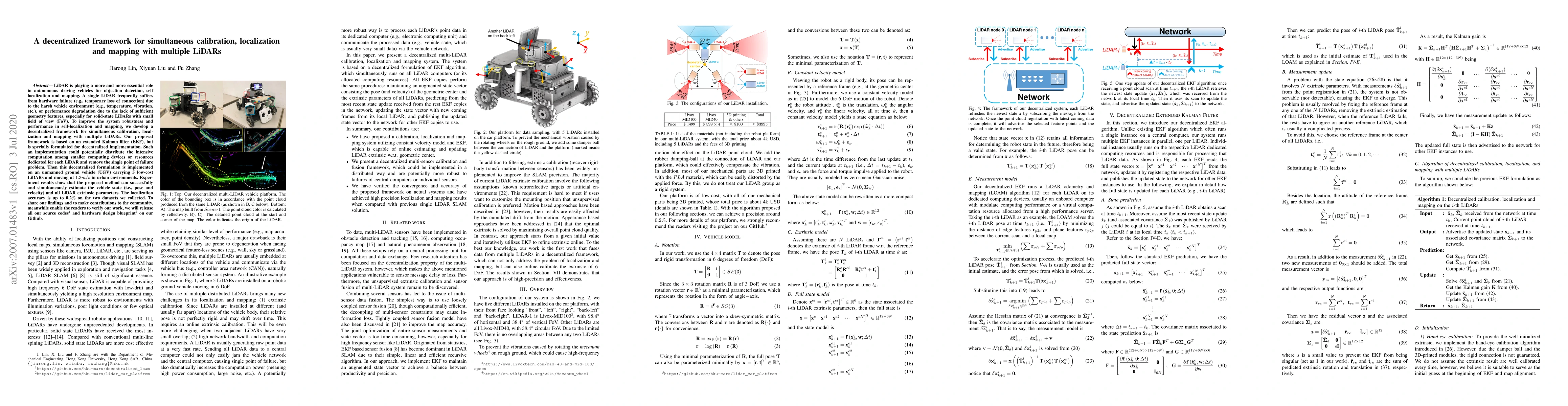
LiDAR is playing a more and more essential role in autonomous driving vehicles for objection detection, self localization and mapping. A single LiDAR frequently suffers from hardware failure (e.g., ...

This paper presents a loop closure method to correct the long-term drift in LiDAR odometry and mapping (LOAM). Our proposed method computes the 2D histogram of keyframes, a local map patch, and uses...
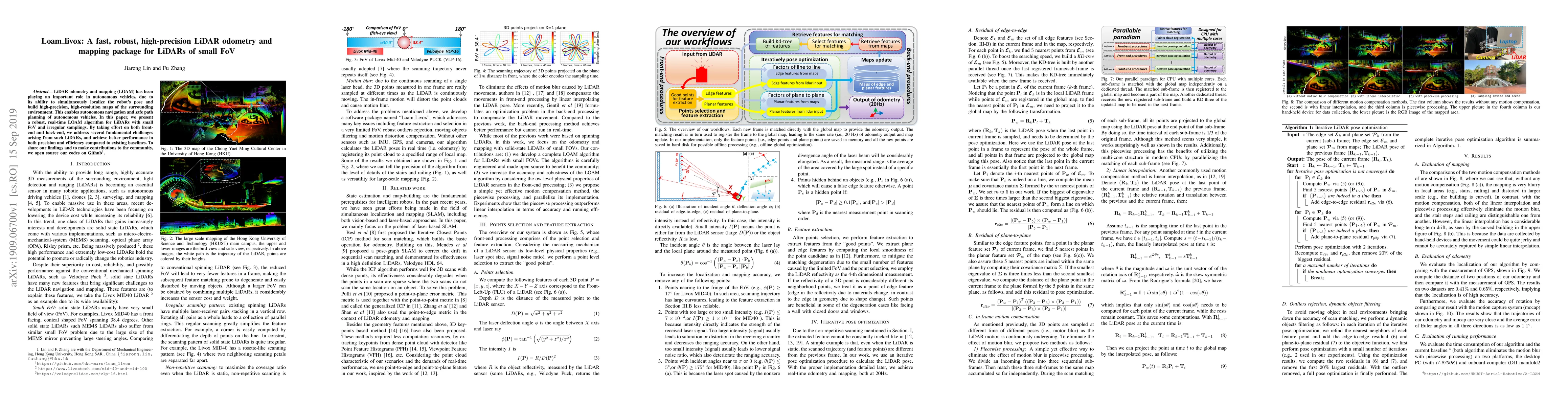
LiDAR odometry and mapping (LOAM) has been playing an important role in autonomous vehicles, due to its ability to simultaneously localize the robot's pose and build high-precision, high-resolution ...
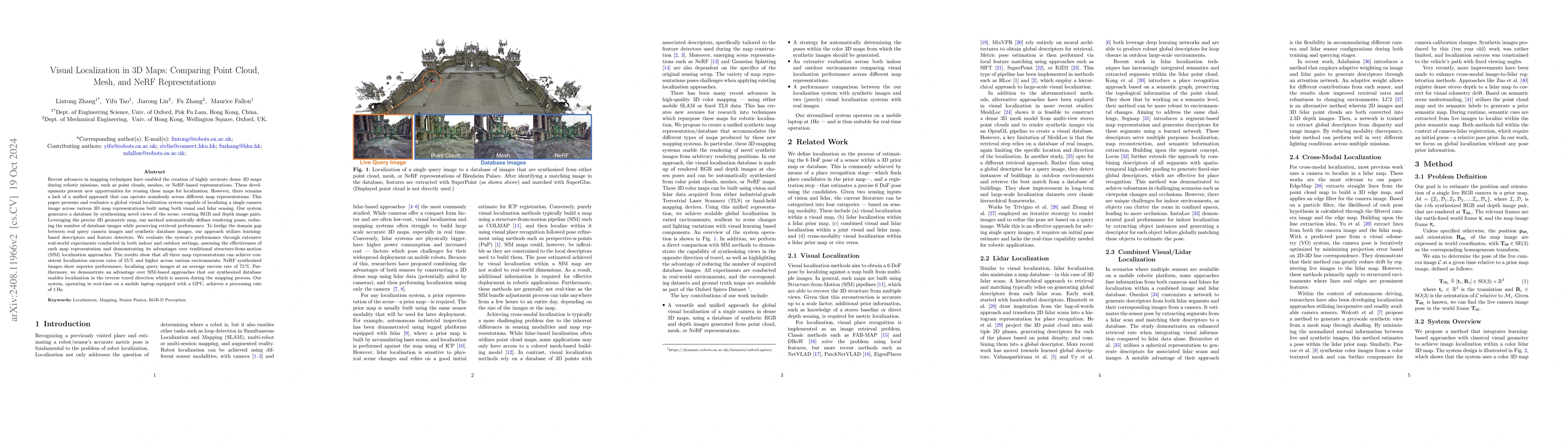
This paper introduces and assesses a cross-modal global visual localization system that can localize camera images within a color 3D map representation built using both visual and lidar sensing. We pr...
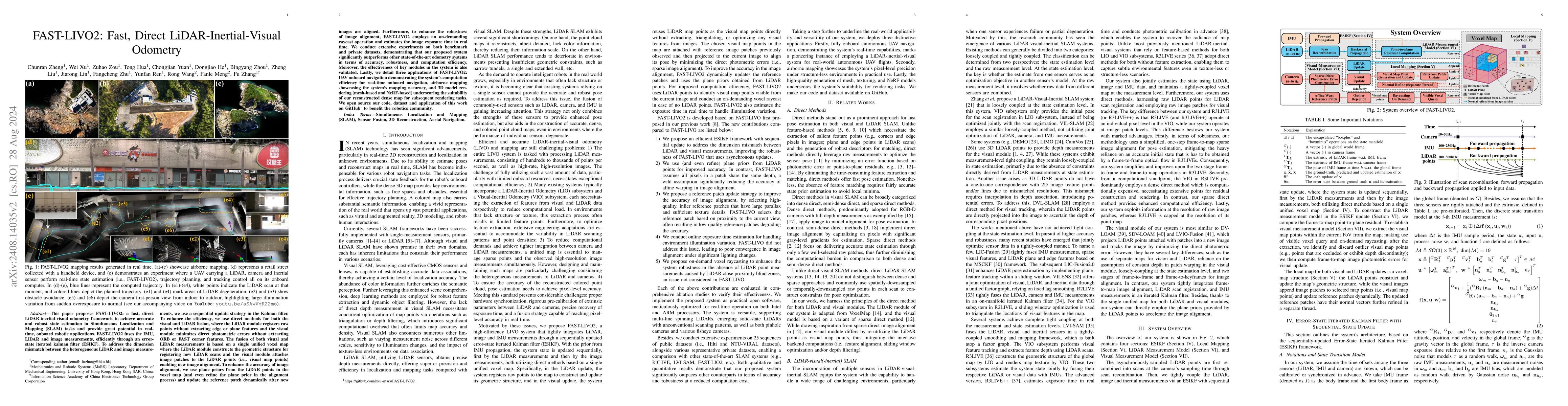
This paper proposes FAST-LIVO2: a fast, direct LiDAR-inertial-visual odometry framework to achieve accurate and robust state estimation in SLAM tasks and provide great potential in real-time, onboard ...
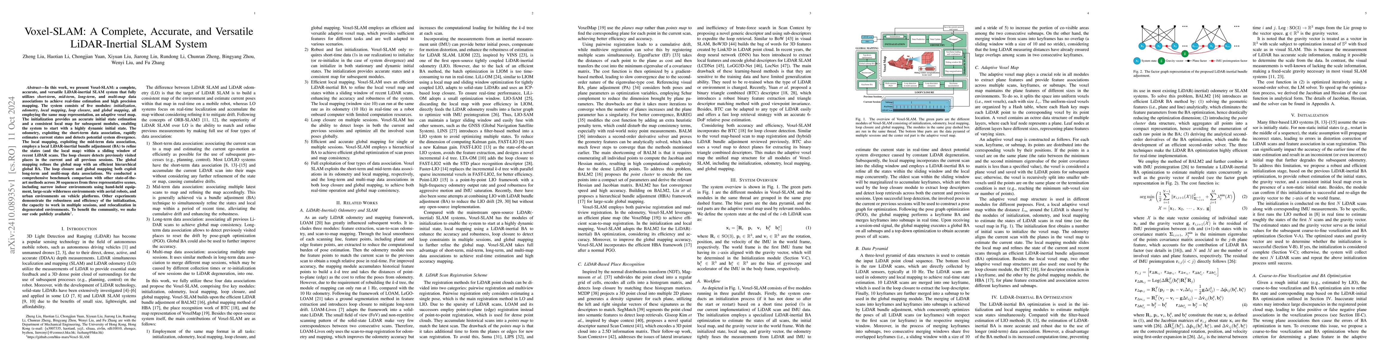
In this work, we present Voxel-SLAM: a complete, accurate, and versatile LiDAR-inertial SLAM system that fully utilizes short-term, mid-term, long-term, and multi-map data associations to achieve real...
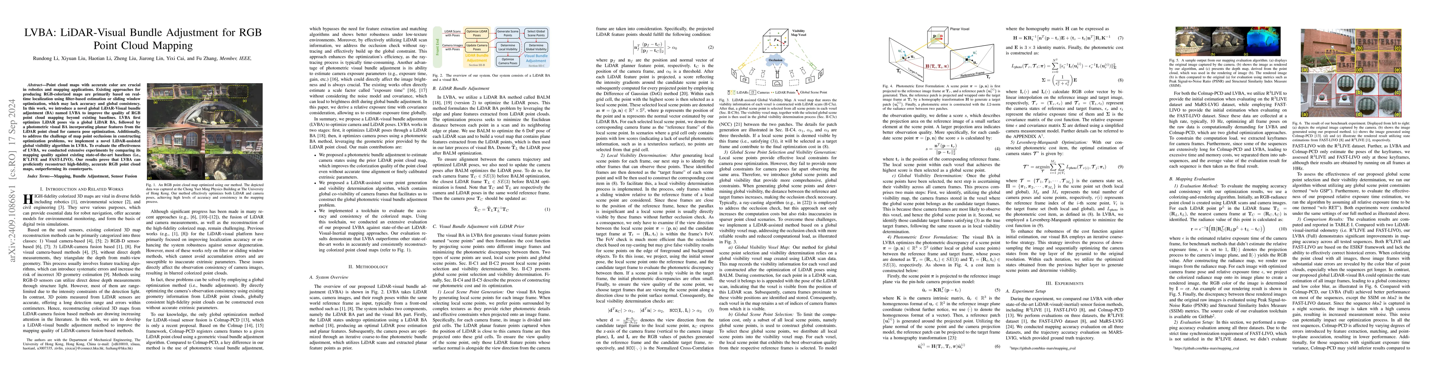
Point cloud maps with accurate color are crucial in robotics and mapping applications. Existing approaches for producing RGB-colorized maps are primarily based on real-time localization using filter-b...
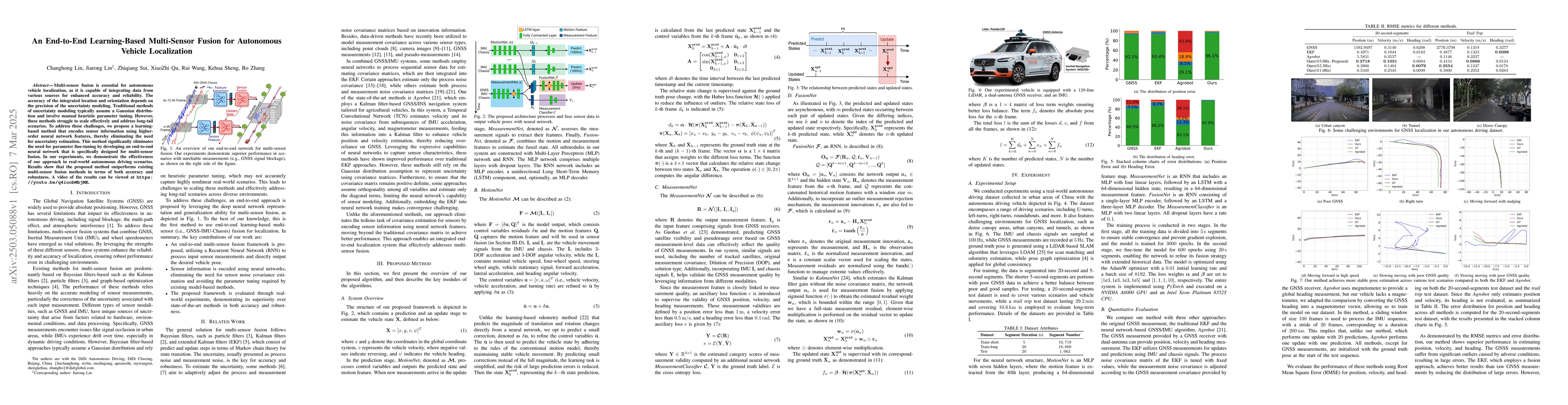
Multi-sensor fusion is essential for autonomous vehicle localization, as it is capable of integrating data from various sources for enhanced accuracy and reliability. The accuracy of the integrated lo...
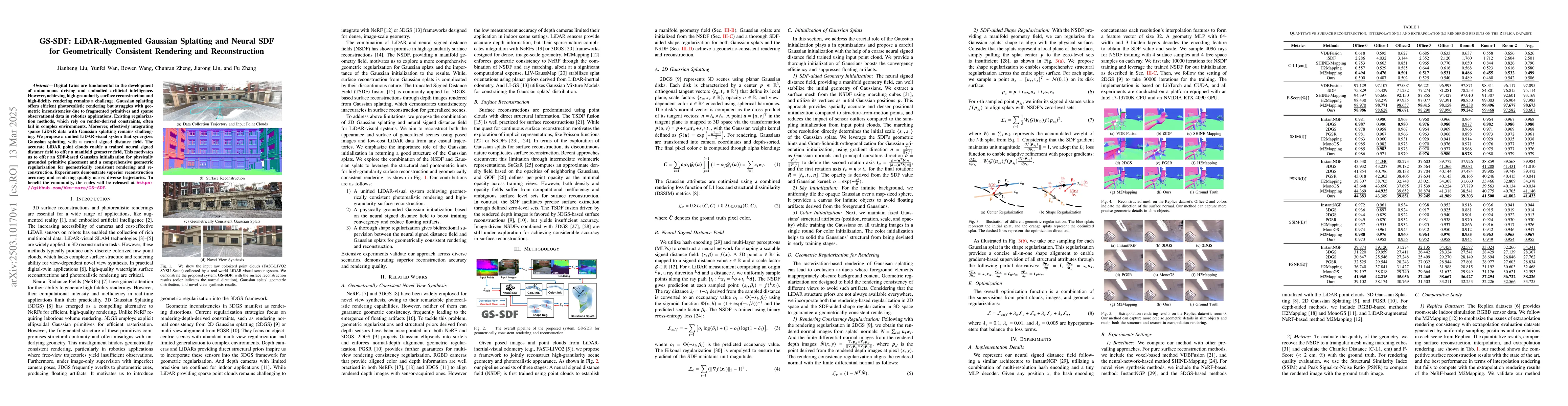
Digital twins are fundamental to the development of autonomous driving and embodied artificial intelligence. However, achieving high-granularity surface reconstruction and high-fidelity rendering rema...
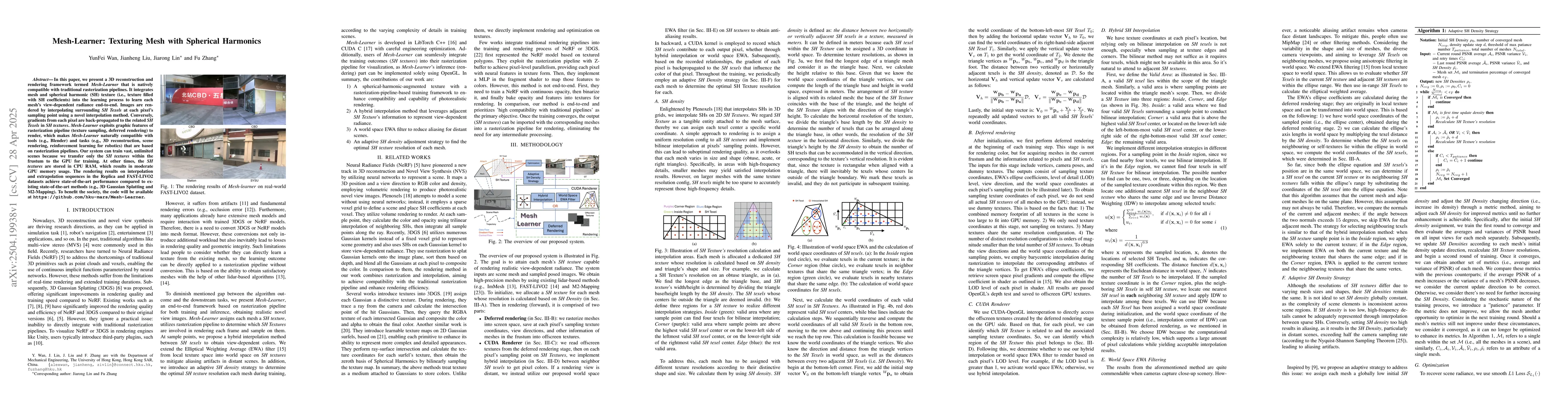
In this paper, we present a 3D reconstruction and rendering framework termed Mesh-Learner that is natively compatible with traditional rasterization pipelines. It integrates mesh and spherical harmoni...