Academic Profile
Statistics
Similar Authors
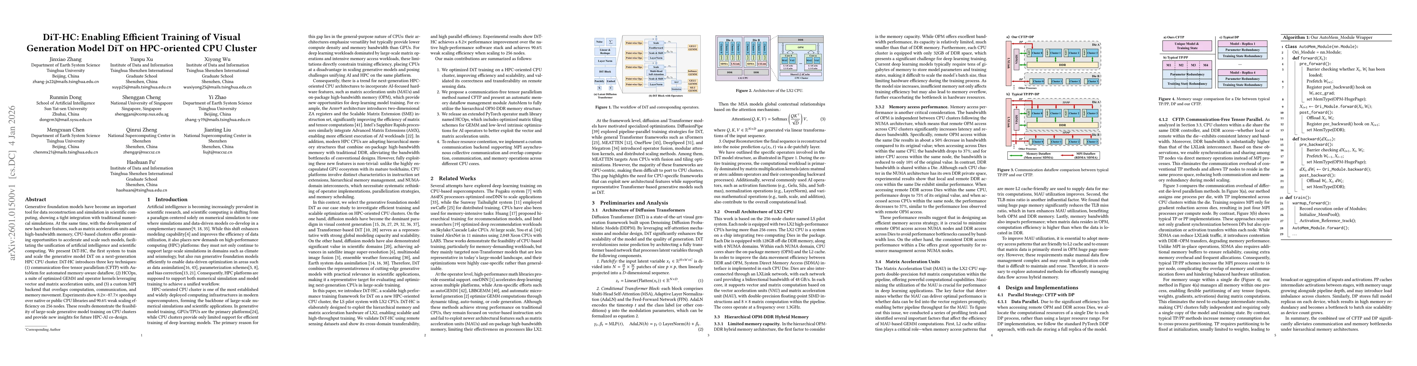
Papers on arXiv
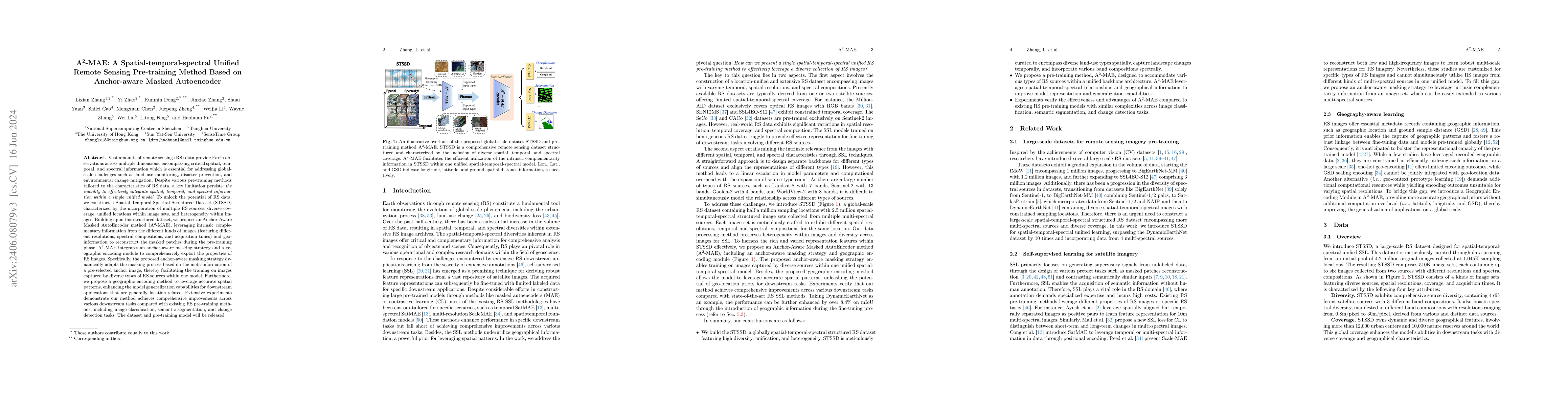
Vast amounts of remote sensing (RS) data provide Earth observations across multiple dimensions, encompassing critical spatial, temporal, and spectral information which is essential for addressing gl...
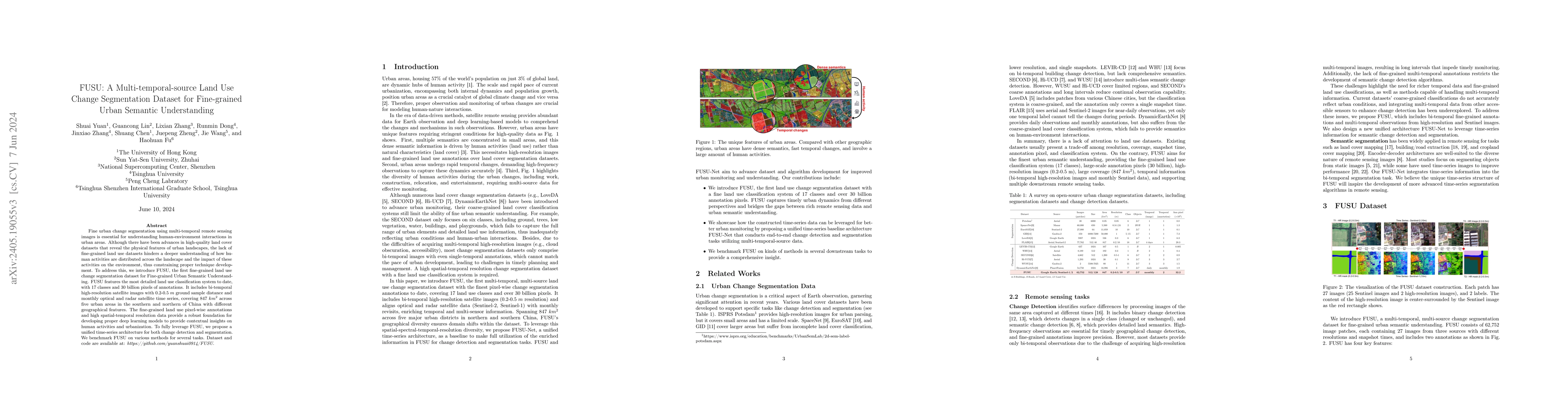
Fine urban change segmentation using multi-temporal remote sensing images is essential for understanding human-environment interactions in urban areas. Although there have been advances in high-qual...
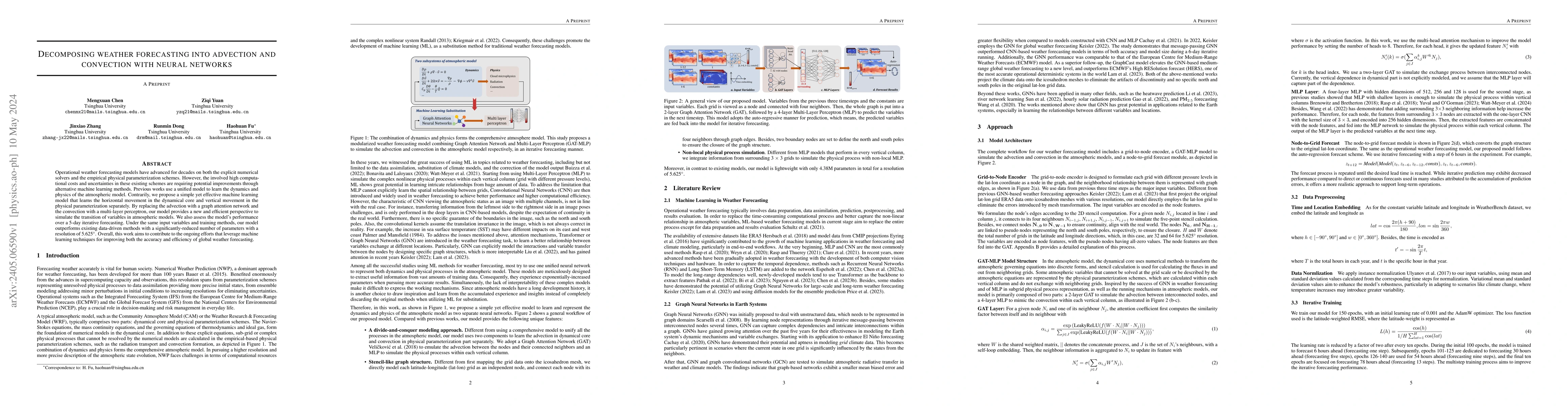
Operational weather forecasting models have advanced for decades on both the explicit numerical solvers and the empirical physical parameterization schemes. However, the involved high computational ...
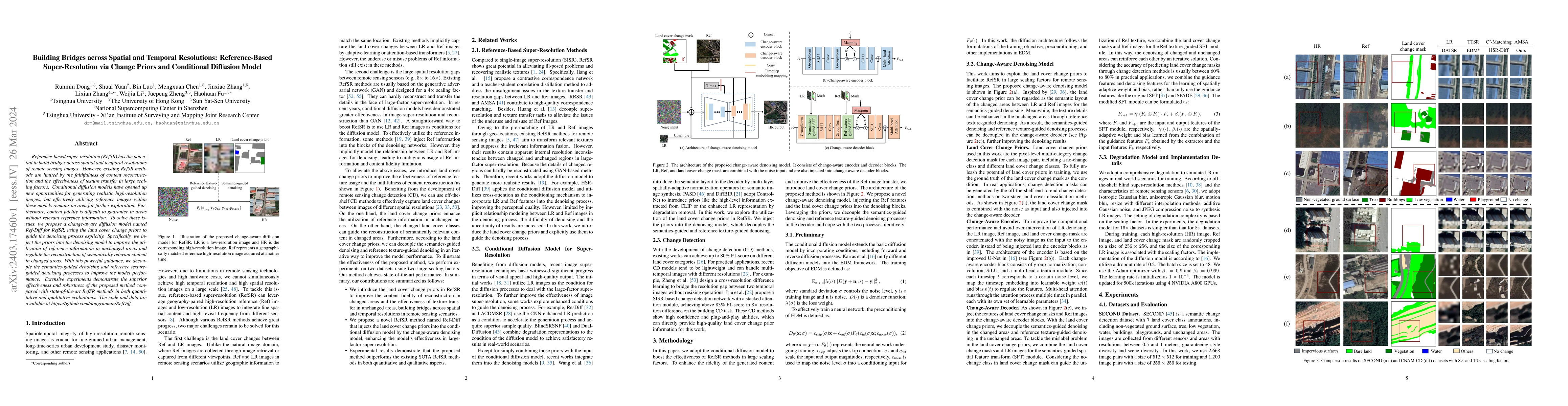
Reference-based super-resolution (RefSR) has the potential to build bridges across spatial and temporal resolutions of remote sensing images. However, existing RefSR methods are limited by the faith...
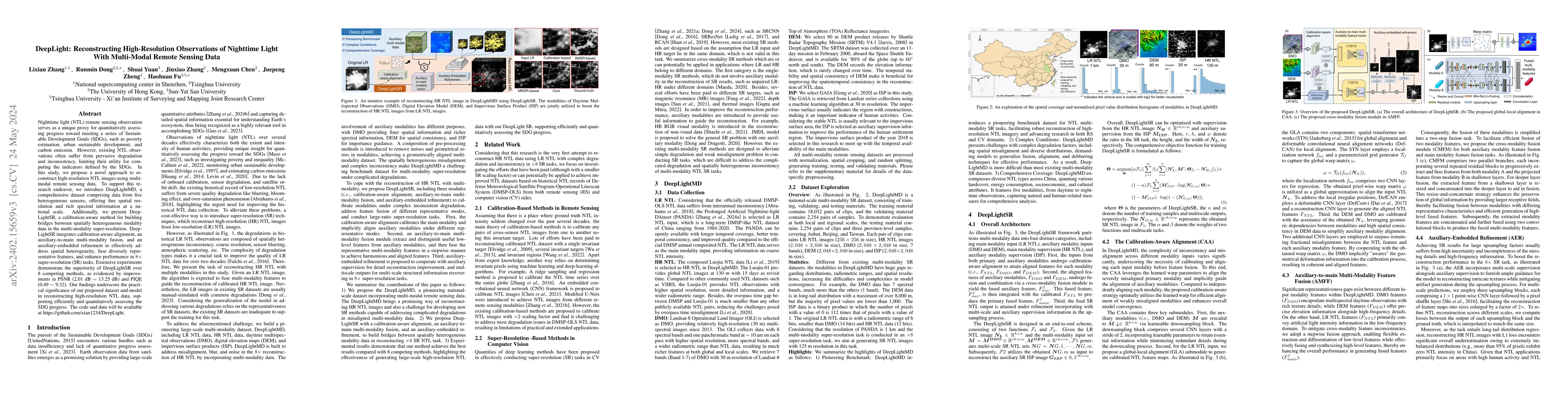
Nighttime light (NTL) remote sensing observation serves as a unique proxy for quantitatively assessing progress toward meeting a series of Sustainable Development Goals (SDGs), such as poverty estim...
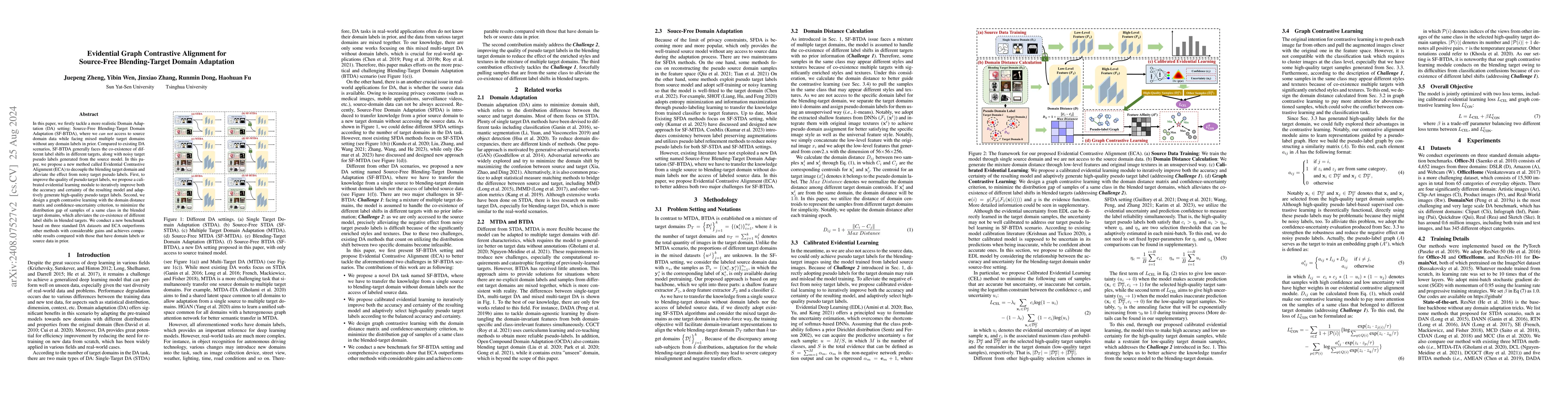
In this paper, we firstly tackle a more realistic Domain Adaptation (DA) setting: Source-Free Blending-Target Domain Adaptation (SF-BTDA), where we can not access to source domain data while facing mi...
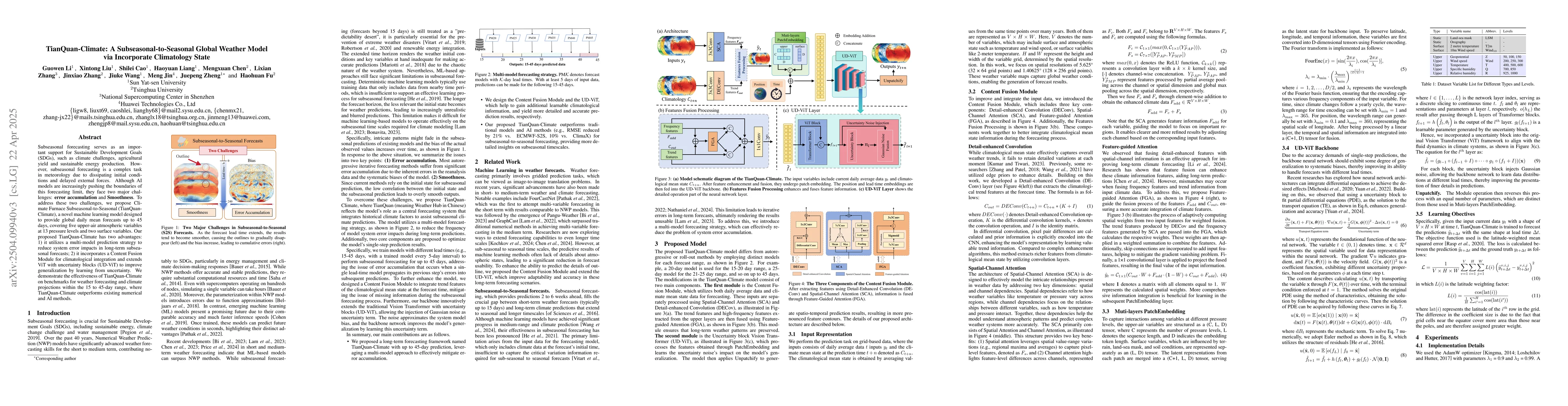
Subseasonal forecasting serves as an important support for Sustainable Development Goals (SDGs), such as climate challenges, agricultural yield and sustainable energy production. However, subseasonal ...
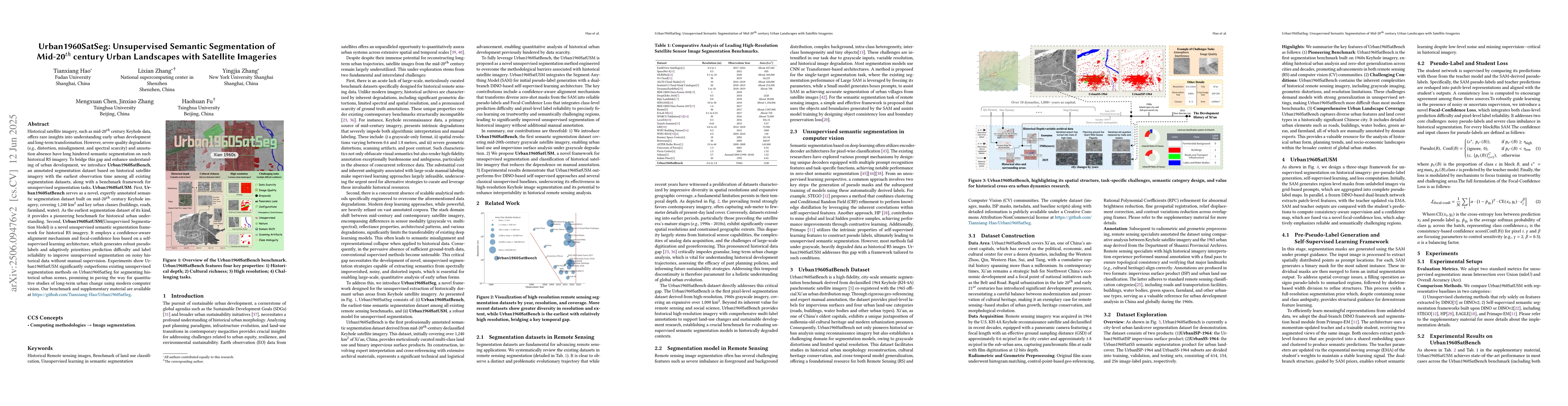
Historical satellite imagery, such as mid-20$^{th}$ century Keyhole data, offers rare insights into understanding early urban development and long-term transformation. However, severe quality degradat...

With the rapid progress of controllable generation, training data synthesis has become a promising way to expand labeled datasets and alleviate manual annotation in remote sensing (RS). However, the c...
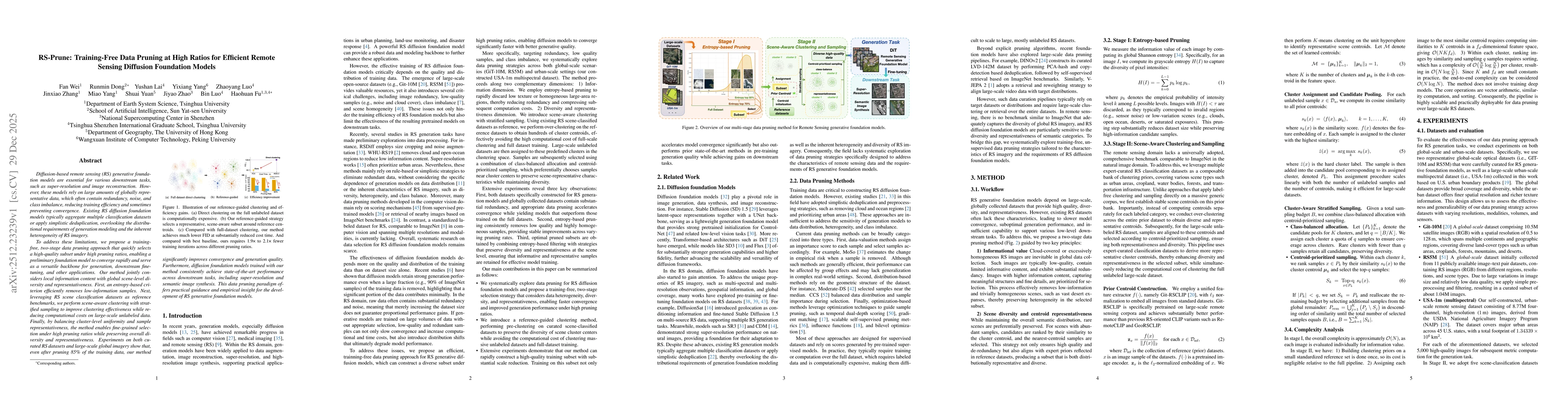
Diffusion-based remote sensing (RS) generative foundation models are cruial for downstream tasks. However, these models rely on large amounts of globally representative data, which often contain redun...
Generative foundation models have become an important tool for data reconstruction and simulation in scientific computing, showing a tight integration with traditional numerical simulations. At the sa...
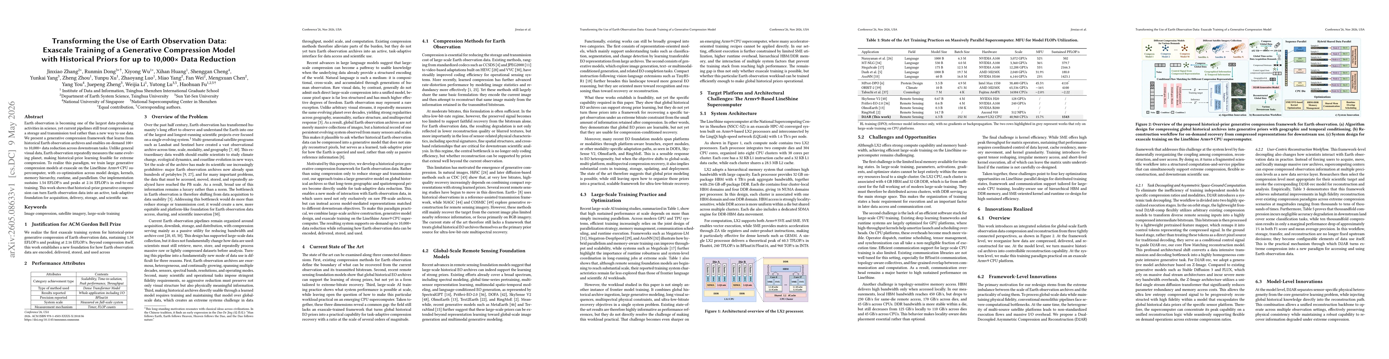
Earth observation is becoming one of the largest data-producing activities in science, yet current pipelines still treat compression as a storage and transmission tool rather than a new way to use dat...
Diffusion-based methods demonstrate significant potential for remote sensing image super-resolution at large scaling factors, particularly in reference-based super-resolution (RefSR) where high-resolu...
Seasonal forecasting of summer rainfall in East Asia remains a grand challenge, as predictability at 3 to 6 month lead times is constrained by the spring predictability barrier, weak large-scale signa...