Academic Profile
Statistics
Similar Authors
Papers on arXiv
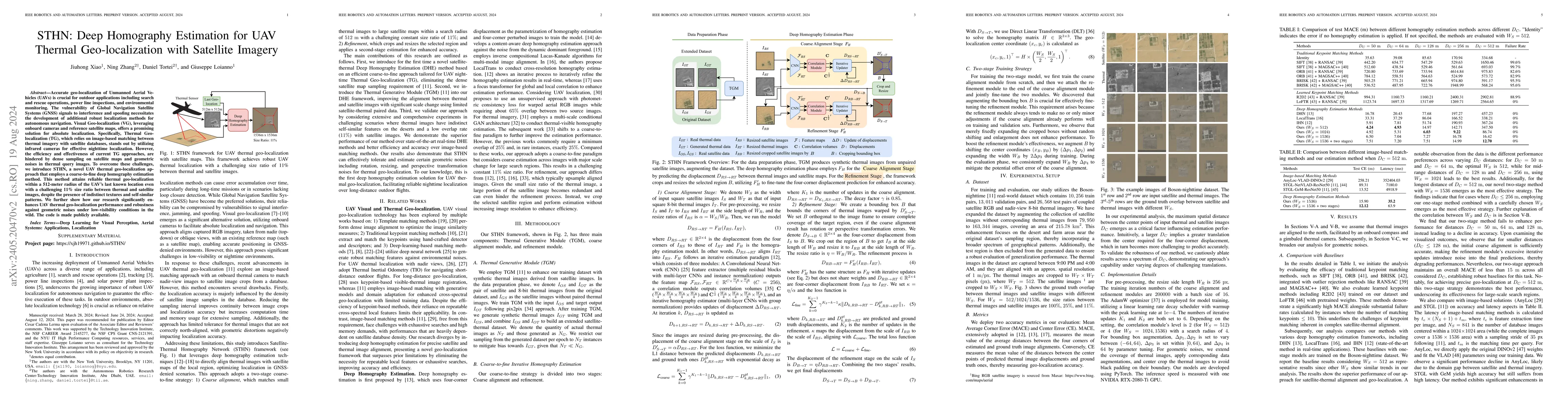
Accurate geo-localization of Unmanned Aerial Vehicles (UAVs) is crucial for a variety of outdoor applications including search and rescue operations, power line inspections, and environmental monito...
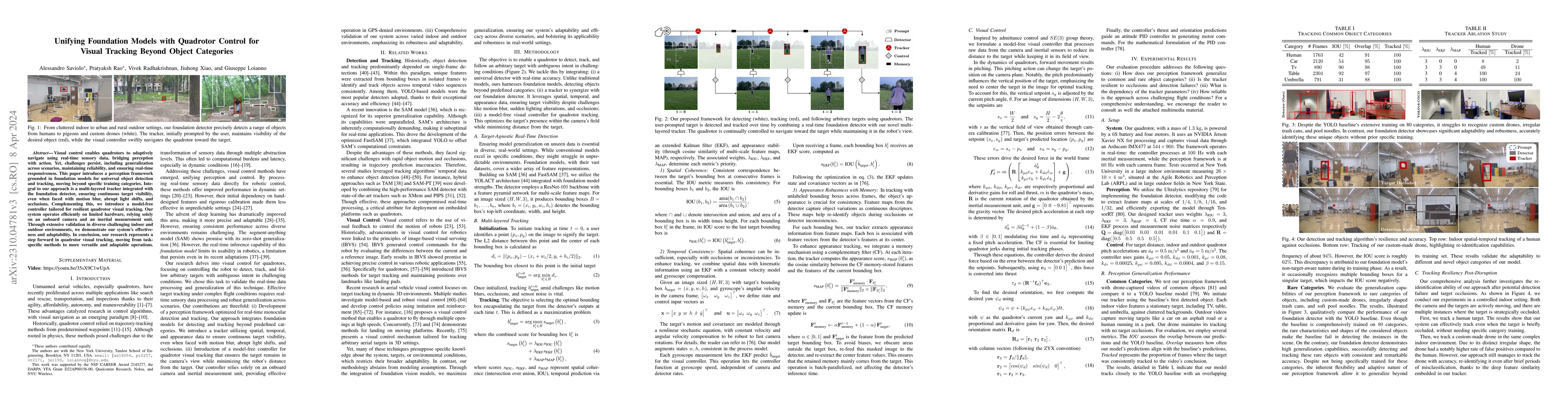
Visual control enables quadrotors to adaptively navigate using real-time sensory data, bridging perception with action. Yet, challenges persist, including generalization across scenarios, maintainin...
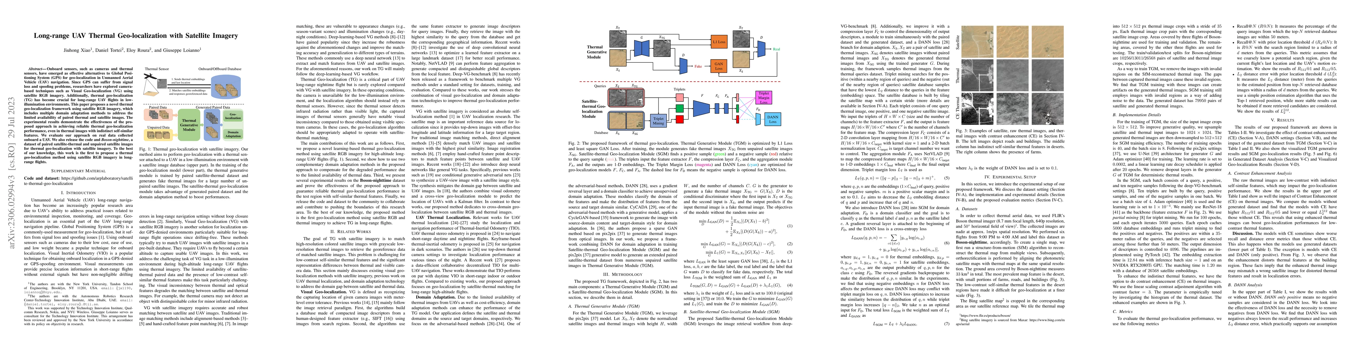
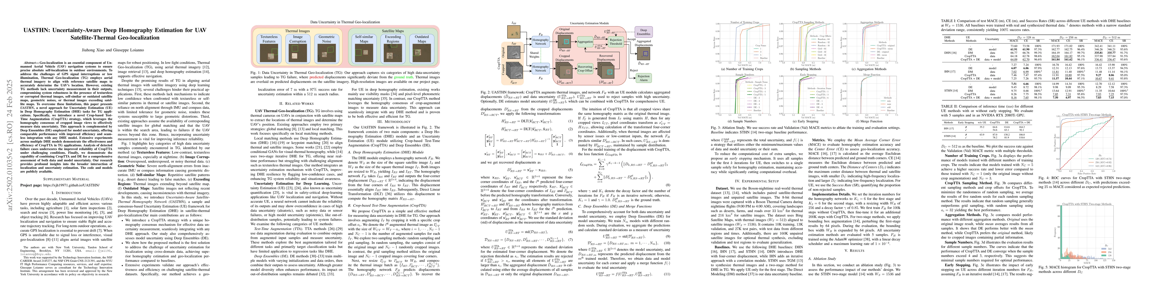
Onboard sensors, such as cameras and thermal sensors, have emerged as effective alternatives to Global Positioning System (GPS) for geo-localization in Unmanned Aerial Vehicle (UAV) navigation. Sinc...
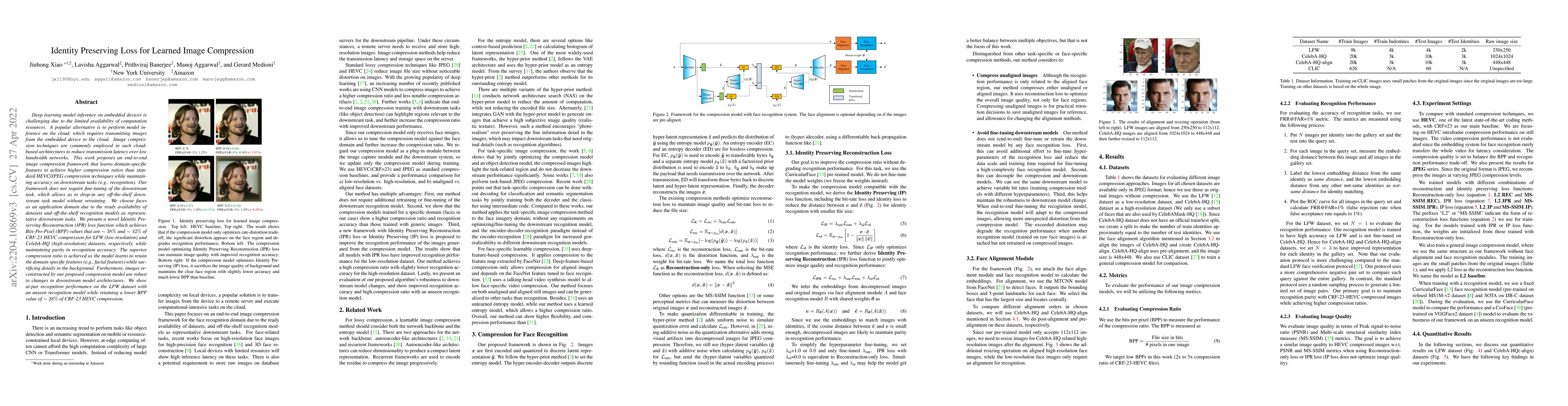
Deep learning model inference on embedded devices is challenging due to the limited availability of computation resources. A popular alternative is to perform model inference on the cloud, which req...
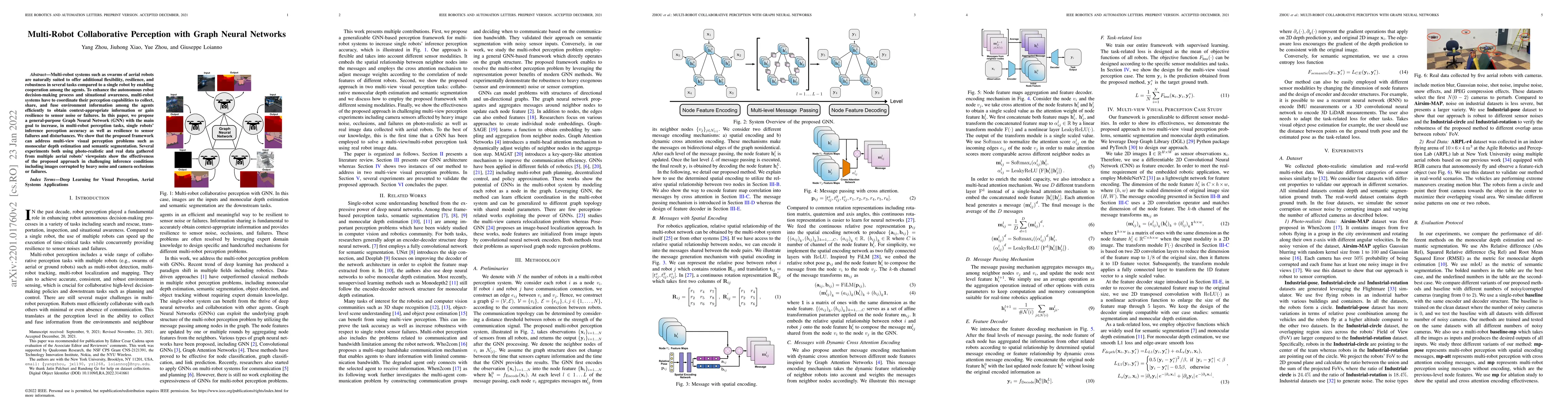
Multi-robot systems such as swarms of aerial robots are naturally suited to offer additional flexibility, resilience, and robustness in several tasks compared to a single robot by enabling cooperati...
Geo-localization is an essential component of Unmanned Aerial Vehicle (UAV) navigation systems to ensure precise absolute self-localization in outdoor environments. To address the challenges of GPS si...
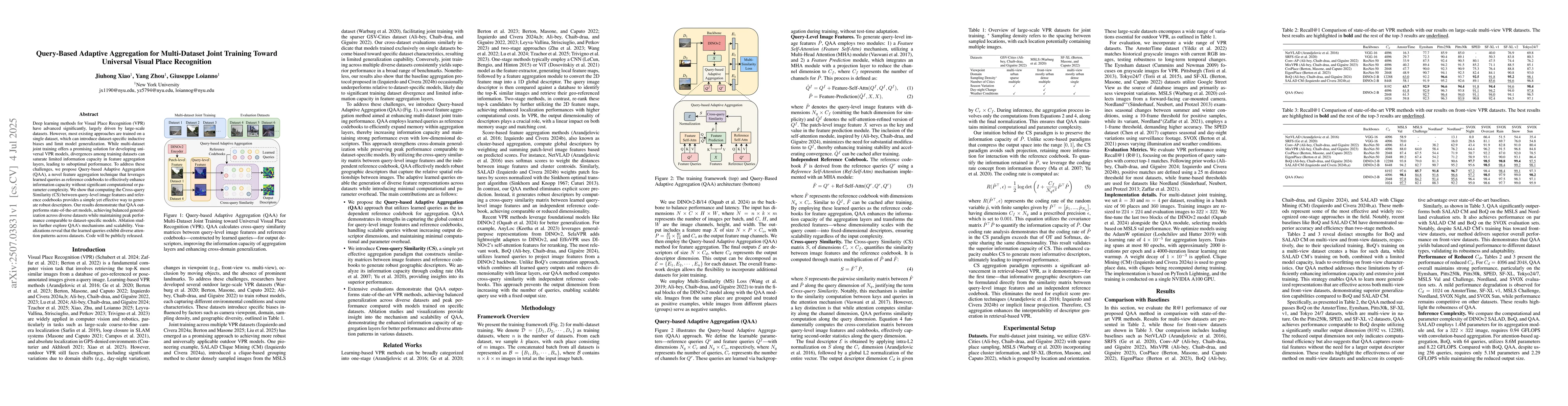
Deep learning methods for Visual Place Recognition (VPR) have advanced significantly, largely driven by large-scale datasets. However, most existing approaches are trained on a single dataset, which c...
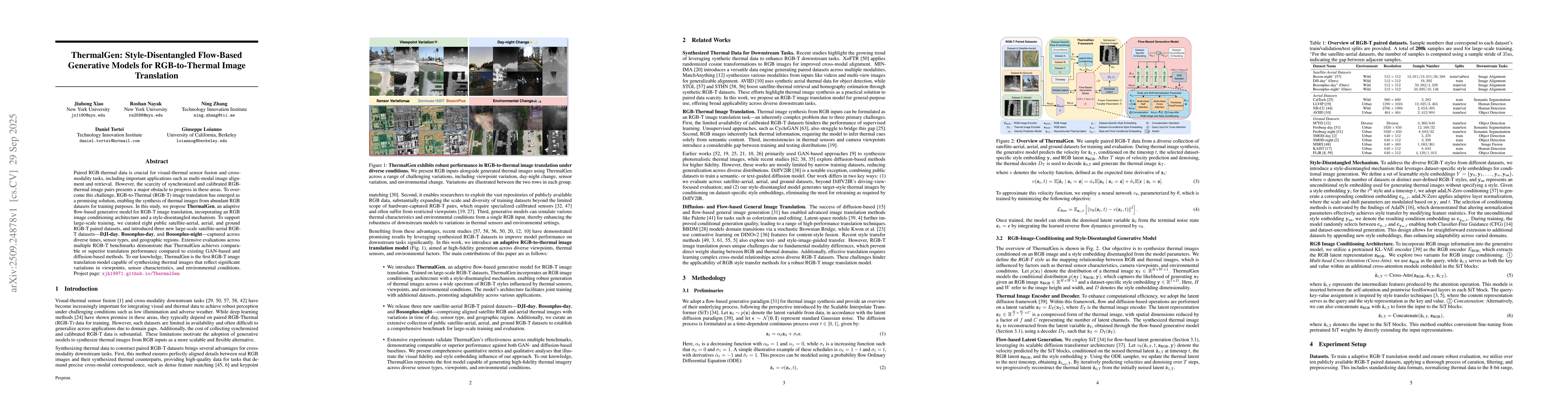
Paired RGB-thermal data is crucial for visual-thermal sensor fusion and cross-modality tasks, including important applications such as multi-modal image alignment and retrieval. However, the scarcity ...