Academic Profile
Statistics
Similar Authors
Papers on arXiv
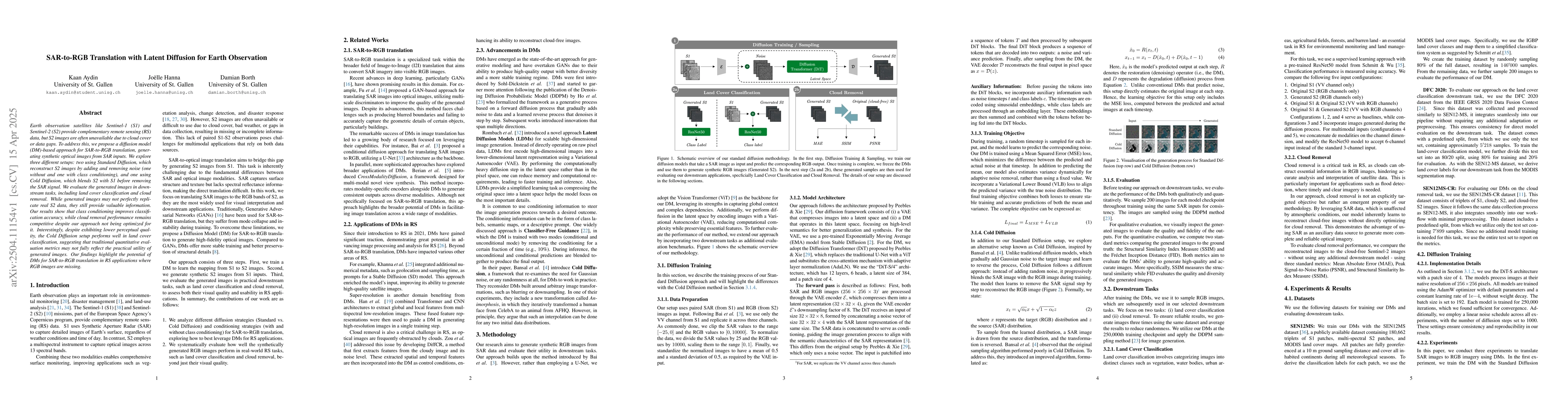
Earth observation satellites like Sentinel-1 (S1) and Sentinel-2 (S2) provide complementary remote sensing (RS) data, but S2 images are often unavailable due to cloud cover or data gaps. To address th...
Remote sensing data is commonly used for tasks such as flood mapping, wildfire detection, or land-use studies. For each task, scientists carefully choose appropriate modalities or leverage data from p...
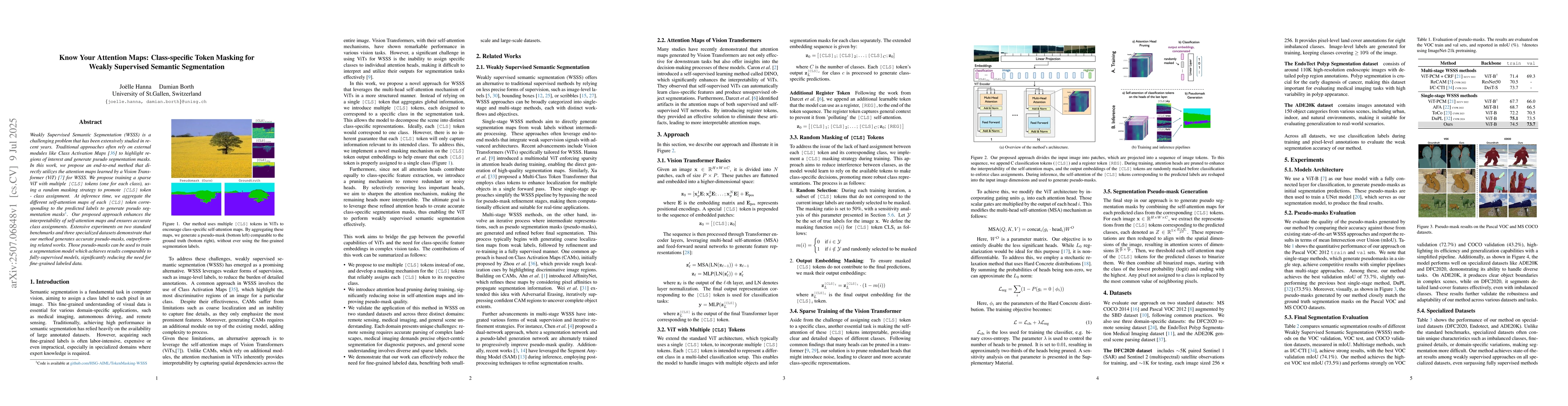
Weakly Supervised Semantic Segmentation (WSSS) is a challenging problem that has been extensively studied in recent years. Traditional approaches often rely on external modules like Class Activation M...
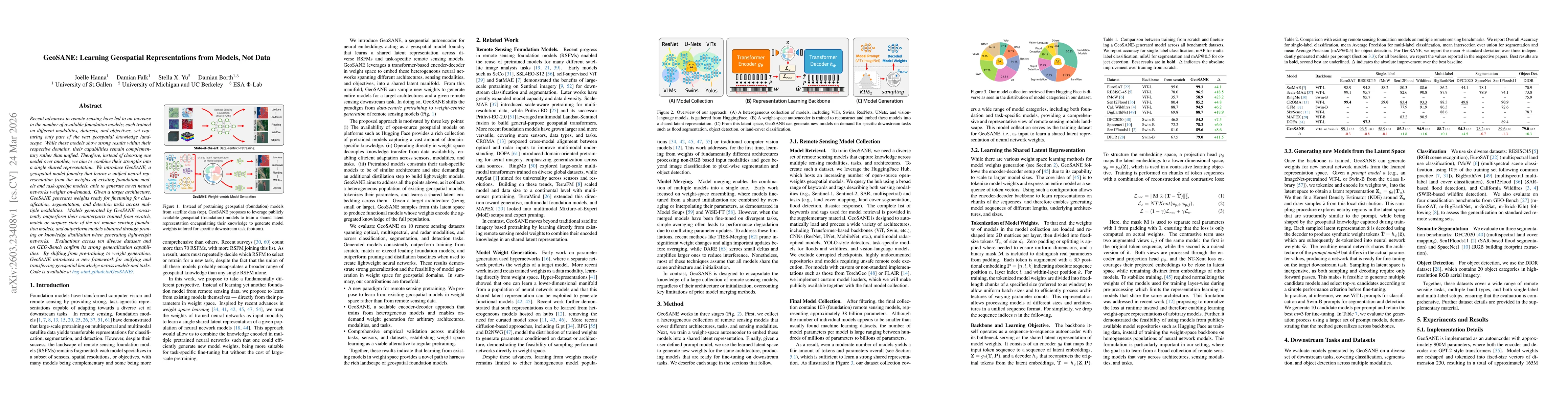
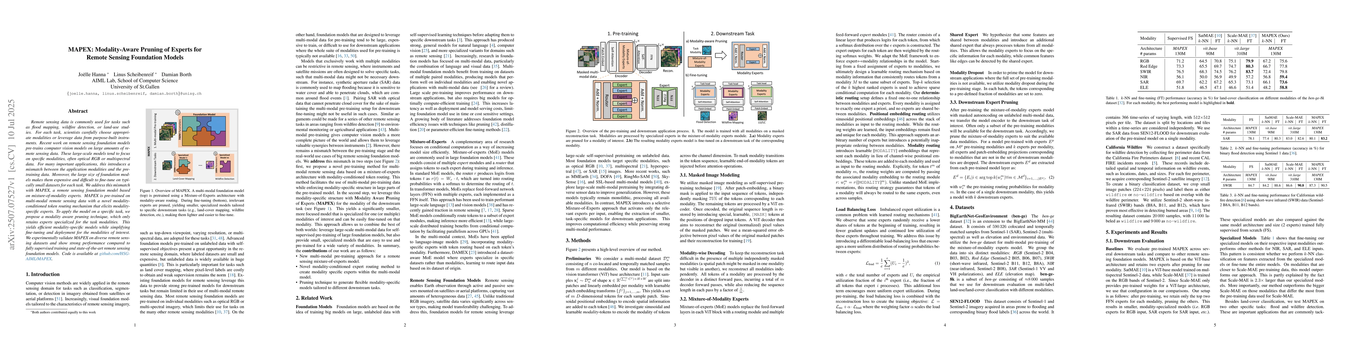
Recent advances in remote sensing have led to an increase in the number of available foundation models; each trained on different modalities, datasets, and objectives, yet capturing only part of the v...