Academic Profile
Statistics
Similar Authors
Papers on arXiv
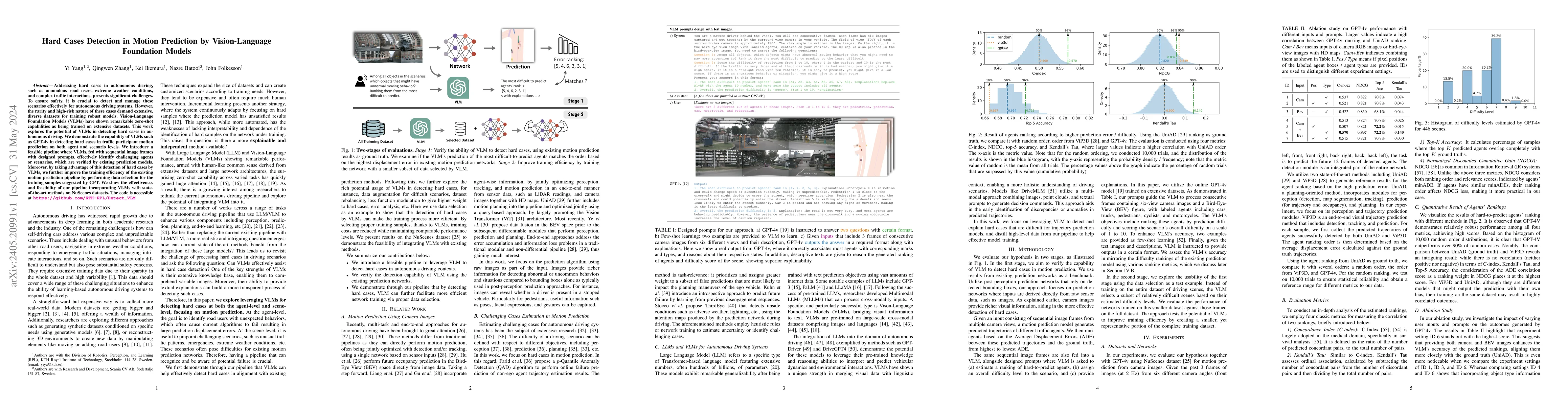
Addressing hard cases in autonomous driving, such as anomalous road users, extreme weather conditions, and complex traffic interactions, presents significant challenges. To ensure safety, it is cruc...
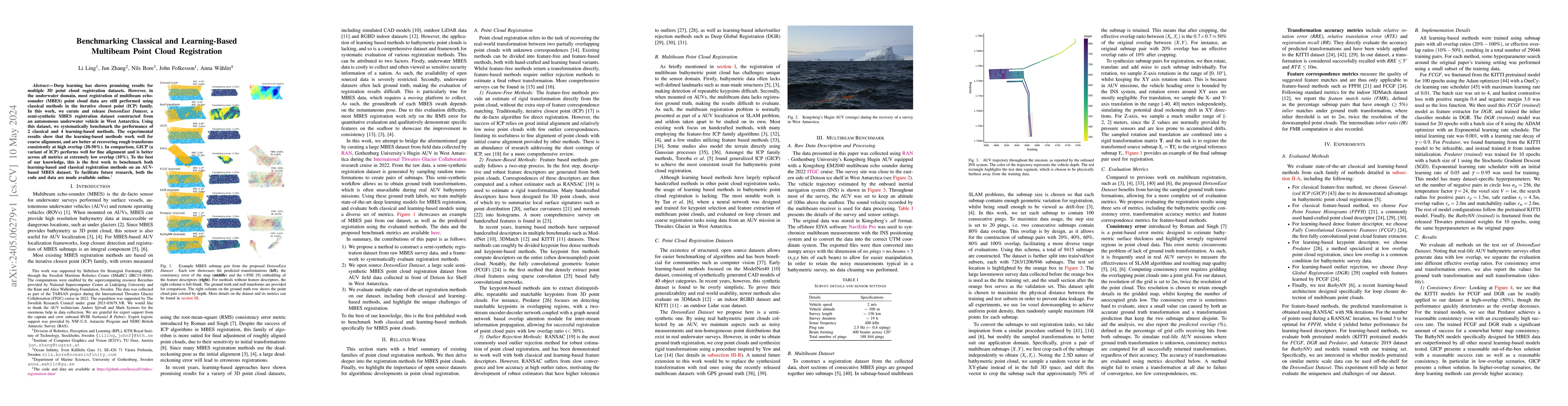
Deep learning has shown promising results for multiple 3D point cloud registration datasets. However, in the underwater domain, most registration of multibeam echo-sounder (MBES) point cloud data ar...
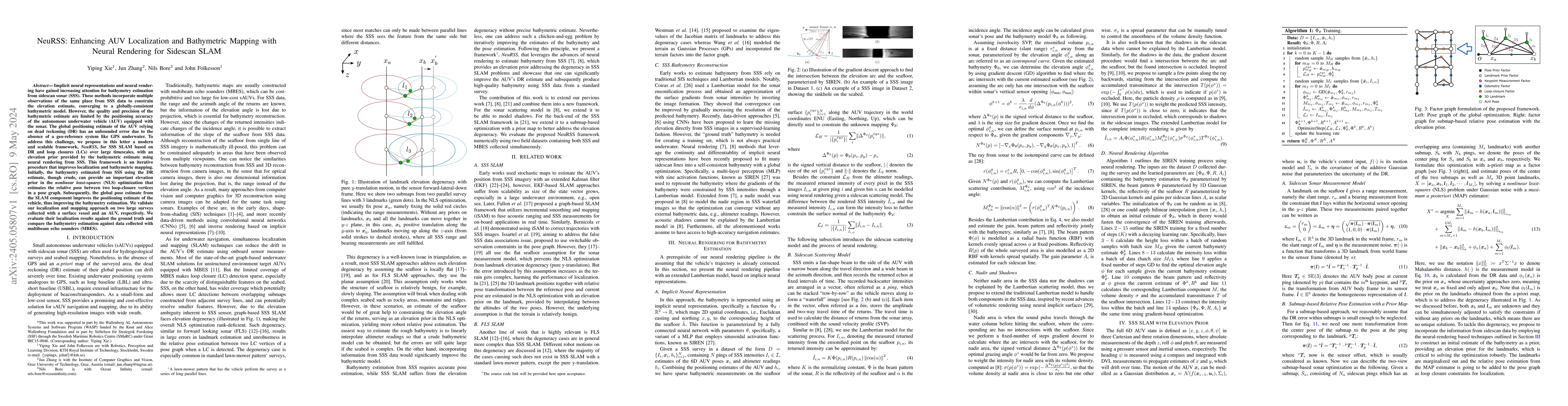
Implicit neural representations and neural rendering have gained increasing attention for bathymetry estimation from sidescan sonar (SSS). These methods incorporate multiple observations of the same...
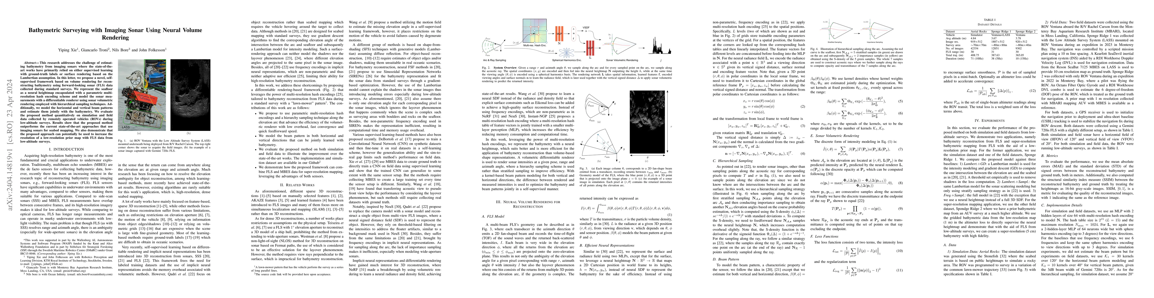
This research addresses the challenge of estimating bathymetry from imaging sonars where the state-of-the-art works have primarily relied on either supervised learning with ground-truth labels or su...
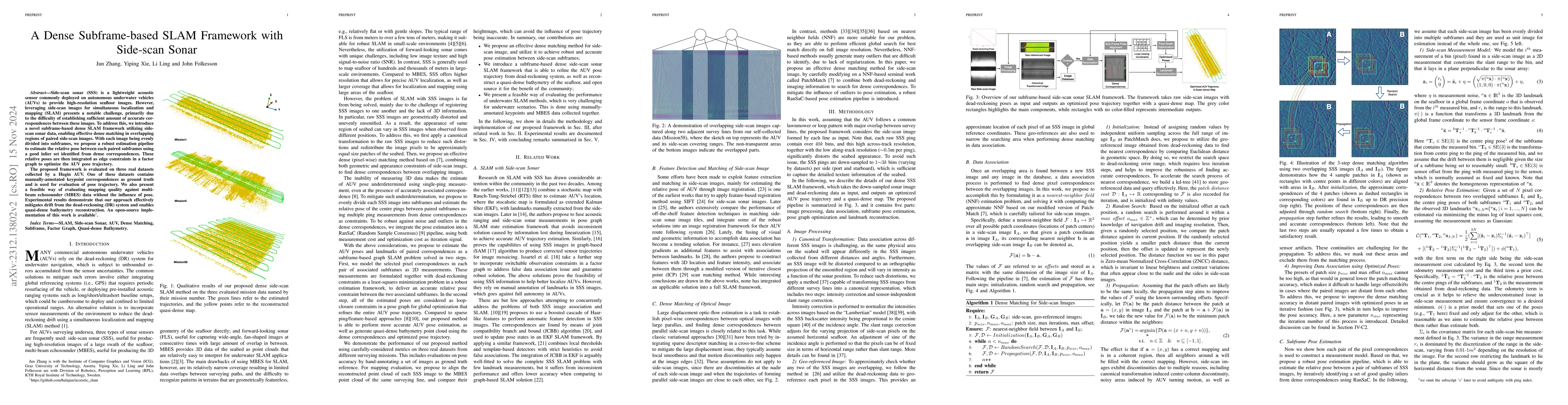
Side-scan sonar (SSS) is a lightweight acoustic sensor that is commonly deployed on autonomous underwater vehicles (AUVs) to provide high-resolution seafloor images. However, leveraging side-scan im...
The evolution of autonomous driving has made remarkable advancements in recent years, evolving into a tangible reality. However, a human-centric large-scale adoption hinges on meeting a variety of m...
As the pretraining technique is growing in popularity, little work has been done on pretrained learning-based motion prediction methods in autonomous driving. In this paper, we propose a framework t...
Due to the challenges regarding the limits of their endurance and autonomous capabilities, underwater docking for autonomous underwater vehicles (AUVs) has become a topic of interest for many academ...
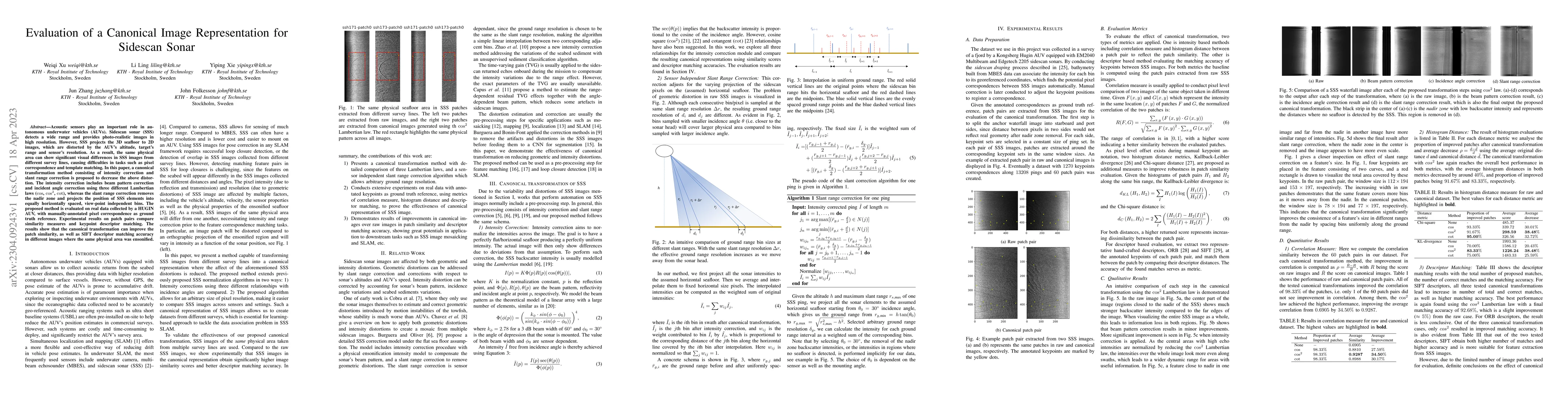
Acoustic sensors play an important role in autonomous underwater vehicles (AUVs). Sidescan sonar (SSS) detects a wide range and provides photo-realistic images in high resolution. However, SSS proje...
Side-scan sonar (SSS) is a lightweight acoustic sensor that is frequently deployed on autonomous underwater vehicles (AUVs) to provide high-resolution seafloor images. However, using side-scan image...
Autonomous underwater vehicles (AUVs) are becoming standard tools for underwater exploration and seabed mapping in both scientific and industrial applications \cite{graham2022rapid, stenius2022syste...
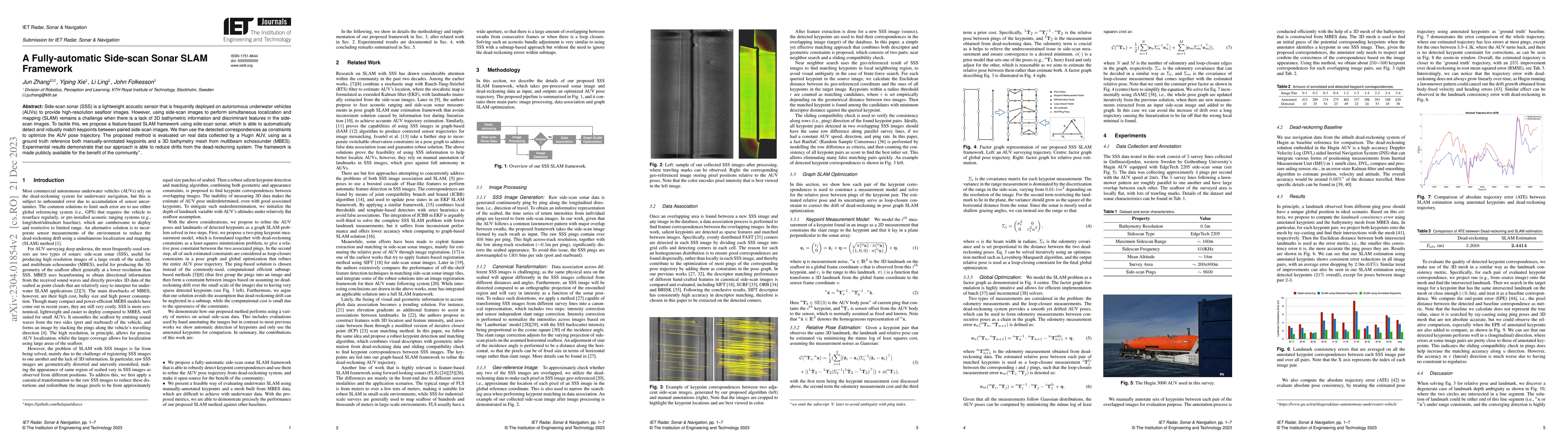
Simultaneous localization and mapping (SLAM) frameworks for autonomous navigation rely on robust data association to identify loop closures for back-end trajectory optimization. In the case of auton...
Sidescan sonar is a small and cost-effective sensing solution that can be easily mounted on most vessels. Historically, it has been used to produce high-definition images that experts may use to ide...
Recent advances in differentiable rendering, which allow calculating the gradients of 2D pixel values with respect to 3D object models, can be applied to estimation of the model parameters by gradie...
Sidescan sonar intensity encodes information about the changes of surface normal of the seabed. However, other factors such as seabed geometry as well as its material composition also affect the ret...
We propose a novel data-driven approach for high-resolution bathymetric reconstruction from sidescan. Sidescan sonar (SSS) intensities as a function of range do contain some information about the sl...

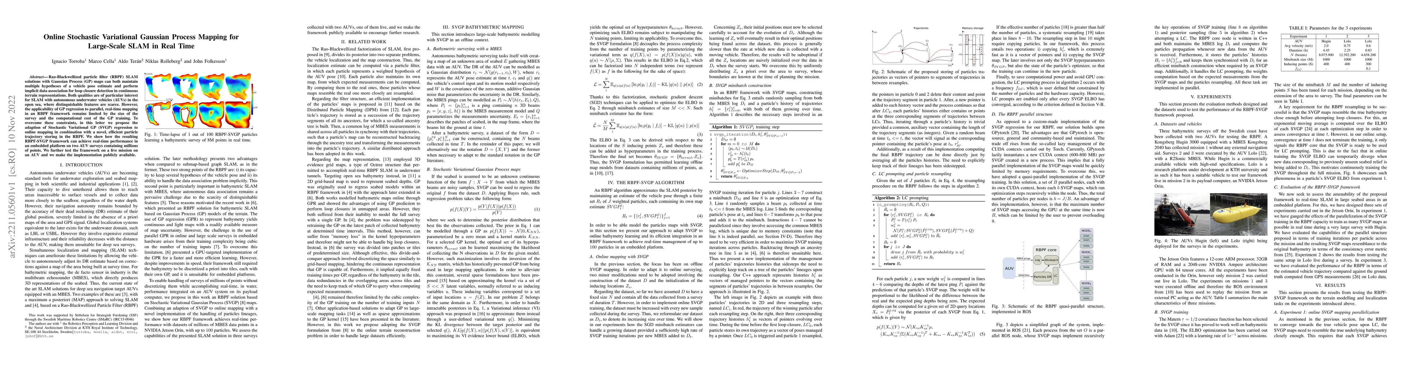
Gaussian processes (GPs) are becoming a standard tool to build terrain representations thanks to their capacity to model map uncertainty. This effectively yields a reliability measure of the areas o...
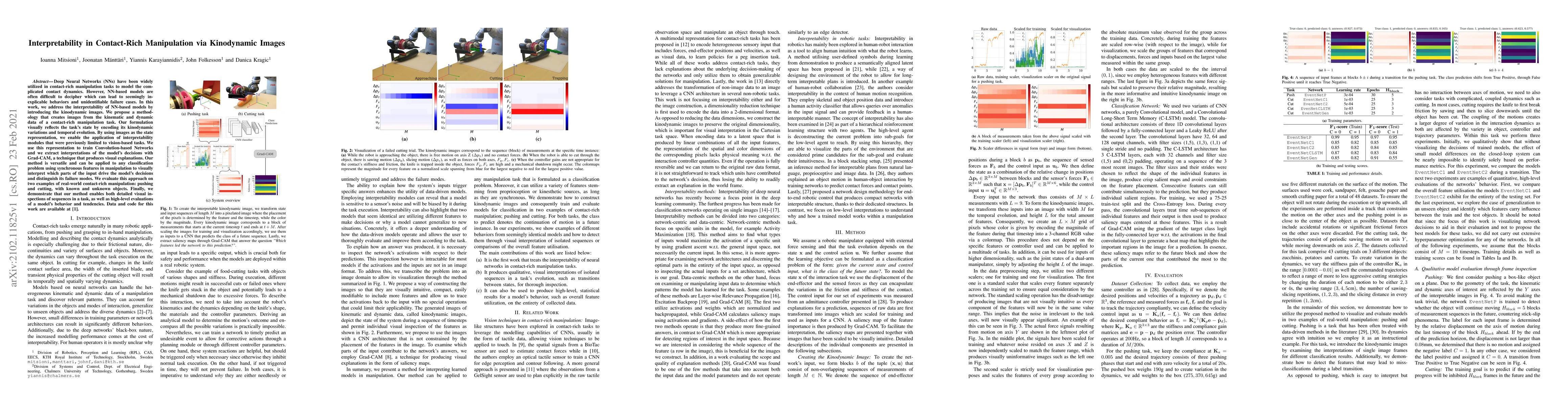
Deep Neural Networks (NNs) have been widely utilized in contact-rich manipulation tasks to model the complicated contact dynamics. However, NN-based models are often difficult to decipher which can ...
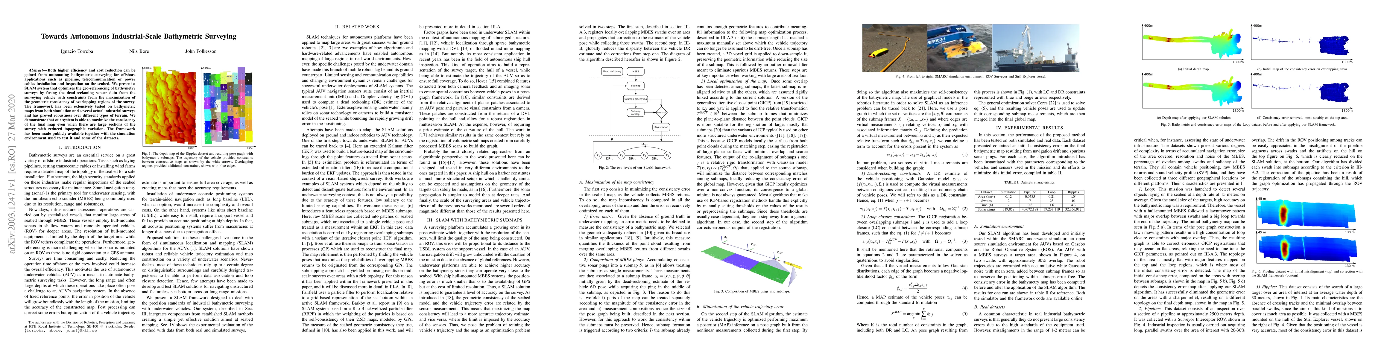
Both higher efficiency and cost reduction can be gained from automating bathymetric surveying for offshore applications such as pipeline, telecommunication or power cables installation and inspectio...
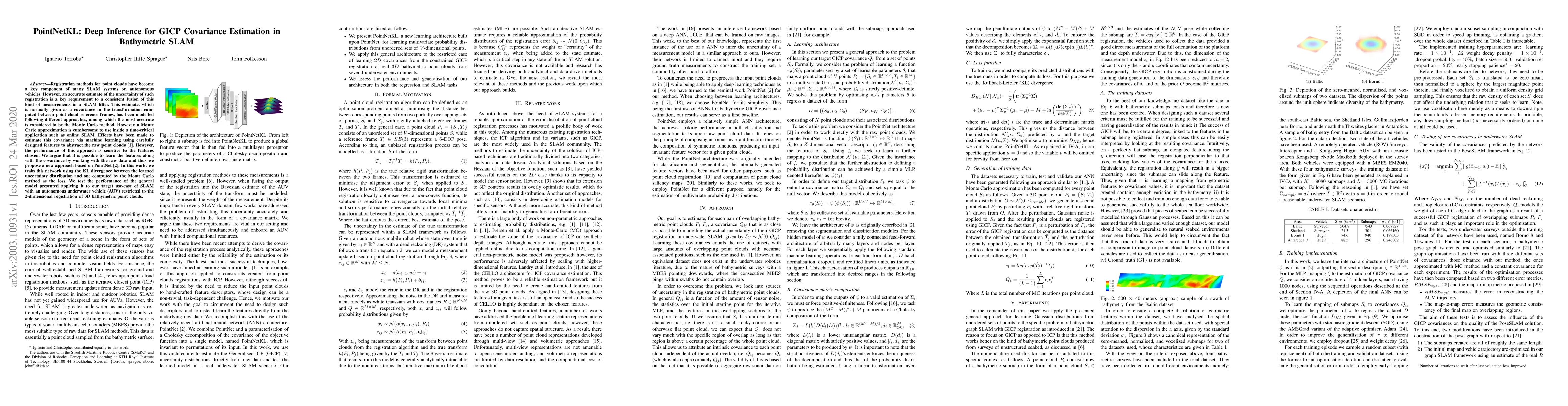
Registration methods for point clouds have become a key component of many SLAM systems on autonomous vehicles. However, an accurate estimate of the uncertainty of such registration is a key requirem...
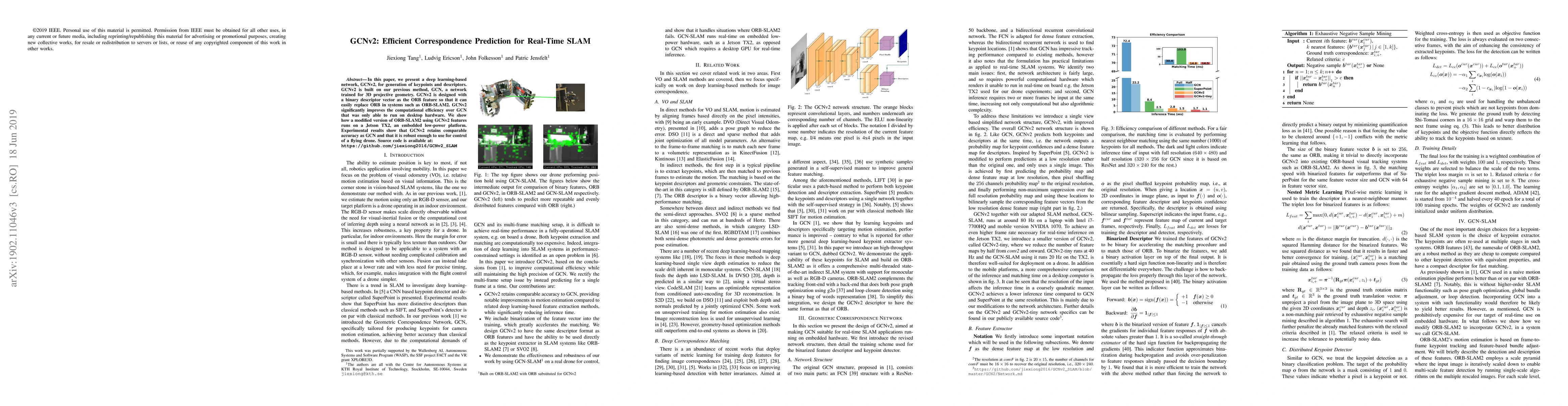
In this paper, we present a deep learning-based network, GCNv2, for generation of keypoints and descriptors. GCNv2 is built on our previous method, GCN, a network trained for 3D projective geometry....
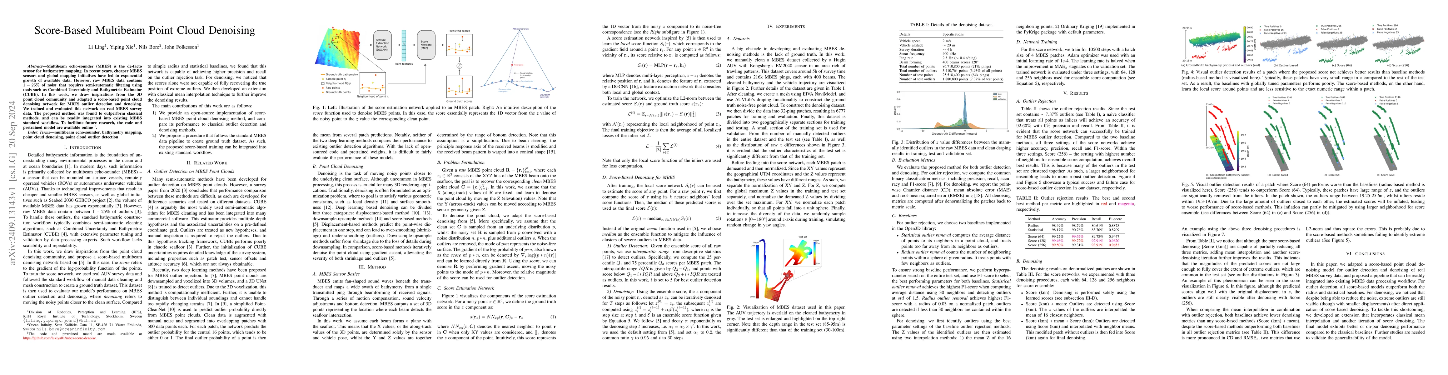
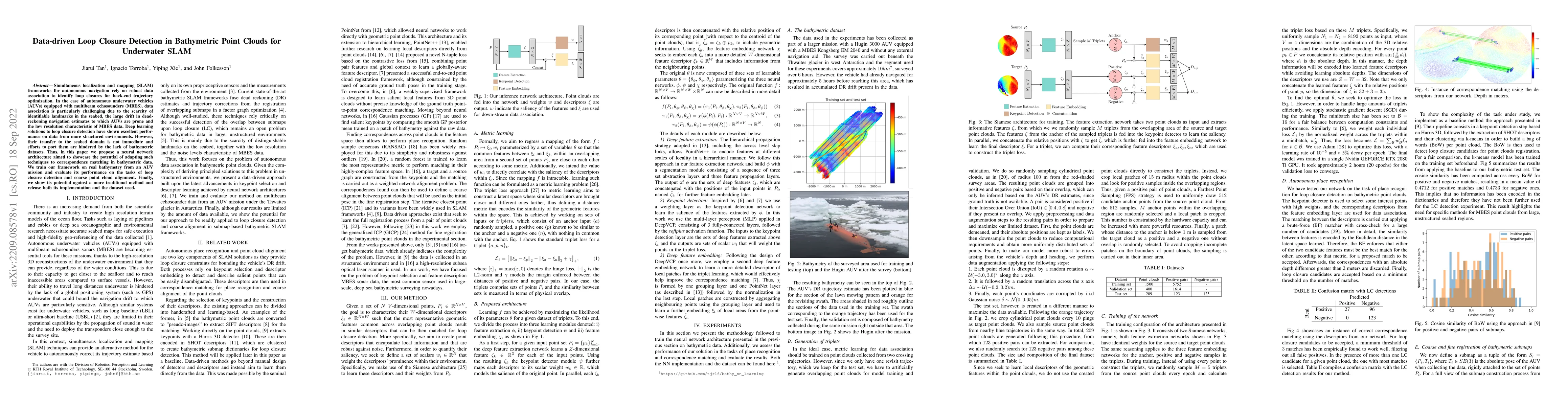
Multibeam echo-sounder (MBES) is the de-facto sensor for bathymetry mapping. In recent years, cheaper MBES sensors and global mapping initiatives have led to exponential growth of available data. Howe...
Informative path planning (IPP) applied to bathymetric mapping allows AUVs to focus on feature-rich areas to quickly reduce uncertainty and increase mapping efficiency. Existing methods based on Bayes...

Developing new functionality for underwater robots and testing them in the real world is time-consuming and resource-intensive. Simulation environments allow for rapid testing before field deployment....
Recent multi-task learning studies suggest that linear scalarization, when using well-chosen fixed task weights, can achieve comparable to or even better performance than complex multi-task optimizati...
Estimating a target's 6-DoF motion in underwater proximity operations is difficult because the chaser lacks target-side proprioception and the available relative observations are sparse, noisy, and of...
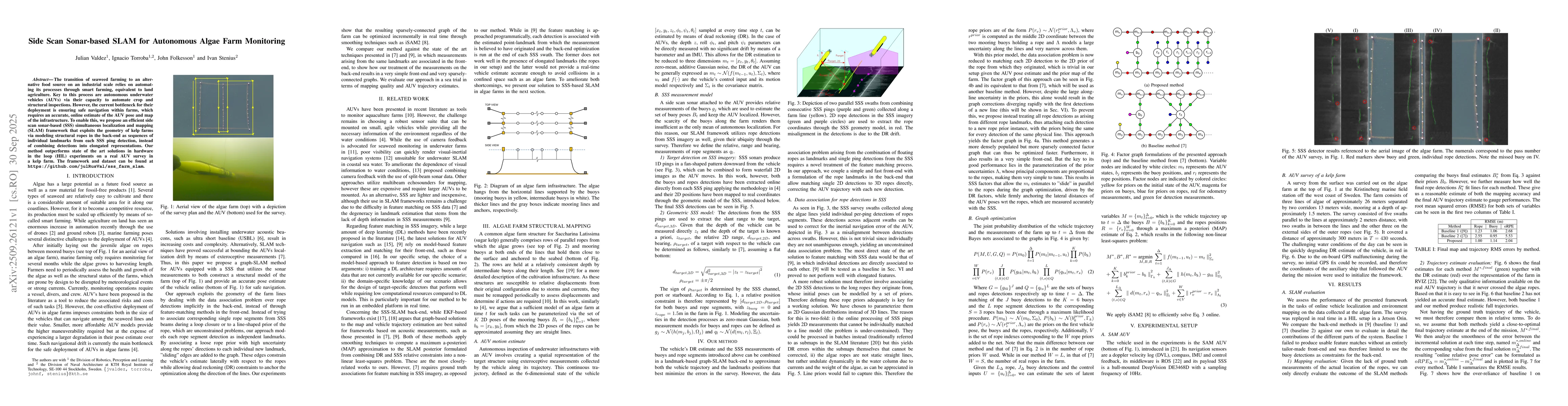
The transition of seaweed farming to an alternative food source on an industrial scale relies on automating its processes through smart farming, equivalent to land agriculture. Key to this process are...
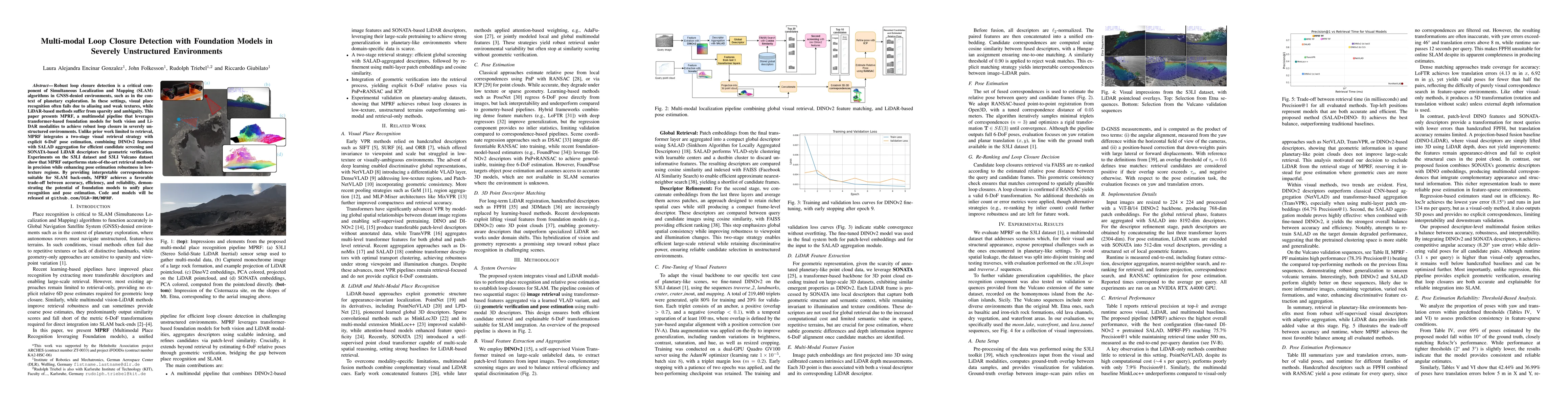
Robust loop closure detection is a critical component of Simultaneous Localization and Mapping (SLAM) algorithms in GNSS-denied environments, such as in the context of planetary exploration. In these ...
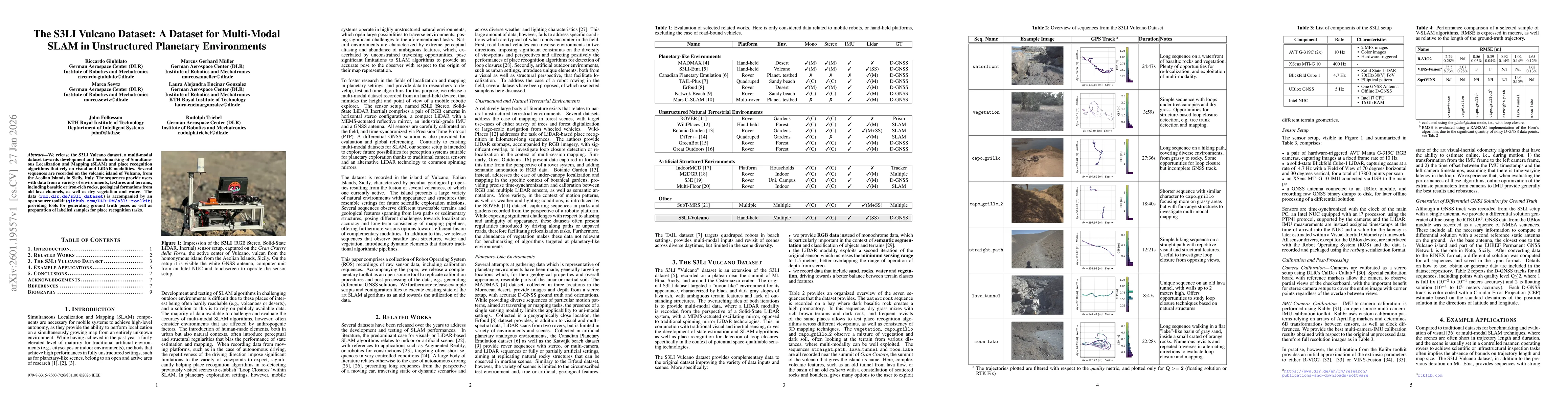
We release the S3LI Vulcano dataset, a multi-modal dataset towards development and benchmarking of Simultaneous Localization and Mapping (SLAM) and place recognition algorithms that rely on visual and...