Academic Profile
Statistics
Similar Authors
Papers on arXiv
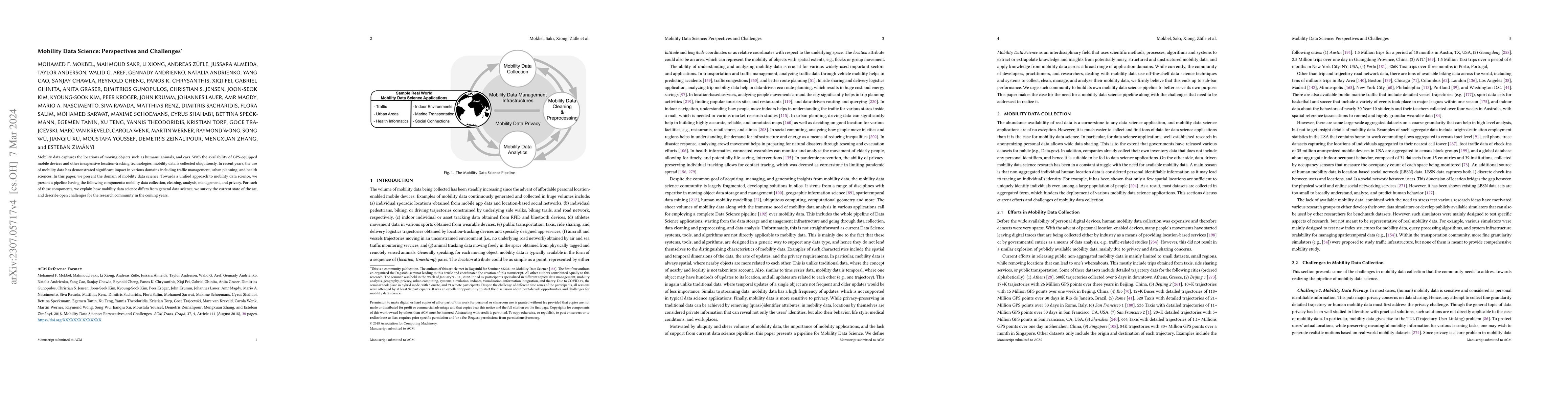
Mobility data captures the locations of moving objects such as humans, animals, and cars. With the availability of GPS-equipped mobile devices and other inexpensive location-tracking technologies, m...
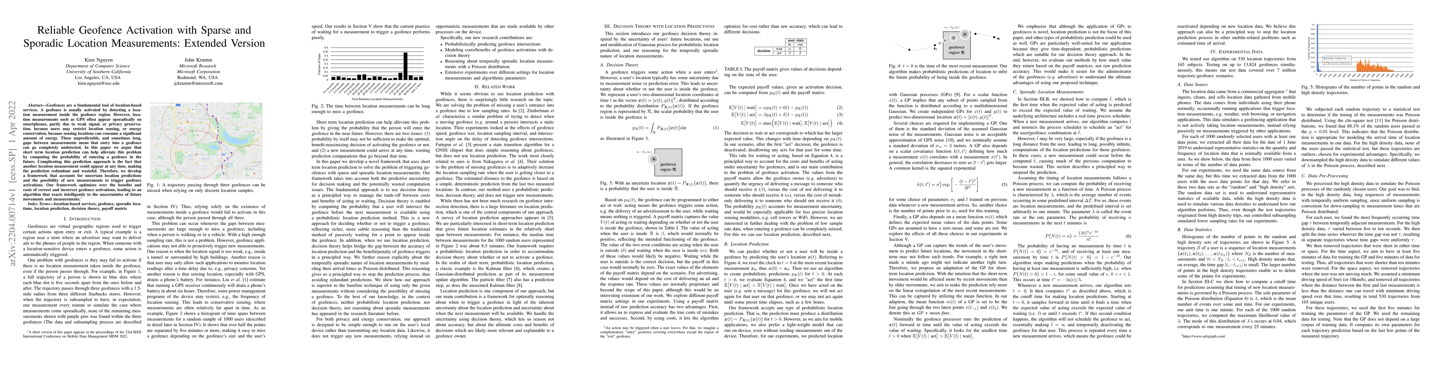
Geofences are a fundamental tool of location-based services. A geofence is usually activated by detecting a location measurement inside the geofence region. However, location measurements such as GP...
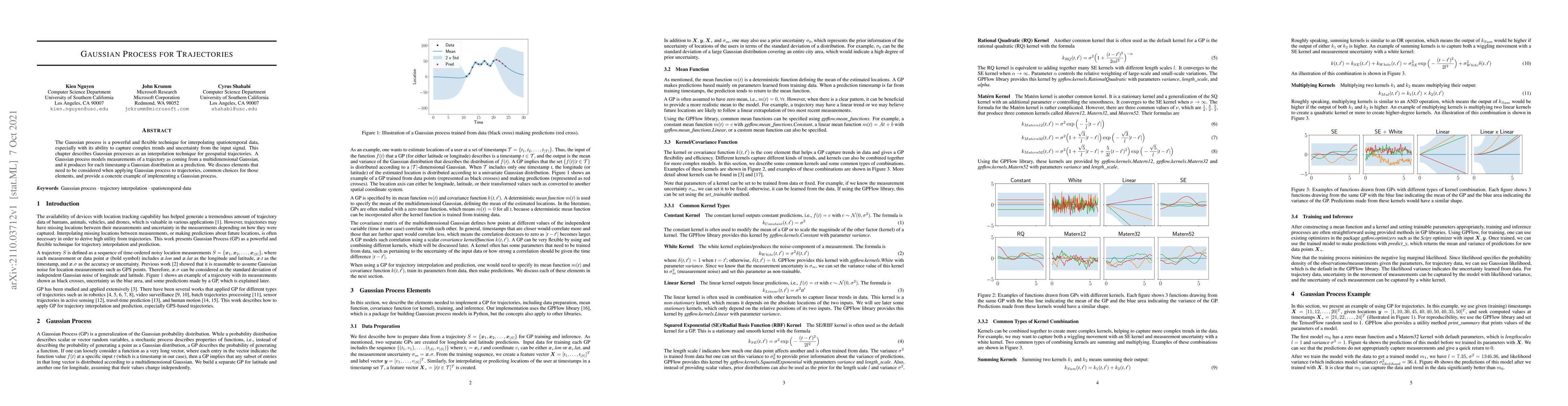
The Gaussian process is a powerful and flexible technique for interpolating spatiotemporal data, especially with its ability to capture complex trends and uncertainty from the input signal. This cha...
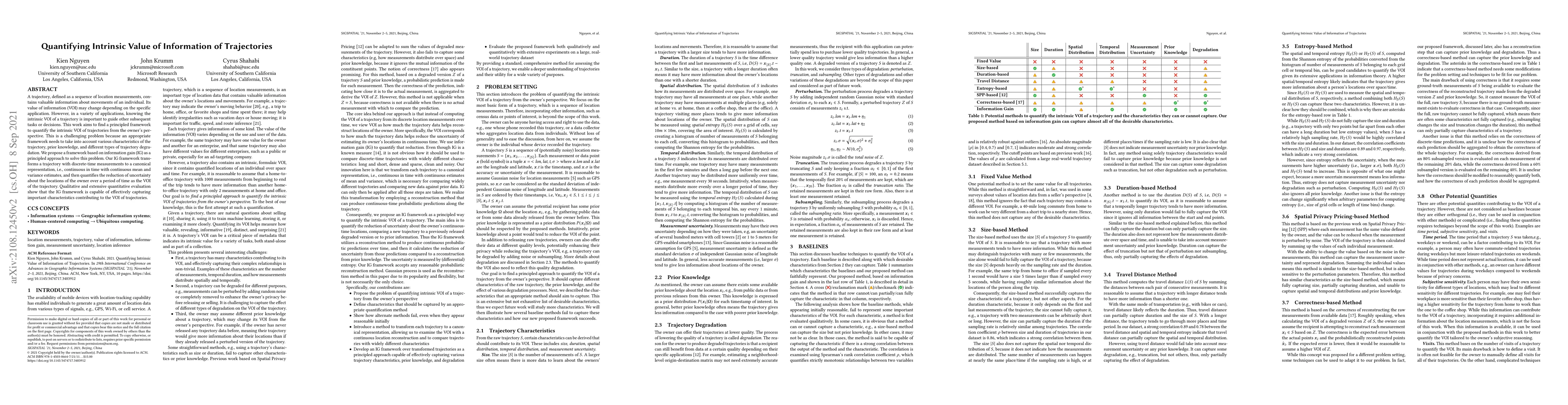
A trajectory, defined as a sequence of location measurements, contains valuable information about movements of an individual. Its value of information (VOI) may change depending on the specific appl...
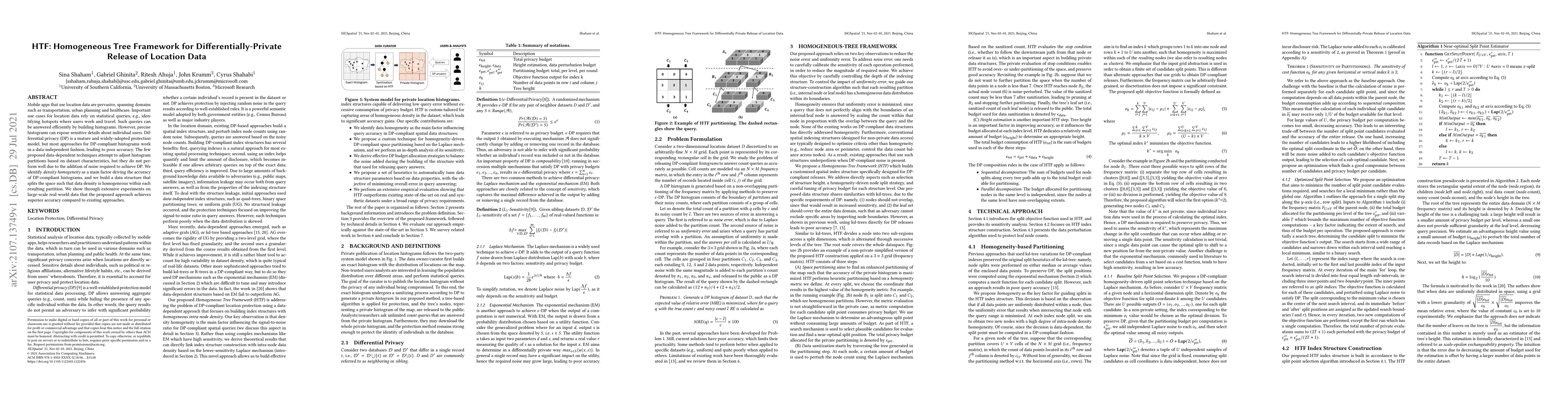
Mobile apps that use location data are pervasive, spanning domains such as transportation, urban planning and healthcare. Important use cases for location data rely on statistical queries, e.g., ide...
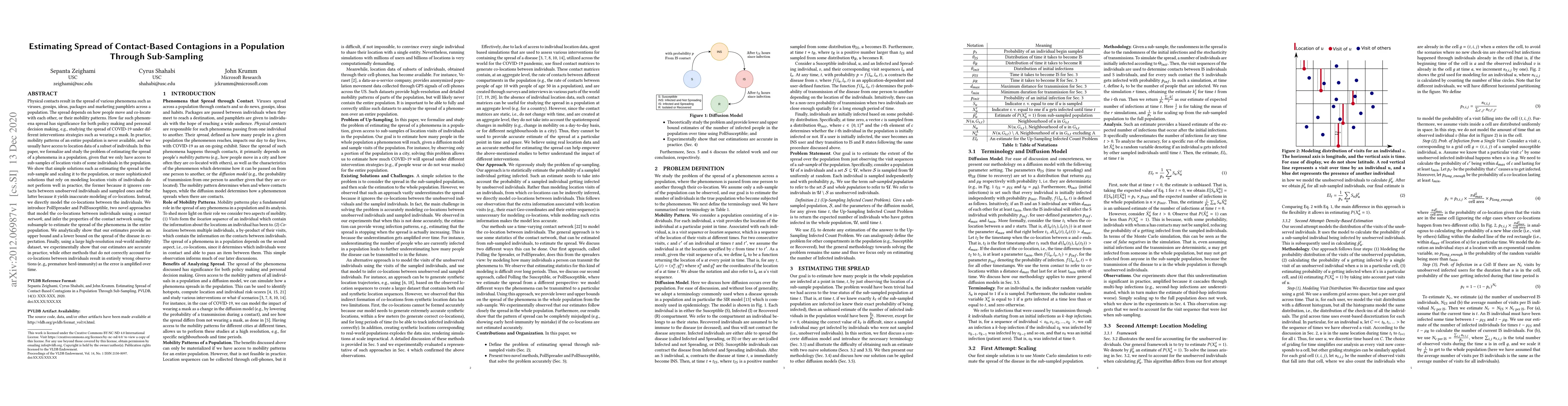
Physical contacts result in the spread of various phenomena such as viruses, gossips, ideas, packages and marketing pamphlets across a population. The spread depends on how people move and co-locate...
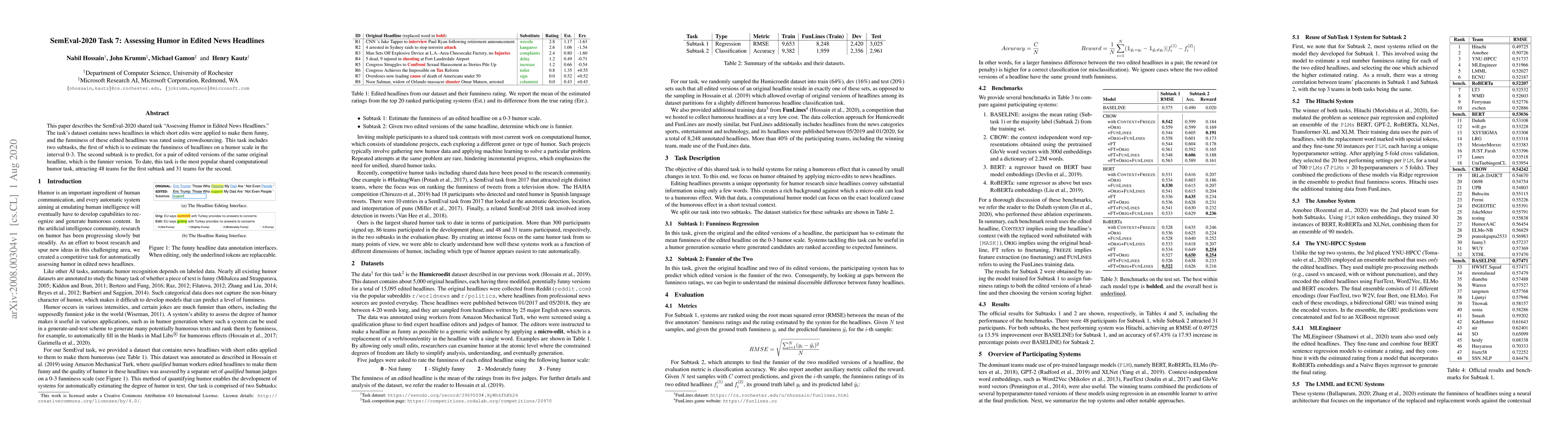
This paper describes the SemEval-2020 shared task "Assessing Humor in Edited News Headlines." The task's dataset contains news headlines in which short edits were applied to make them funny, and the...
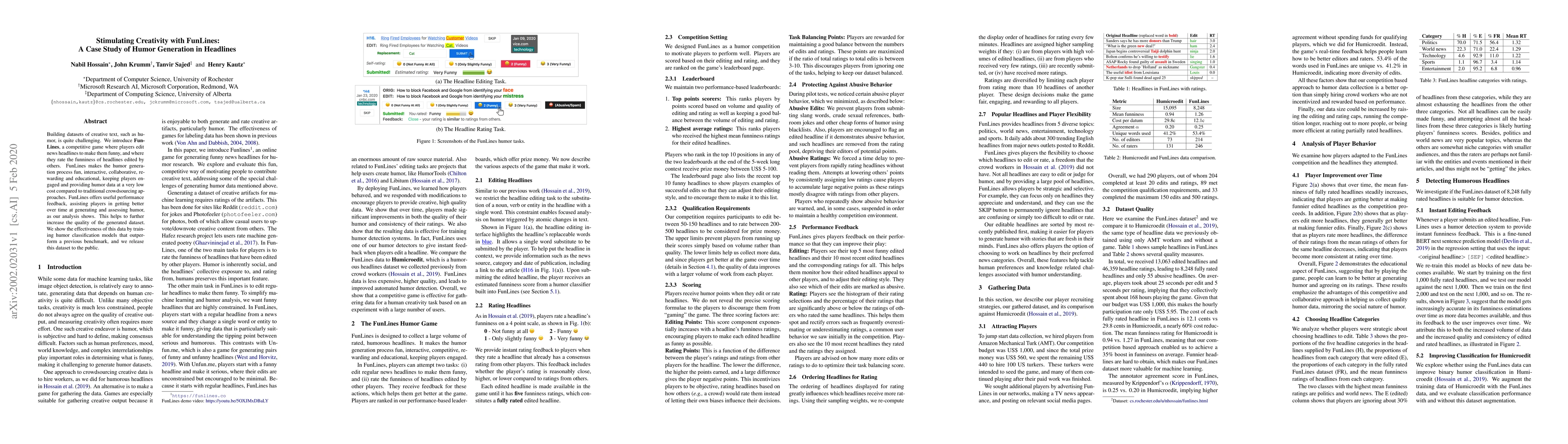
Building datasets of creative text, such as humor, is quite challenging. We introduce FunLines, a competitive game where players edit news headlines to make them funny, and where they rate the funni...
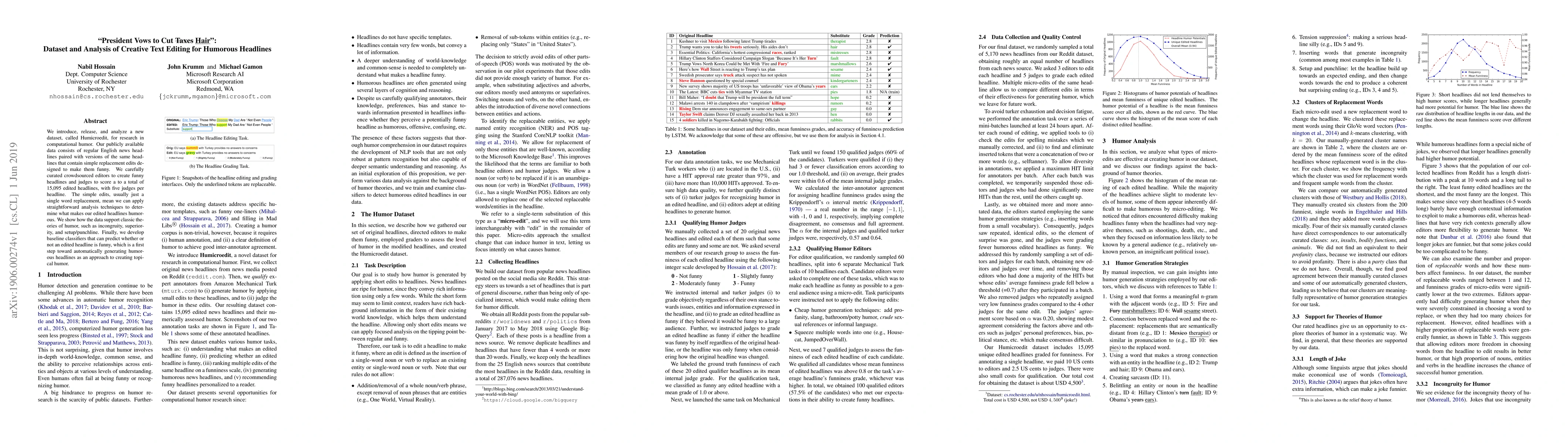
We introduce, release, and analyze a new dataset, called Humicroedit, for research in computational humor. Our publicly available data consists of regular English news headlines paired with versions...
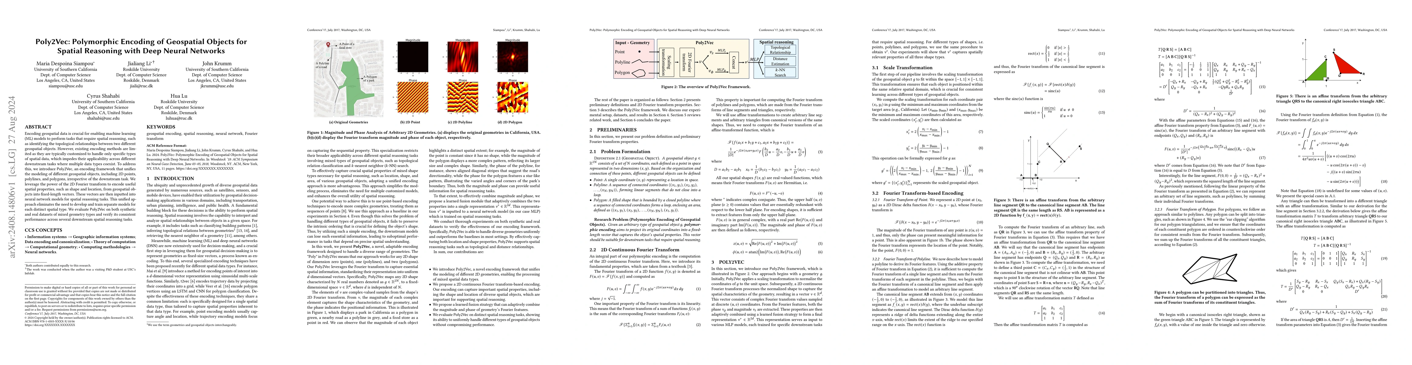
Encoding geospatial data is crucial for enabling machine learning (ML) models to perform tasks that require spatial reasoning, such as identifying the topological relationships between two different g...
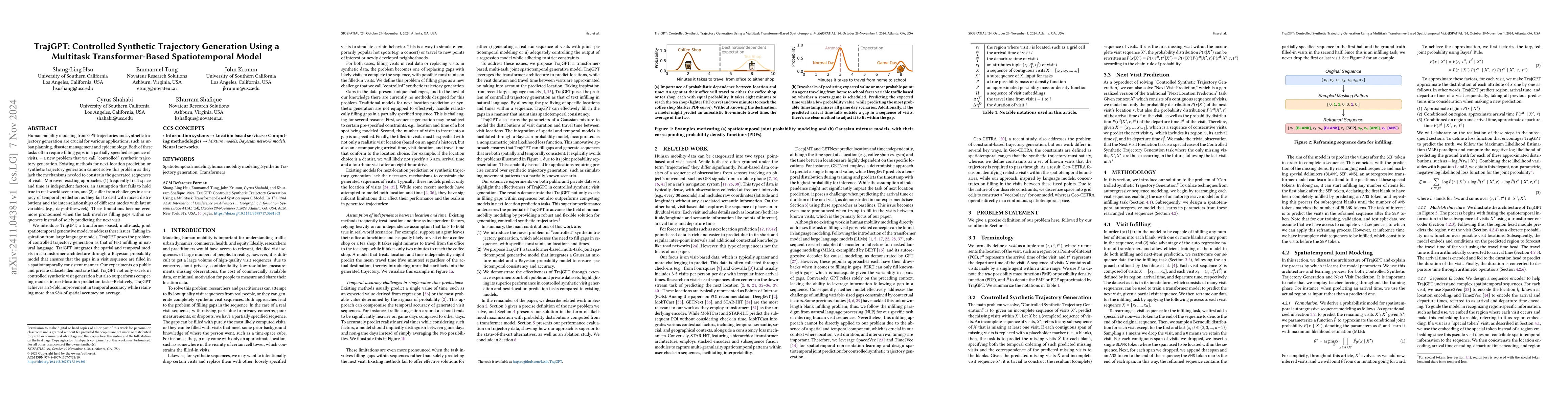
Human mobility modeling from GPS-trajectories and synthetic trajectory generation are crucial for various applications, such as urban planning, disaster management and epidemiology. Both of these task...
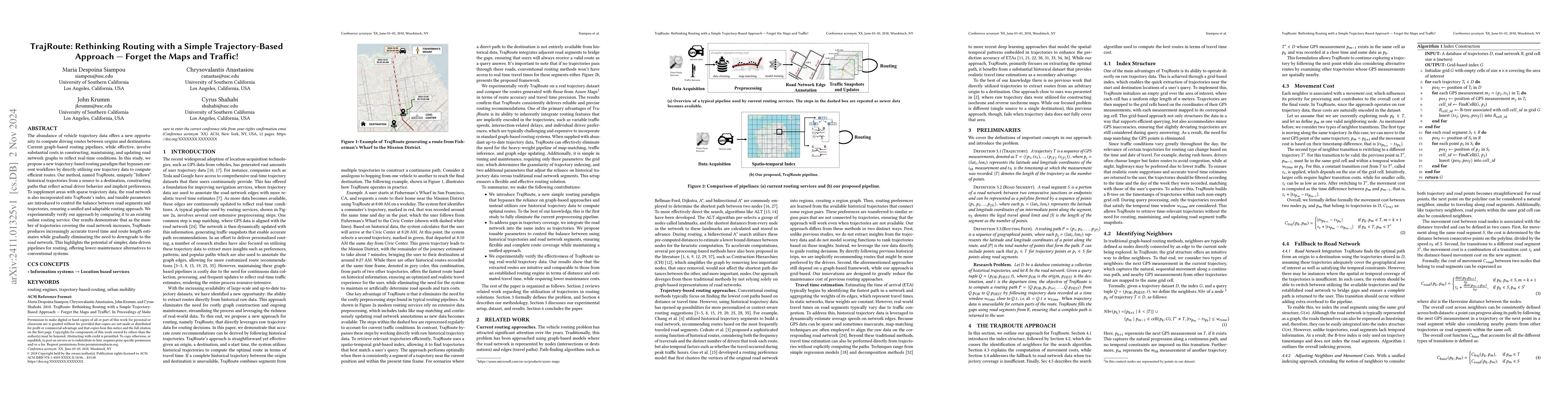
The abundance of vehicle trajectory data offers a new opportunity to compute driving routes between origins and destinations. Current graph-based routing pipelines, while effective, involve substantia...
Road traffic congestion is a persistent problem. Focusing resources on the causes of congestion is a potentially efficient strategy for reducing slowdowns. We present NEXICA, an algorithm to discover ...
Human mobility appears highly diverse, yet much of a person's daily mobility can be explained by a small set of recurring behavioral templates, such as commuting, school-centered activities, caregivin...