Academic Profile
Statistics
Similar Authors
Papers on arXiv
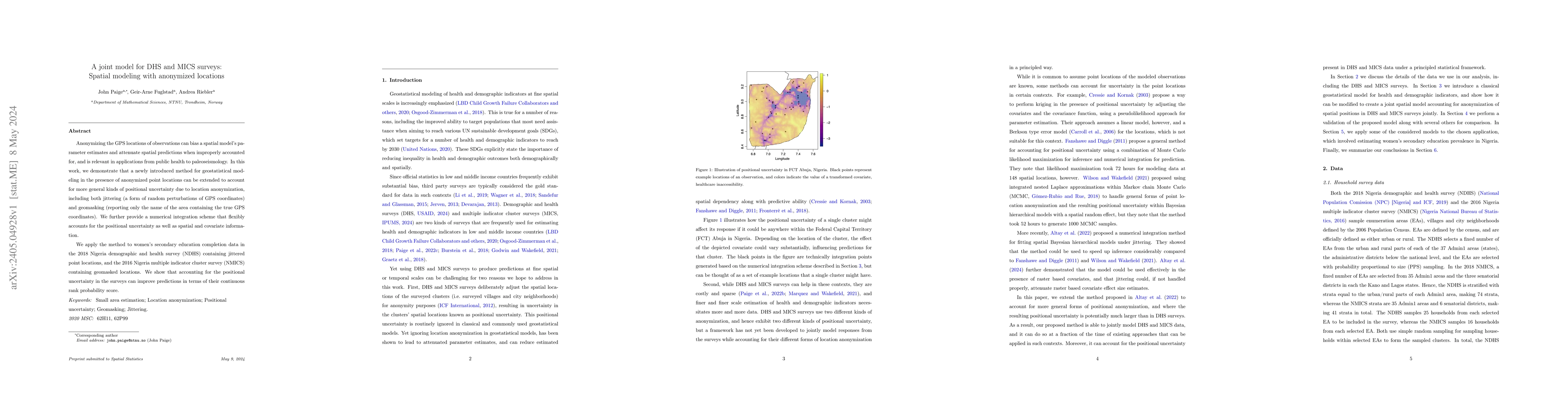
Anonymizing the GPS locations of observations can bias a spatial model's parameter estimates and attenuate spatial predictions when improperly accounted for, and is relevant in applications from pub...
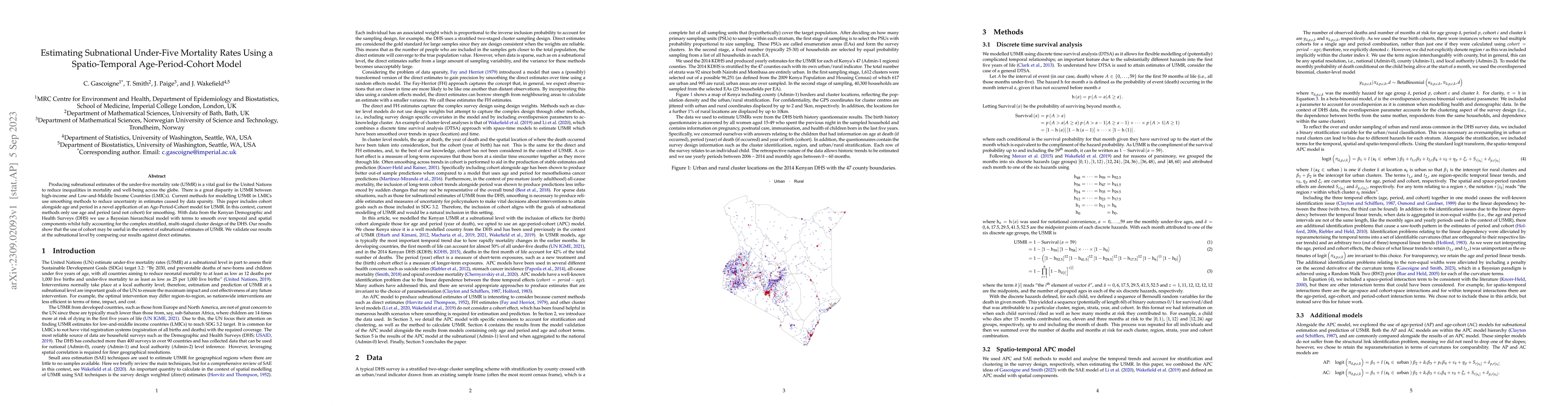
Producing subnational estimates of the under-five mortality rate (U5MR) is a vital goal for the United Nations to reduce inequalities in mortality and well-being across the globe. There is a great d...
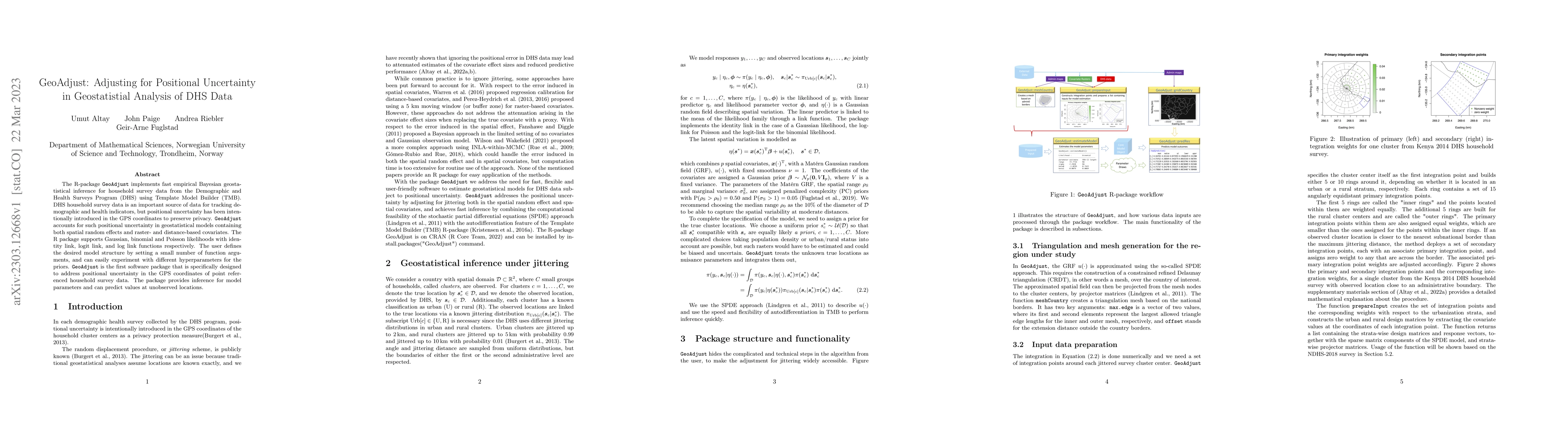
The R-package GeoAdjust https://github.com/umut-altay/GeoAdjust-package implements fast empirical Bayesian geostatistical inference for household survey data from the Demographic and Health Surveys ...
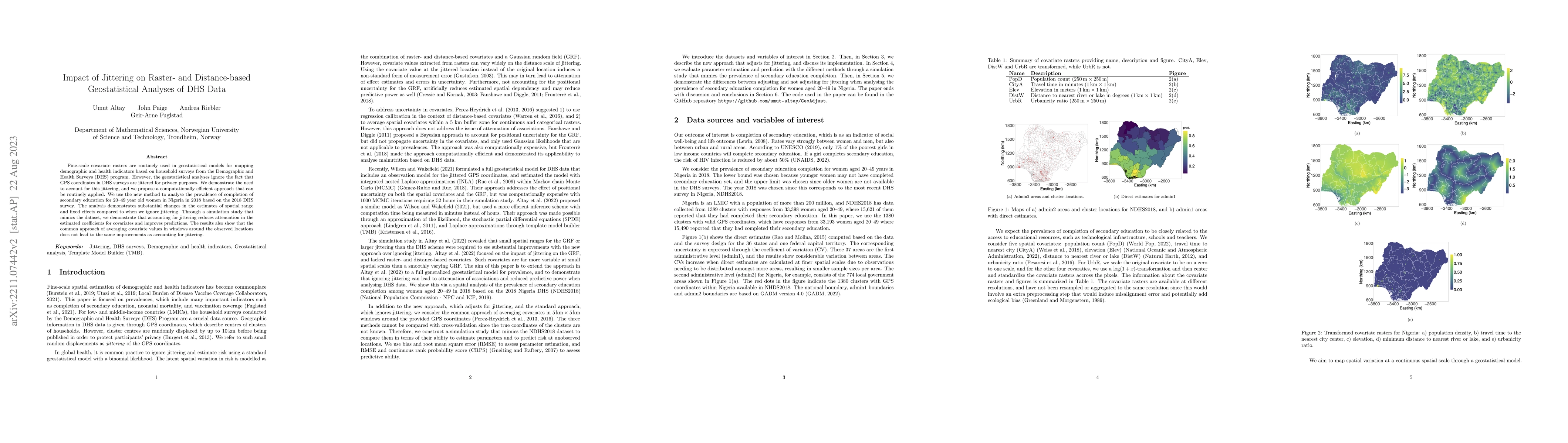
Fine-scale covariate rasters are routinely used in geostatistical models for mapping demographic and health indicators based on household surveys from the Demographic and Health Surveys (DHS) progra...
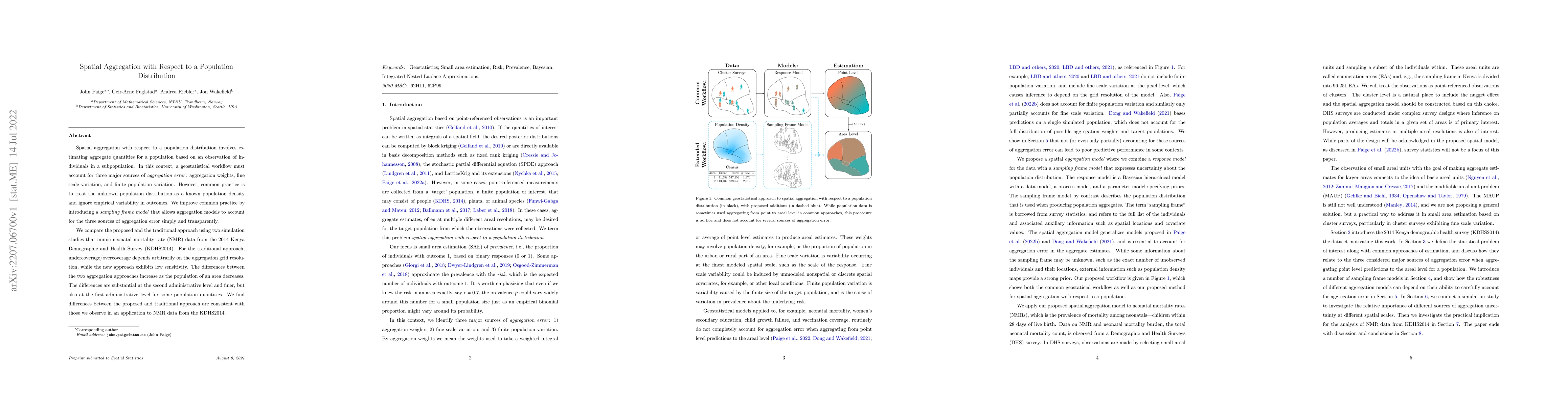
Spatial aggregation with respect to a population distribution involves estimating aggregate quantities for a population based on an observation of individuals in a subpopulation. In this context, a ...
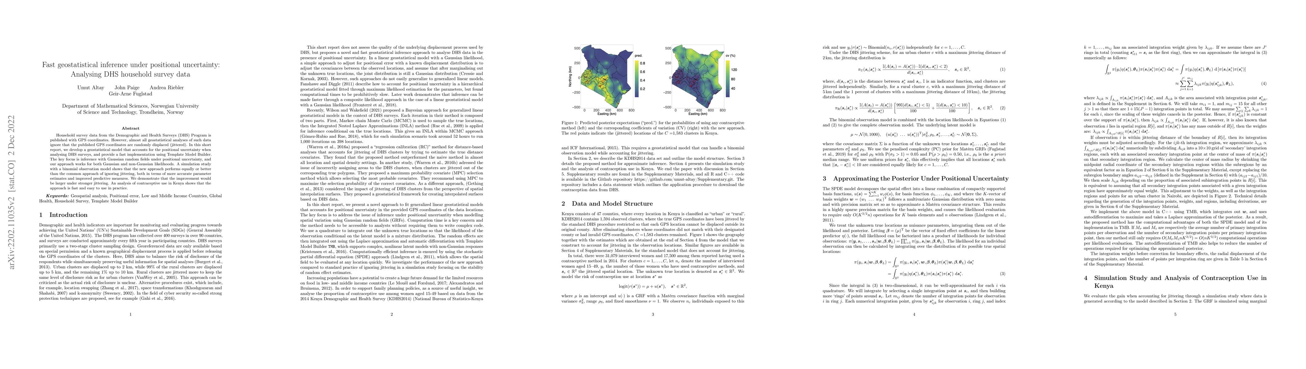
Household survey data from the Demographic and Health Surveys (DHS) Program is published with GPS coordinates. However, almost all geostatistical analyses of such data ignore that the published GPS ...
Current implementations of multiresolution methods are limited in terms of possible types of responses and approaches to inference. We provide a multiresolution approach for spatial analysis of non-...
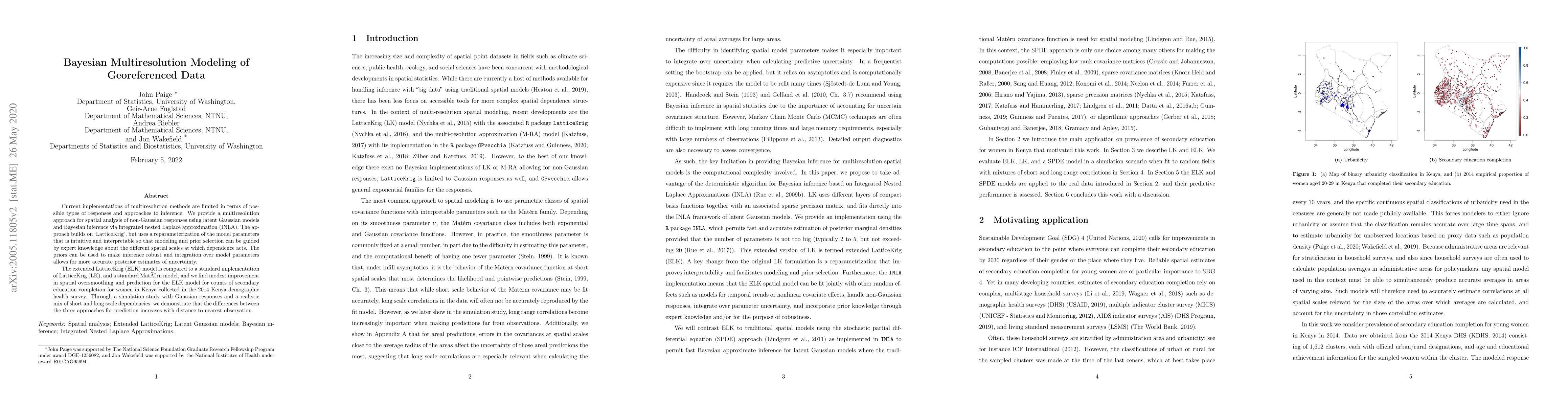
The need for rigorous and timely health and demographic summaries has provided the impetus for an explosion in geographic studies, with a common approach being the production of pixel-level maps, pa...