2
arXiv Papers
Profile
Academic Profile
Metrics
Statistics
2
arXiv Papers
Network
Similar Authors
Publications
Papers on arXiv
arXiv
Learning to Detect Fortified Areas
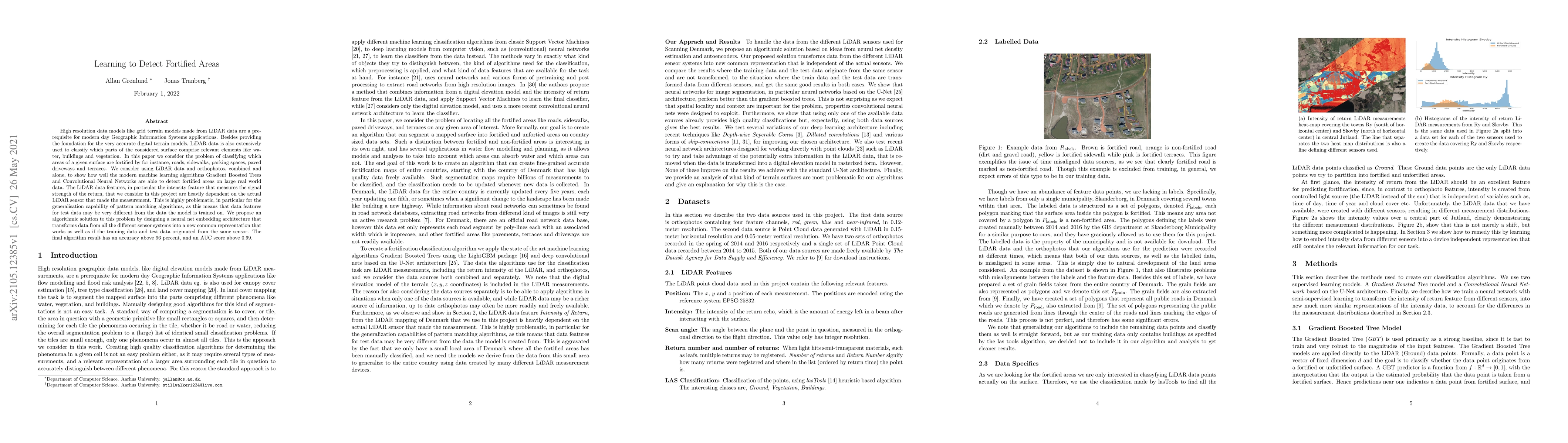
High resolution data models like grid terrain models made from LiDAR data are a prerequisite for modern day Geographic Information Systems applications. Besides providing the foundation for the very...
arXiv
Learning to Find Hydrological Corrections
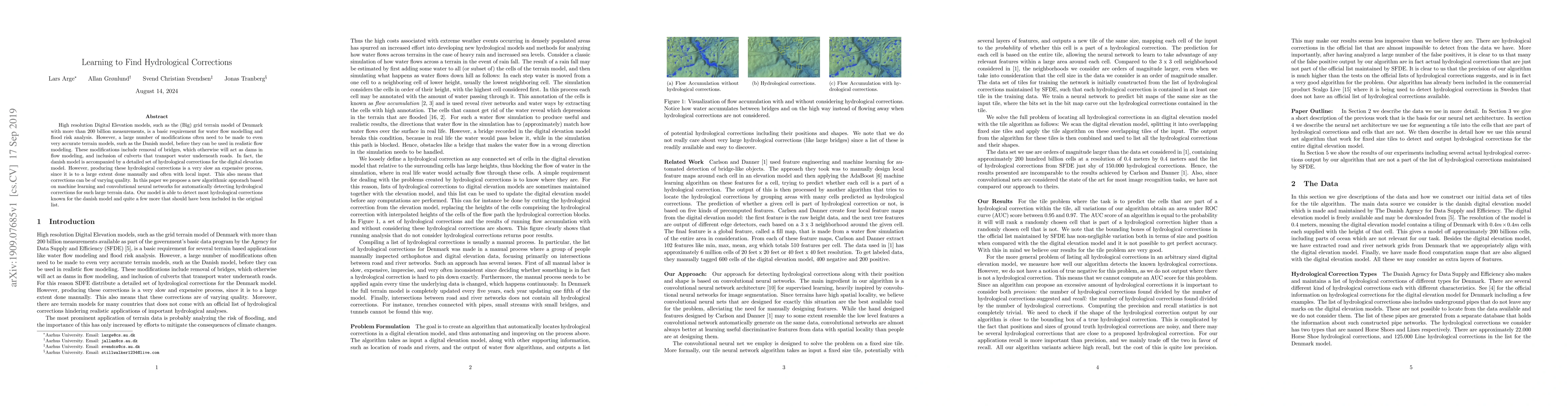
High resolution Digital Elevation models, such as the (Big) grid terrain model of Denmark with more than 200 billion measurements, is a basic requirement for water flow modelling and flood risk anal...