Academic Profile
Statistics
Similar Authors
Papers on arXiv
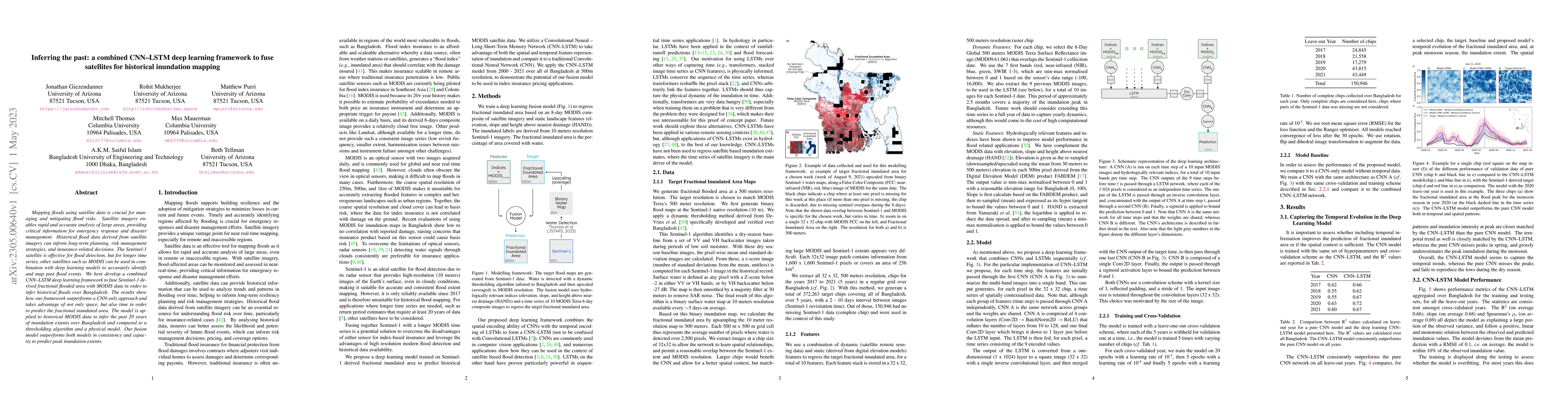
Mapping floods using satellite data is crucial for managing and mitigating flood risks. Satellite imagery enables rapid and accurate analysis of large areas, providing critical information for emerg...
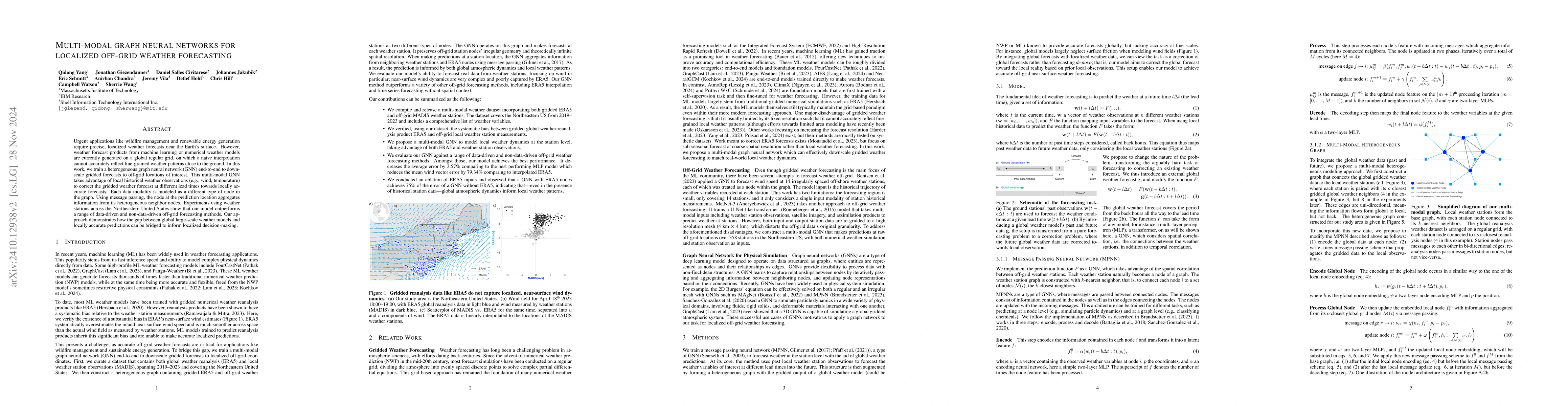
Urgent applications like wildfire management and renewable energy generation require precise, localized weather forecasts near the Earth's surface. However, weather forecast products from machine lear...
Impact evaluations of new technologies are critical to assessing and improving investment in national and international development goals. Yet many of these technologies are introduced and promoted at...
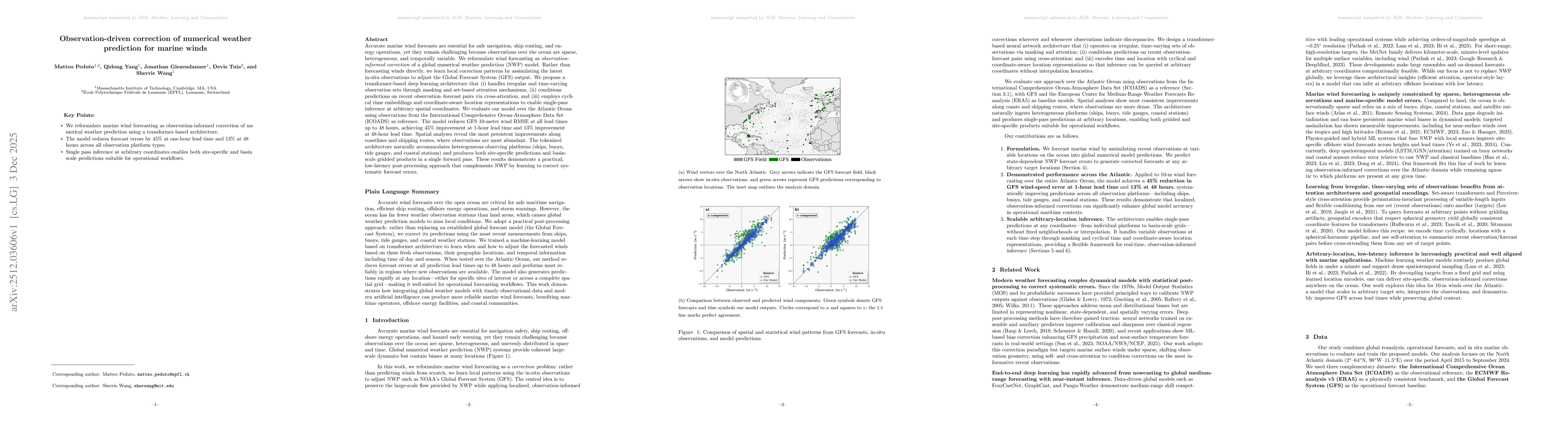
Accurate marine wind forecasts are essential for safe navigation, ship routing, and energy operations, yet they remain challenging because observations over the ocean are sparse, heterogeneous, and te...
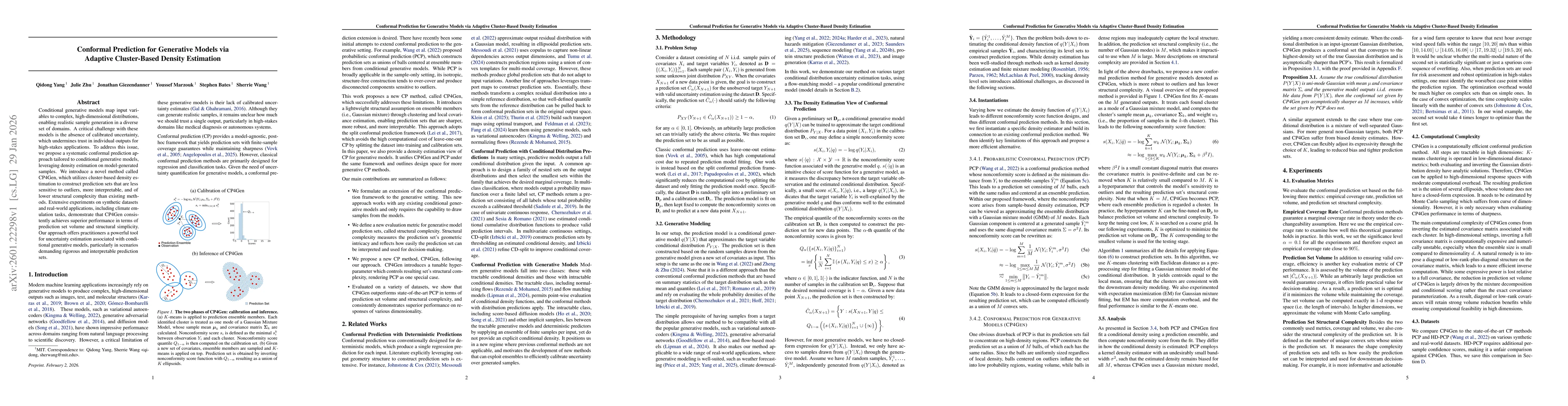
Conditional generative models map input variables to complex, high-dimensional distributions, enabling realistic sample generation in a diverse set of domains. A critical challenge with these models i...
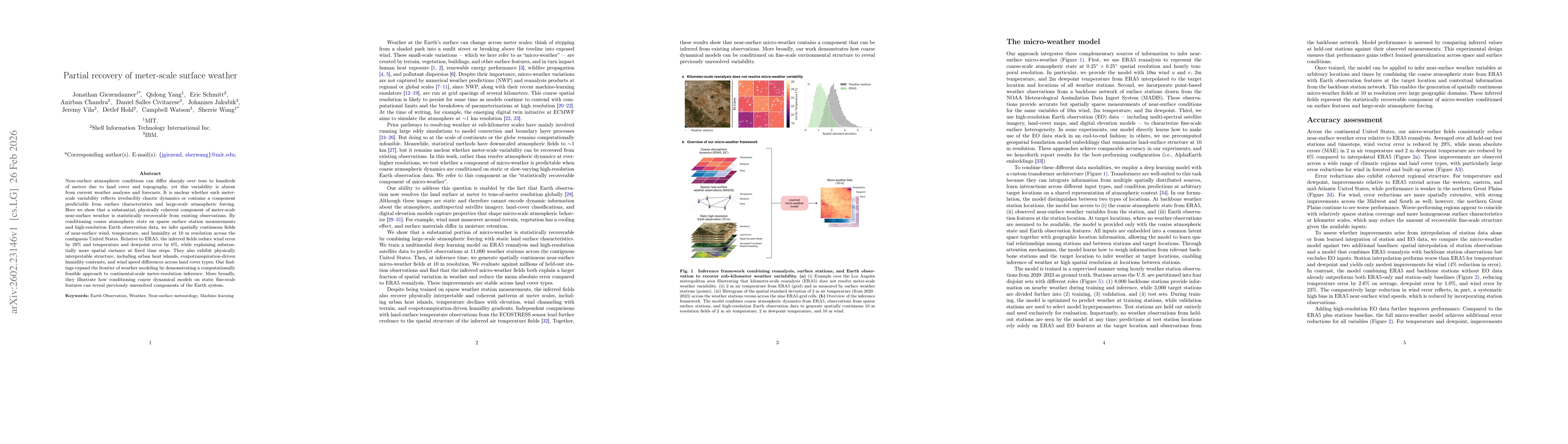
Near-surface atmospheric conditions can differ sharply over tens to hundreds of meters due to land cover and topography, yet this variability is absent from current weather analyses and forecasts. It ...
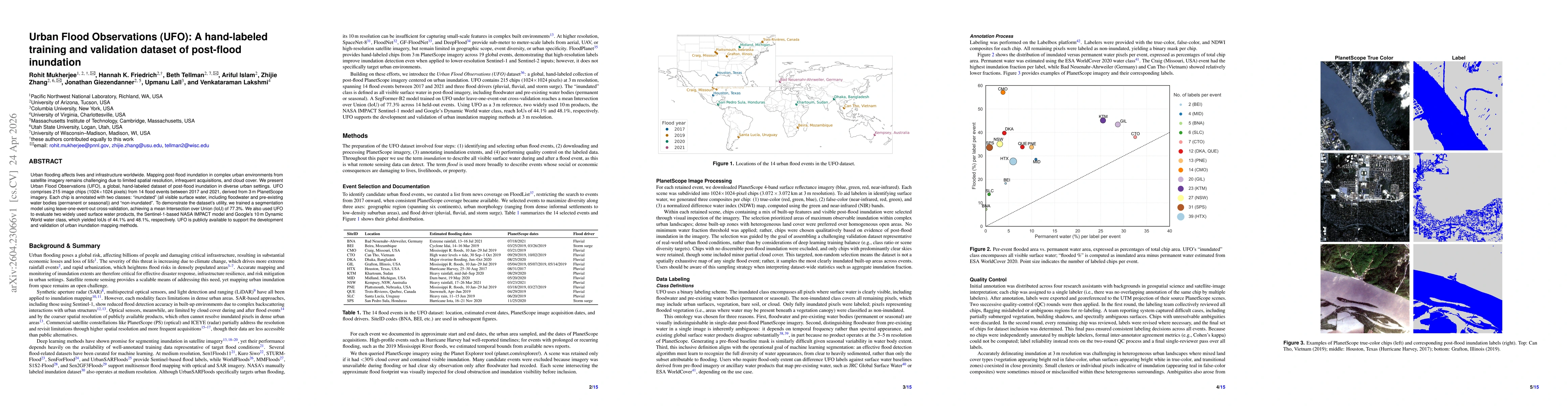
Urban flooding affects lives and infrastructure worldwide. Mapping inundation in complex urban environments from satellite imagery remains challenging due to limited spatial resolution, infrequent acq...