Josef Taher

9 papers on arXiv

Academic Profile

Name: Josef Taher
Total Papers: 15

Statistics

arXiv Papers 9
Total Publications 15

Papers on arXiv

Thumbnail for Towards High-Definition Maps: a Framework Leveraging Semantic
  Segmentation to Improve NDT Map Compression and Descriptivity

Towards High-Definition Maps: a Framework Leveraging Semantic Segmentation to Improve NDT Map Compression and Descriptivity

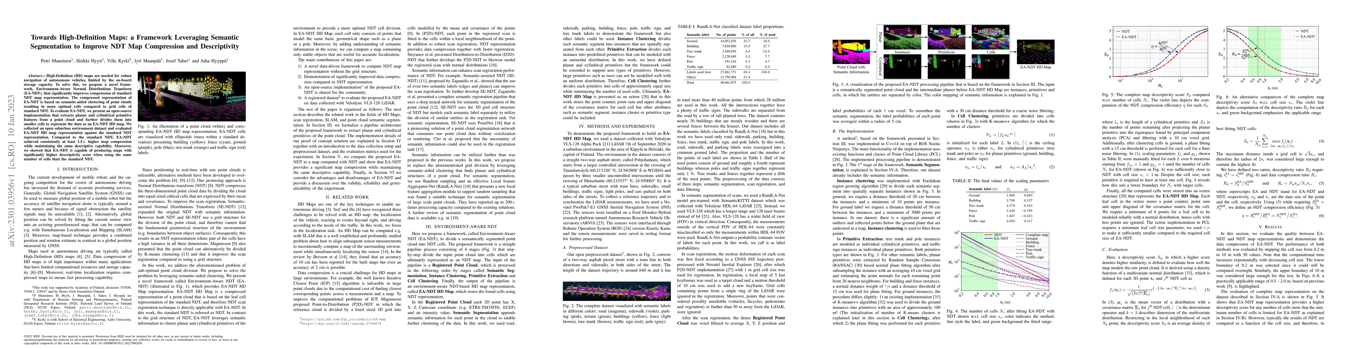
High-Definition (HD) maps are needed for robust navigation of autonomous vehicles, limited by the on-board storage capacity. To solve this, we propose a novel framework, Environment-Aware Normal Dis...

Thumbnail for Leveraging Road Area Semantic Segmentation with Auxiliary Steering Task

Leveraging Road Area Semantic Segmentation with Auxiliary Steering Task

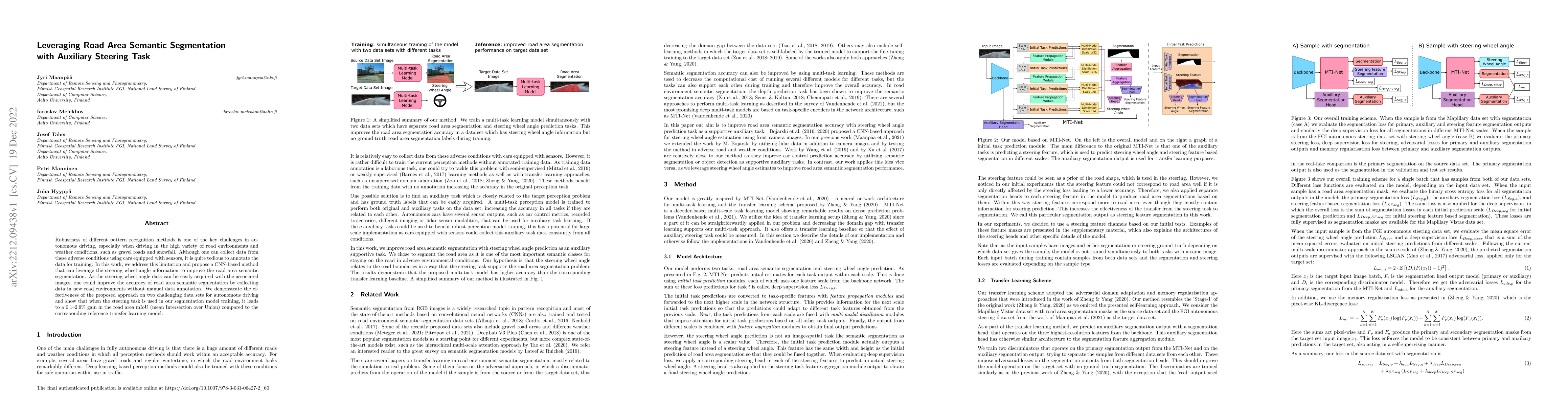
Robustness of different pattern recognition methods is one of the key challenges in autonomous driving, especially when driving in the high variety of road environments and weather conditions, such ...

Thumbnail for Unsupervised semantic segmentation of urban high-density multispectral
  point clouds

Unsupervised semantic segmentation of urban high-density multispectral point clouds

The availability of highly accurate urban airborne laser scanning (ALS) data will increase rapidly in the future, especially as acquisition costs decrease, for example through the use of drones. Curre...

Thumbnail for Unsupervised deep learning for semantic segmentation of multispectral
  LiDAR forest point clouds

Unsupervised deep learning for semantic segmentation of multispectral LiDAR forest point clouds

Point clouds captured with laser scanning systems from forest environments can be utilized in a wide variety of applications within forestry and plant ecology, such as the estimation of tree stem attr...

Thumbnail for Multispectral airborne laser scanning for tree species classification: a
  benchmark of machine learning and deep learning algorithms

Multispectral airborne laser scanning for tree species classification: a benchmark of machine learning and deep learning algorithms

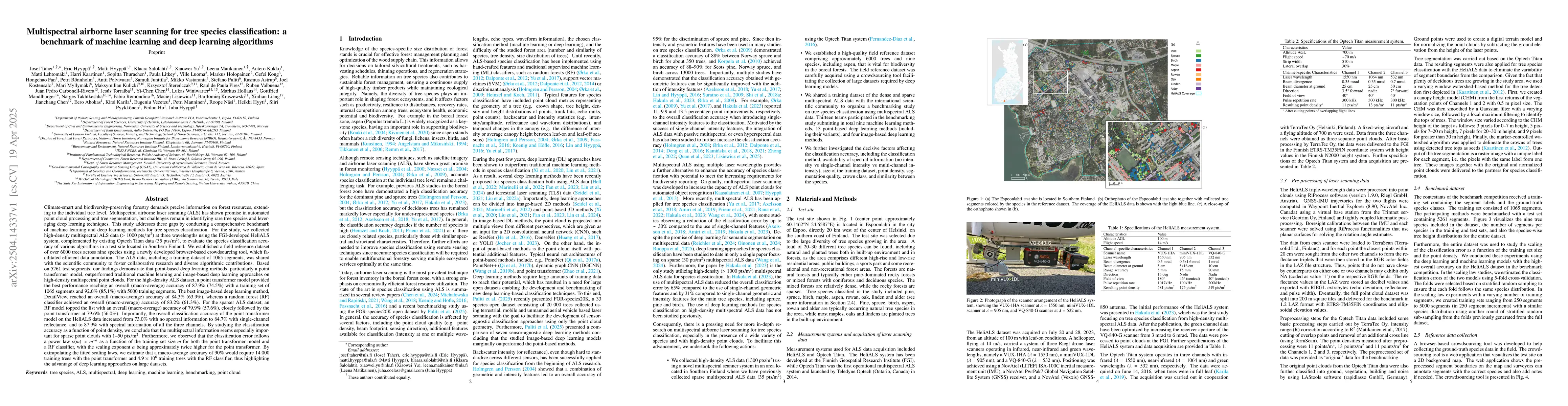
Climate-smart and biodiversity-preserving forestry demands precise information on forest resources, extending to the individual tree level. Multispectral airborne laser scanning (ALS) has shown promis...

Thumbnail for NormalView: sensor-agnostic tree species classification from backpack and aerial lidar data using geometric projections

NormalView: sensor-agnostic tree species classification from backpack and aerial lidar data using geometric projections

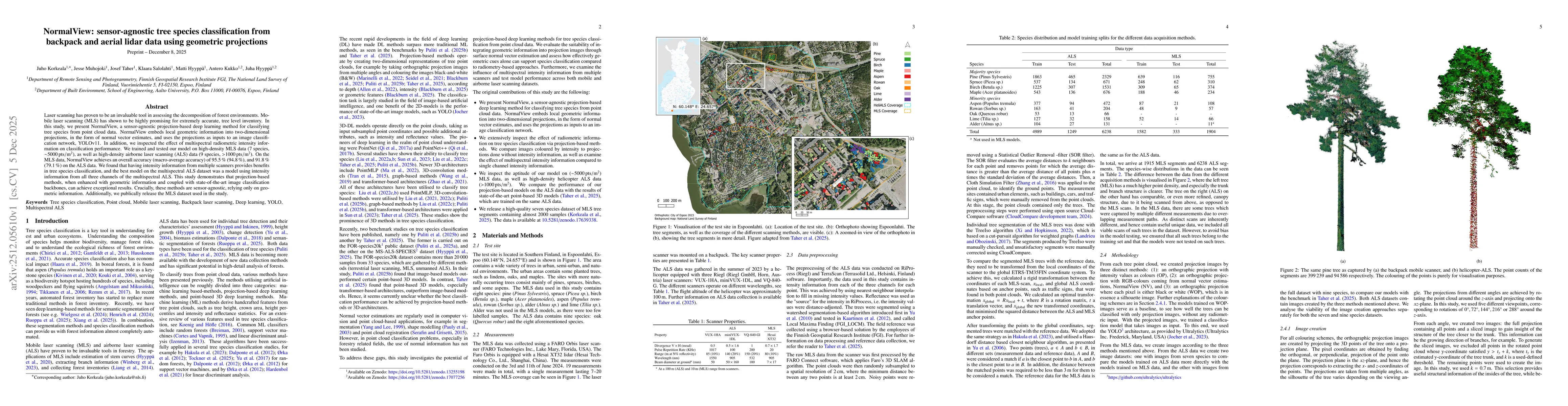
Laser scanning has proven to be an invaluable tool in assessing the decomposition of forest environments. Mobile laser scanning (MLS) has shown to be highly promising for extremely accurate, tree leve...

Thumbnail for Learning Image-based Tree Crown Segmentation from Enhanced Lidar-based Pseudo-labels

Learning Image-based Tree Crown Segmentation from Enhanced Lidar-based Pseudo-labels

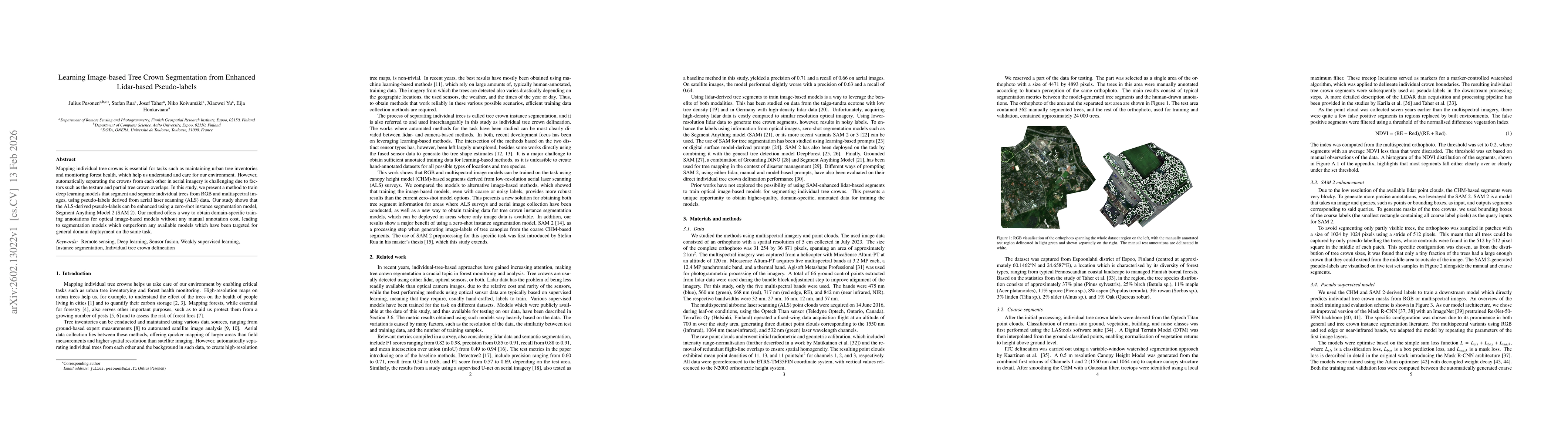
Mapping individual tree crowns is essential for tasks such as maintaining urban tree inventories and monitoring forest health, which help us understand and care for our environment. However, automatic...

Thumbnail for Riverine Land Cover Mapping through Semantic Segmentation of Multispectral Point Clouds

Riverine Land Cover Mapping through Semantic Segmentation of Multispectral Point Clouds

Accurate land cover mapping in riverine environments is essential for effective river management, ecological understanding, and geomorphic change monitoring. This study explores the use of Point Trans...

Thumbnail for Multispectral airborne laser scanning dataset for tree species classification: MS-ALS-SPECIES

Multispectral airborne laser scanning dataset for tree species classification: MS-ALS-SPECIES

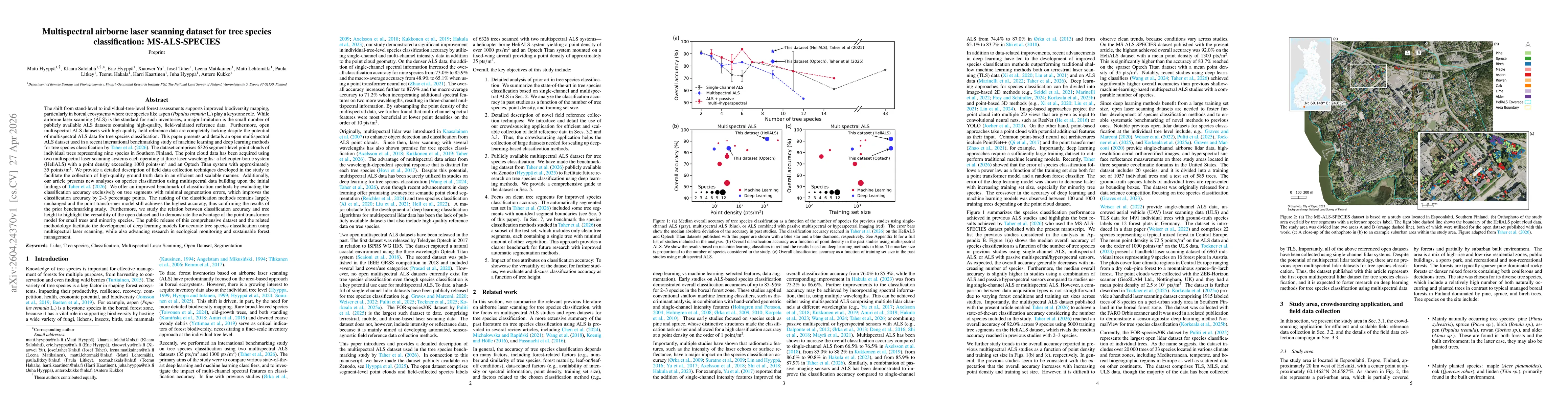
The shift from stand-level to individual-tree-level forest assessments supports improved biodiversity mapping, particularly in boreal ecosystems where tree species like aspen (Populus tremula L.) play...

This website uses cookies to ensure you get the best experience. Learn more