ArxivLens
J
Researcher

Juelin Zhu

6 papers on arXiv

6 arXiv Papers
9 Total Publications
Profile

Academic Profile

Name Juelin Zhu
Total Papers 9
Scholar Profile View on Semantic Scholar
Metrics

Statistics

6 arXiv Papers
9 Total Publications
Publications

Papers on arXiv

Thumbnail for UAVD4L: A Large-Scale Dataset for UAV 6-DoF Localization
arXiv
UAVD4L: A Large-Scale Dataset for UAV 6-DoF Localization

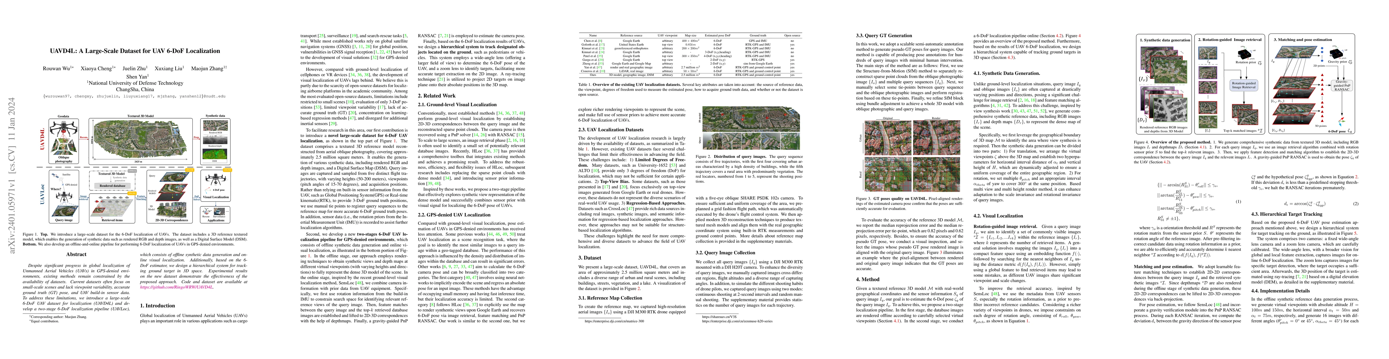
Despite significant progress in global localization of Unmanned Aerial Vehicles (UAVs) in GPS-denied environments, existing methods remain constrained by the availability of datasets. Current datase...

Thumbnail for Render-and-Compare: Cross-View 6 DoF Localization from Noisy Prior
arXiv
Render-and-Compare: Cross-View 6 DoF Localization from Noisy Prior

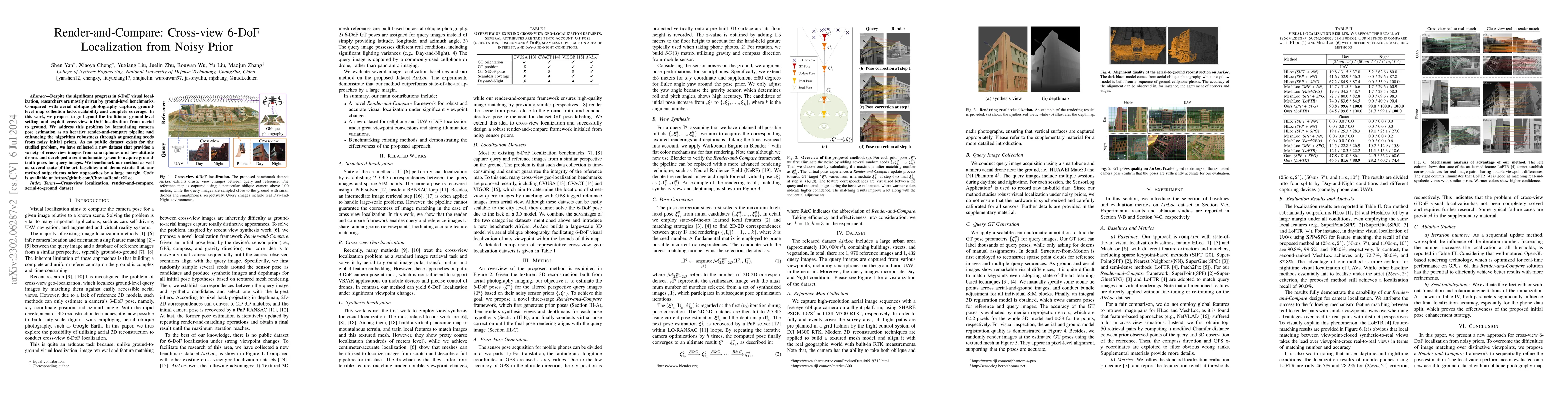
Despite the significant progress in 6-DoF visual localization, researchers are mostly driven by ground-level benchmarks. Compared with aerial oblique photography, ground-level map collection lacks s...

Thumbnail for LoD-Loc: Aerial Visual Localization using LoD 3D Map with Neural
  Wireframe Alignment
arXiv
LoD-Loc: Aerial Visual Localization using LoD 3D Map with Neural Wireframe Alignment

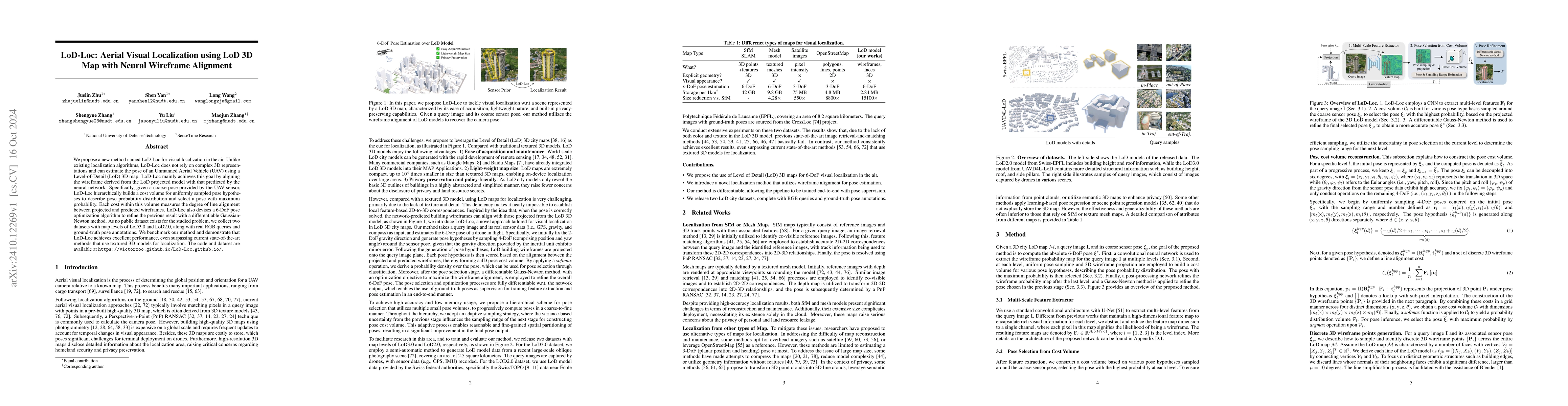
We propose a new method named LoD-Loc for visual localization in the air. Unlike existing localization algorithms, LoD-Loc does not rely on complex 3D representations and can estimate the pose of an U...

Thumbnail for Generalizable Multispectral Land Cover Classification via
  Frequency-Aware Mixture of Low-Rank Token Experts
arXiv
Generalizable Multispectral Land Cover Classification via Frequency-Aware Mixture of Low-Rank Token Experts

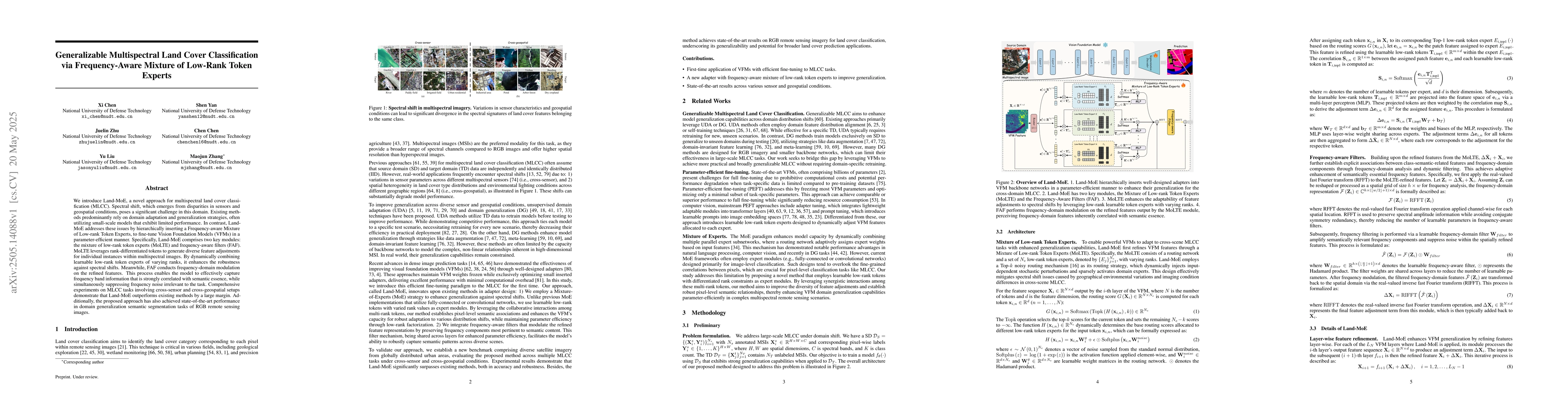
We introduce Land-MoE, a novel approach for multispectral land cover classification (MLCC). Spectral shift, which emerges from disparities in sensors and geospatial conditions, poses a significant cha...

Thumbnail for LoD-Loc v2: Aerial Visual Localization over Low Level-of-Detail City
  Models using Explicit Silhouette Alignment
arXiv
LoD-Loc v2: Aerial Visual Localization over Low Level-of-Detail City Models using Explicit Silhouette Alignment

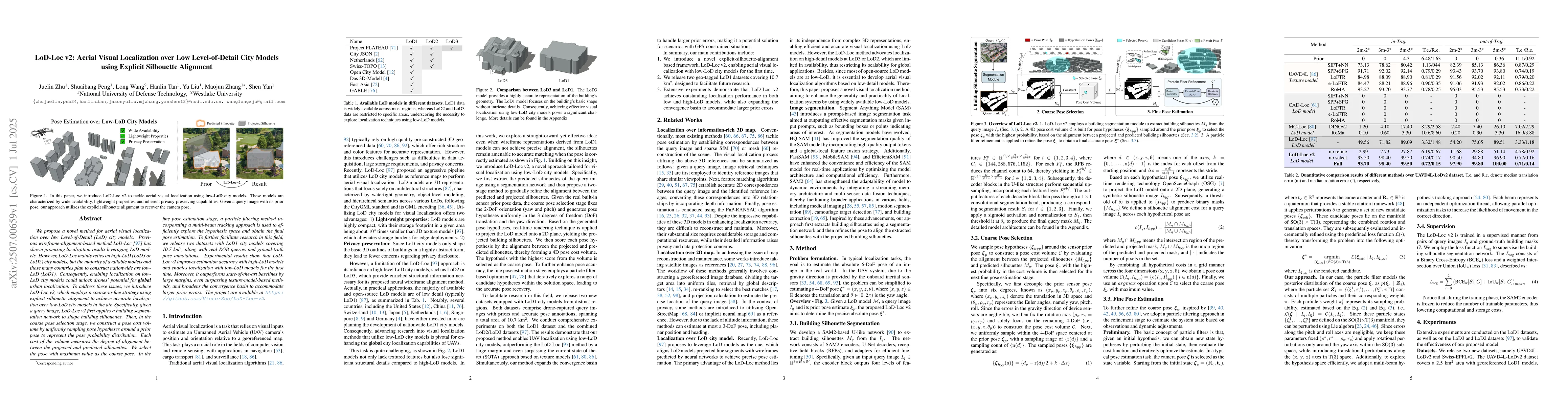
We propose a novel method for aerial visual localization over low Level-of-Detail (LoD) city models. Previous wireframe-alignment-based method LoD-Loc has shown promising localization results leveragi...

Thumbnail for LoD-Loc v3: Generalized Aerial Localization in Dense Cities using Instance Silhouette Alignment
arXiv
LoD-Loc v3: Generalized Aerial Localization in Dense Cities using Instance Silhouette Alignment

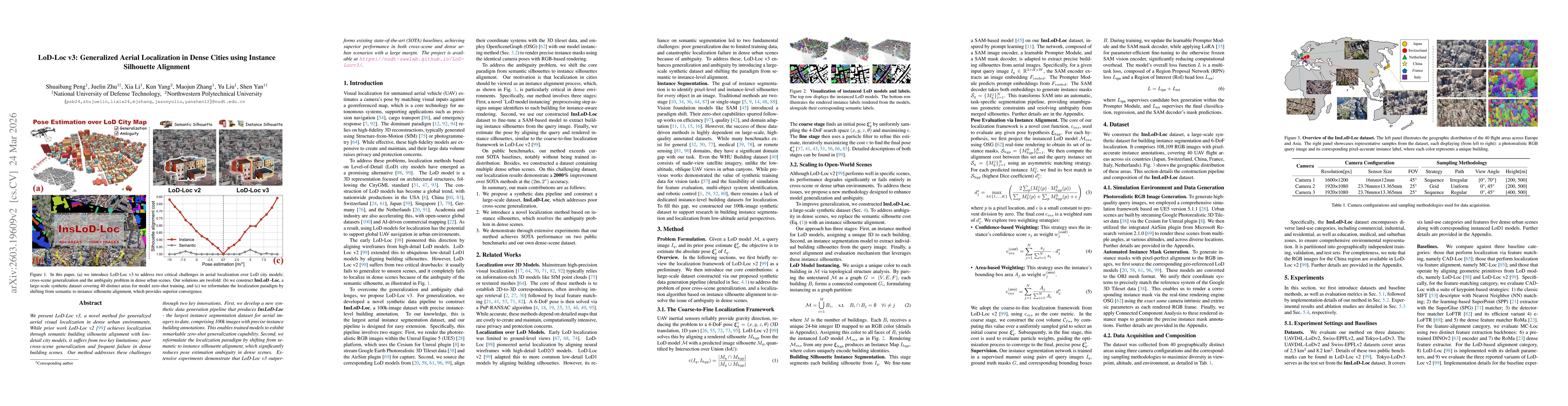
We present LoD-Loc v3, a novel method for generalized aerial visual localization in dense urban environments. While prior work LoD-Loc v2 achieves localization through semantic building silhouette ali...

This website uses cookies to ensure you get the best experience. Learn more