Academic Profile
Statistics
Similar Authors
Papers on arXiv
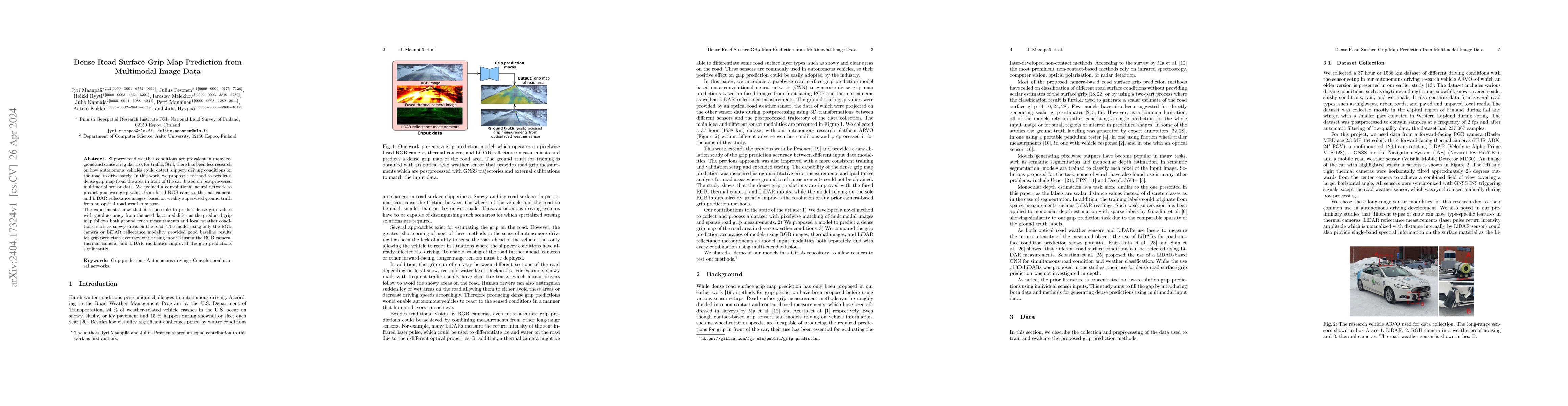
Slippery road weather conditions are prevalent in many regions and cause a regular risk for traffic. Still, there has been less research on how autonomous vehicles could detect slippery driving cond...
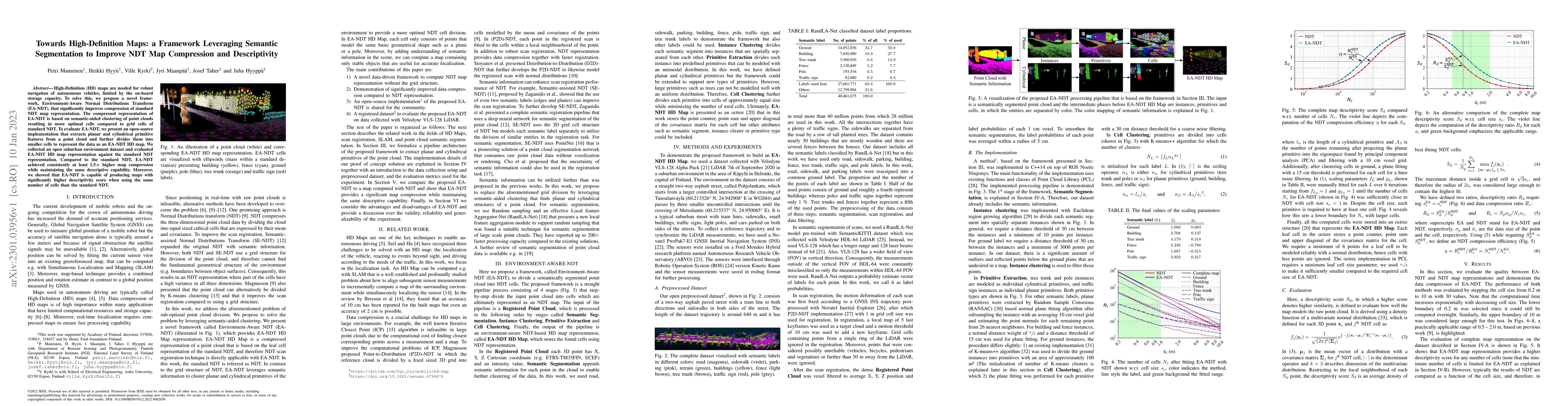
High-Definition (HD) maps are needed for robust navigation of autonomous vehicles, limited by the on-board storage capacity. To solve this, we propose a novel framework, Environment-Aware Normal Dis...
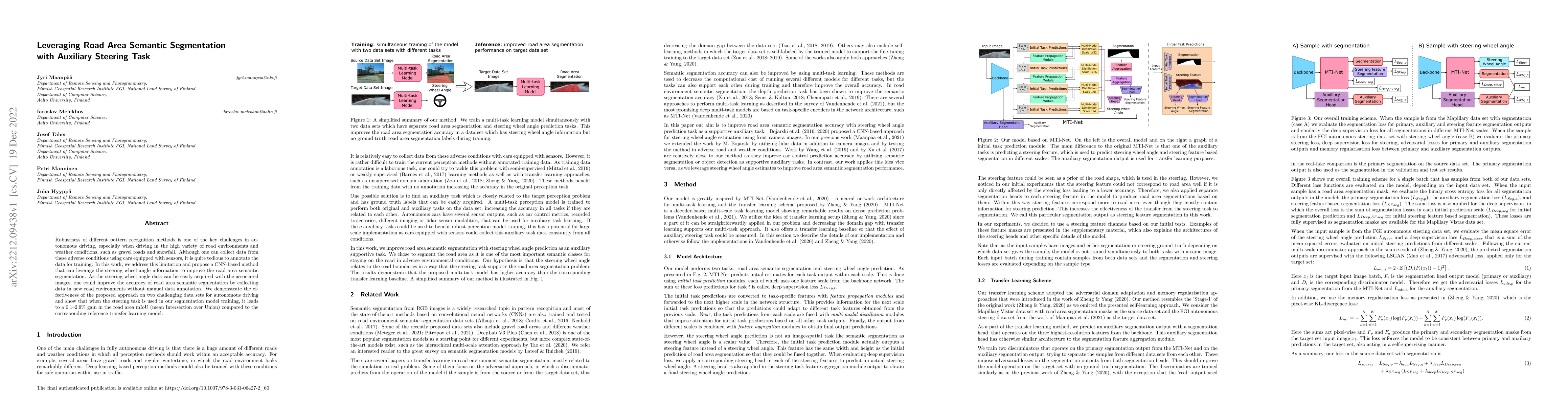
Robustness of different pattern recognition methods is one of the key challenges in autonomous driving, especially when driving in the high variety of road environments and weather conditions, such ...
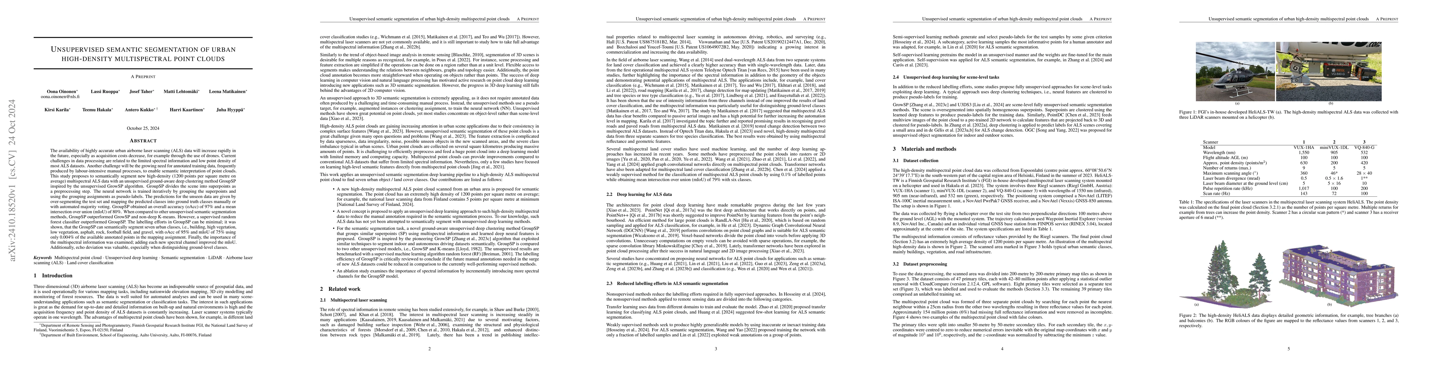
The availability of highly accurate urban airborne laser scanning (ALS) data will increase rapidly in the future, especially as acquisition costs decrease, for example through the use of drones. Curre...
Point clouds captured with laser scanning systems from forest environments can be utilized in a wide variety of applications within forestry and plant ecology, such as the estimation of tree stem attr...
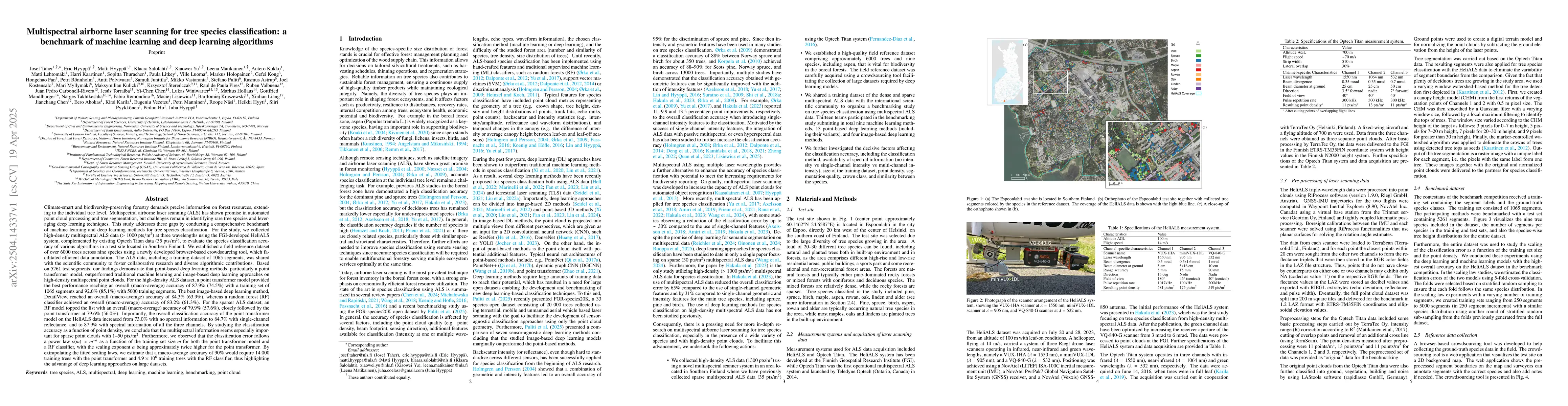
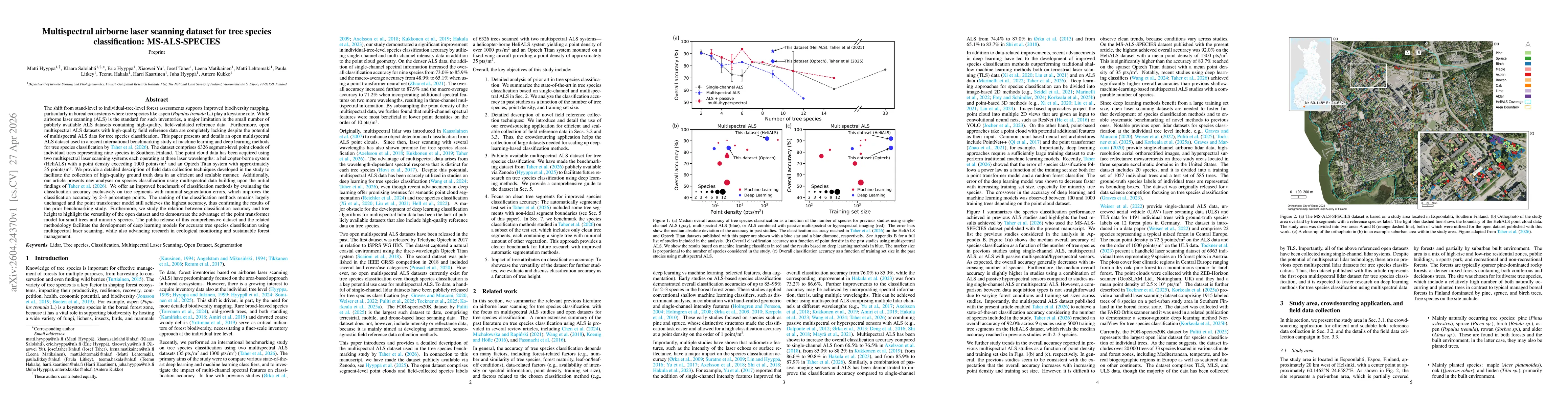
Climate-smart and biodiversity-preserving forestry demands precise information on forest resources, extending to the individual tree level. Multispectral airborne laser scanning (ALS) has shown promis...
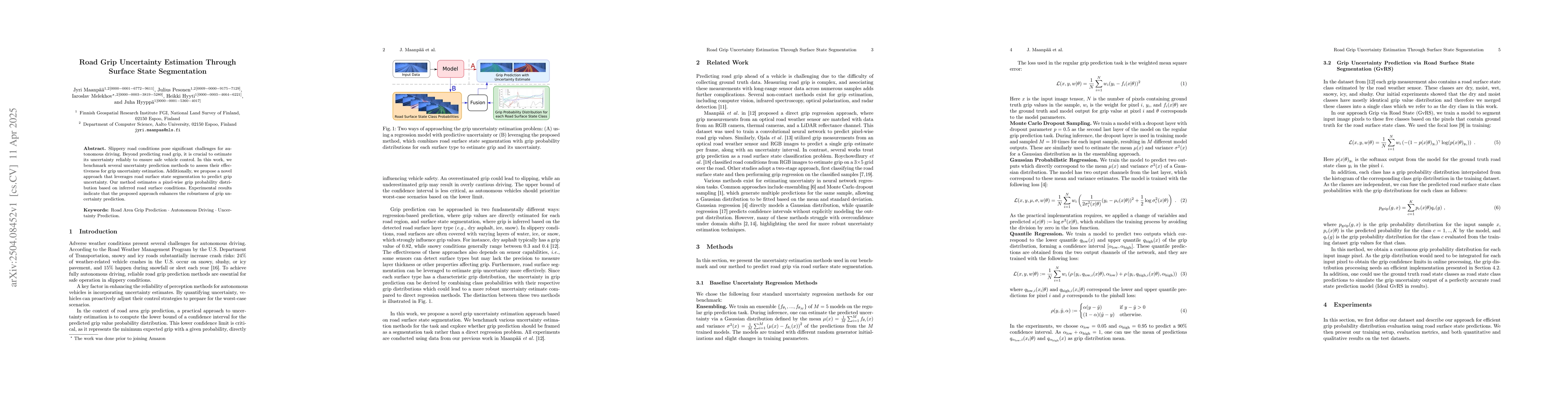
Slippery road conditions pose significant challenges for autonomous driving. Beyond predicting road grip, it is crucial to estimate its uncertainty reliably to ensure safe vehicle control. In this wor...
Conservation and decision-making regarding forest resources necessitate regular forest inventory. Light detection and ranging (LiDAR) in laser scanning systems has gained significant attention over th...
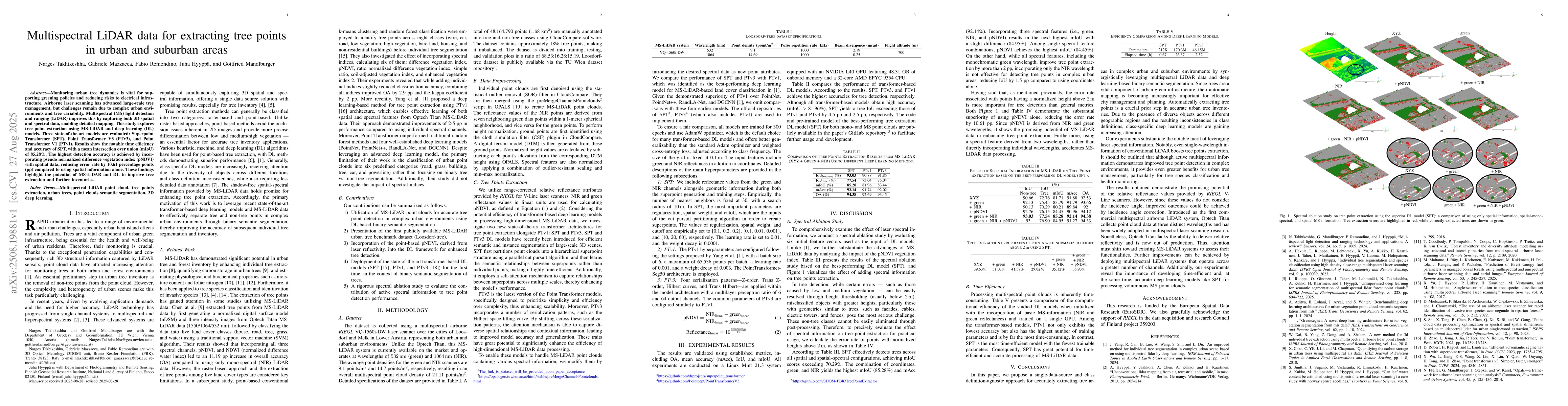
Monitoring urban tree dynamics is vital for supporting greening policies and reducing risks to electrical infrastructure. Airborne laser scanning has advanced large-scale tree management, but challeng...
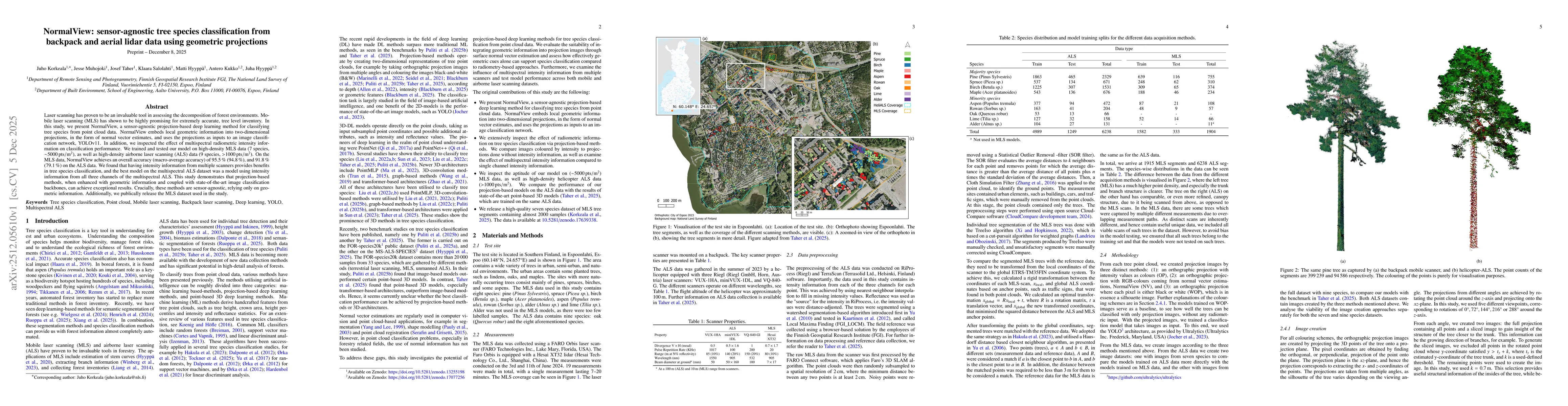
Laser scanning has proven to be an invaluable tool in assessing the decomposition of forest environments. Mobile laser scanning (MLS) has shown to be highly promising for extremely accurate, tree leve...
The shift from stand-level to individual-tree-level forest assessments supports improved biodiversity mapping, particularly in boreal ecosystems where tree species like aspen (Populus tremula L.) play...
Land Use Land Cover (LULC) classification is essential for national 3D mapping, geospatial analysis, and sustainable planning. Multispectral (MS) LiDAR provides synchronized spatial-spectral informati...