Academic Profile
Statistics
Similar Authors
Papers on arXiv
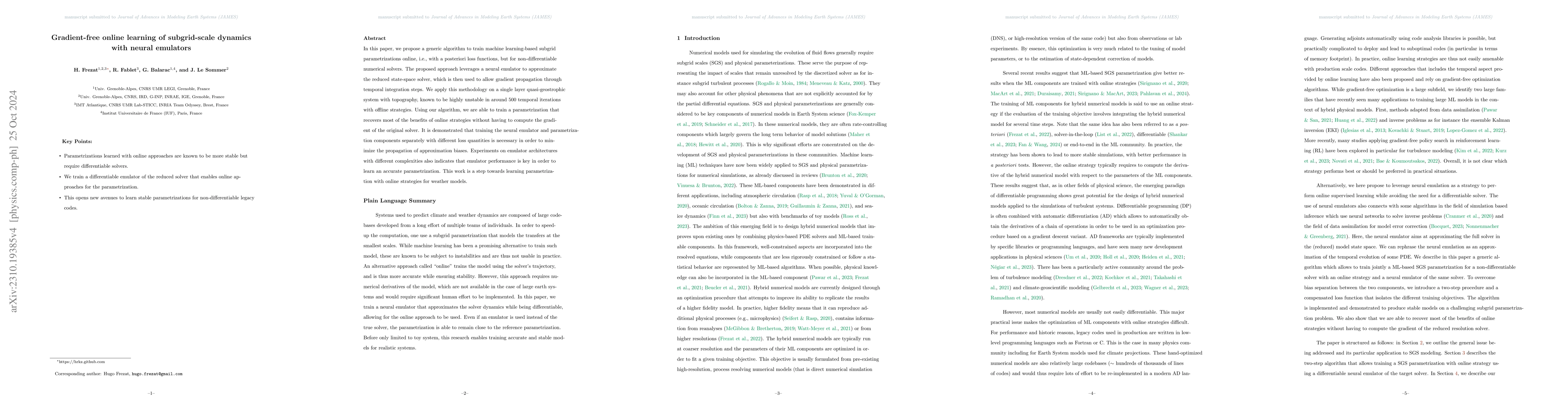
In this paper, we propose a generic algorithm to train machine learning-based subgrid parametrizations online, i.e., with a posteriori loss functions, but for non-differentiable numerical solvers. T...
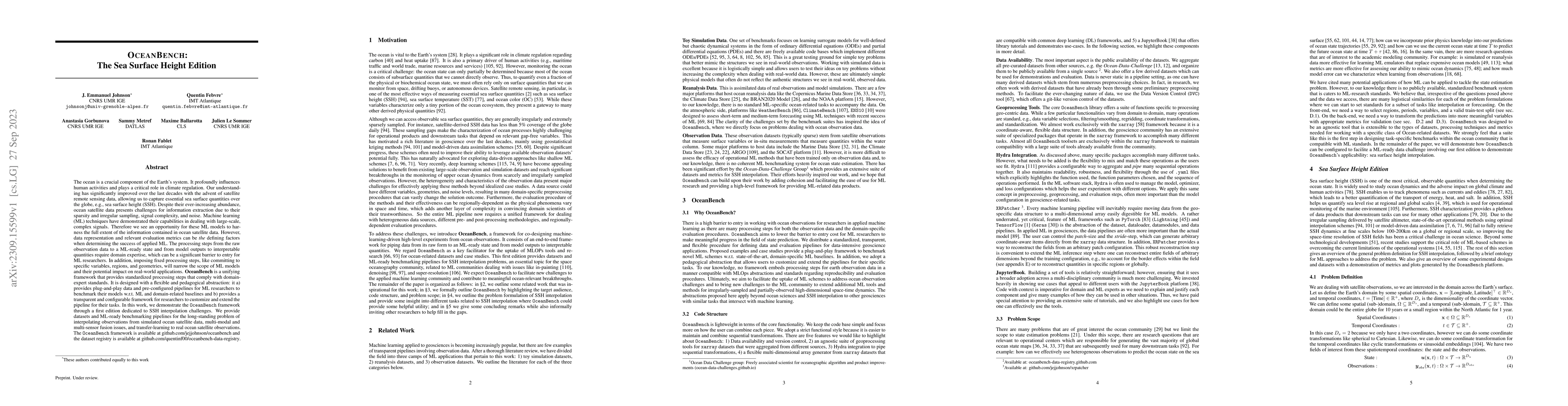
The ocean profoundly influences human activities and plays a critical role in climate regulation. Our understanding has improved over the last decades with the advent of satellite remote sensing dat...
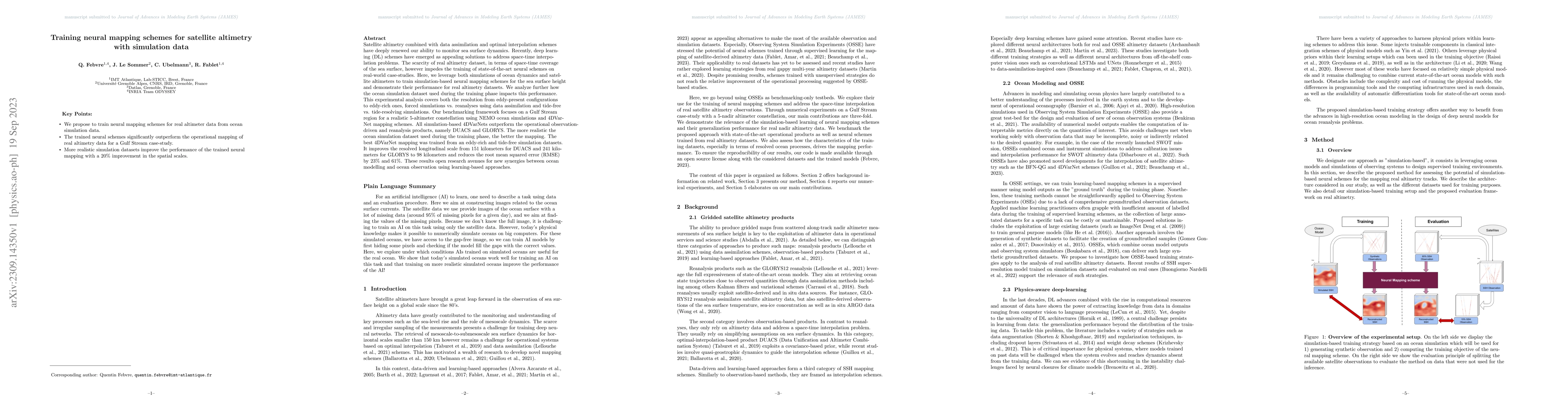
Satellite altimetry combined with data assimilation and optimal interpolation schemes have deeply renewed our ability to monitor sea surface dynamics. Recently, deep learning (DL) schemes have emerg...
Sea surface height (SSH) is a key geophysical parameter for monitoring and studying meso-scale surface ocean dynamics. For several decades, the mapping of SSH products at regional and global scales ...
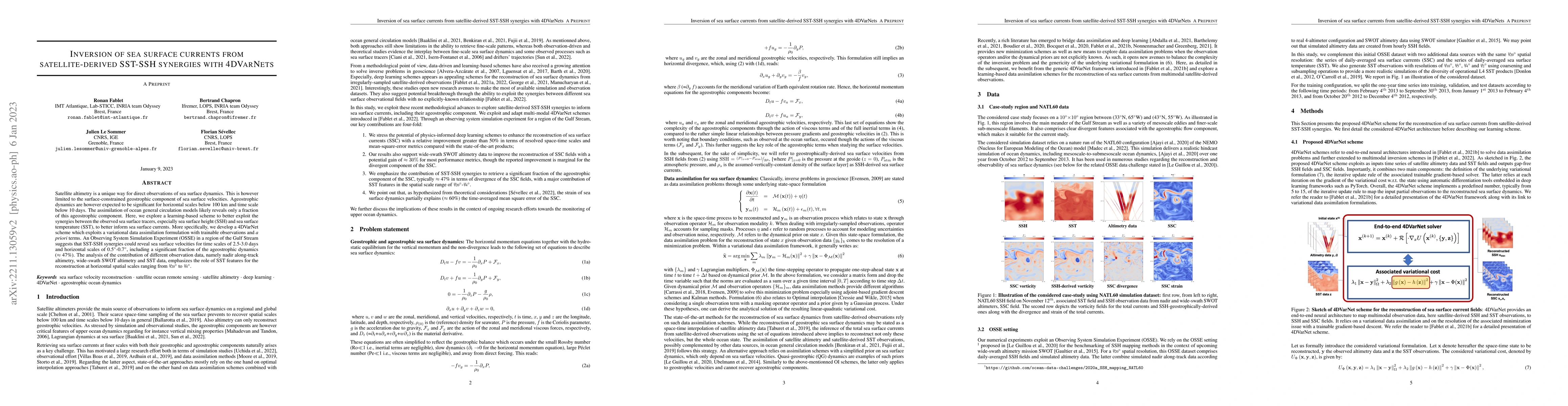
Satellite altimetry is a unique way for direct observations of sea surface dynamics. This is however limited to the surface-constrained geostrophic component of sea surface velocities. Ageostrophic ...
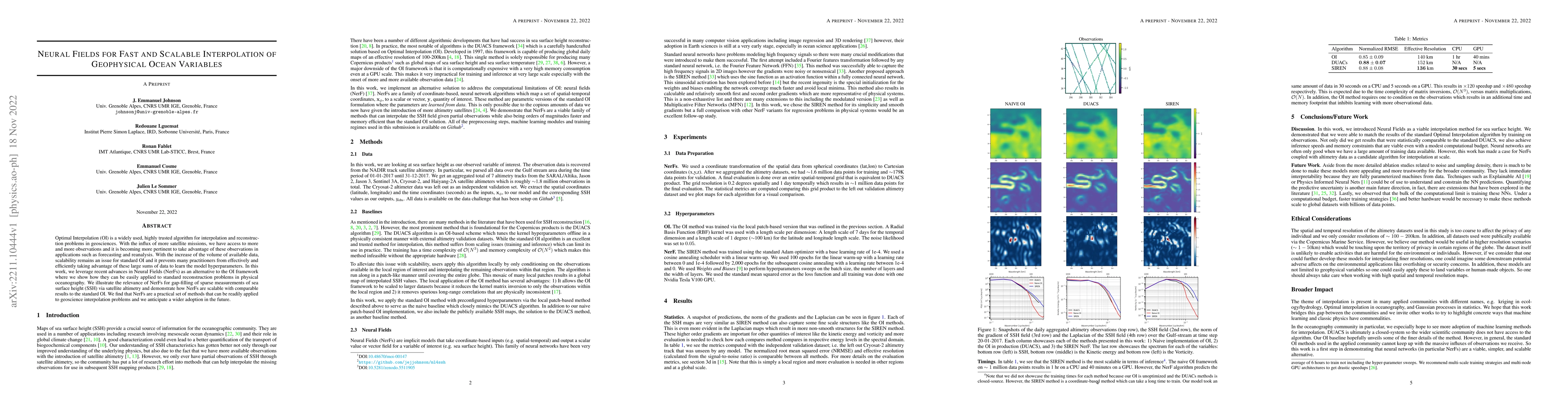
Optimal Interpolation (OI) is a widely used, highly trusted algorithm for interpolation and reconstruction problems in geosciences. With the influx of more satellite missions, we have access to more...
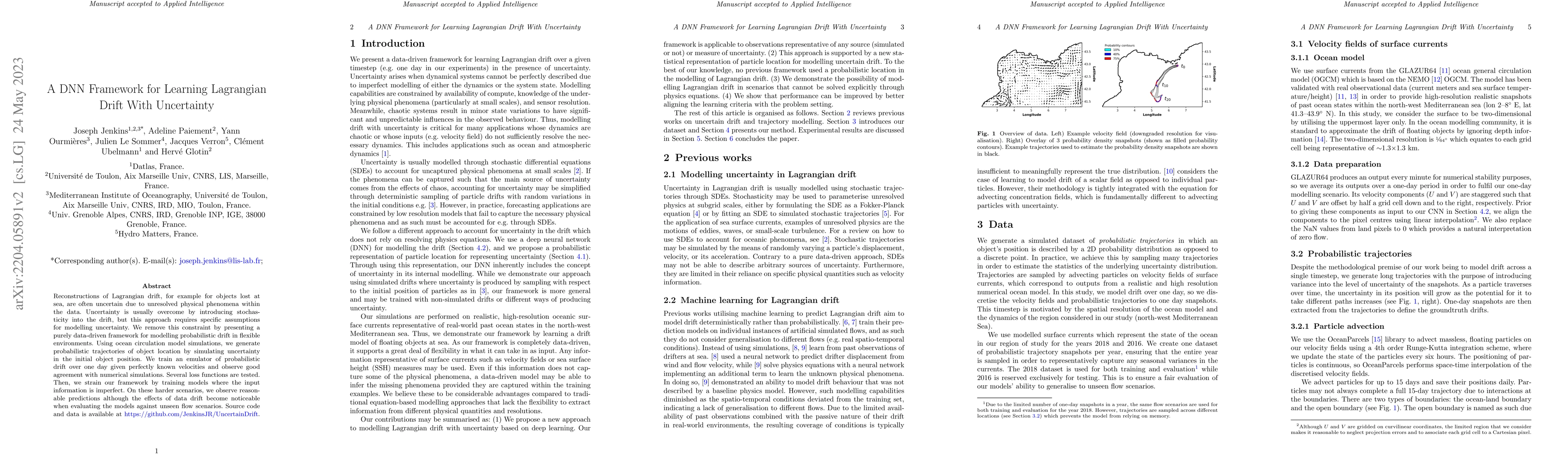
Reconstructions of Lagrangian drift, for example for objects lost at sea, are often uncertain due to unresolved physical phenomena within the data. Uncertainty is usually overcome by introducing sto...
The use of machine learning to build subgrid parametrizations for climate models is receiving growing attention. State-of-the-art strategies address the problem as a supervised learning task and opt...
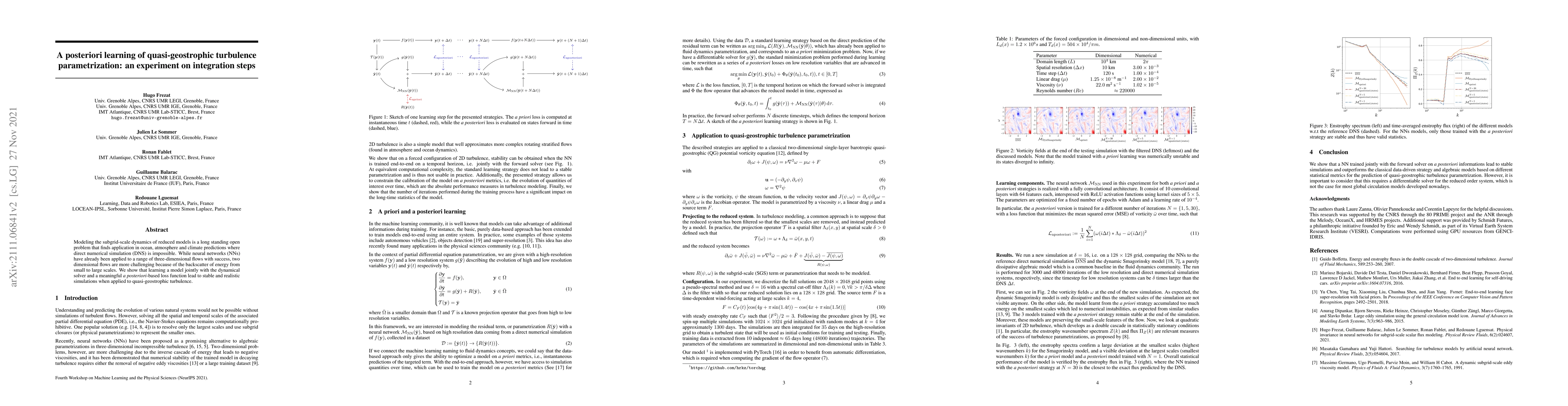
Modeling the subgrid-scale dynamics of reduced models is a long standing open problem that finds application in ocean, atmosphere and climate predictions where direct numerical simulation (DNS) is i...
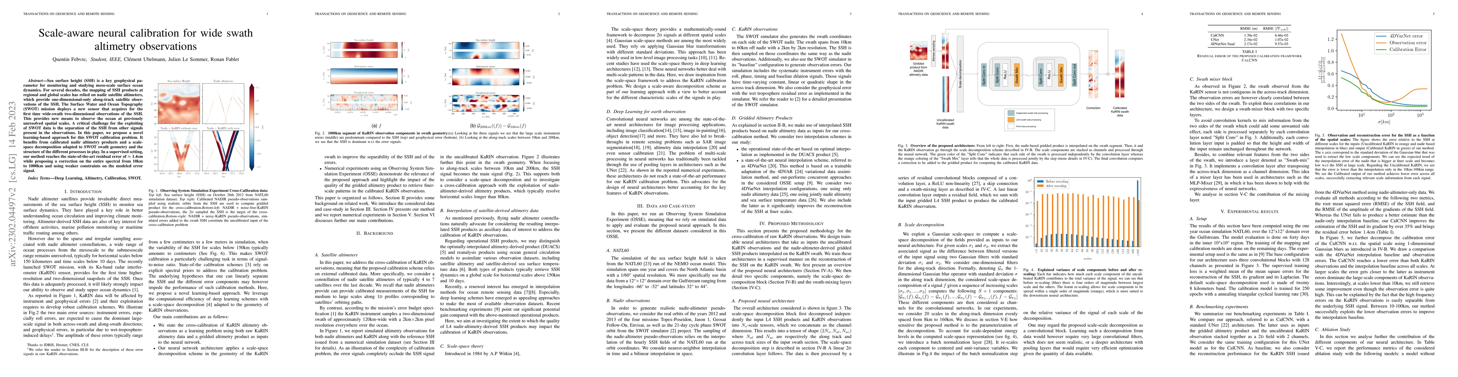
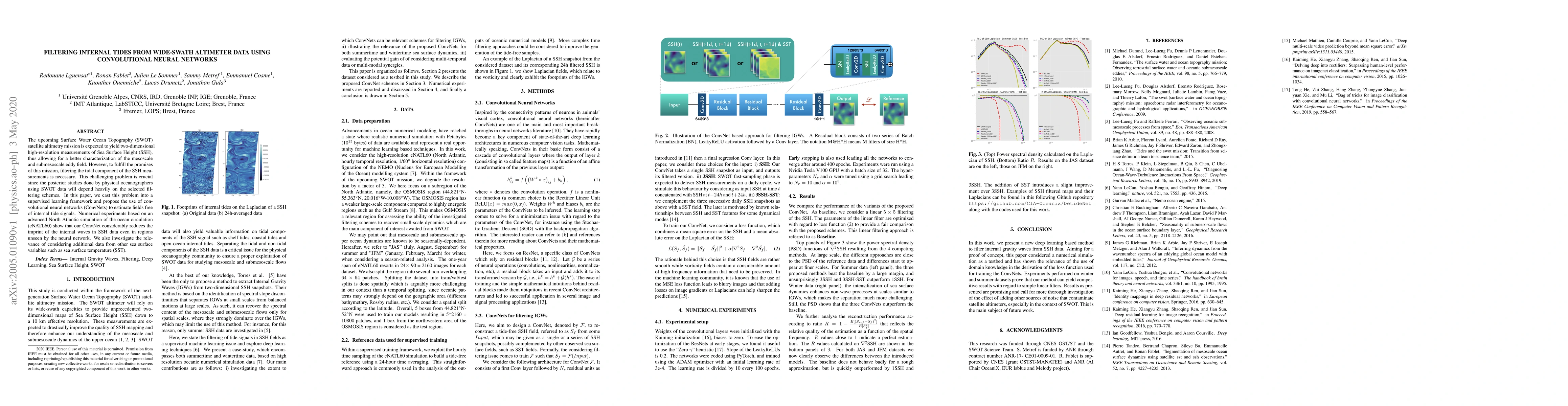
Satellite radar altimeters are a key source of observation of ocean surface dynamics. However, current sensor technology and mapping techniques do not yet allow to systematically resolve scales smal...
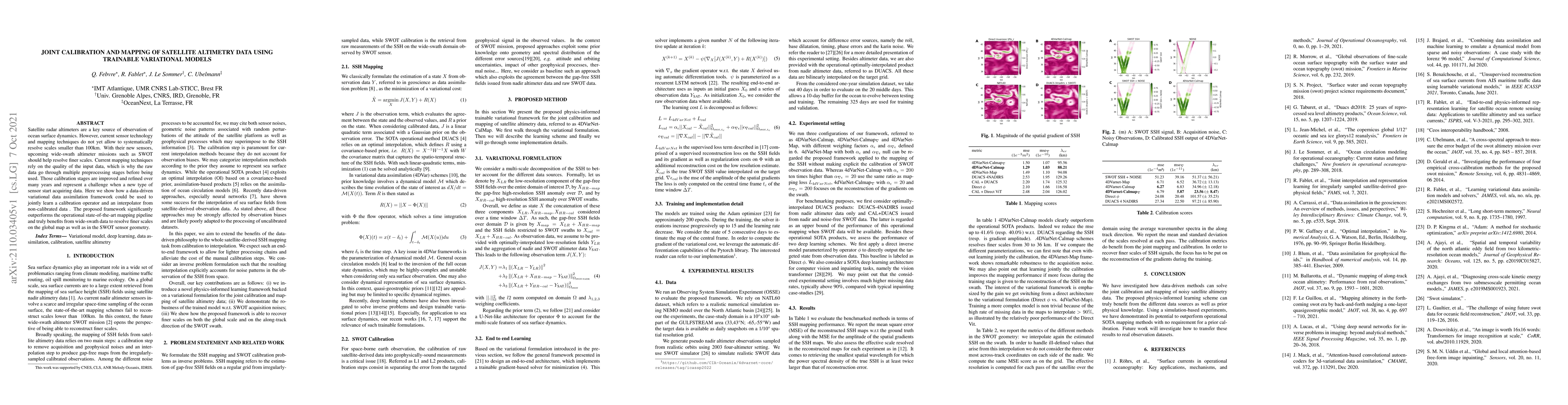
The upcoming Surface Water Ocean Topography (SWOT) satellite altimetry mission is expected to yield two-dimensional high-resolution measurements of Sea Surface Height (SSH), thus allowing for a bett...

We introduce a new strategy designed to help physicists discover hidden laws governing dynamical systems. We propose to use machine learning automatic differentiation libraries to develop hybrid num...
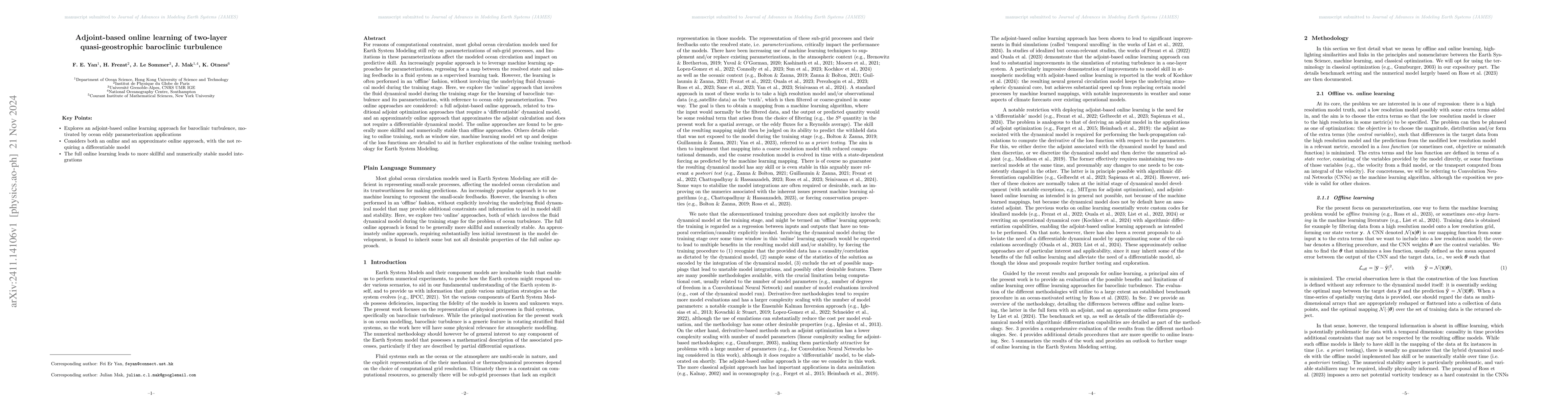
For reasons of computational constraint, most global ocean circulation models used for Earth System Modeling still rely on parameterizations of sub-grid processes, and limitations in these parameteriz...
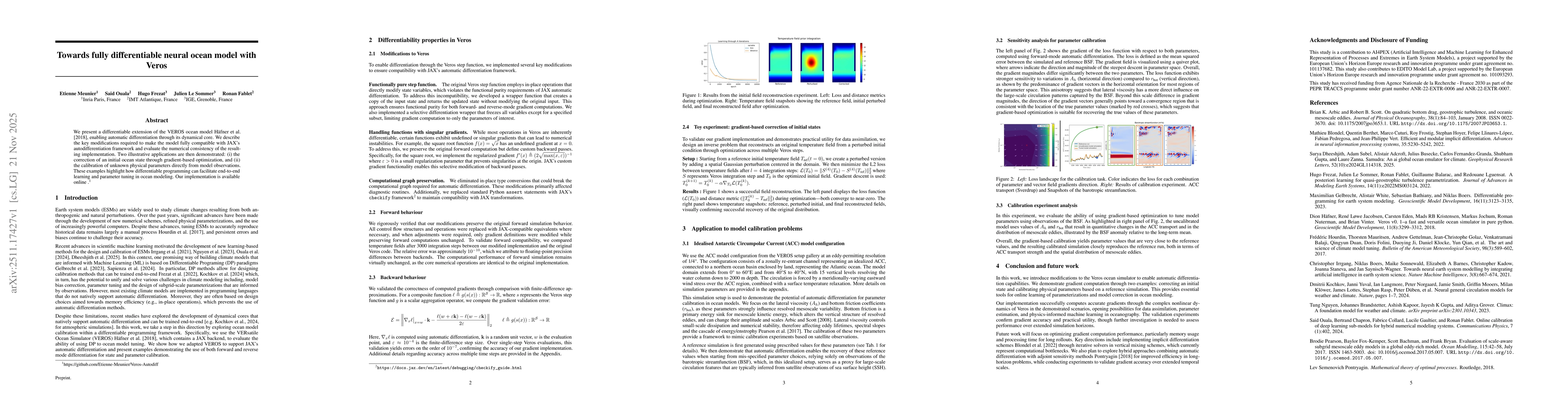
We present a differentiable extension of the VEROS ocean model, enabling automatic differentiation through its dynamical core. We describe the key modifications required to make the model fully compat...

We present an end-to-end deep learning framework for short-term forecasting of global sea surface dynamics based on sparse satellite altimetry data. Building on two state-of-the-art architectures: U-N...
While geostrophy remains the simplest and most practical balance to extract velocity information from sea-surface height anomaly (SSHa), confusions remain within the oceanographic community to what ex...