Academic Profile
Statistics
Similar Authors
Papers on arXiv
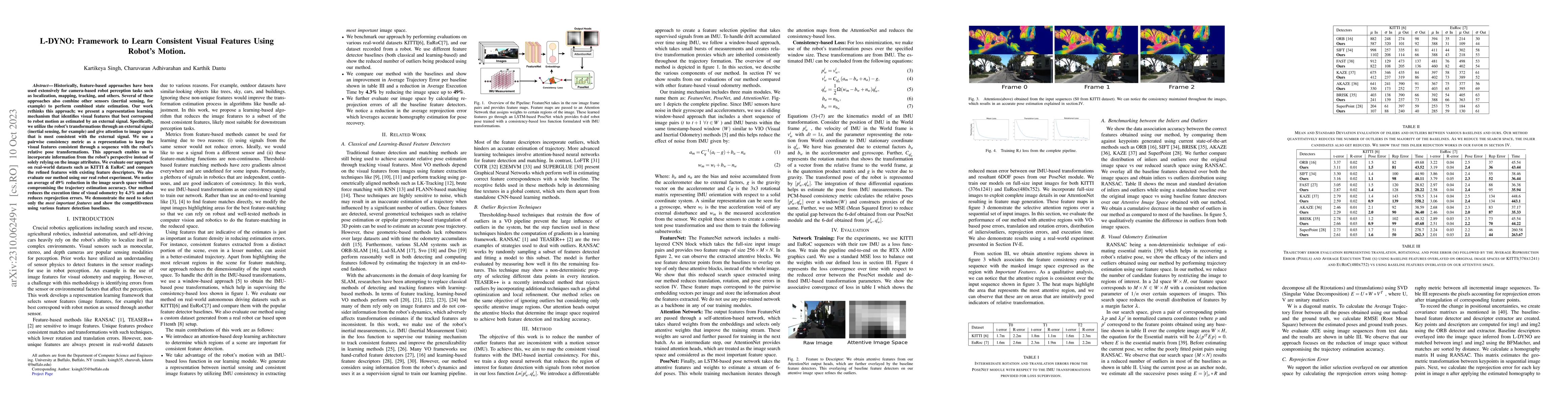
Historically, feature-based approaches have been used extensively for camera-based robot perception tasks such as localization, mapping, tracking, and others. Several of these approaches also combin...
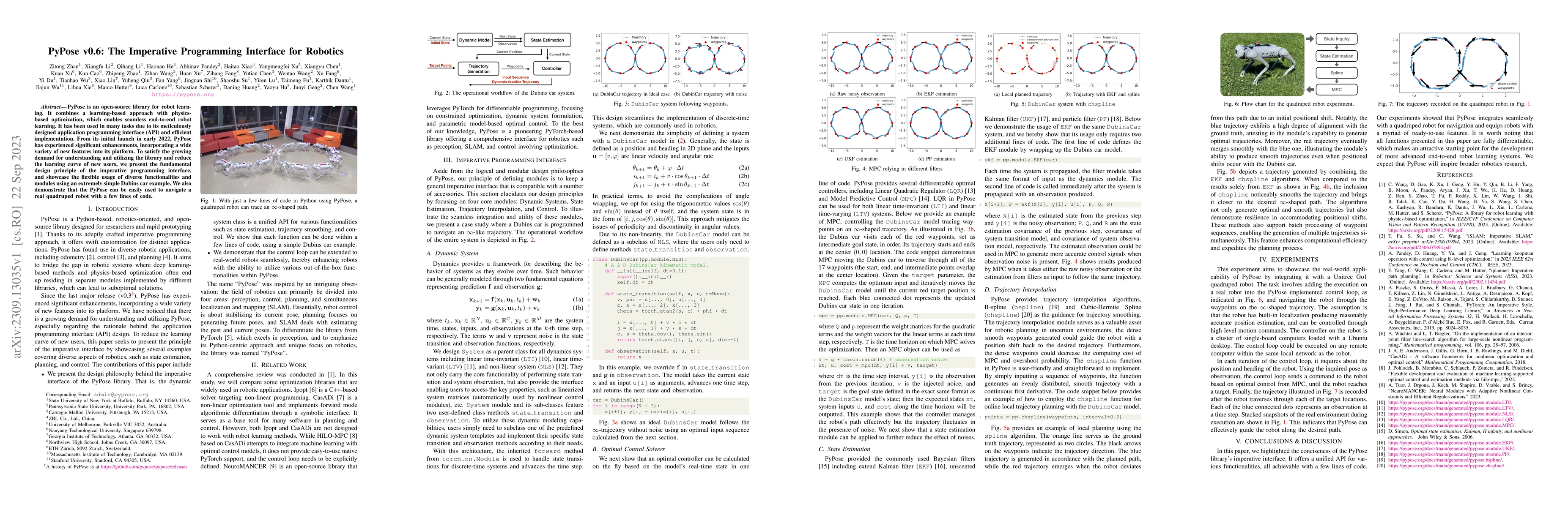
PyPose is an open-source library for robot learning. It combines a learning-based approach with physics-based optimization, which enables seamless end-to-end robot learning. It has been used in many...
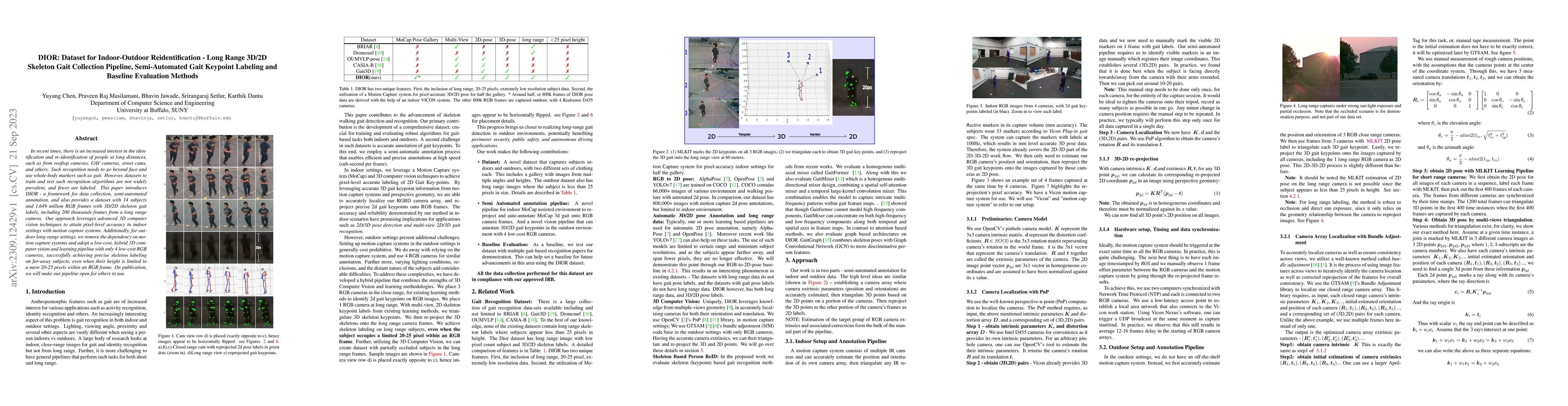
In recent times, there is an increased interest in the identification and re-identification of people at long distances, such as from rooftop cameras, UAV cameras, street cams, and others. Such reco...
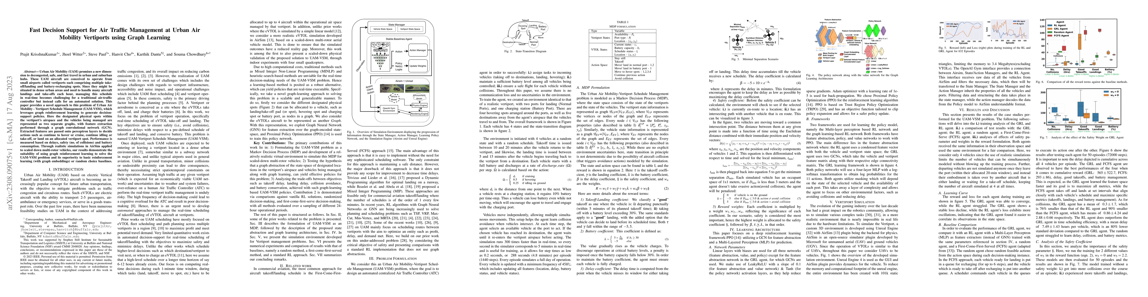
Urban Air Mobility (UAM) promises a new dimension to decongested, safe, and fast travel in urban and suburban hubs. These UAM aircraft are conceived to operate from small airports called vertiports ...
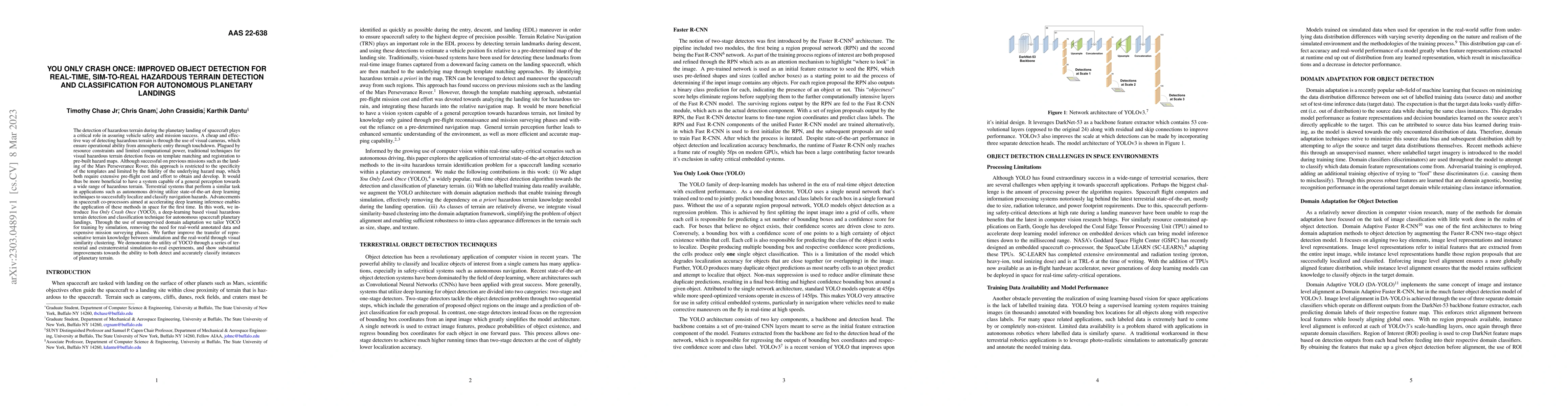
The detection of hazardous terrain during the planetary landing of spacecraft plays a critical role in assuring vehicle safety and mission success. A cheap and effective way of detecting hazardous t...
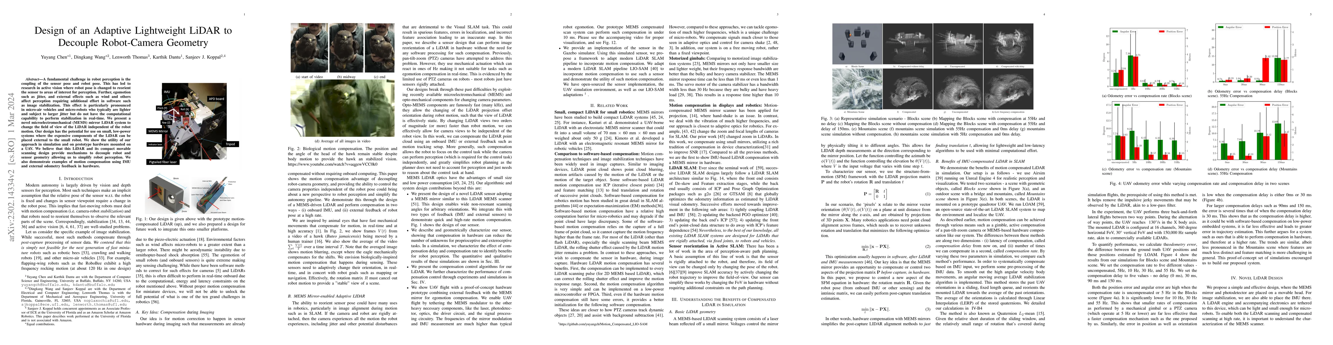
A fundamental challenge in robot perception is the coupling of the sensor pose and robot pose. This has led to research in active vision where robot pose is changed to reorient the sensor to areas o...
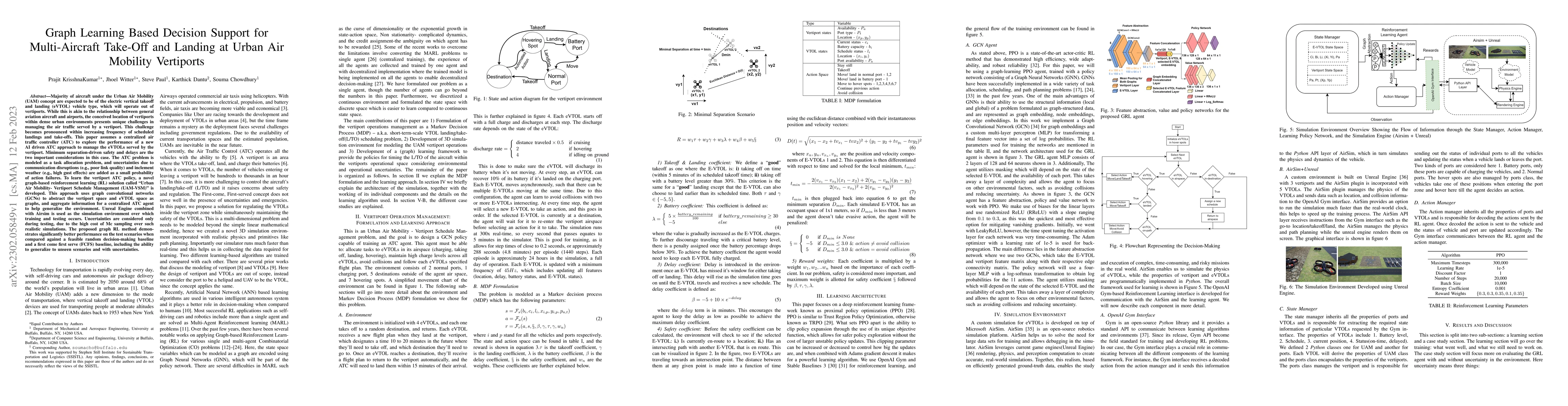
Majority of aircraft under the Urban Air Mobility (UAM) concept are expected to be of the electric vertical takeoff and landing (eVTOL) vehicle type, which will operate out of vertiports. While this...
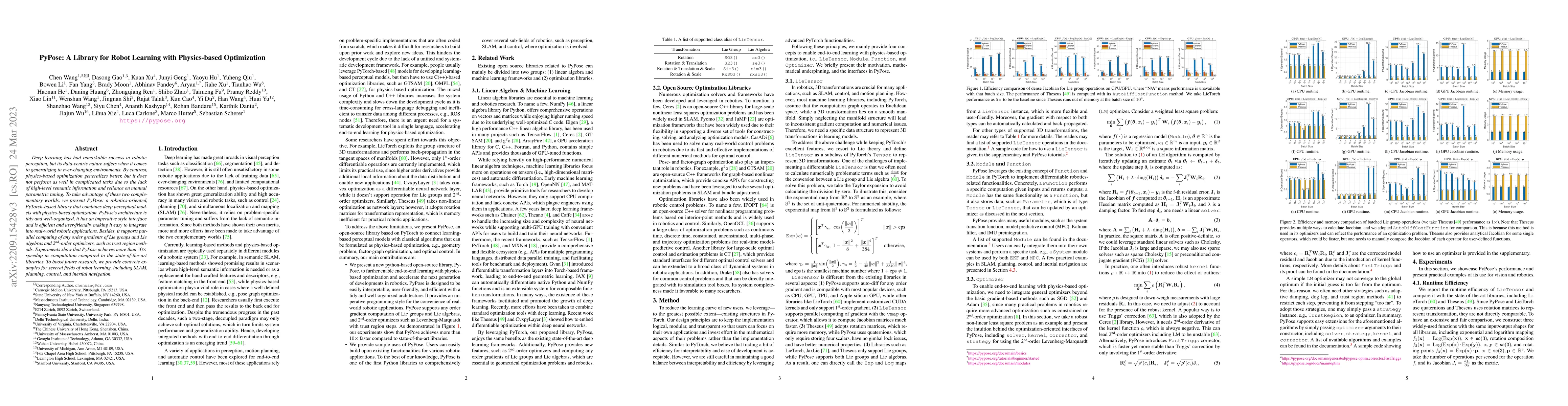
Deep learning has had remarkable success in robotic perception, but its data-centric nature suffers when it comes to generalizing to ever-changing environments. By contrast, physics-based optimizati...
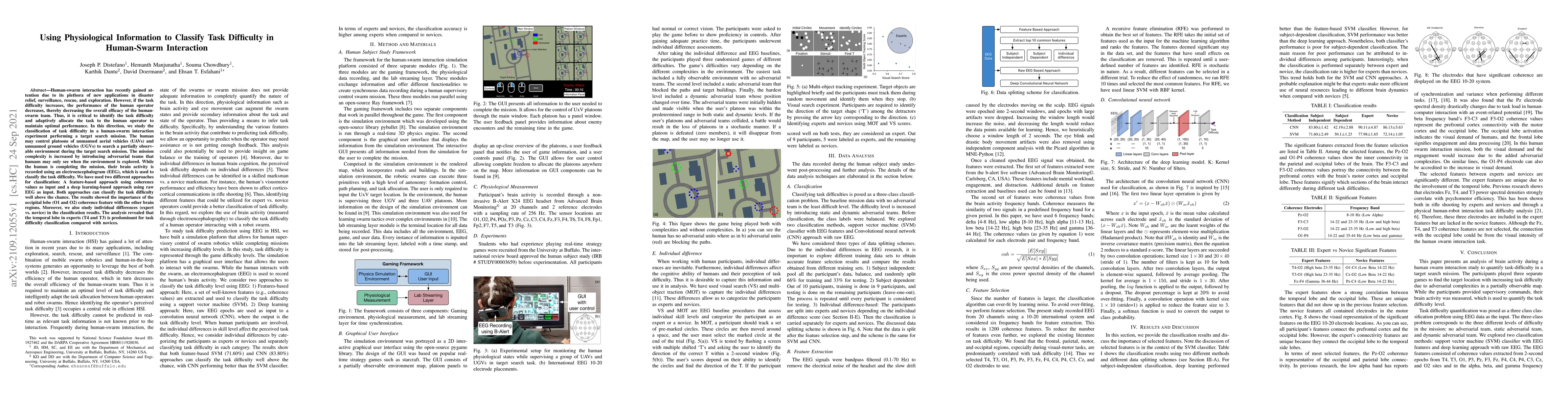
Human-swarm interaction has recently gained attention due to its plethora of new applications in disaster relief, surveillance, rescue, and exploration. However, if the task difficulty increases, th...
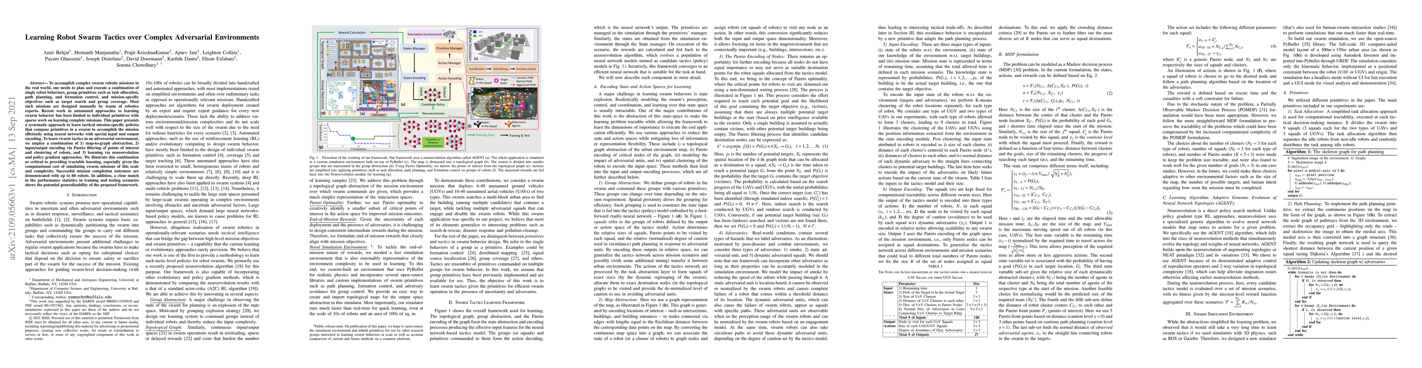
To accomplish complex swarm robotic missions in the real world, one needs to plan and execute a combination of single robot behaviors, group primitives such as task allocation, path planning, and fo...
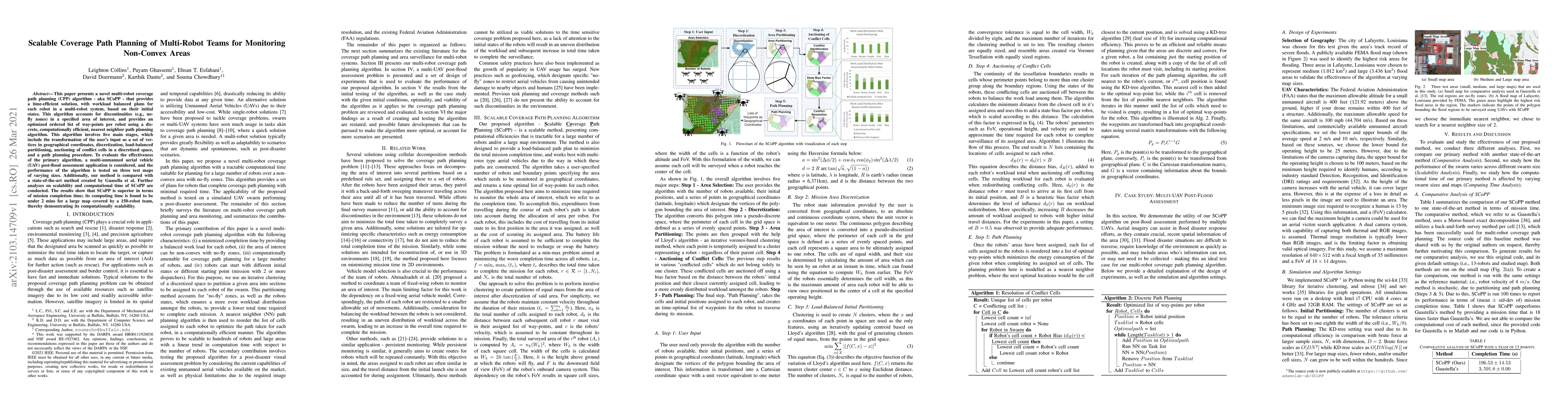
This paper presents a novel multi-robot coverage path planning (CPP) algorithm - aka SCoPP - that provides a time-efficient solution, with workload balanced plans for each robot in a multi-robot sys...
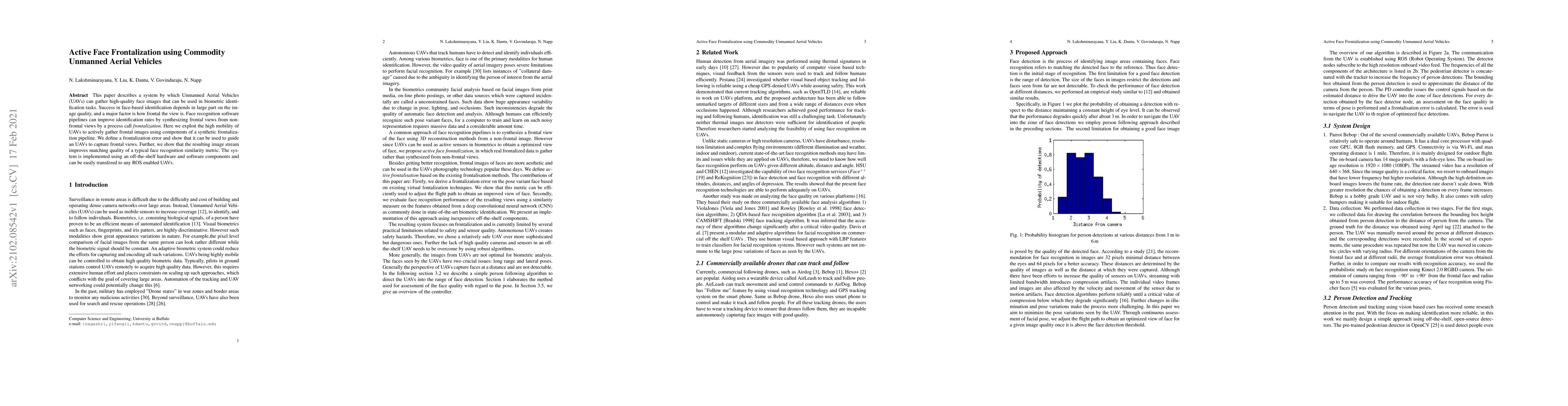
This paper describes a system by which Unmanned Aerial Vehicles (UAVs) can gather high-quality face images that can be used in biometric identification tasks. Success in face-based identification de...
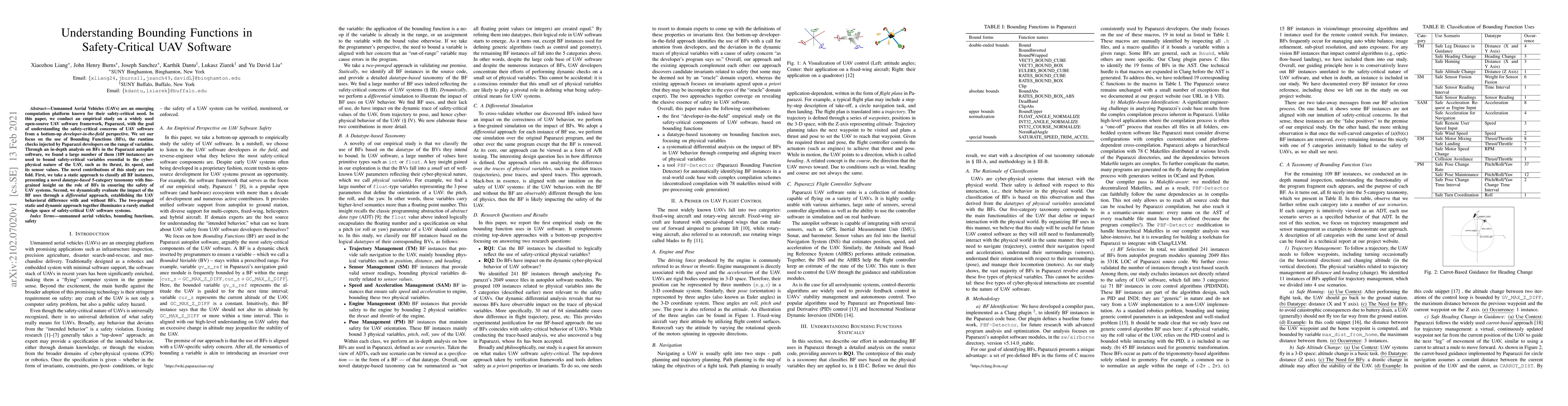
Unmanned Aerial Vehicles (UAVs) are an emerging computation platform known for their safety-critical need. In this paper, we conduct an empirical study on a widely used open-source UAV software fram...
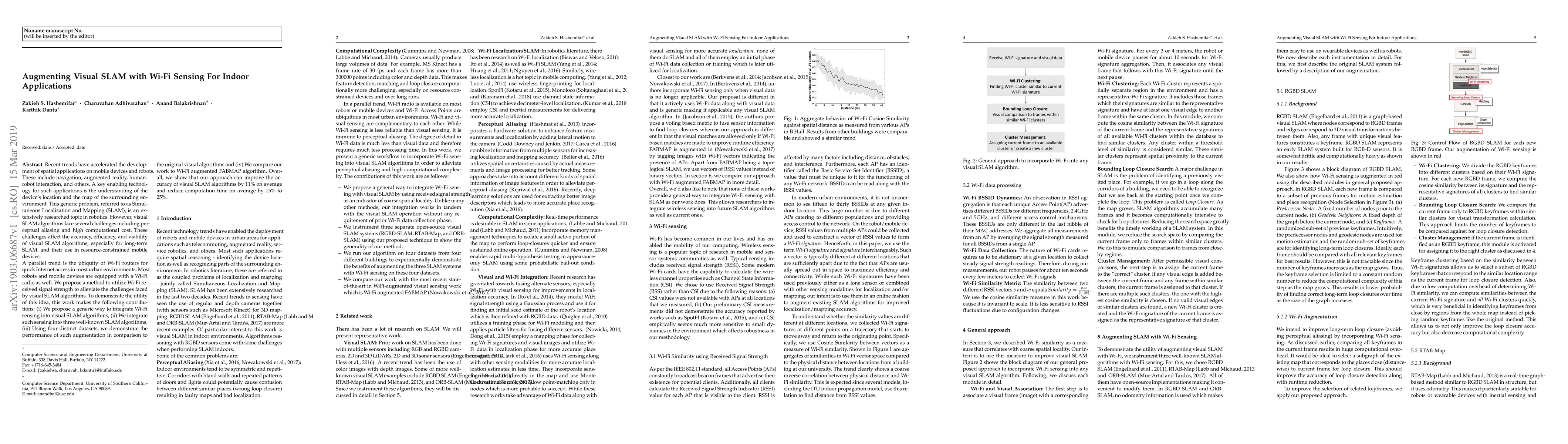
Recent trends have accelerated the development of spatial applications on mobile devices and robots. These include navigation, augmented reality, human-robot interaction, and others. A key enabling ...
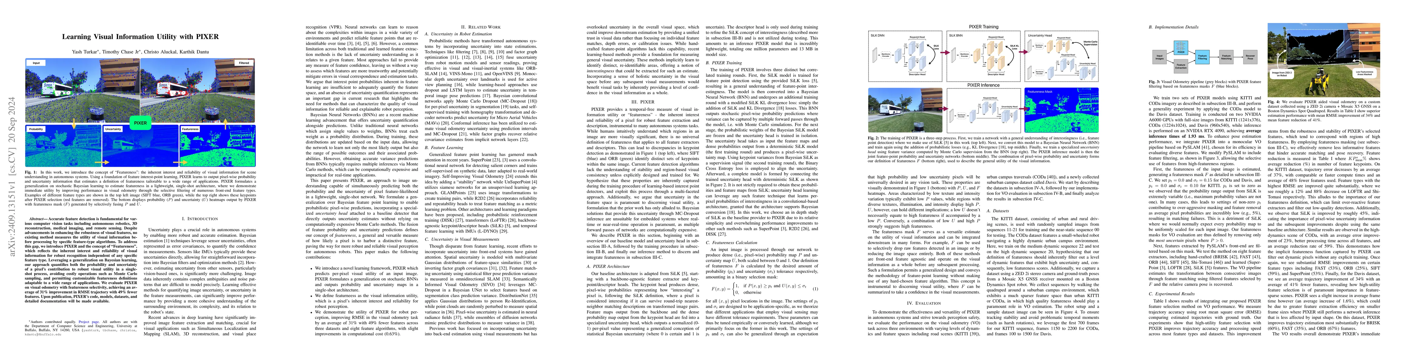
Accurate feature detection is fundamental for various computer vision tasks, including autonomous robotics, 3D reconstruction, medical imaging, and remote sensing. Despite advancements in enhancing th...
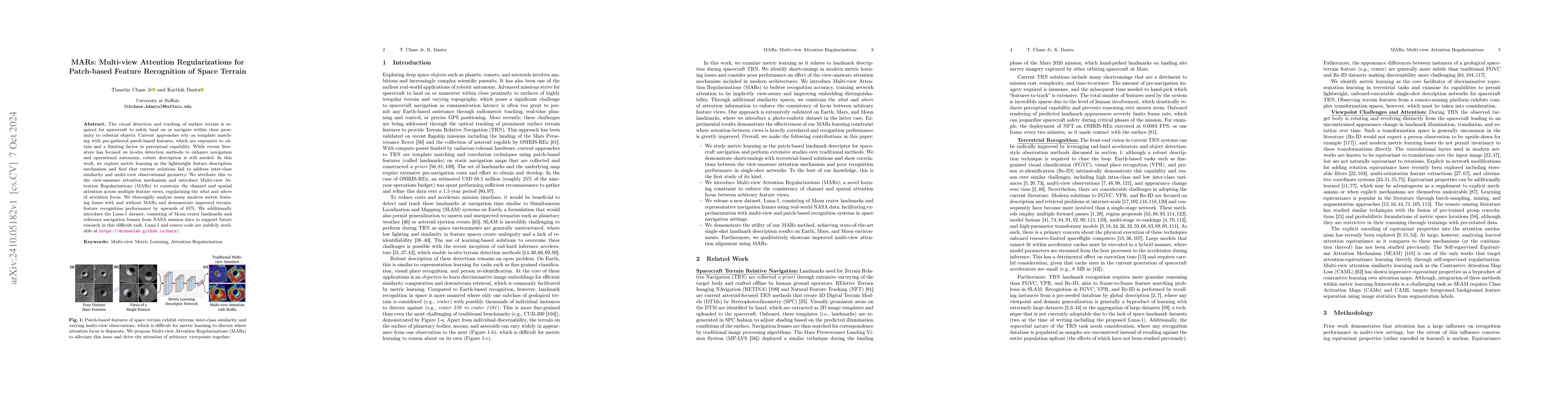
The visual detection and tracking of surface terrain is required for spacecraft to safely land on or navigate within close proximity to celestial objects. Current approaches rely on template matching ...
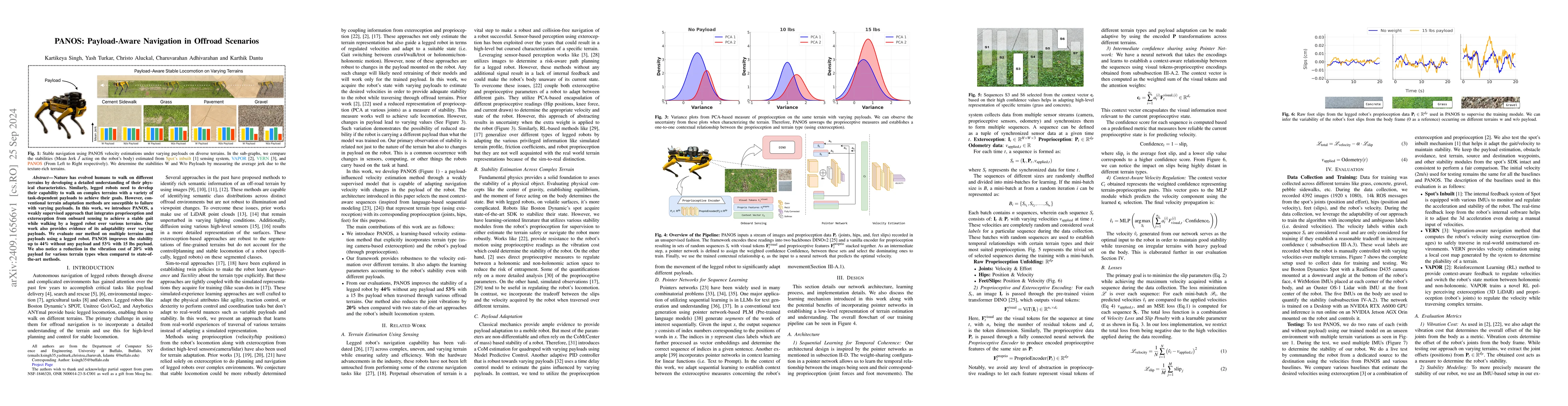
Nature has evolved humans to walk on different terrains by developing a detailed understanding of their physical characteristics. Similarly, legged robots need to develop their capability to walk on c...
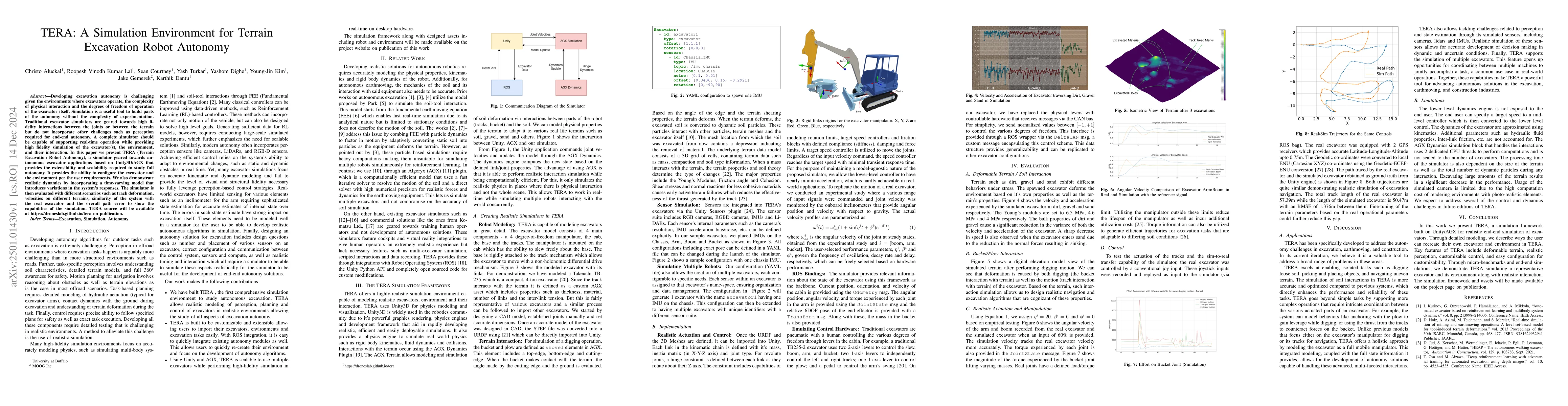
Developing excavation autonomy is challenging given the environments where excavators operate, the complexity of physical interaction and the degrees of freedom of operation of the excavator itself. S...
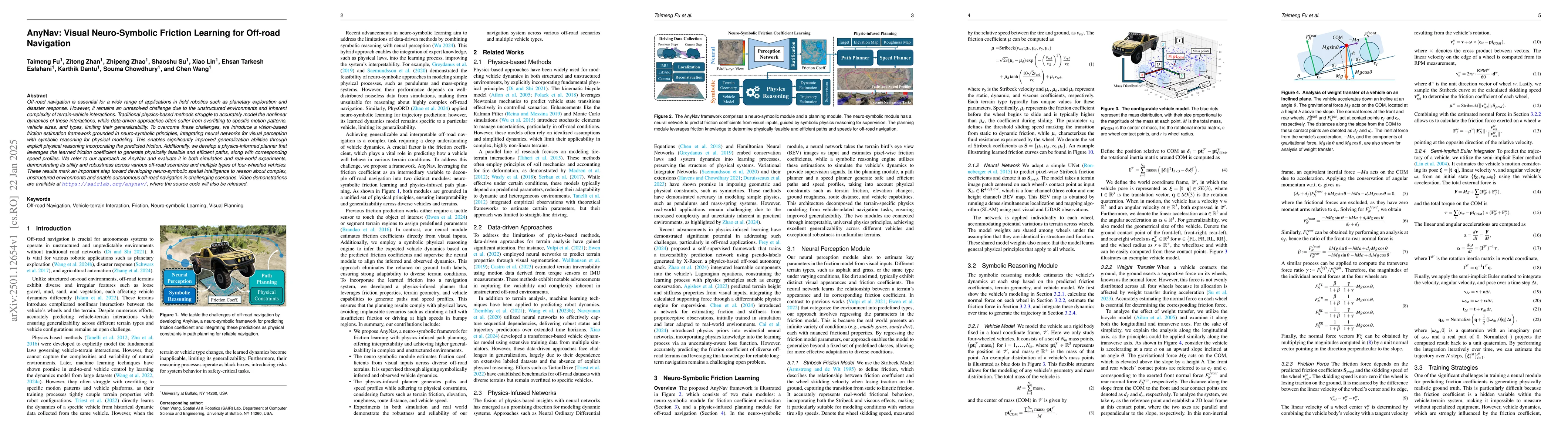
Off-road navigation is essential for a wide range of applications in field robotics such as planetary exploration and disaster response. However, it remains an unresolved challenge due to the unstruct...
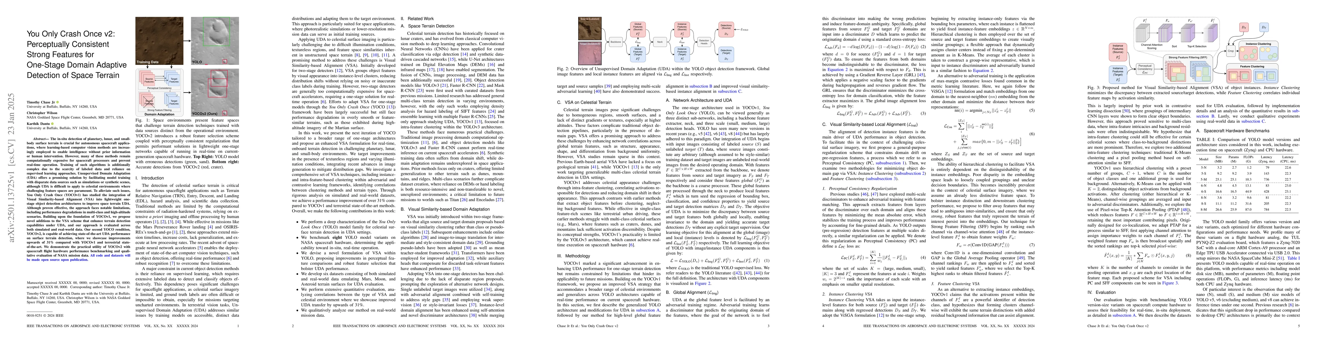
The in-situ detection of planetary, lunar, and small-body surface terrain is crucial for autonomous spacecraft applications, where learning-based computer vision methods are increasingly employed to e...
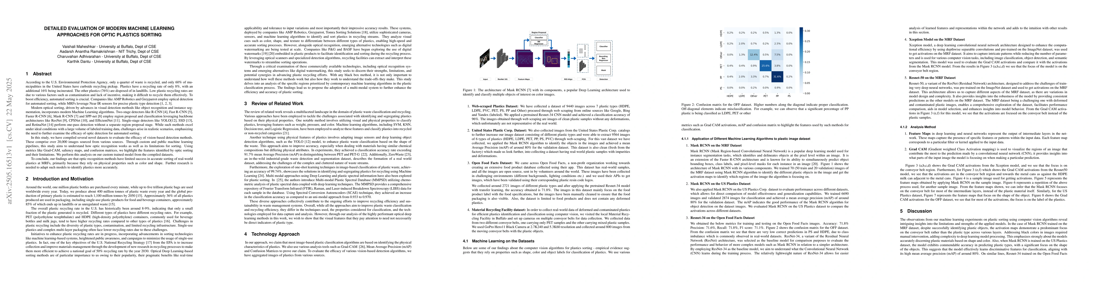
According to the EPA, only 25% of waste is recycled, and just 60% of U.S. municipalities offer curbside recycling. Plastics fare worse, with a recycling rate of only 8%; an additional 16% is incinerat...
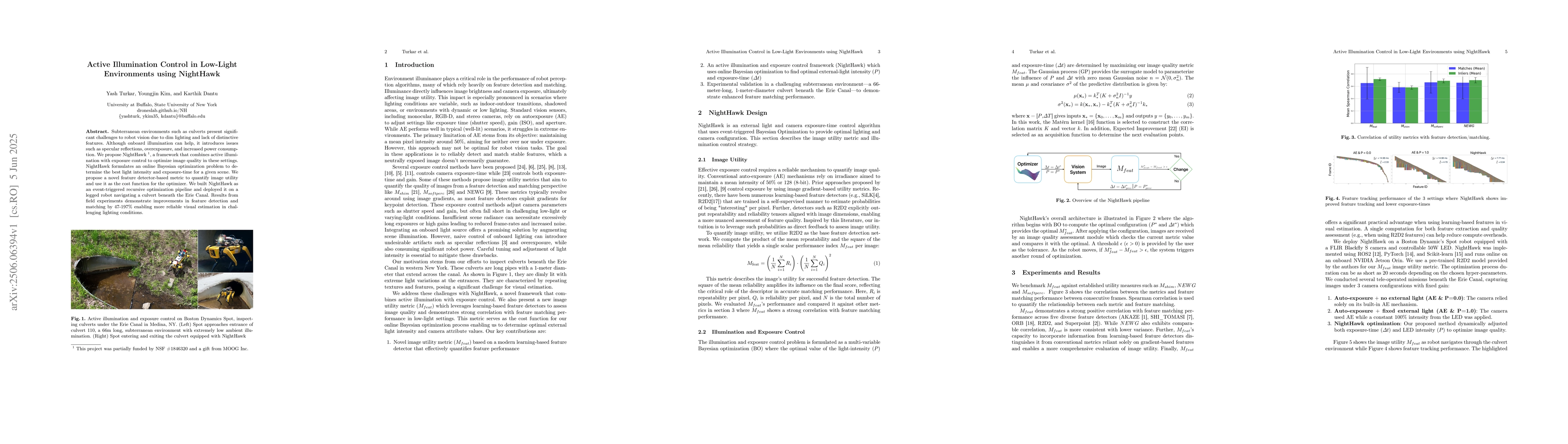
Subterranean environments such as culverts present significant challenges to robot vision due to dim lighting and lack of distinctive features. Although onboard illumination can help, it introduces is...
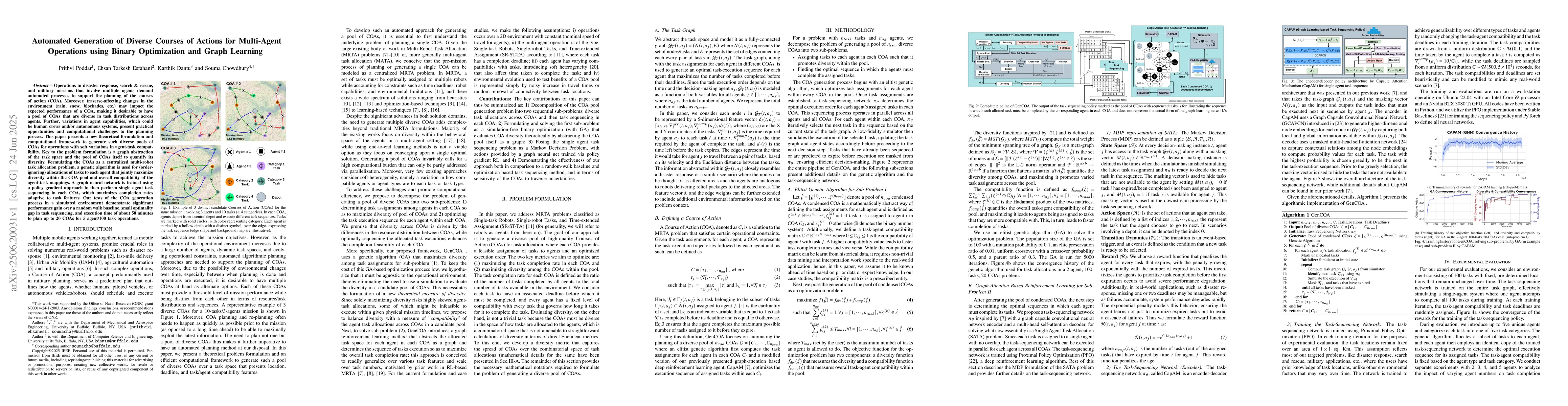
Operations in disaster response, search \& rescue, and military missions that involve multiple agents demand automated processes to support the planning of the courses of action (COA). Moreover, trave...
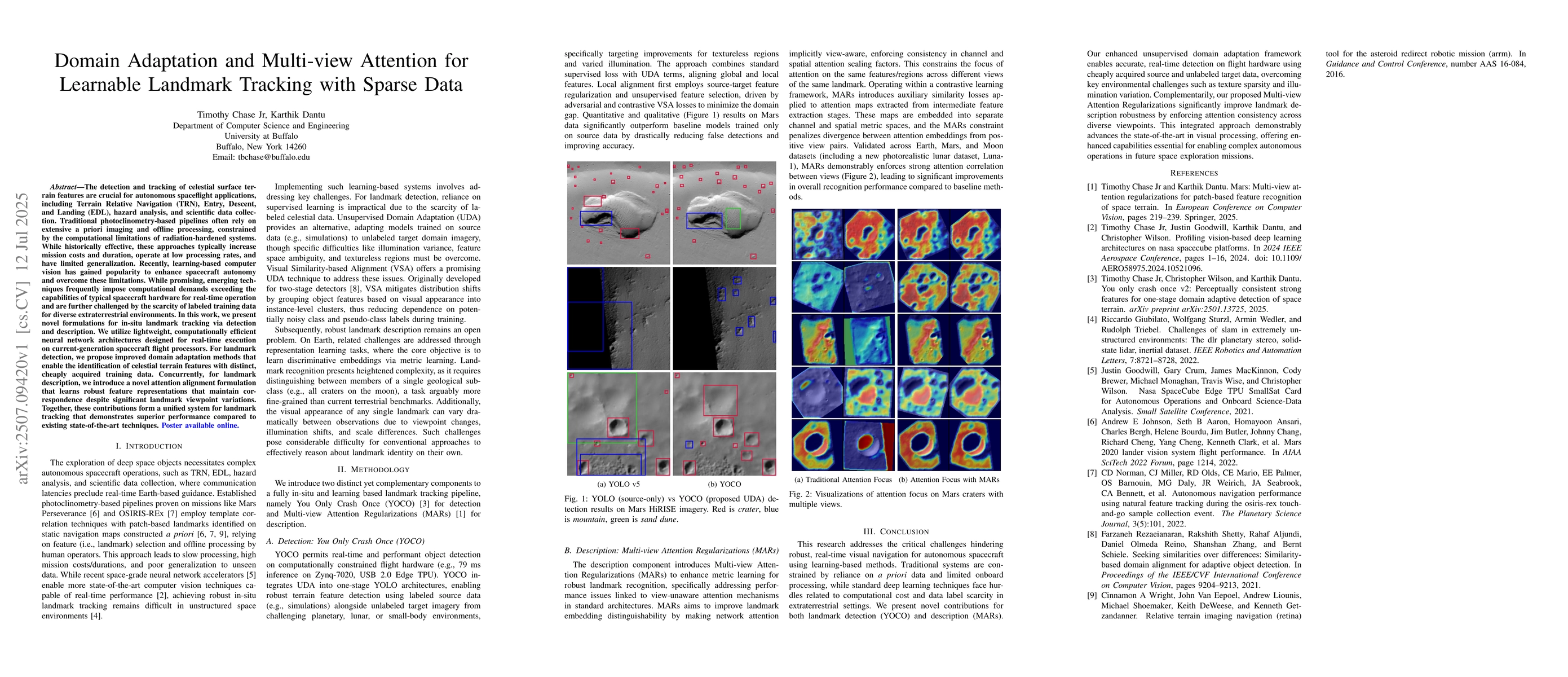
The detection and tracking of celestial surface terrain features are crucial for autonomous spaceflight applications, including Terrain Relative Navigation (TRN), Entry, Descent, and Landing (EDL), ha...
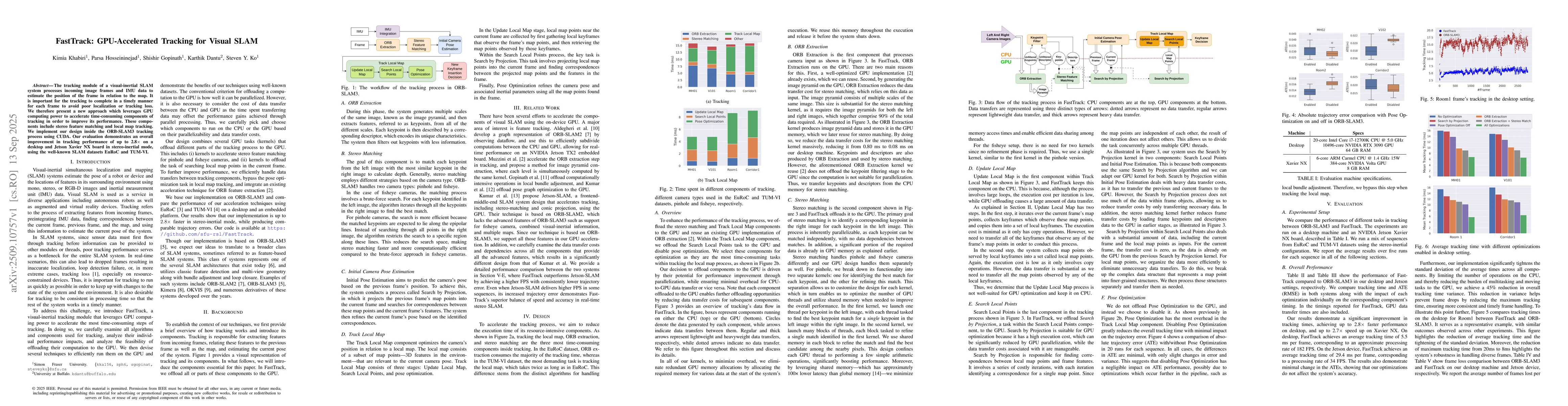
The tracking module of a visual-inertial SLAM system processes incoming image frames and IMU data to estimate the position of the frame in relation to the map. It is important for the tracking to comp...
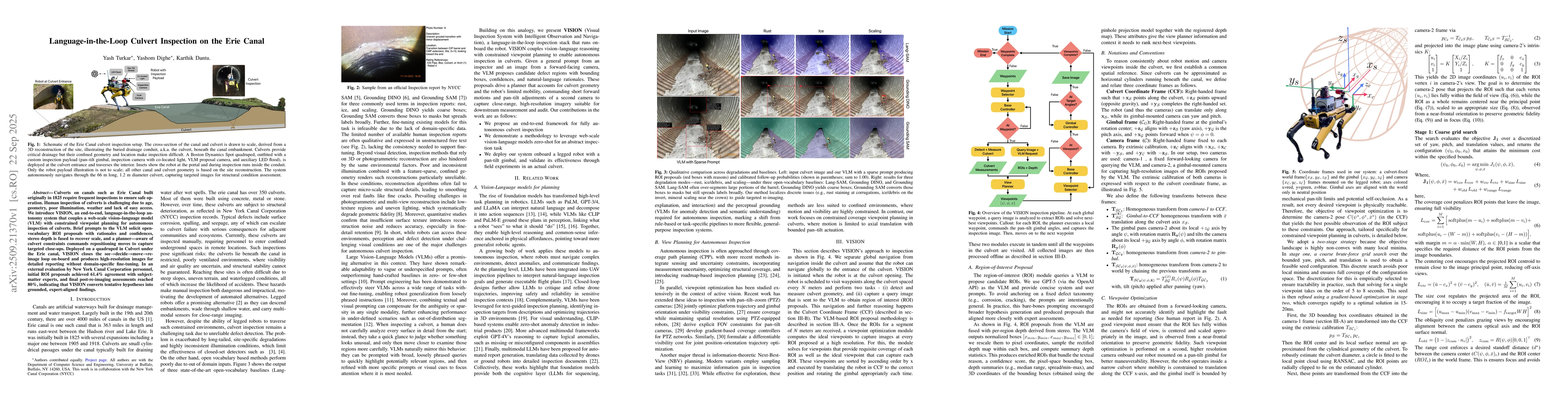
Culverts on canals such as the Erie Canal, built originally in 1825, require frequent inspections to ensure safe operation. Human inspection of culverts is challenging due to age, geometry, poor illum...
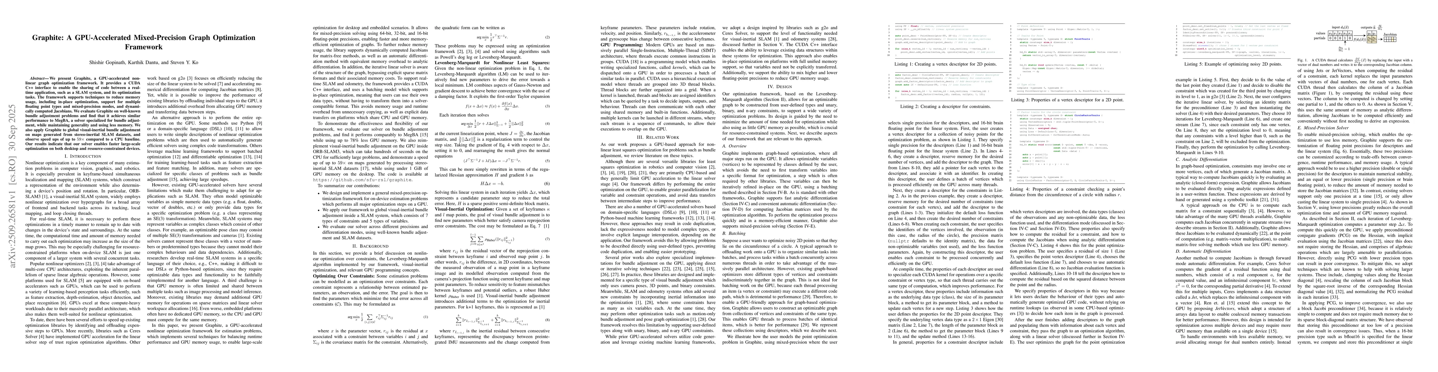
We present Graphite, a GPU-accelerated nonlinear graph optimization framework. It provides a CUDA C++ interface to enable the sharing of code between a realtime application, such as a SLAM system, and...
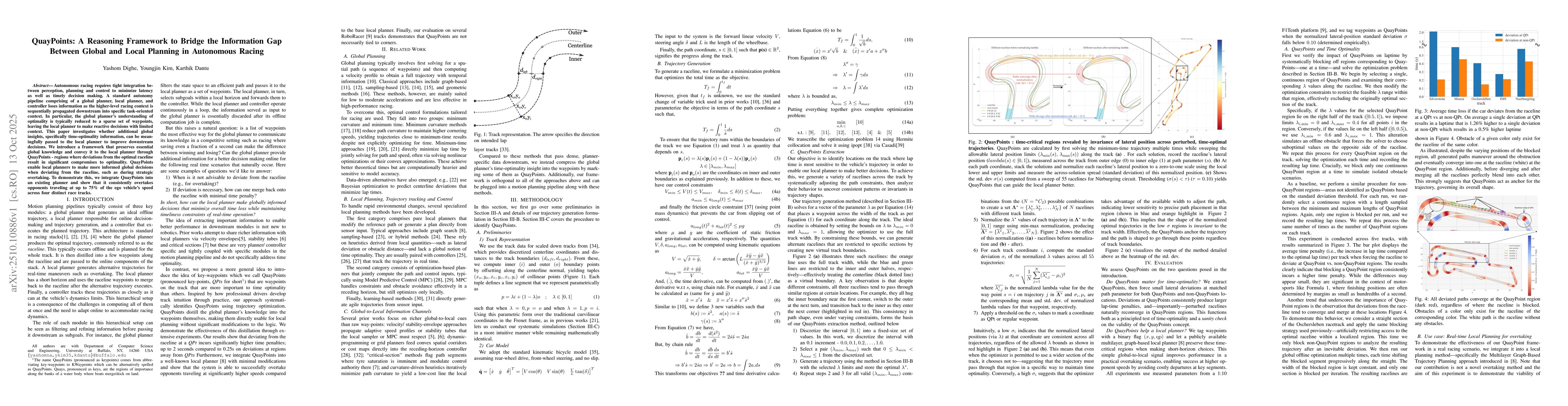
Autonomous racing requires tight integration between perception, planning and control to minimize latency as well as timely decision making. A standard autonomy pipeline comprising a global planner, l...
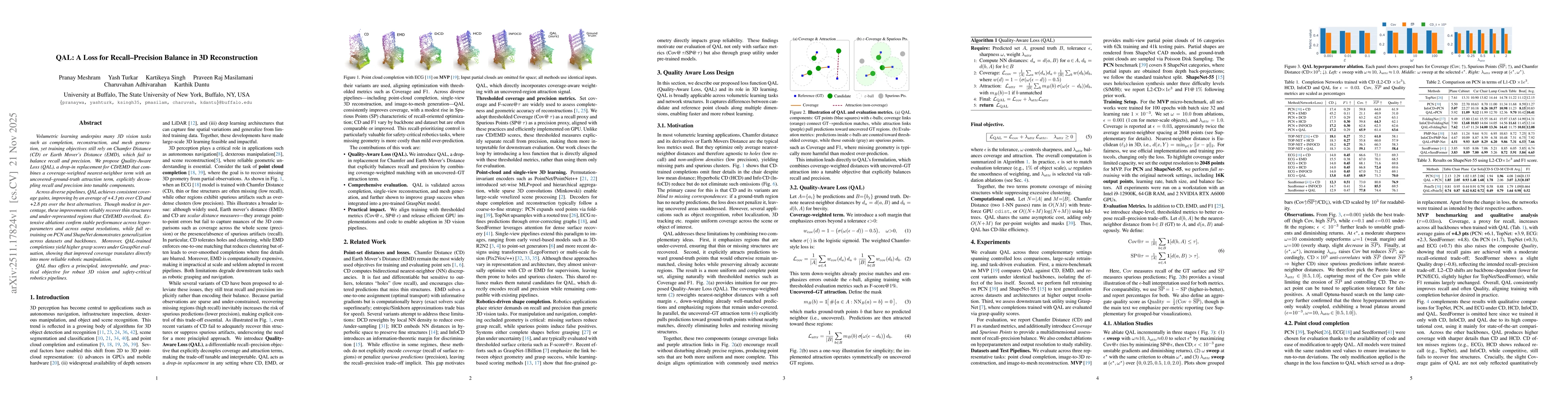
Volumetric learning underpins many 3D vision tasks such as completion, reconstruction, and mesh generation, yet training objectives still rely on Chamfer Distance (CD) or Earth Mover's Distance (EMD),...
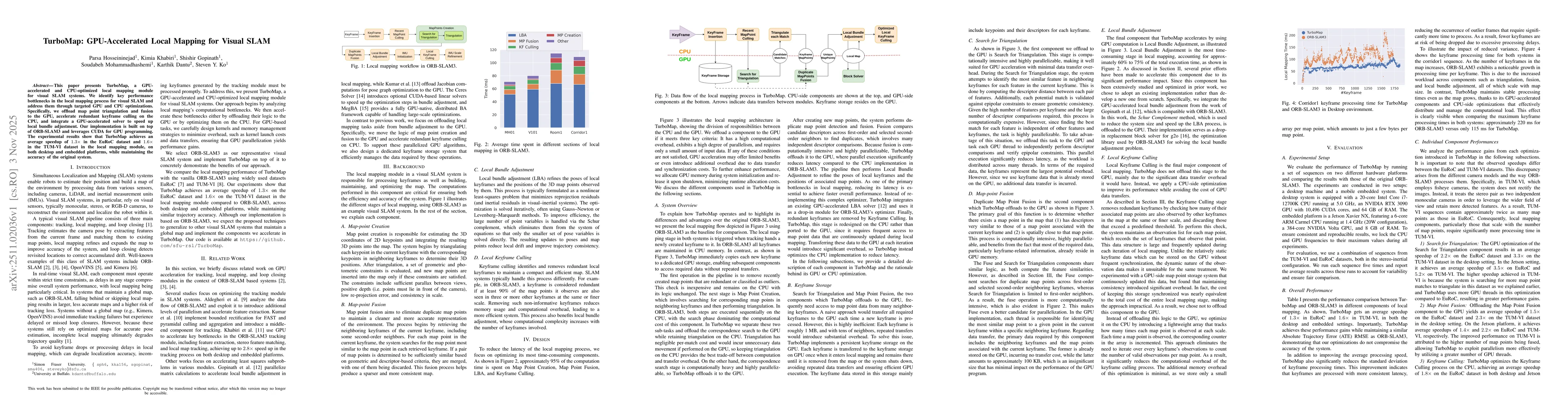
This paper presents TurboMap, a GPU-accelerated and CPU-optimized local mapping module for visual SLAM systems. We identify key performance bottlenecks in the local mapping process for visual SLAM and...
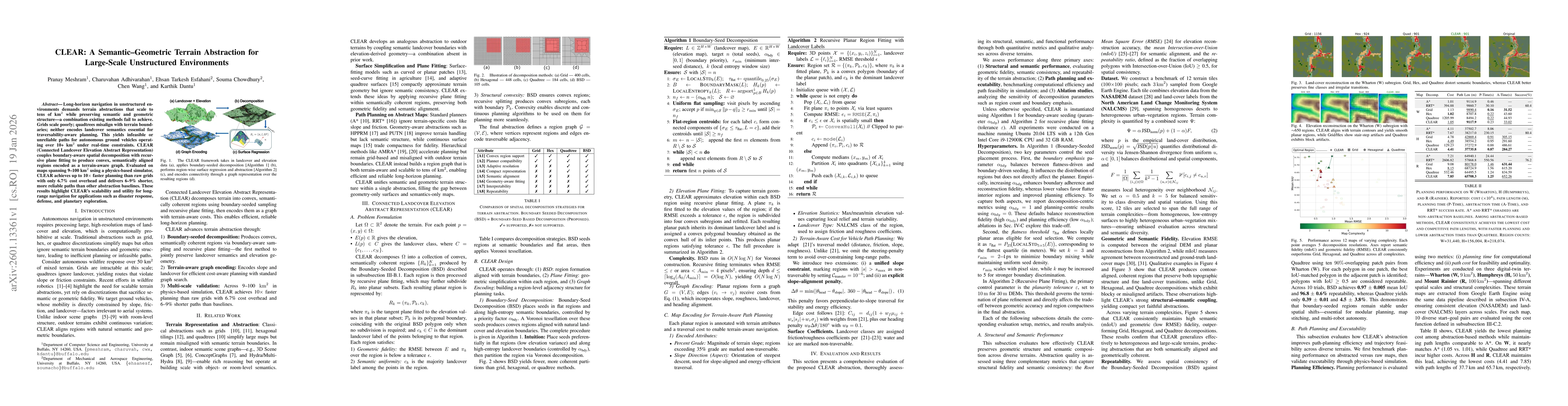
Long-horizon navigation in unstructured environments demands terrain abstractions that scale to tens of km$^2$ while preserving semantic and geometric structure, a combination existing methods fail to...
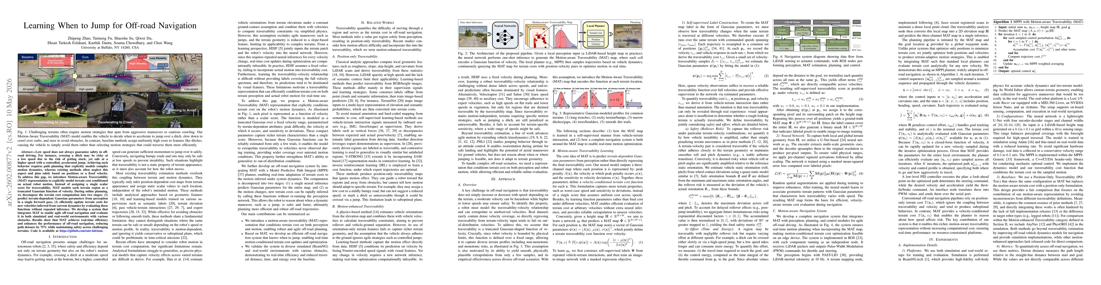
Low speed does not always guarantee safety in off-road driving. For instance, crossing a ditch may be risky at a low speed due to the risk of getting stuck, yet safe at a higher speed with a controlle...
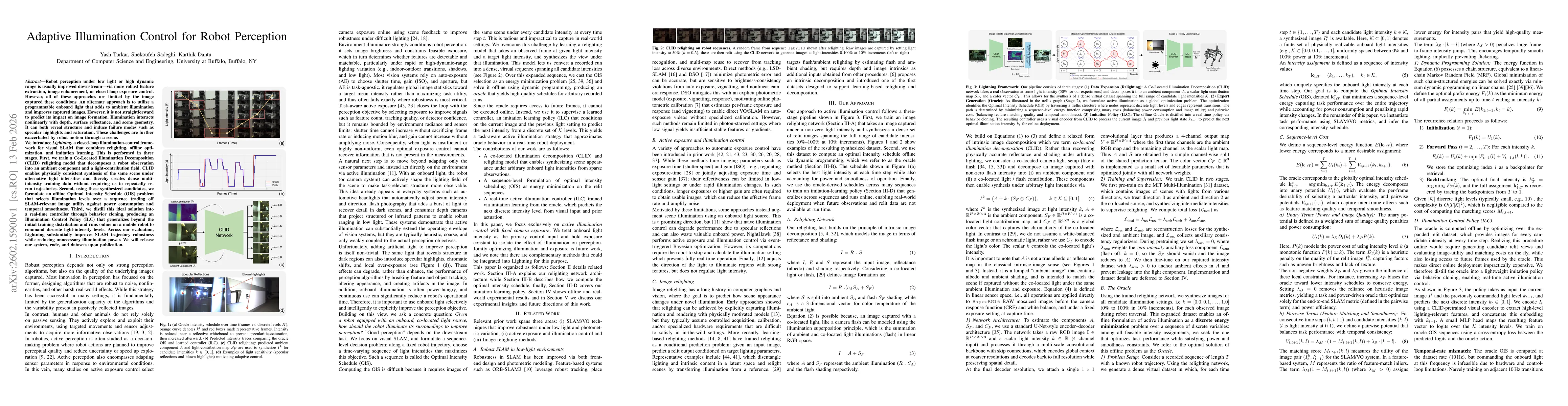
Robot perception under low light or high dynamic range is usually improved downstream - via more robust feature extraction, image enhancement, or closed-loop exposure control. However, all of these ap...
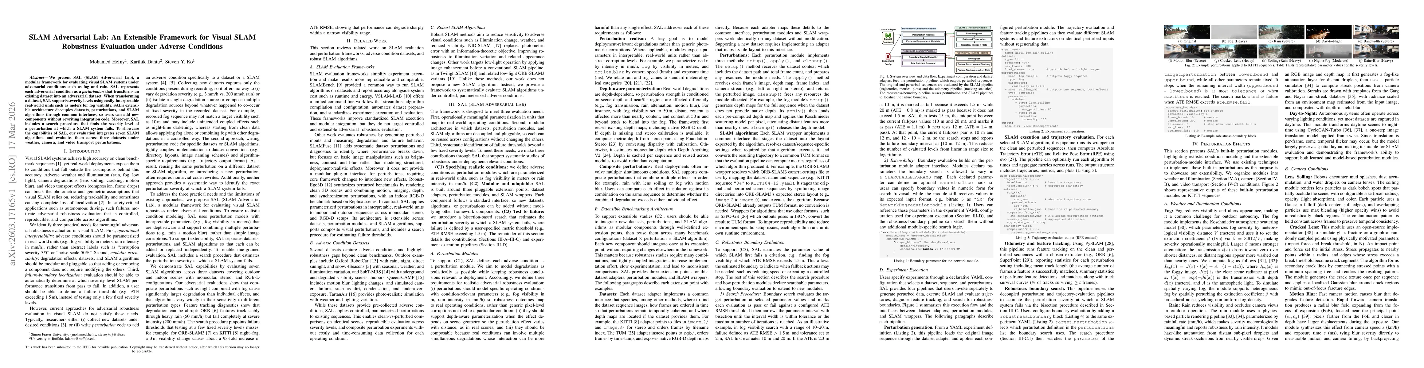
We present SAL (SLAM Adversarial Lab), a modular framework for evaluating visual SLAM systems under adversarial conditions such as fog and rain. SAL represents each adversarial condition as a perturba...
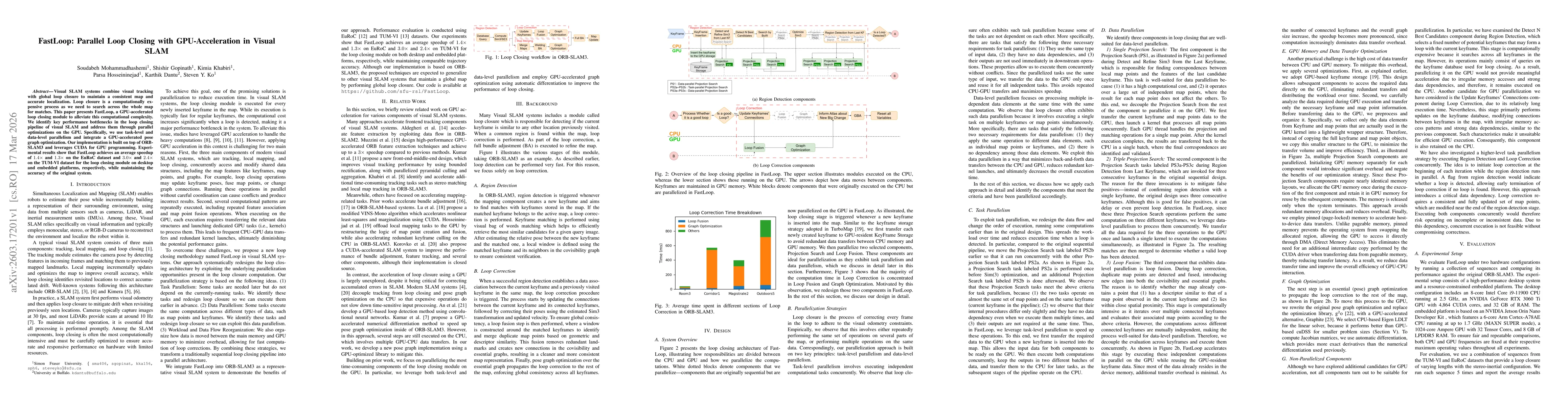
Visual SLAM systems combine visual tracking with global loop closure to maintain a consistent map and accurate localization. Loop closure is a computationally expensive process as we need to search ac...
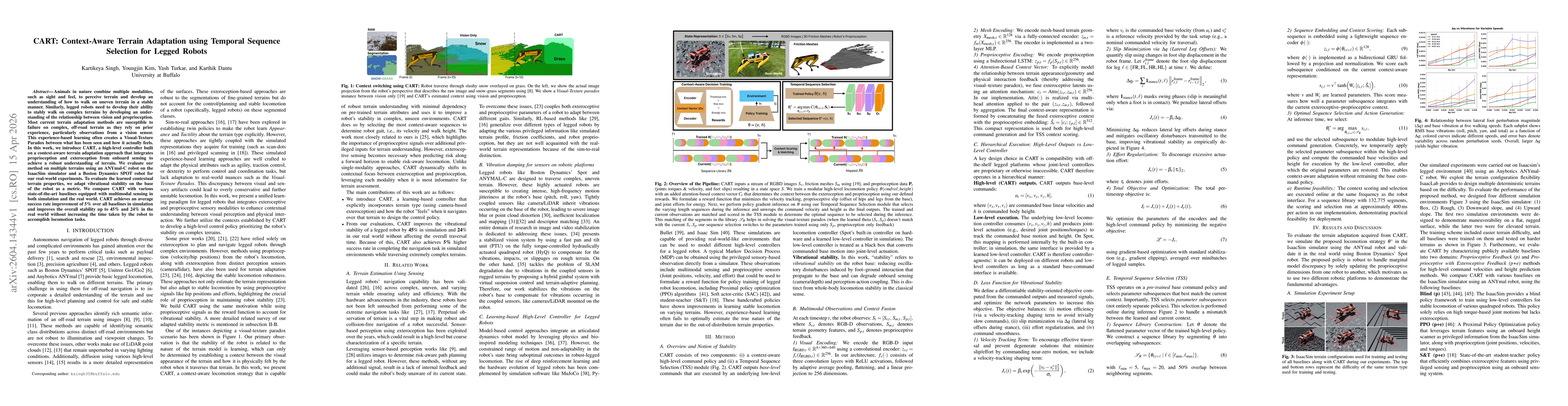
Animals in nature combine multiple modalities, such as sight and feel, to perceive terrain and develop an understanding of how to walk on uneven terrain in a stable manner. Similarly, legged robots ne...
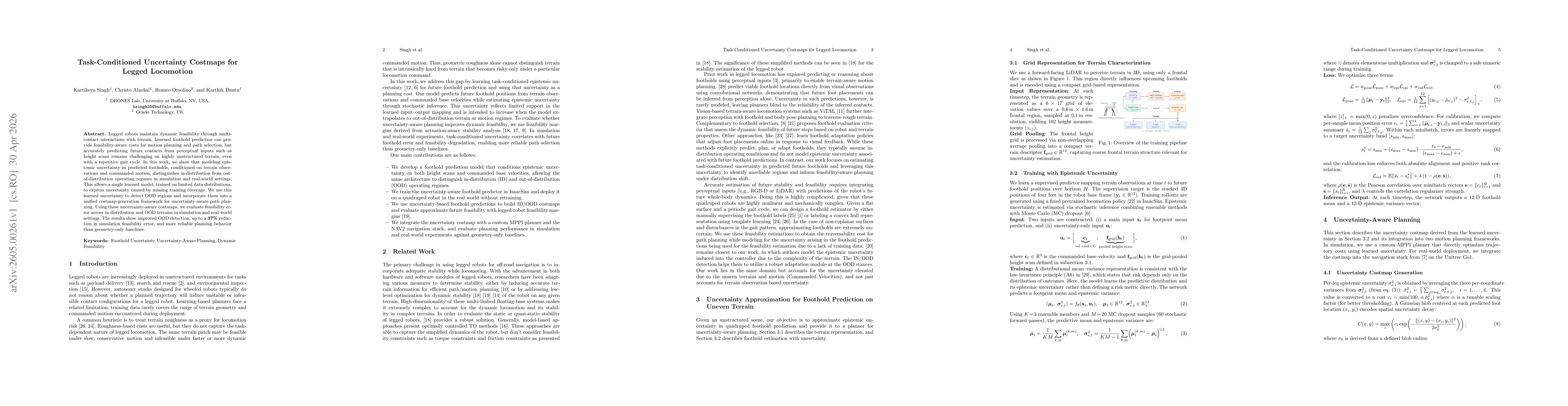
Legged robots maintain dynamic feasibility through multicontact interactions with terrain. Learned foothold prediction can provide feasibility-aware costs for motion planning and path selection, but a...
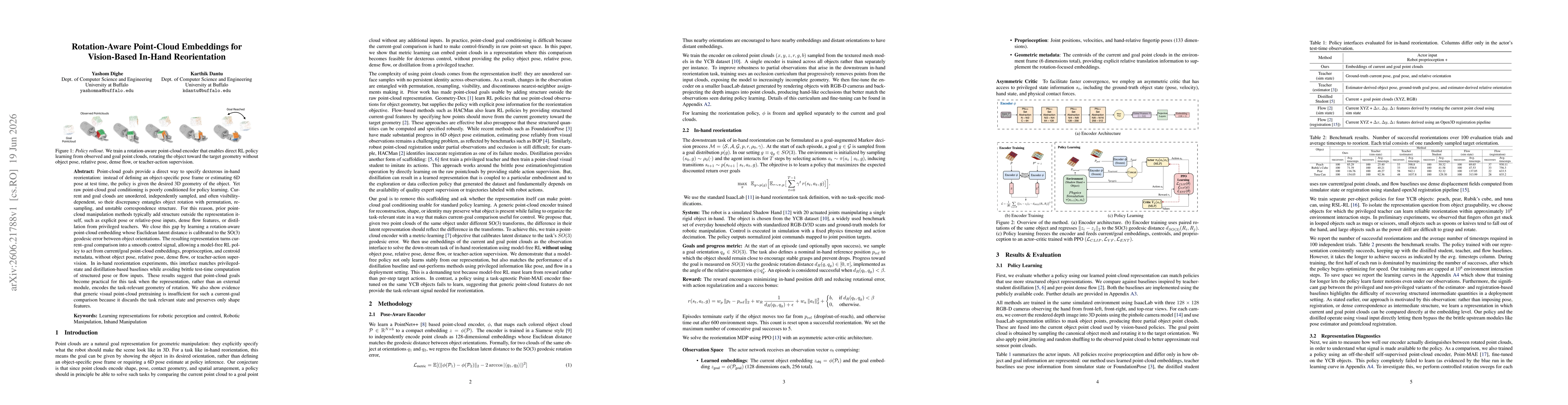
Point-cloud goals provide a direct way to specify dexterous in-hand reorientation: instead of defining an object-specific pose frame or estimating 6D pose at test time, the policy is given the desired...