Academic Profile
Statistics
Similar Authors
Papers on arXiv
Recent progress in semantic scene understanding has primarily been enabled by the availability of semantically annotated bi-modal (camera and lidar) datasets in urban environments. However, such ann...
The test-time optimization of scene flow - using a coordinate network as a neural prior - has gained popularity due to its simplicity, lack of dataset bias, and state-of-the-art performance. We obse...
Many existing datasets for lidar place recognition are solely representative of structured urban environments, and have recently been saturated in performance by deep learning based approaches. Natu...
In large-scale metric localization, an incorrect result during retrieval will lead to an incorrect pose estimate or loop closure. Re-ranking methods propose to take into account all the top retrieva...
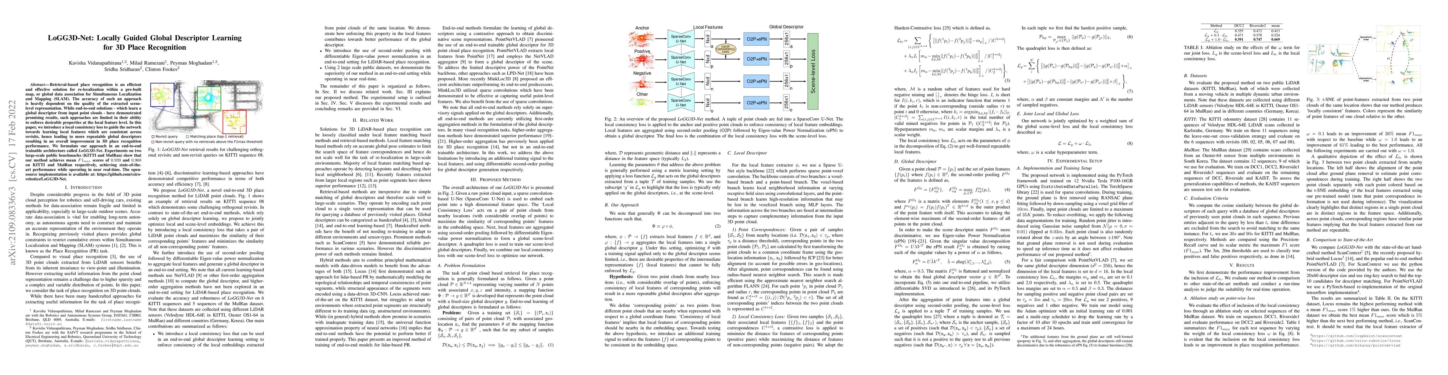
Retrieval-based place recognition is an efficient and effective solution for re-localization within a pre-built map, or global data association for Simultaneous Localization and Mapping (SLAM). The ...
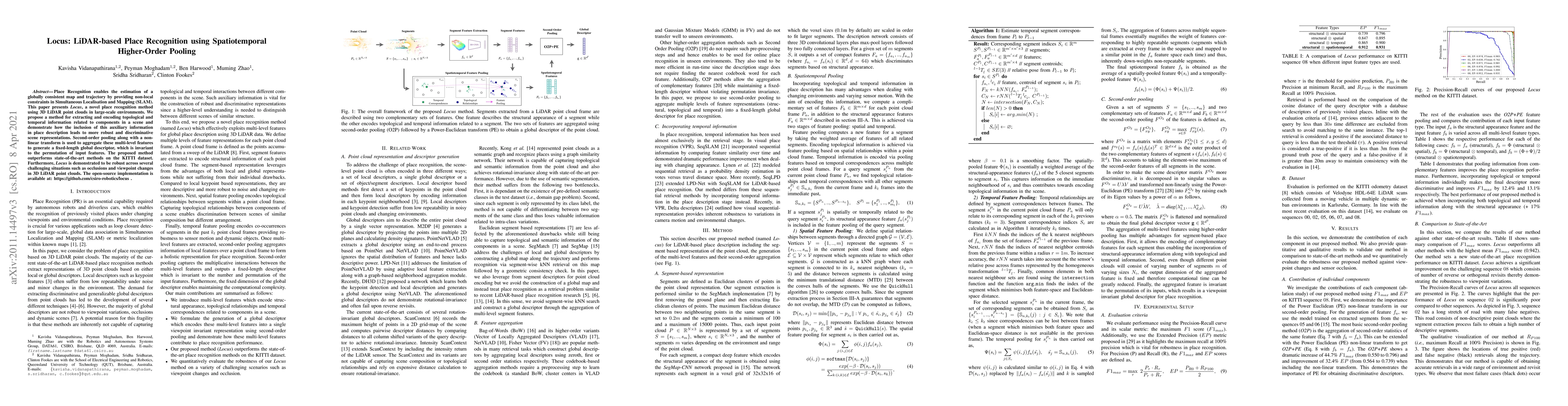
Place Recognition enables the estimation of a globally consistent map and trajectory by providing non-local constraints in Simultaneous Localisation and Mapping (SLAM). This paper presents Locus, a ...