Academic Profile
Statistics
Similar Authors
Papers on arXiv
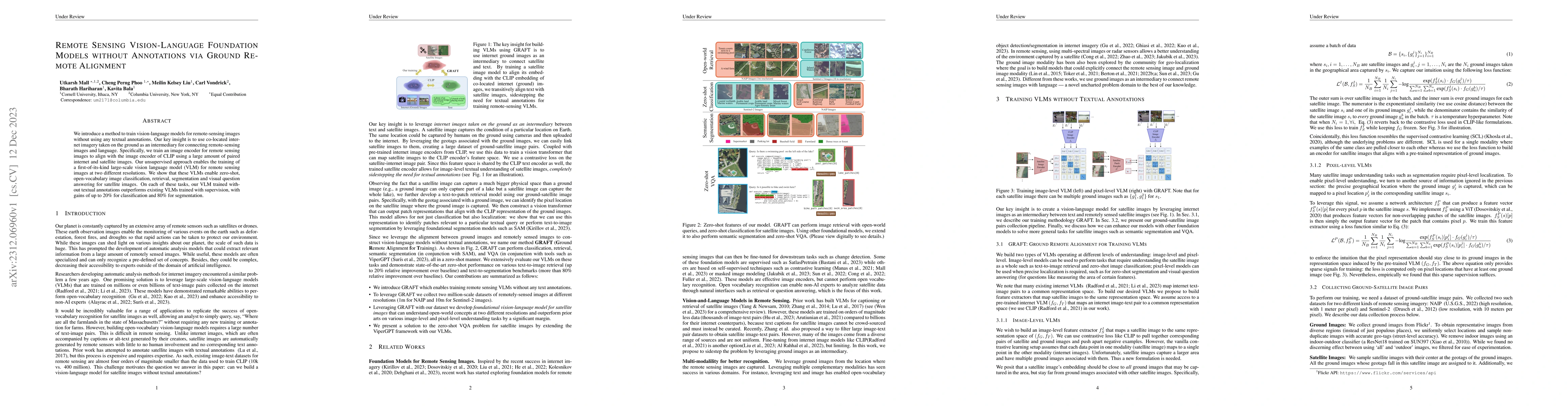
We introduce a method to train vision-language models for remote-sensing images without using any textual annotations. Our key insight is to use co-located internet imagery taken on the ground as an...
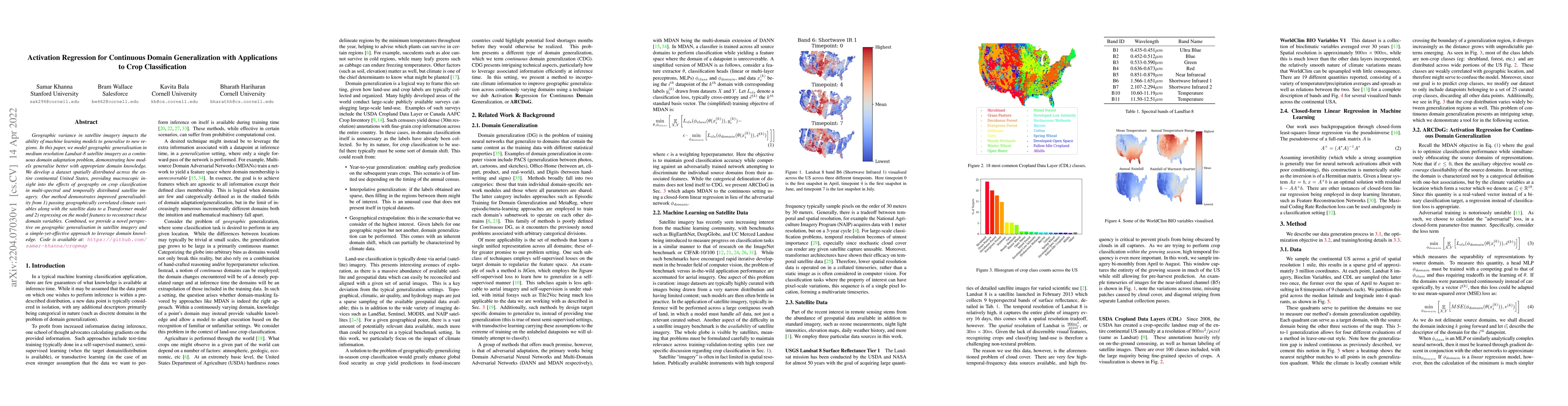
Geographic variance in satellite imagery impacts the ability of machine learning models to generalise to new regions. In this paper, we model geographic generalisation in medium resolution Landsat-8...
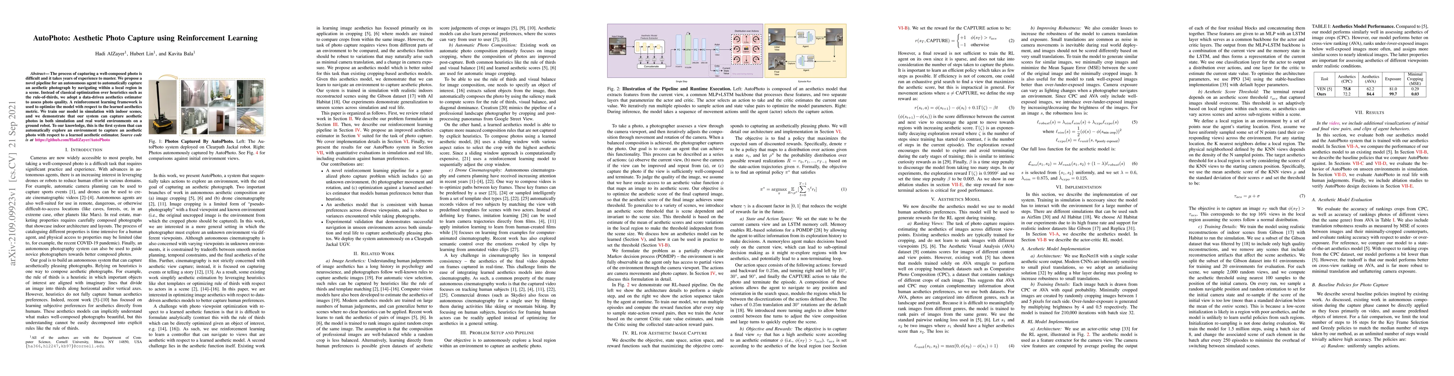
The process of capturing a well-composed photo is difficult and it takes years of experience to master. We propose a novel pipeline for an autonomous agent to automatically capture an aesthetic phot...
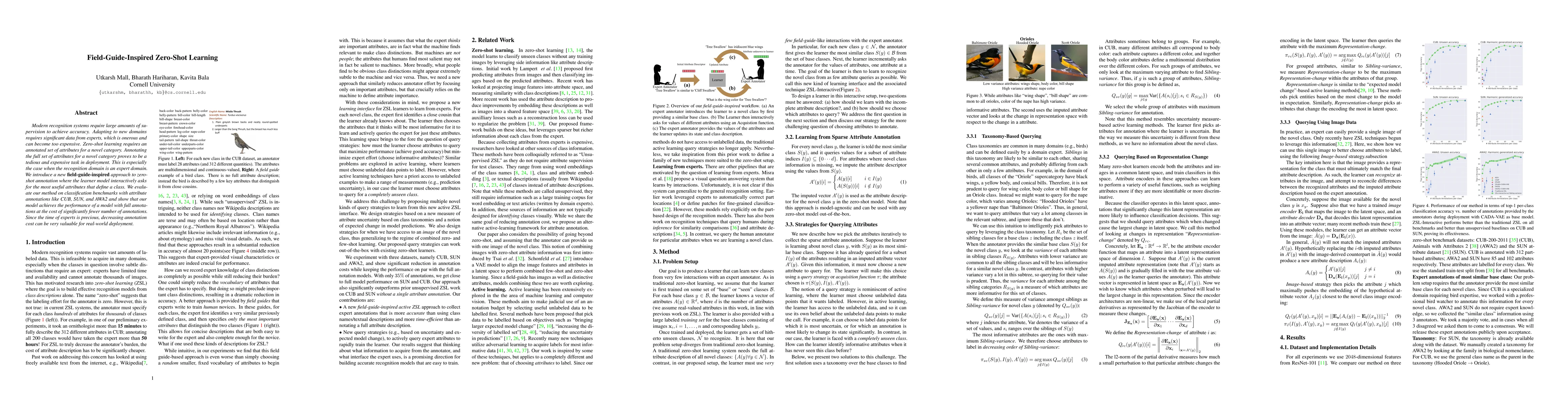
Modern recognition systems require large amounts of supervision to achieve accuracy. Adapting to new domains requires significant data from experts, which is onerous and can become too expensive. Ze...
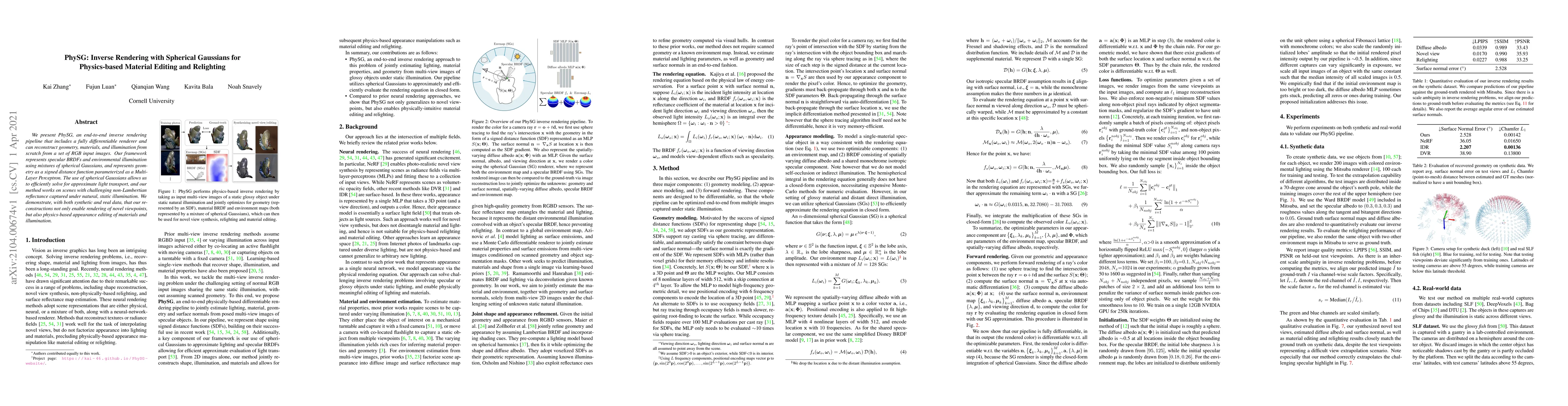
We present PhySG, an end-to-end inverse rendering pipeline that includes a fully differentiable renderer and can reconstruct geometry, materials, and illumination from scratch from a set of RGB inpu...
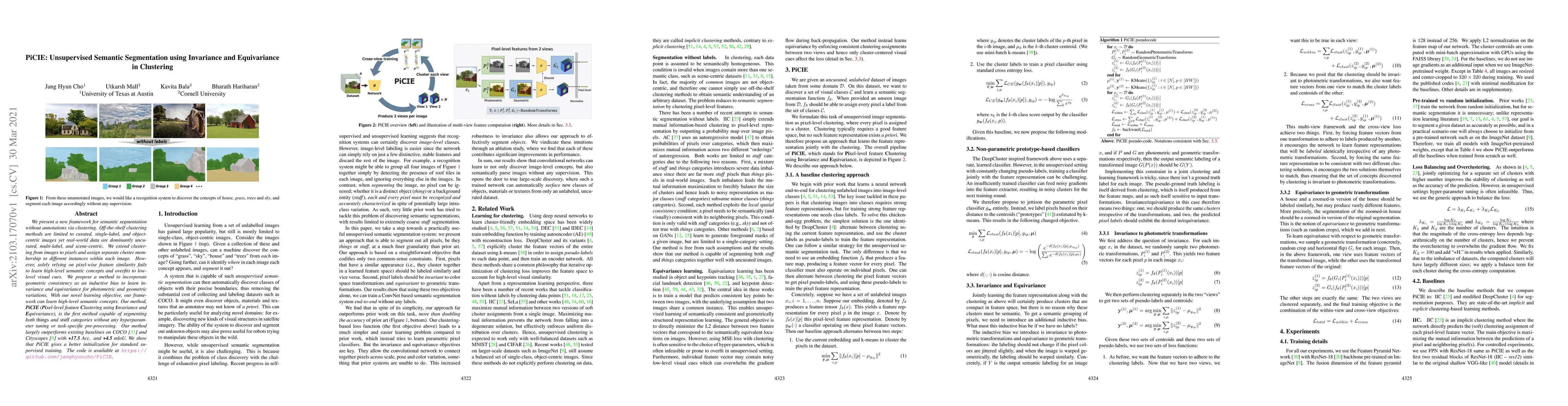
We present a new framework for semantic segmentation without annotations via clustering. Off-the-shelf clustering methods are limited to curated, single-label, and object-centric images yet real-wor...
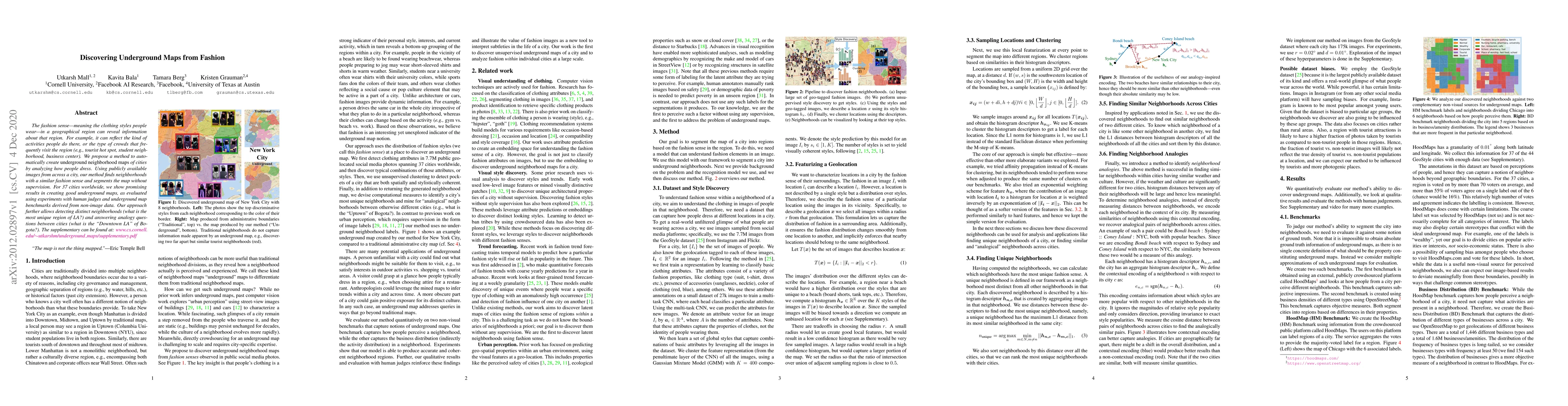
The fashion sense -- meaning the clothing styles people wear -- in a geographical region can reveal information about that region. For example, it can reflect the kind of activities people do there,...
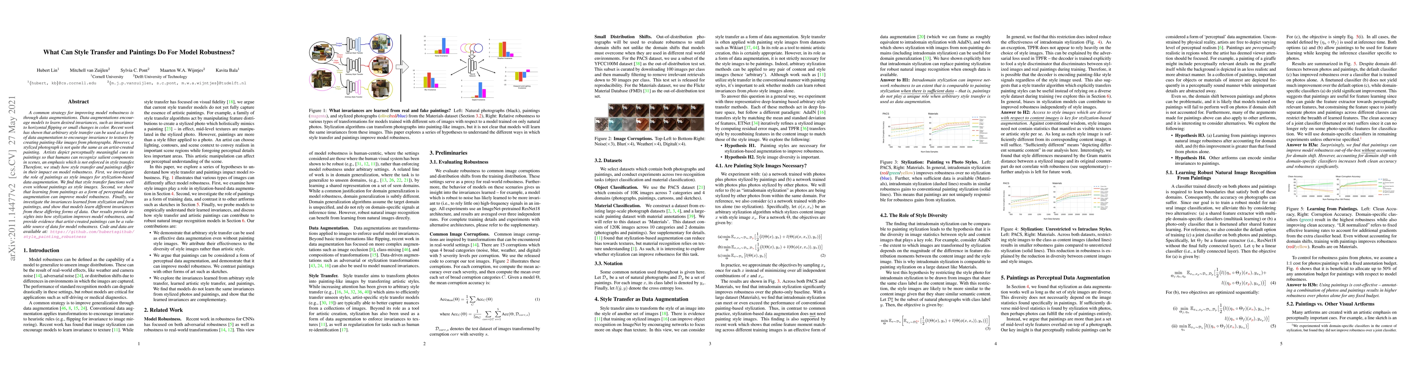
A common strategy for improving model robustness is through data augmentations. Data augmentations encourage models to learn desired invariances, such as invariance to horizontal flipping or small c...
Deep learning has paved the way for strong recognition systems which are often both trained on and applied to natural images. In this paper, we examine the give-and-take relationship between such vi...
Planning in unstructured environments is challenging -- it relies on sensing, perception, scene reconstruction, and reasoning about various uncertainties. We propose DeepSemanticHPPC, a novel uncert...
Image datasets with high-quality pixel-level annotations are valuable for semantic segmentation: labelling every pixel in an image ensures that rare classes and small objects are annotated. However,...
Understanding fashion styles and trends is of great potential interest to retailers and consumers alike. The photos people upload to social media are a historical and public data source of how peopl...
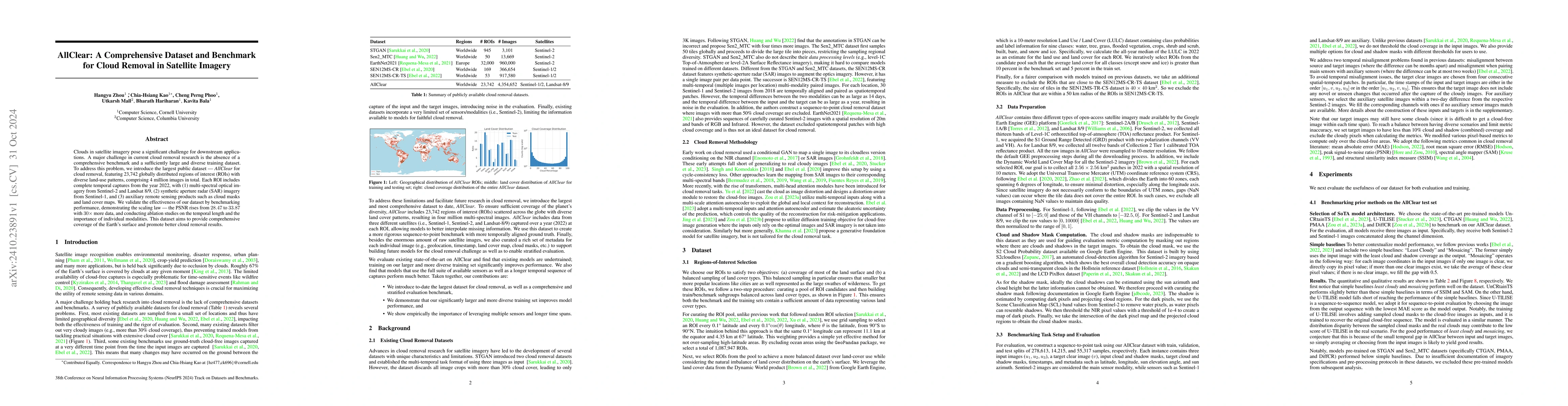
Clouds in satellite imagery pose a significant challenge for downstream applications. A major challenge in current cloud removal research is the absence of a comprehensive benchmark and a sufficiently...
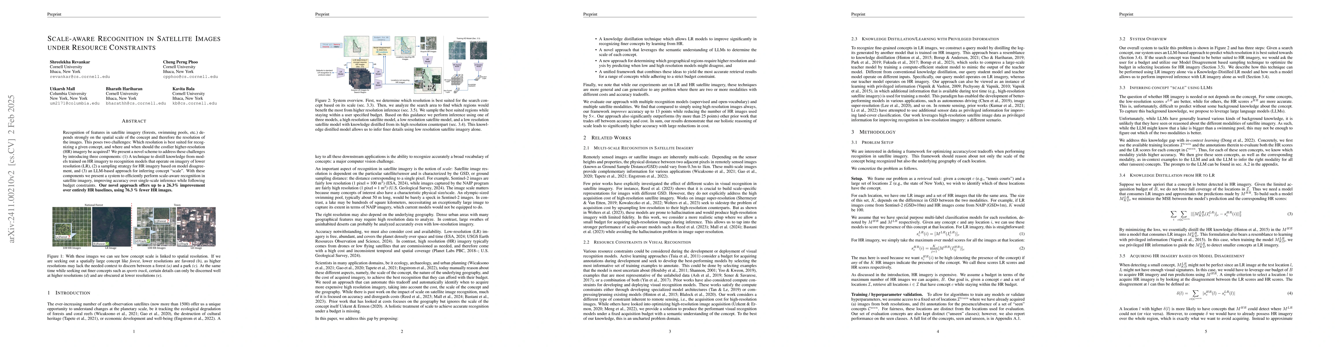
Recognition of features in satellite imagery (forests, swimming pools, etc.) depends strongly on the spatial scale of the concept and therefore the resolution of the images. This poses two challenges:...
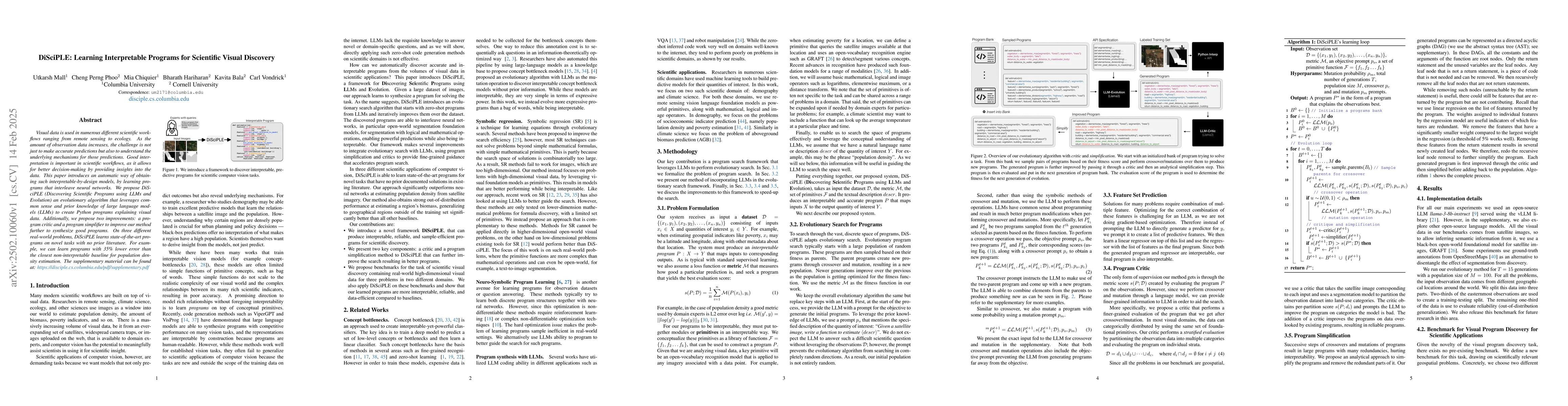
Visual data is used in numerous different scientific workflows ranging from remote sensing to ecology. As the amount of observation data increases, the challenge is not just to make accurate predictio...
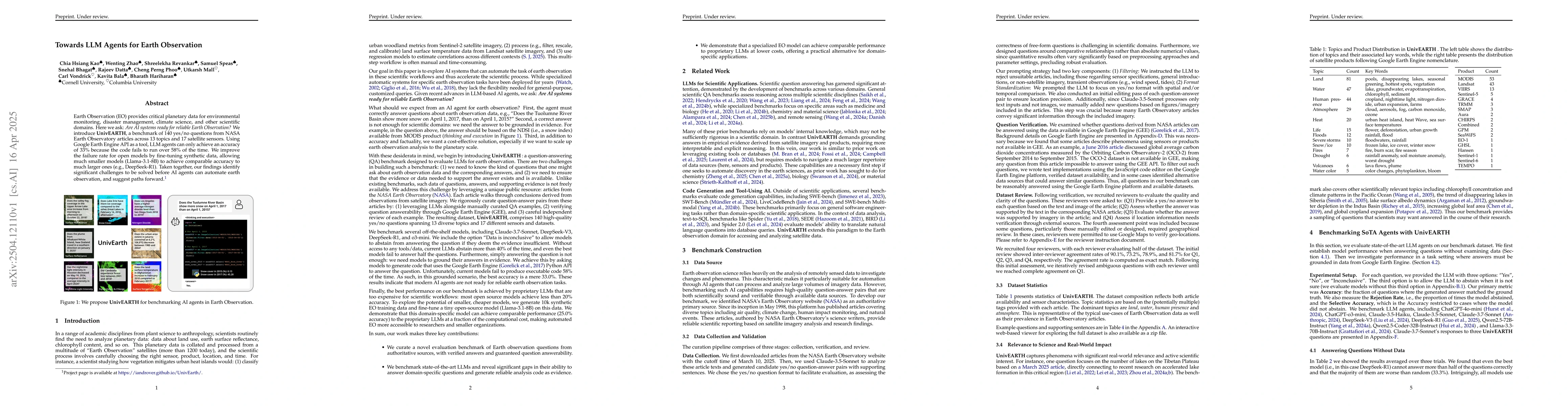
Earth Observation (EO) provides critical planetary data for environmental monitoring, disaster management, climate science, and other scientific domains. Here we ask: Are AI systems ready for reliable...
Natural disasters cause devastating damage to communities and infrastructure every year. Effective disaster response is hampered by the difficulty of accessing affected areas during and after events. ...