Academic Profile
Statistics
Similar Authors
Papers on arXiv
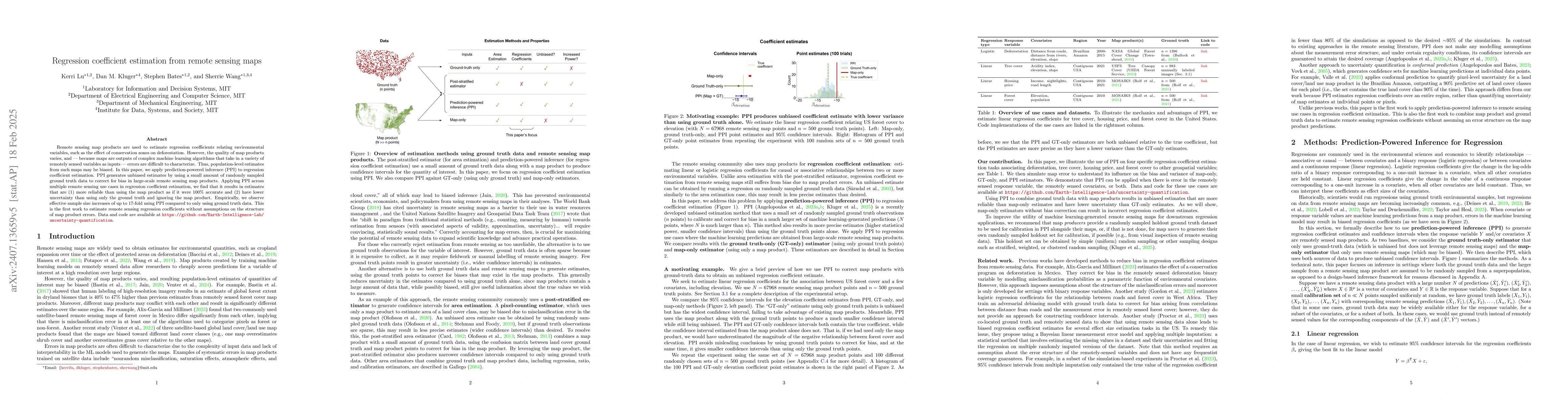
Remote sensing map products are used to obtain estimates of environmental quantities, such as deforested area or the effect of conservation zones on deforestation. However, the quality of map products...
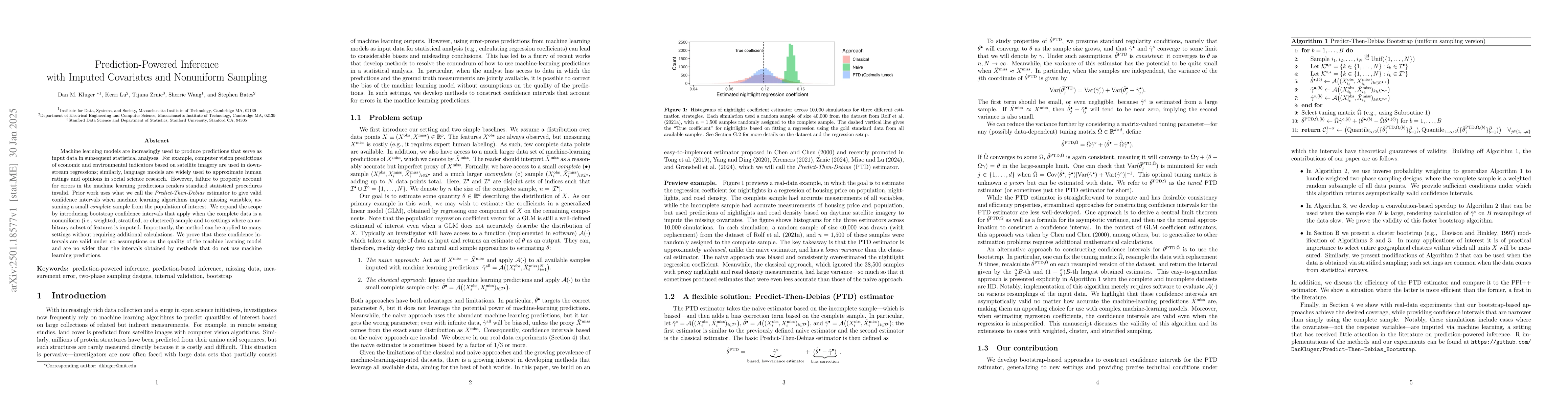
Machine learning models are increasingly used to produce predictions that serve as input data in subsequent statistical analyses. For example, computer vision predictions of economic and environmental...
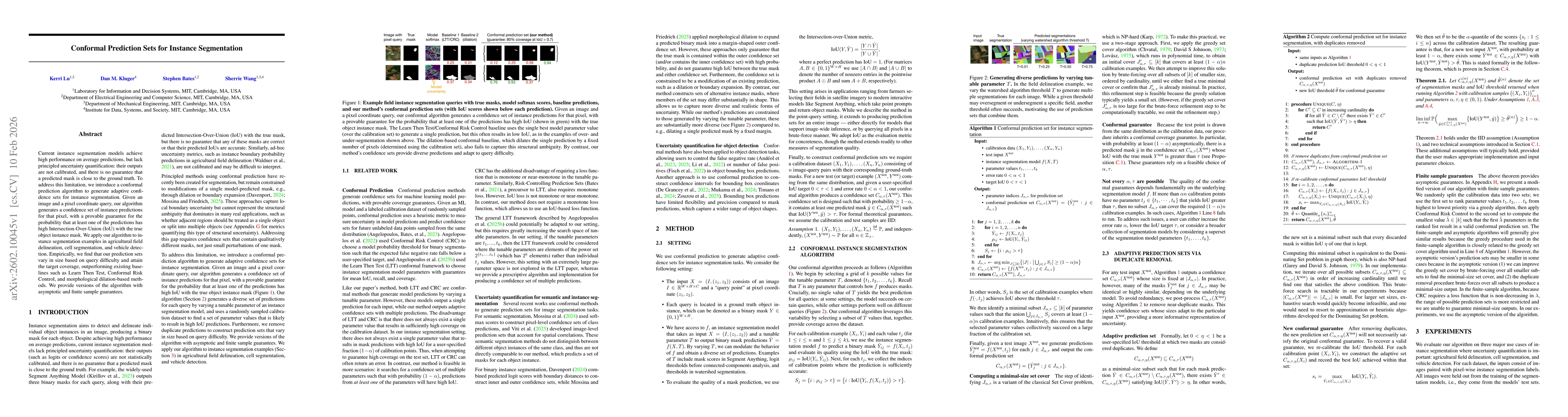
Current instance segmentation models achieve high performance on average predictions, but lack principled uncertainty quantification: their outputs are not calibrated, and there is no guarantee that a...