ArxivLens
K
Researcher

Kyeongjin Ahn

5 papers on arXiv

5 arXiv Papers
17 Total Publications
Profile

Academic Profile

Name K. Ahn
Total Papers 17
Scholar Profile View on Semantic Scholar
Metrics

Statistics

5 arXiv Papers
17 Total Publications
Publications

Papers on arXiv

Thumbnail for Generalizable Disaster Damage Assessment via Change Detection with
  Vision Foundation Model
arXiv
Generalizable Disaster Damage Assessment via Change Detection with Vision Foundation Model

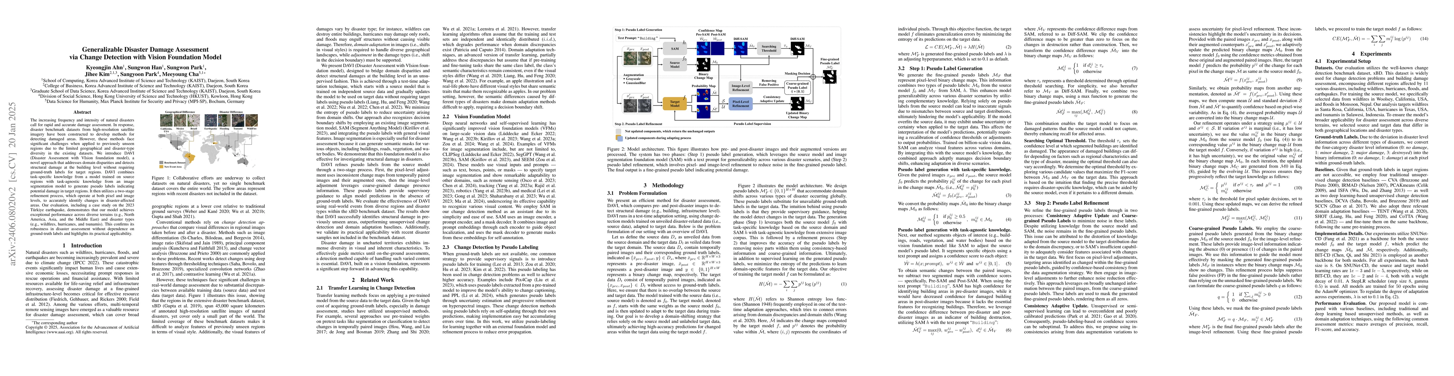
The increasing frequency and intensity of natural disasters demand more sophisticated approaches for rapid and precise damage assessment. To tackle this issue, researchers have developed various met...

Thumbnail for Classifying and Tracking International Aid Contribution Towards SDGs
arXiv
Classifying and Tracking International Aid Contribution Towards SDGs

International aid is a critical mechanism for promoting economic growth and well-being in developing nations, supporting progress toward the Sustainable Development Goals (SDGs). However, tracking aid...

Thumbnail for GeoReg: Weight-Constrained Few-Shot Regression for Socio-Economic
  Estimation using LLM
arXiv
GeoReg: Weight-Constrained Few-Shot Regression for Socio-Economic Estimation using LLM

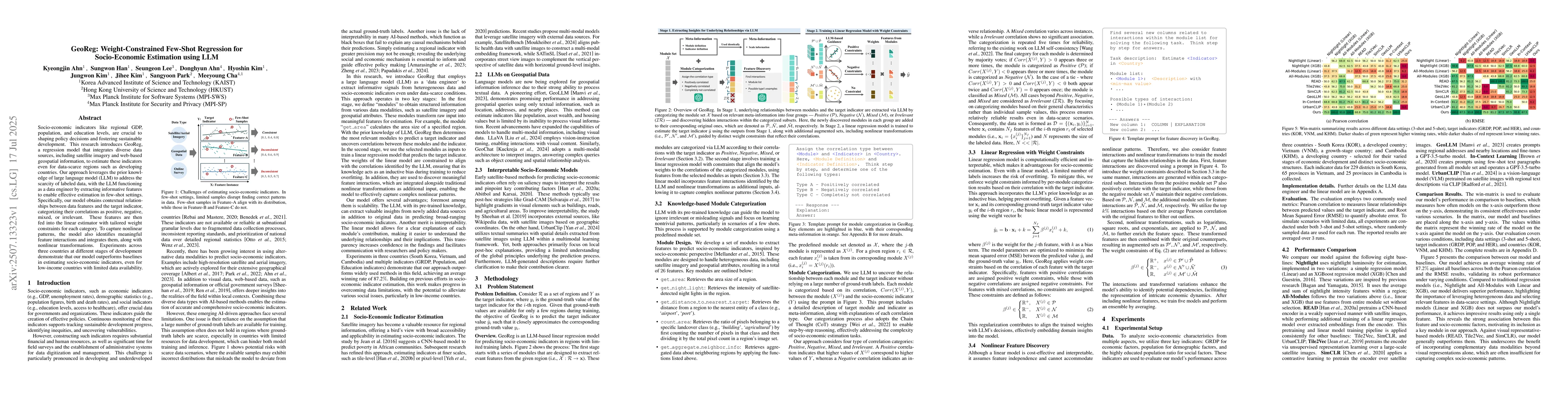
Socio-economic indicators like regional GDP, population, and education levels, are crucial to shaping policy decisions and fostering sustainable development. This research introduces GeoReg a regressi...

Thumbnail for Mapping Reduced Accessibility to WASH Facilities in Rohingya Refugee Camps With Sub-Meter Imagery
arXiv
Mapping Reduced Accessibility to WASH Facilities in Rohingya Refugee Camps With Sub-Meter Imagery

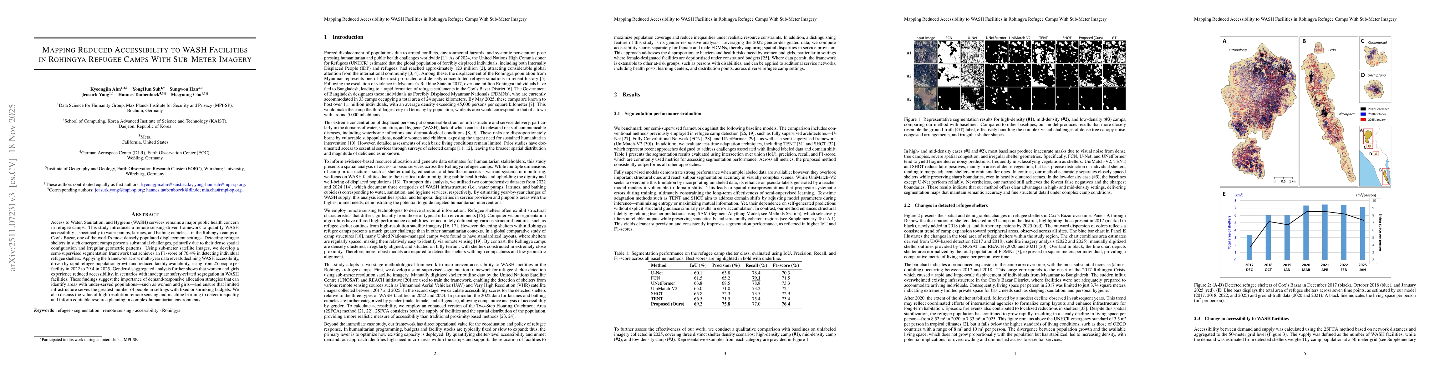
Access to Water, Sanitation, and Hygiene (WASH) services remains a major public health concern in refugee camps. This study introduces a remote sensing-driven framework to quantify WASH accessibility-...

Thumbnail for GeoX: Mastering Geospatial Reasoning Through Self-Play and Verifiable Rewards
arXiv
GeoX: Mastering Geospatial Reasoning Through Self-Play and Verifiable Rewards

Geospatial reasoning requires solving image-grounded problems over the complex spatial structure of a scene. However, developing this capability is hindered by the cost of annotating a vast and combin...

This website uses cookies to ensure you get the best experience. Learn more