Academic Profile
Statistics
Similar Authors
Papers on arXiv
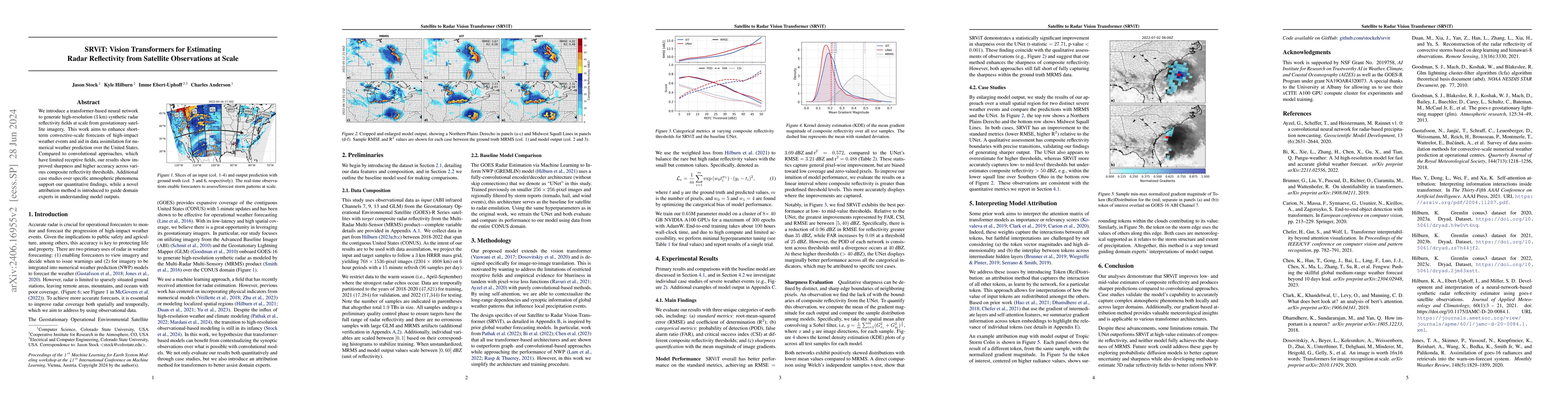
We introduce a transformer-based neural network to generate high-resolution (3km) synthetic radar reflectivity fields at scale from geostationary satellite imagery. This work aims to enhance short-ter...
Increases in wildfire activity and the resulting impacts have prompted the development of high-resolution wildfire behavior models for forecasting fire spread. Recent progress in using satellites to...
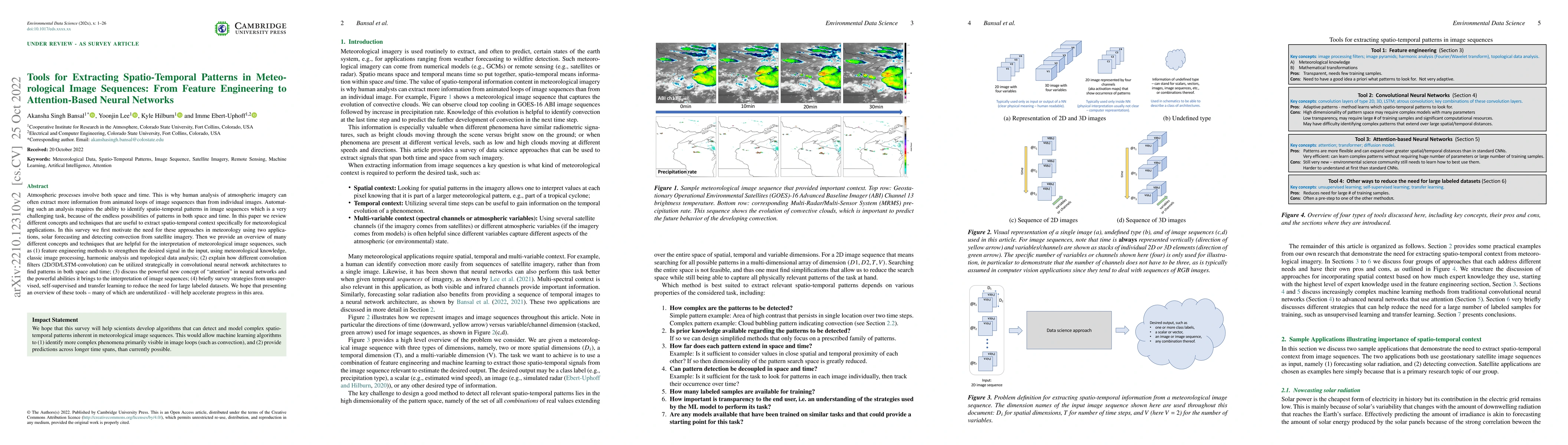
Atmospheric processes involve both space and time. This is why human analysis of atmospheric imagery can often extract more information from animated loops of image sequences than from individual im...
Neural networks are increasingly used in environmental science applications. Furthermore, neural network models are trained by minimizing a loss function, and it is crucial to choose the loss functi...
Increasing wildfire occurrence has spurred growing interest in wildfire spread prediction. However, even the most complex wildfire models diverge from observed progression during multi-day simulations...
An Explainable Boosting Machine (EBM) is an interpretable machine learning (ML) algorithm that has benefits in high risk applications but has not yet found much use in atmospheric science. The overall...
This study presents a probabilistic surrogate model for localized wildfire spread based on a conditional flow matching algorithm. The approach models fire progression as a stochastic process by learni...