Kyle McCullough

6 papers on arXiv

Academic Profile

Name: Kyle A. McCullough
Total Papers: 6

Statistics

arXiv Papers 6
Total Publications 6

Papers on arXiv

Thumbnail for STPLS3D: A Large-Scale Synthetic and Real Aerial Photogrammetry 3D Point
  Cloud Dataset

STPLS3D: A Large-Scale Synthetic and Real Aerial Photogrammetry 3D Point Cloud Dataset

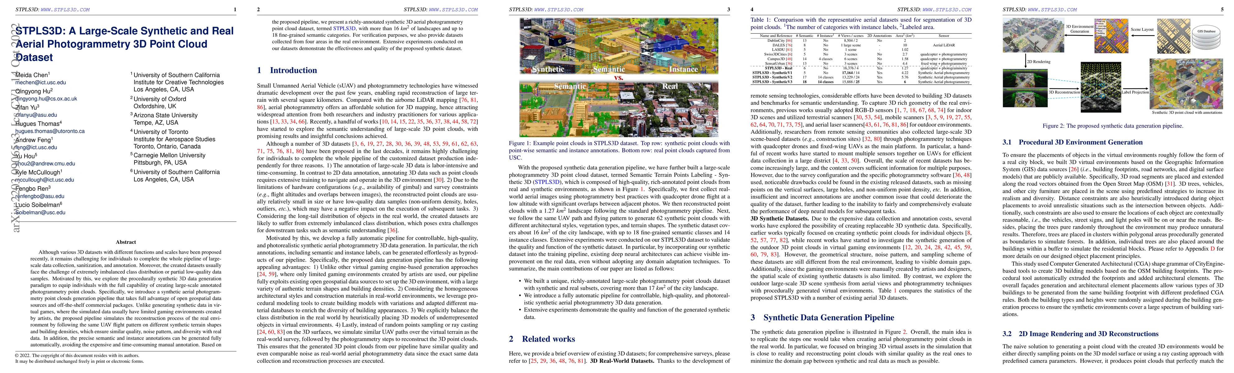
Although various 3D datasets with different functions and scales have been proposed recently, it remains challenging for individuals to complete the whole pipeline of large-scale data collection, sa...

Thumbnail for Ground material classification for UAV-based photogrammetric 3D data A
  2D-3D Hybrid Approach

Ground material classification for UAV-based photogrammetric 3D data A 2D-3D Hybrid Approach

In recent years, photogrammetry has been widely used in many areas to create photorealistic 3D virtual data representing the physical environment. The innovation of small unmanned aerial vehicles (s...

Thumbnail for Utilizing Satellite Imagery Datasets and Machine Learning Data Models to
  Evaluate Infrastructure Change in Undeveloped Regions

Utilizing Satellite Imagery Datasets and Machine Learning Data Models to Evaluate Infrastructure Change in Undeveloped Regions

In the globalized economic world, it has become important to understand the purpose behind infrastructural and construction initiatives occurring within developing regions of the earth. This is crit...

Thumbnail for Semantic Segmentation and Data Fusion of Microsoft Bing 3D Cities and
  Small UAV-based Photogrammetric Data

Semantic Segmentation and Data Fusion of Microsoft Bing 3D Cities and Small UAV-based Photogrammetric Data

With state-of-the-art sensing and photogrammetric techniques, Microsoft Bing Maps team has created over 125 highly detailed 3D cities from 11 different countries that cover hundreds of thousands of ...

Thumbnail for Generating synthetic photogrammetric data for training deep learning
  based 3D point cloud segmentation models

Generating synthetic photogrammetric data for training deep learning based 3D point cloud segmentation models

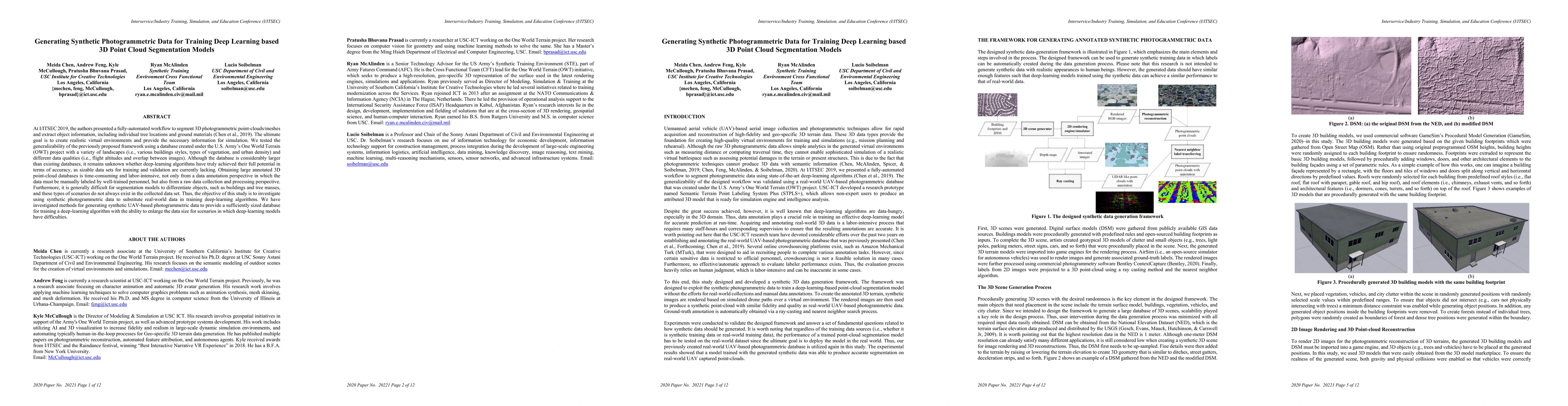
At I/ITSEC 2019, the authors presented a fully-automated workflow to segment 3D photogrammetric point-clouds/meshes and extract object information, including individual tree locations and ground mat...

Thumbnail for Fully Automated Photogrammetric Data Segmentation and Object Information
  Extraction Approach for Creating Simulation Terrain

Fully Automated Photogrammetric Data Segmentation and Object Information Extraction Approach for Creating Simulation Terrain

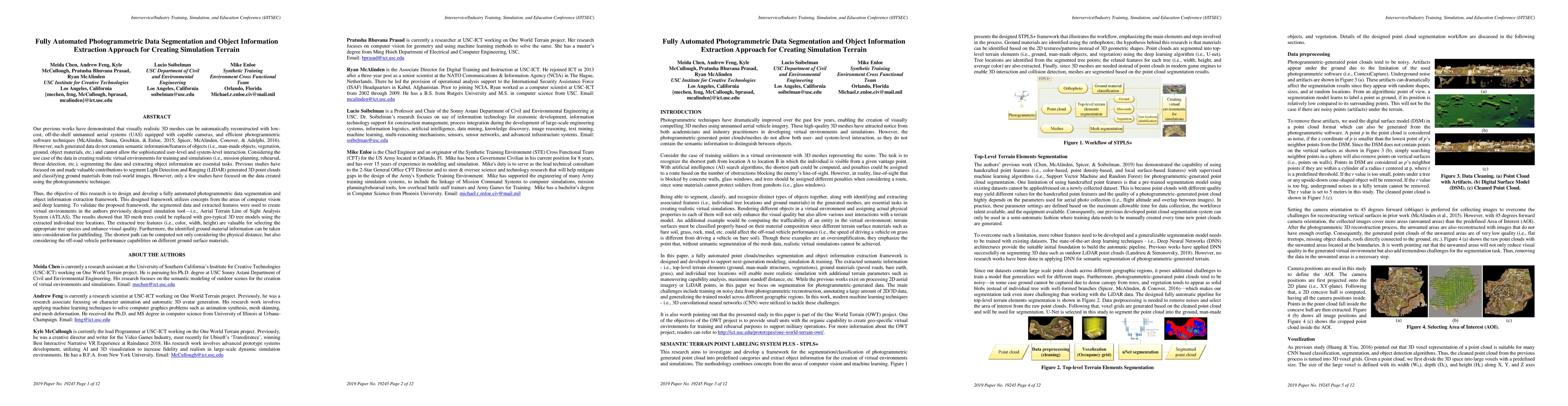
Our previous works have demonstrated that visually realistic 3D meshes can be automatically reconstructed with low-cost, off-the-shelf unmanned aerial systems (UAS) equipped with capable cameras, an...

This website uses cookies to ensure you get the best experience. Learn more