Lan Mu

5 papers on arXiv

Academic Profile

Name: L. Mu
Total Papers: 14

Statistics

arXiv Papers 5
Total Publications 14

Papers on arXiv

Thumbnail for TorchSpatial: A Location Encoding Framework and Benchmark for Spatial
  Representation Learning

TorchSpatial: A Location Encoding Framework and Benchmark for Spatial Representation Learning

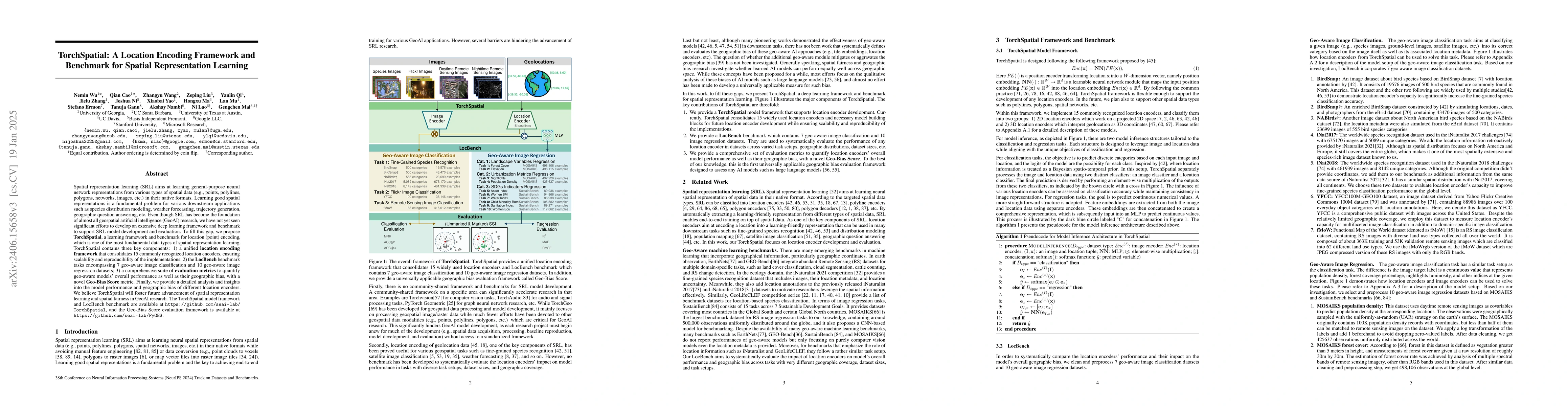
Spatial representation learning (SRL) aims at learning general-purpose neural network representations from various types of spatial data (e.g., points, polylines, polygons, networks, images, etc.) i...

Thumbnail for Img2Loc: Revisiting Image Geolocalization using Multi-modality
  Foundation Models and Image-based Retrieval-Augmented Generation

Img2Loc: Revisiting Image Geolocalization using Multi-modality Foundation Models and Image-based Retrieval-Augmented Generation

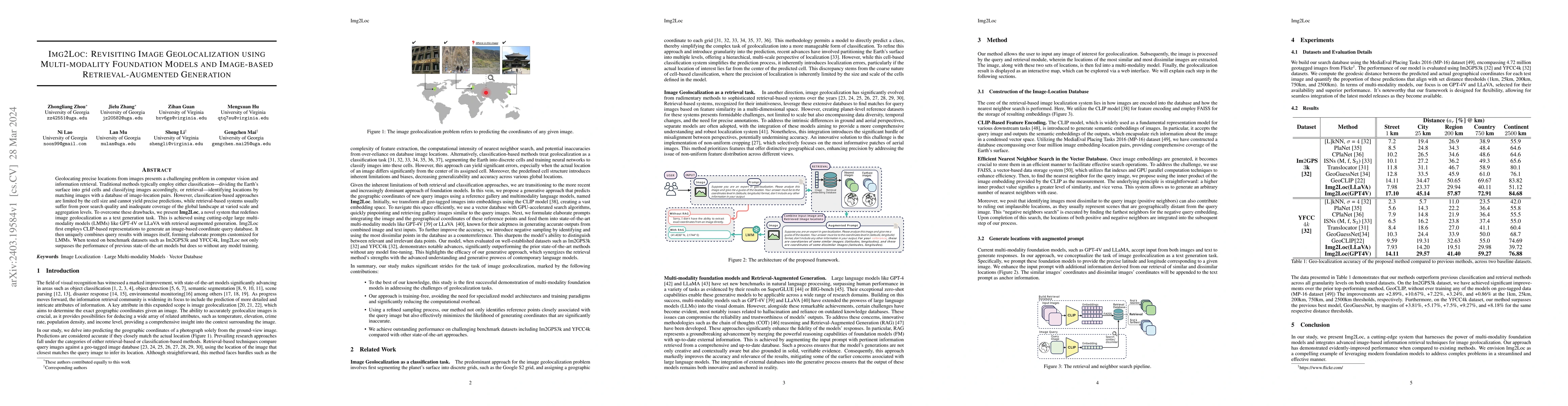
Geolocating precise locations from images presents a challenging problem in computer vision and information retrieval.Traditional methods typically employ either classification, which dividing the E...

Thumbnail for On the Promises and Challenges of Multimodal Foundation Models for
  Geographical, Environmental, Agricultural, and Urban Planning Applications

On the Promises and Challenges of Multimodal Foundation Models for Geographical, Environmental, Agricultural, and Urban Planning Applications

The advent of large language models (LLMs) has heightened interest in their potential for multimodal applications that integrate language and vision. This paper explores the capabilities of GPT-4V i...

Thumbnail for Text2Seg: Remote Sensing Image Semantic Segmentation via Text-Guided
  Visual Foundation Models

Text2Seg: Remote Sensing Image Semantic Segmentation via Text-Guided Visual Foundation Models

Recent advancements in foundation models (FMs), such as GPT-4 and LLaMA, have attracted significant attention due to their exceptional performance in zero-shot learning scenarios. Similarly, in the ...

Thumbnail for LocDiffusion: Identifying Locations on Earth by Diffusing in the Hilbert
  Space

LocDiffusion: Identifying Locations on Earth by Diffusing in the Hilbert Space

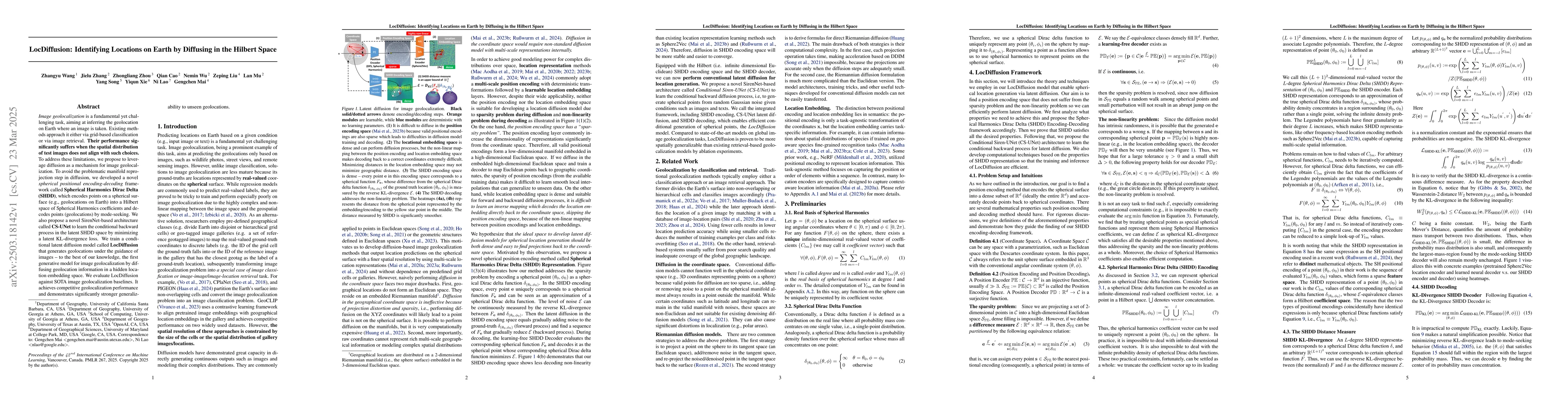
Image geolocalization is a fundamental yet challenging task, aiming at inferring the geolocation on Earth where an image is taken. Existing methods approach it either via grid-based classification or ...

This website uses cookies to ensure you get the best experience. Learn more