ArxivLens
L
Researcher

Larry Matthies

6 papers on arXiv

6 arXiv Papers
6 Total Publications
Profile

Academic Profile

Name Larry H. Matthies
Total Papers 6
Scholar Profile View on Semantic Scholar
Metrics

Statistics

6 arXiv Papers
6 Total Publications
Publications

Papers on arXiv

Thumbnail for ShadowNav: Autonomous Global Localization for Lunar Navigation in
  Darkness
arXiv
ShadowNav: Autonomous Global Localization for Lunar Navigation in Darkness

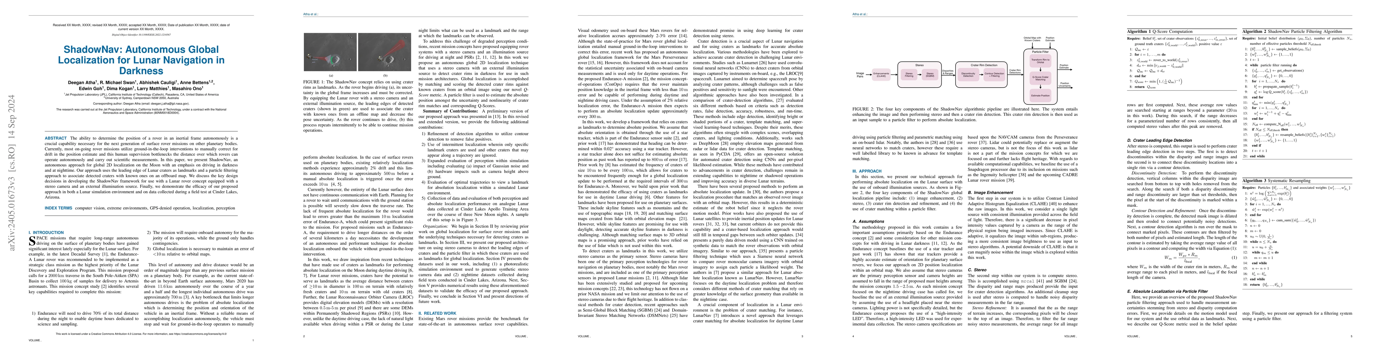
The ability to determine the pose of a rover in an inertial frame autonomously is a crucial capability necessary for the next generation of surface rover missions on other planetary bodies. Currentl...

Thumbnail for ShadowNav: Crater-Based Localization for Nighttime and Permanently
  Shadowed Region Lunar Navigation
arXiv
ShadowNav: Crater-Based Localization for Nighttime and Permanently Shadowed Region Lunar Navigation

There has been an increase in interest in missions that drive significantly longer distances per day than what has currently been performed. Further, some of these proposed missions require autonomo...

Thumbnail for LunarNav: Crater-based Localization for Long-range Autonomous Lunar
  Rover Navigation
arXiv
LunarNav: Crater-based Localization for Long-range Autonomous Lunar Rover Navigation

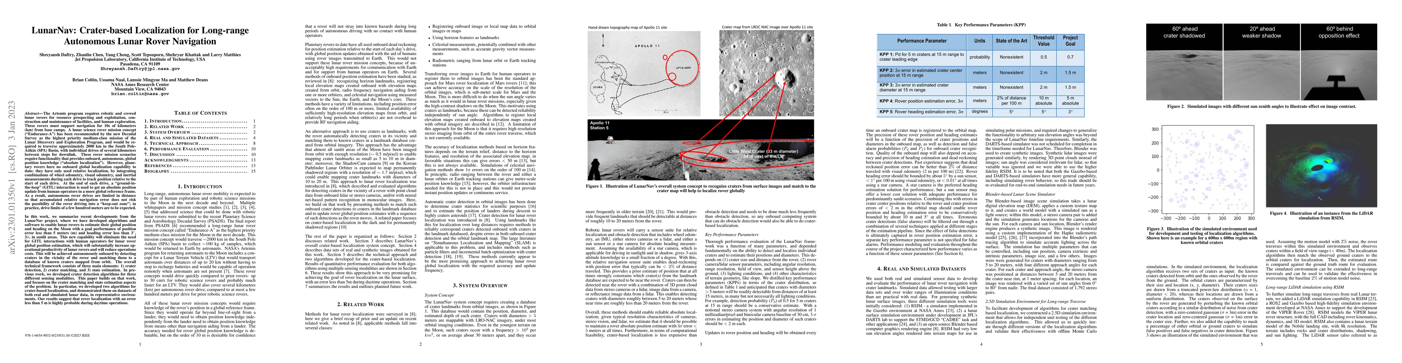
The Artemis program requires robotic and crewed lunar rovers for resource prospecting and exploitation, construction and maintenance of facilities, and human exploration. These rovers must support n...

Thumbnail for Lunar Rover Localization Using Craters as Landmarks
arXiv
Lunar Rover Localization Using Craters as Landmarks

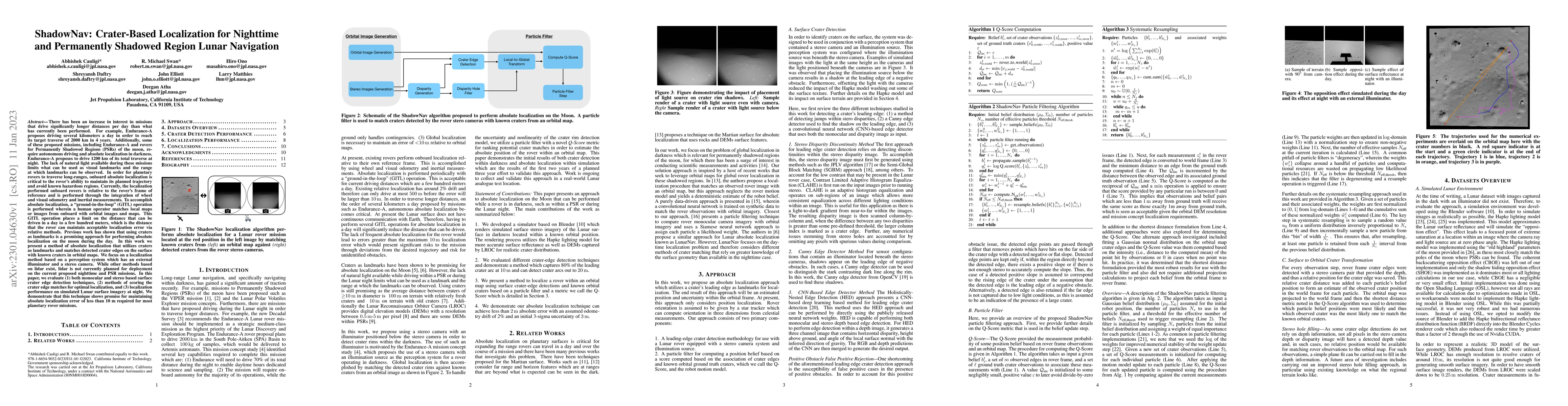
Onboard localization capabilities for planetary rovers to date have used relative navigation, by integrating combinations of wheel odometry, visual odometry, and inertial measurements during each dr...

Thumbnail for Mid-Air Helicopter Delivery at Mars Using a Jetpack
arXiv
Mid-Air Helicopter Delivery at Mars Using a Jetpack

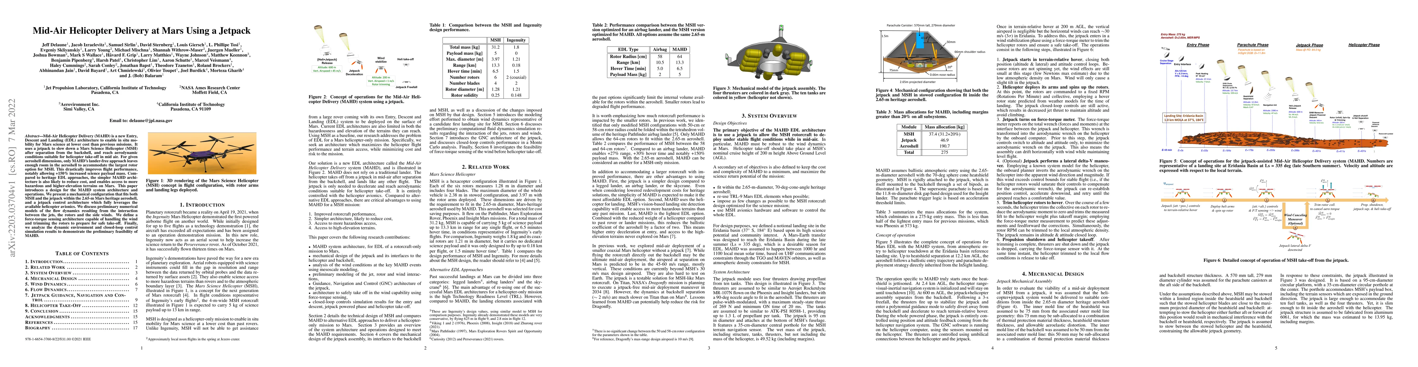
Mid-Air Helicopter Delivery (MAHD) is a new Entry, Descent and Landing (EDL) architecture to enable in situ mobility for Mars science at lower cost than previous missions. It uses a jetpack to slow ...

Thumbnail for Multi-Resolution Elevation Mapping and Safe Landing Site Detection with
  Applications to Planetary Rotorcraft
arXiv
Multi-Resolution Elevation Mapping and Safe Landing Site Detection with Applications to Planetary Rotorcraft

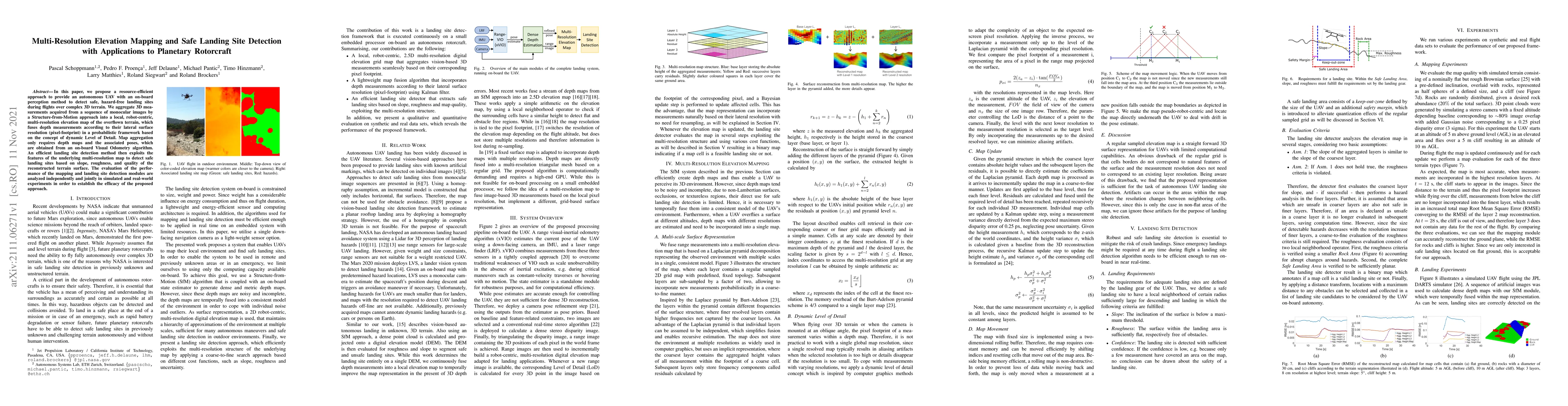
In this paper, we propose a resource-efficient approach to provide an autonomous UAV with an on-board perception method to detect safe, hazard-free landing sites during flights over complex 3D terra...

This website uses cookies to ensure you get the best experience. Learn more