Academic Profile
Statistics
Similar Authors
Papers on arXiv
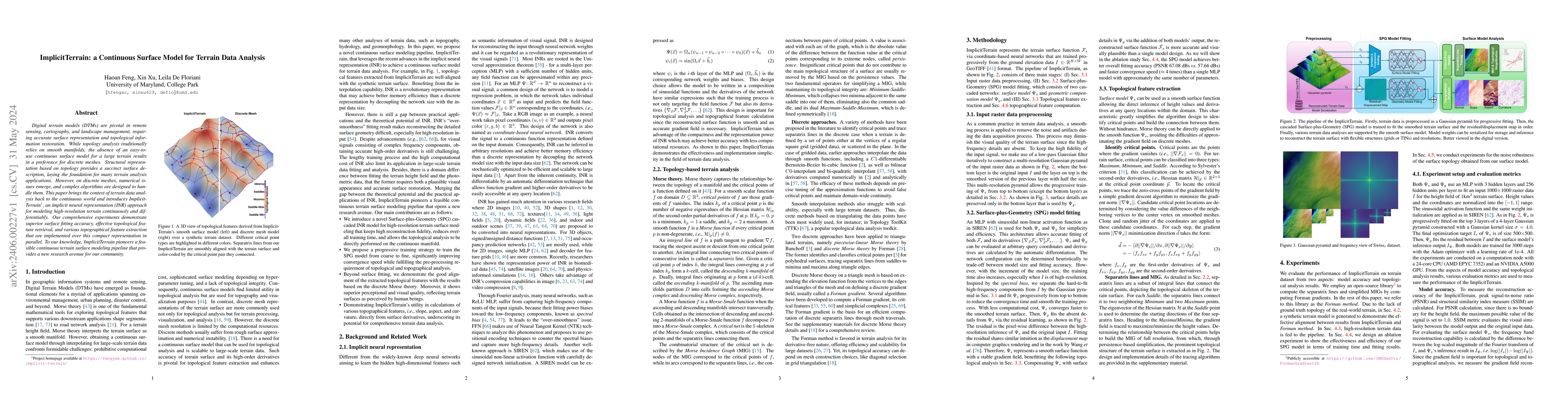
Digital terrain models (DTMs) are pivotal in remote sensing, cartography, and landscape management, requiring accurate surface representation and topological information restoration. While topology ...
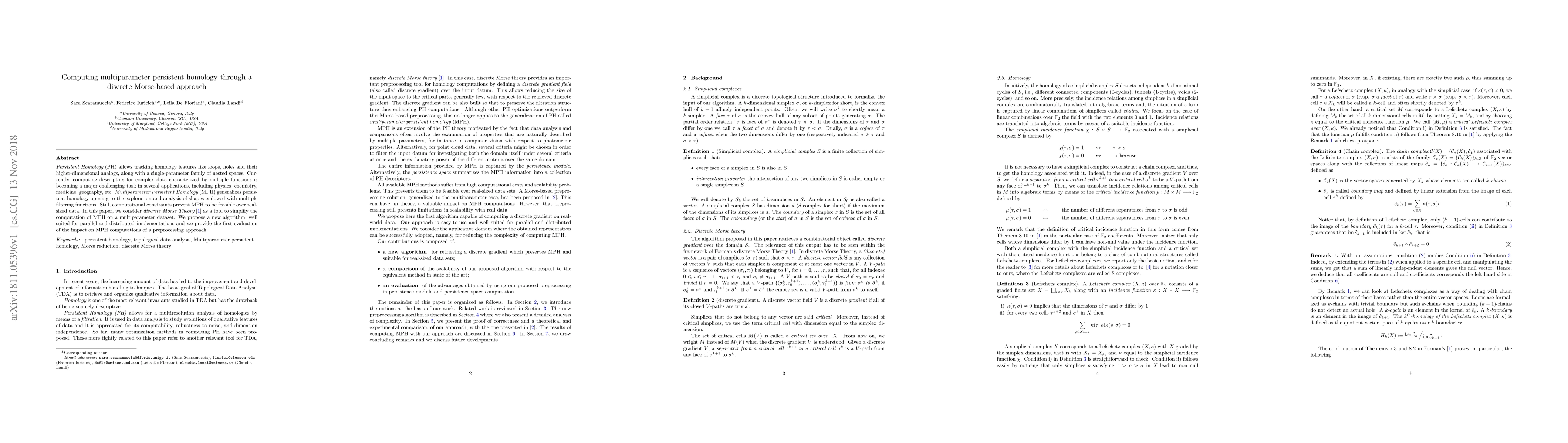
Persistent Homology (PH) allows tracking homology features like loops, holes and their higher-dimensional analogs, along with a single-parameter family of nested spaces. Currently, computing descrip...
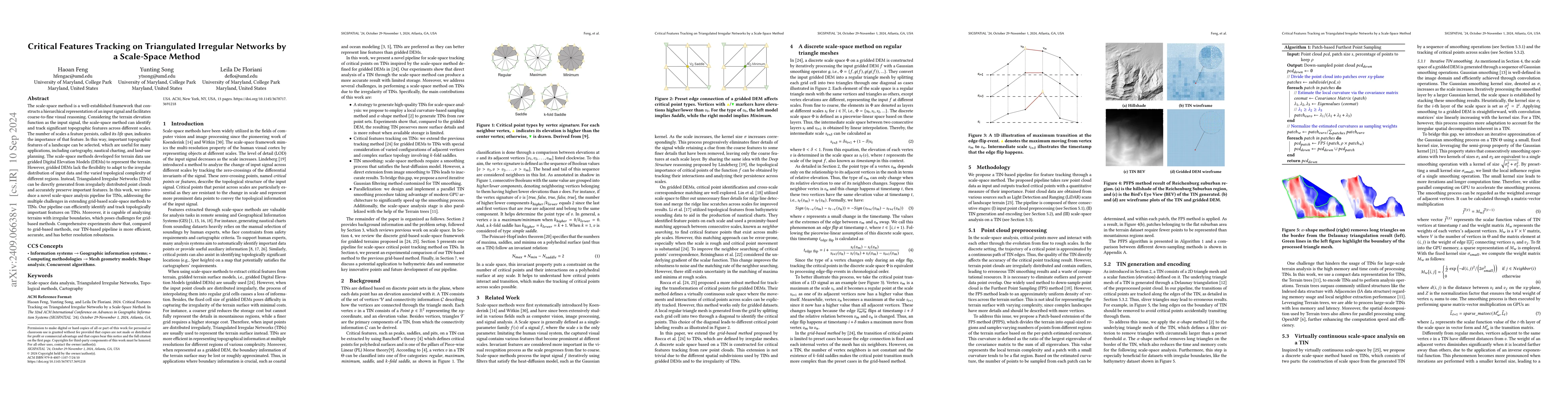
The scale-space method is a well-established framework that constructs a hierarchical representation of an input signal and facilitates coarse-to-fine visual reasoning. Considering the terrain elevati...
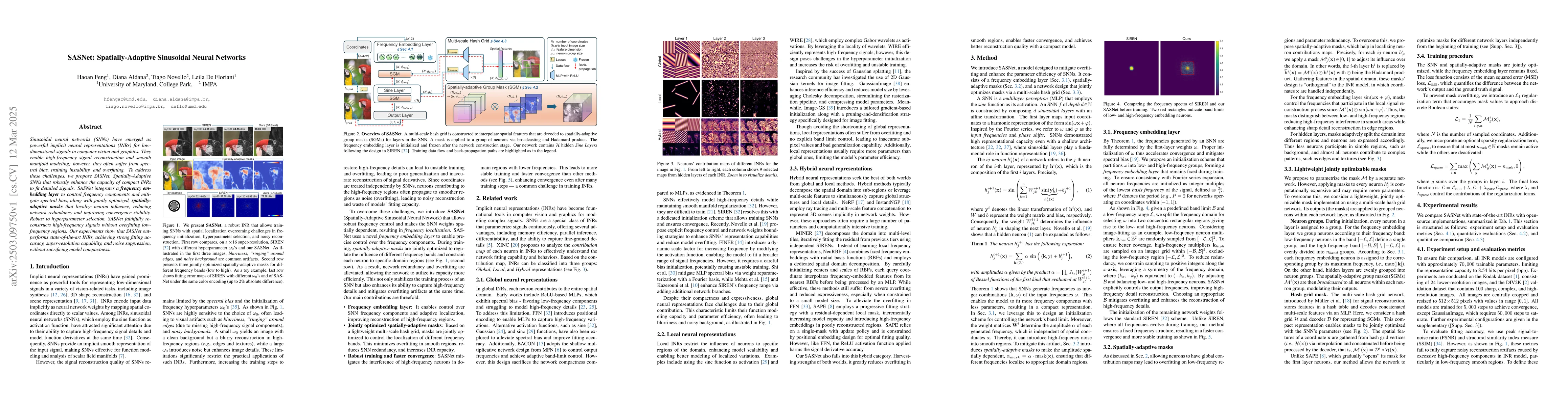
Sinusoidal neural networks (SNNs) have emerged as powerful implicit neural representations (INRs) for low-dimensional signals in computer vision and graphics. They enable high-frequency signal reconst...
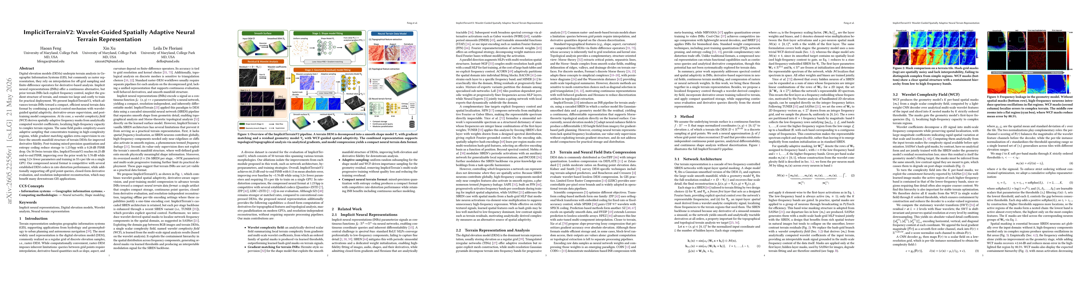
Digital elevation models (DEMs) underpin terrain analysis in Geographic Information Systems (GIS), but in their common raster form, they rely on interpolation for off-grid sampling and finite-differen...
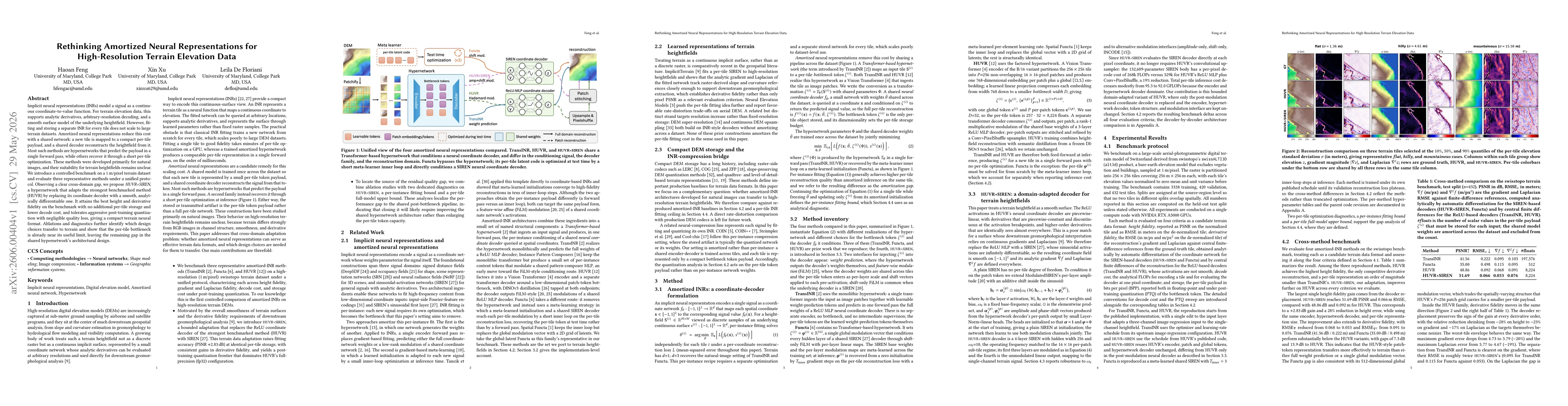
Implicit neural representations (INRs) model a signal as a continuous coordinate-to-value function. For terrain elevation data, this supports analytic derivatives, arbitrary-resolution decoding, and a...