Academic Profile
Statistics
Similar Authors
Papers on arXiv
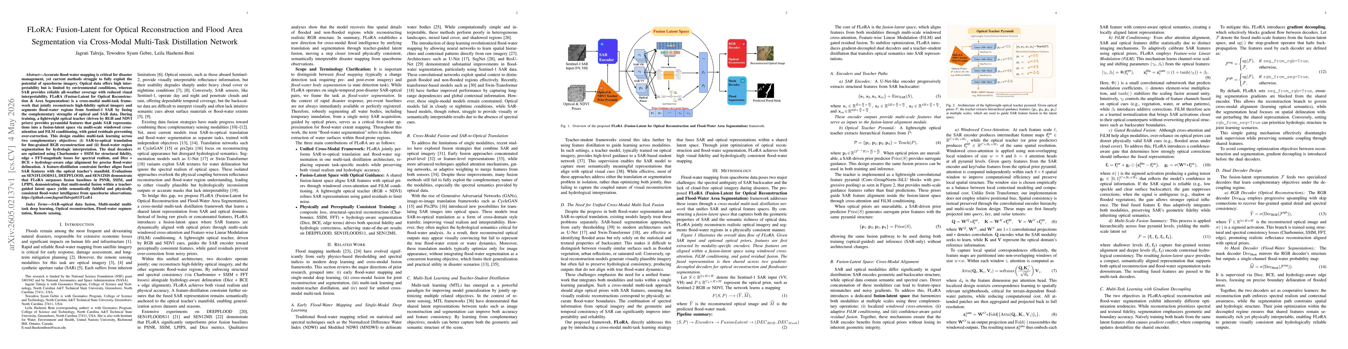
Accurate flood water mapping is critical for disaster management, yet current methods struggle to fully exploit the potential of spaceborne imagery. Optical data offers high interpretability but is li...
Rapid and accurate flood extent mapping from Remote Sensing data, such as Synthetic Aperture Radar (SAR), is critical for operational disaster response, but standard Deep Learning models often produce...
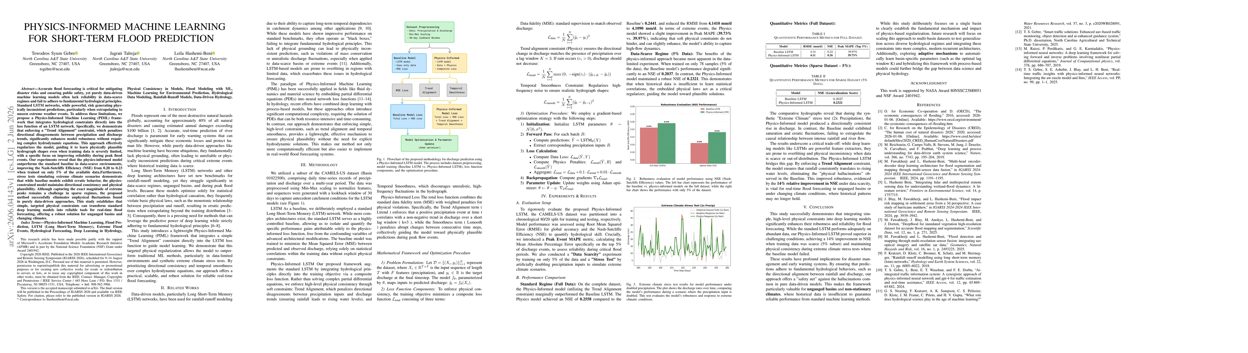
Accurate flood forecasting is essential for mitigating disaster risks and protecting communities. However, purely data-driven machine learning models often struggle in data-scarce environments and may...
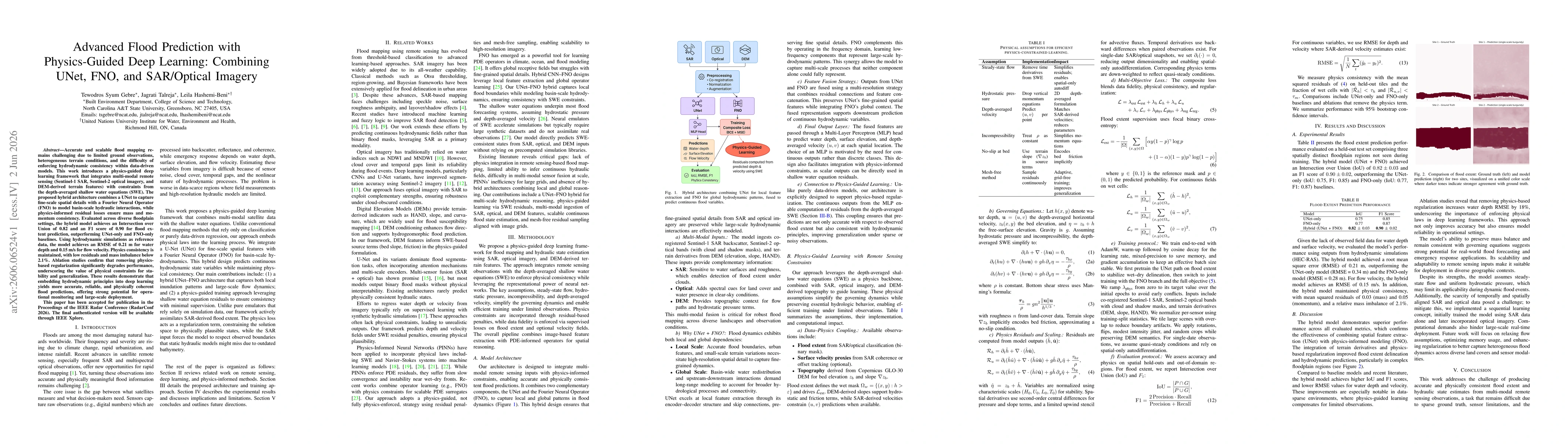
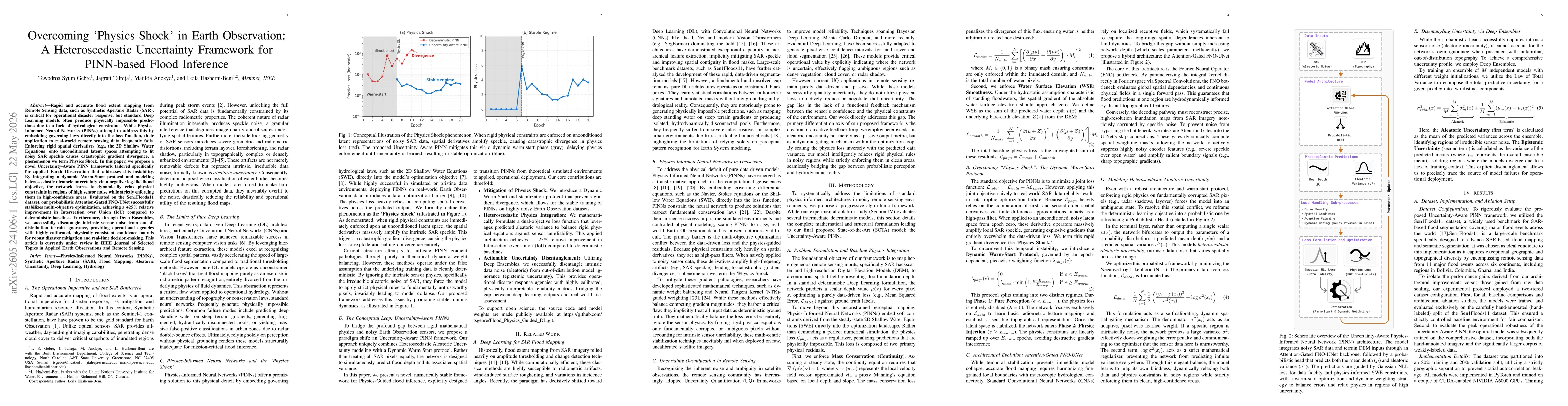
Accurate and scalable flood mapping remains challenging due to limited ground observations, heterogeneous terrain conditions, and the difficulty of enforcing hydrodynamic consistency within data-drive...
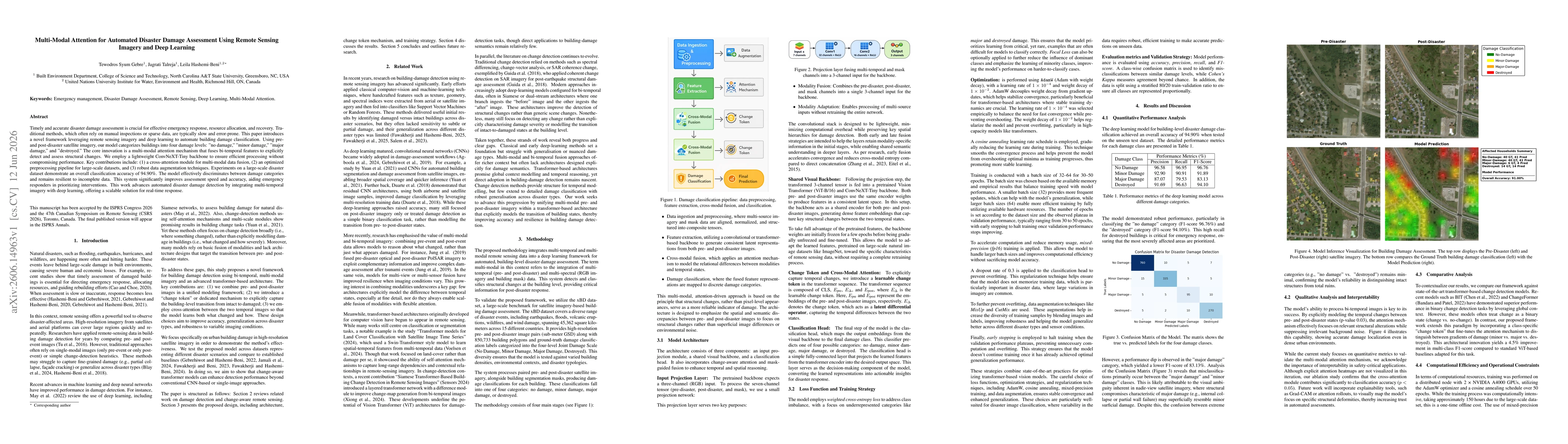
Timely and accurate disaster damage assessment is crucial for effective emergency response, resource allocation, and recovery. Traditional methods, which often rely on manual inspections or sparse dat...
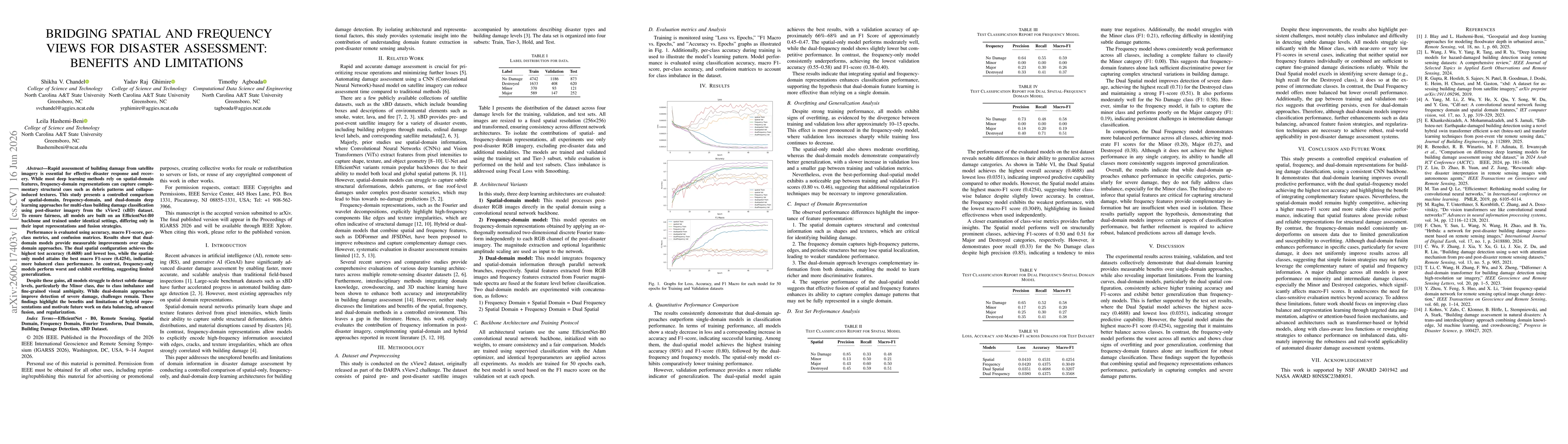
Rapid assessment of building damage from satellite imagery is essential for effective disaster response and recovery. While most deep learning methods rely on spatial-domain features, frequency-domain...
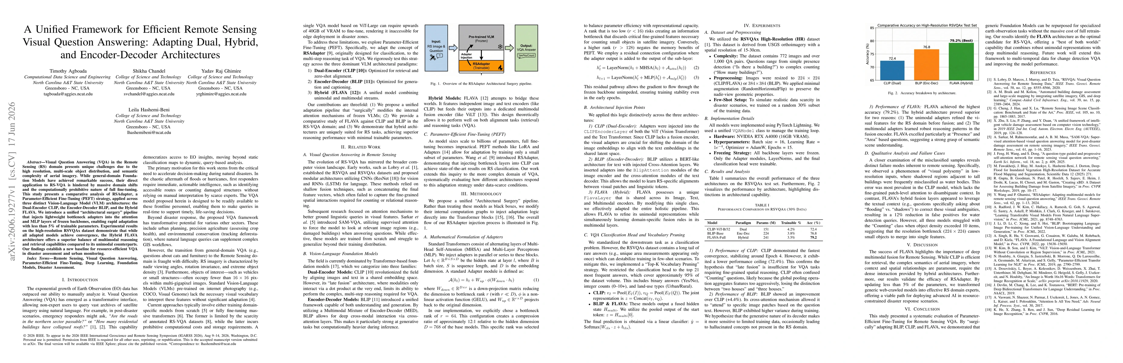
Visual Question Answering (VQA) in the Remote Sensing (RS) domain presents unique challenges due to the high resolution, multi scale object distribution, and semantic complexity of aerial imagery. Whi...