Academic Profile
Statistics
Similar Authors
Papers on arXiv
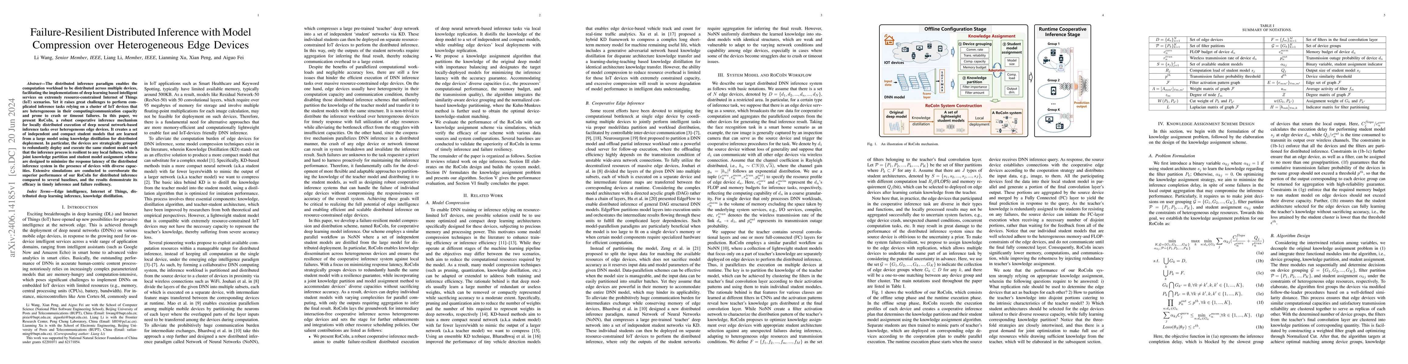
The distributed inference paradigm enables the computation workload to be distributed across multiple devices, facilitating the implementations of deep learning based intelligent services on extremely...
Many rescue missions demand effective perception and real-time decision making, which highly rely on effective data collection and processing. In this study, we propose a three-layer architecture of...
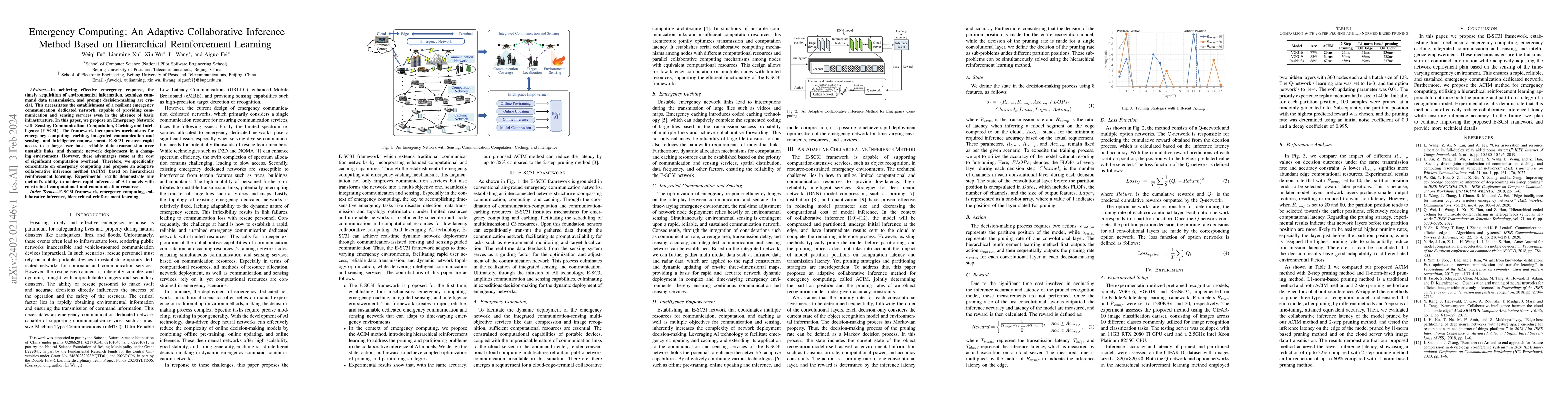
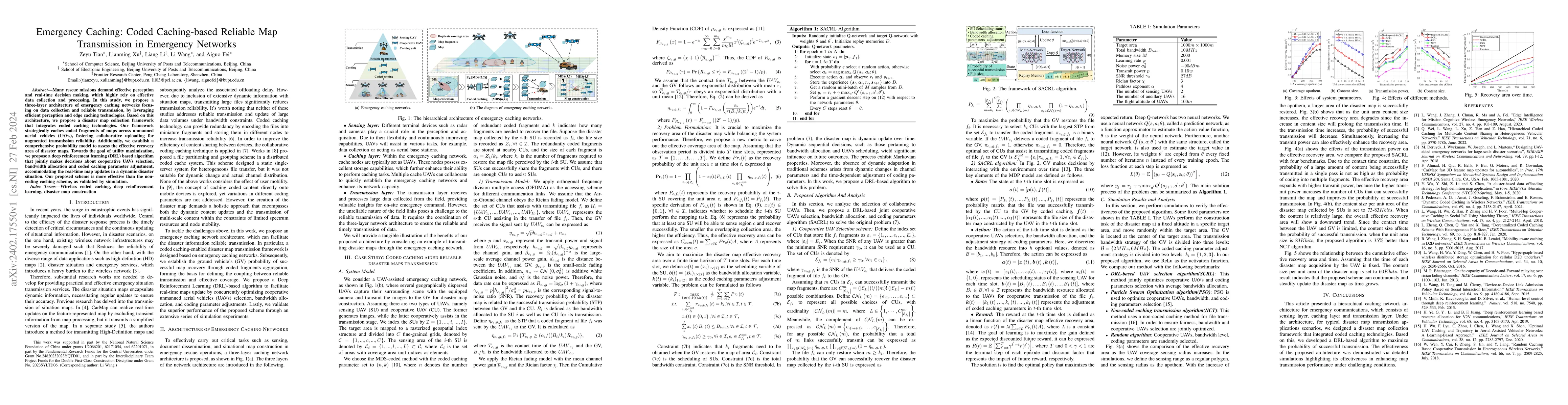
In achieving effective emergency response, the timely acquisition of environmental information, seamless command data transmission, and prompt decision-making are crucial. This necessitates the esta...
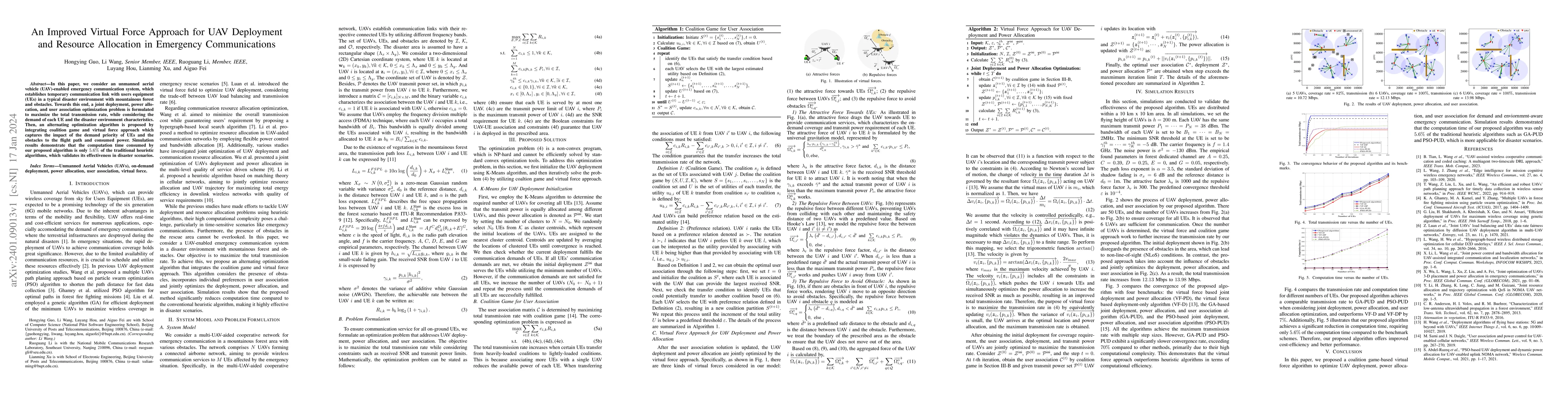
In this paper, we consider an unmanned aerial vehicle (UAV)-enabled emergency communication system, which establishes temporary communication link with users equipment (UEs) in a typical disaster en...
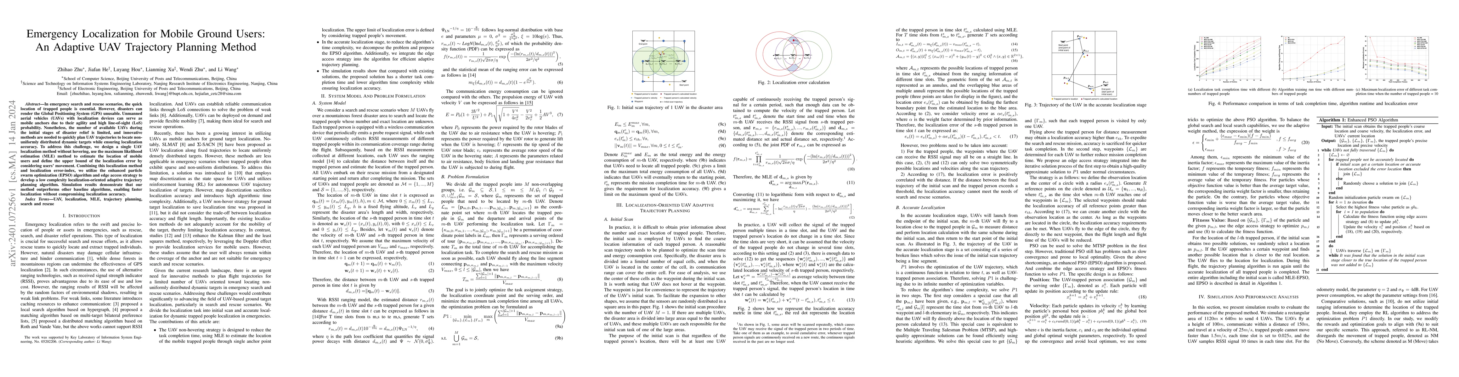
In emergency search and rescue scenarios, the quick location of trapped people is essential. However, disasters can render the Global Positioning System (GPS) unusable. Unmanned aerial vehicles (UAV...
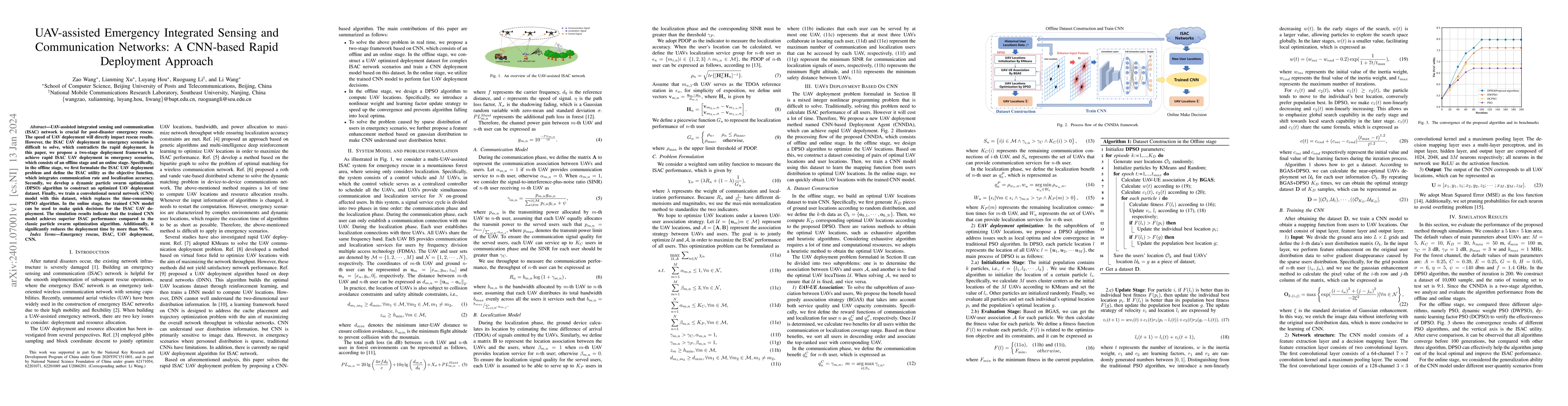
UAV-assisted integrated sensing and communication (ISAC) network is crucial for post-disaster emergency rescue. The speed of UAV deployment will directly impact rescue results. However, the ISAC UAV...

Deep learning (DL)-based channel state information (CSI) feedback has shown promising potential to improve spectrum efficiency in massive MIMO systems. However, practical DL approaches require a siz...
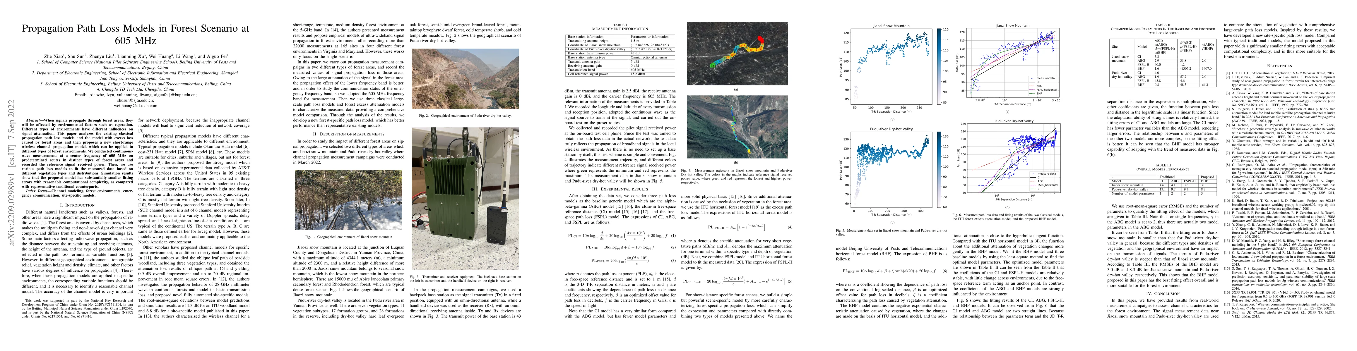
When signals propagate through forest areas, they will be affected by environmental factors such as vegetation. Different types of environments have different influences on signal attenuation. This ...
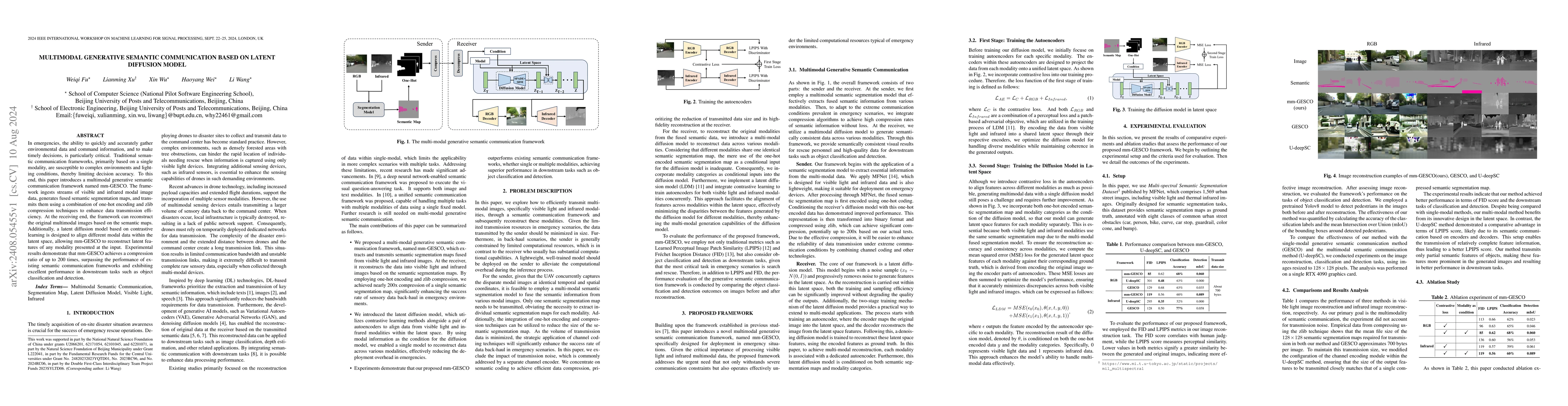
In emergencies, the ability to quickly and accurately gather environmental data and command information, and to make timely decisions, is particularly critical. Traditional semantic communication fram...
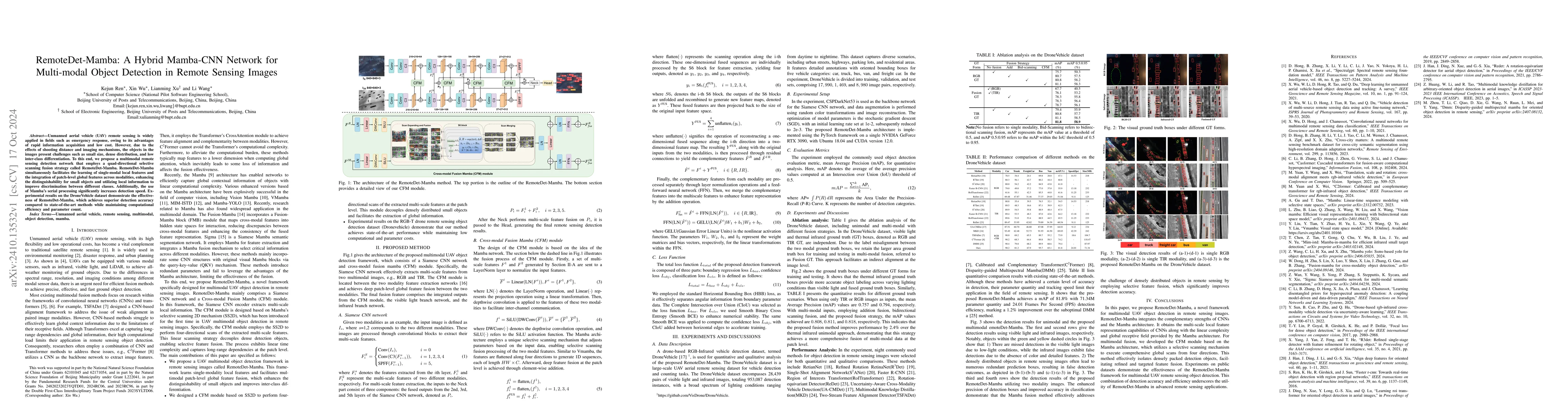
Unmanned aerial vehicle (UAV) remote sensing is widely applied in fields such as emergency response, owing to its advantages of rapid information acquisition and low cost. However, due to the effects ...
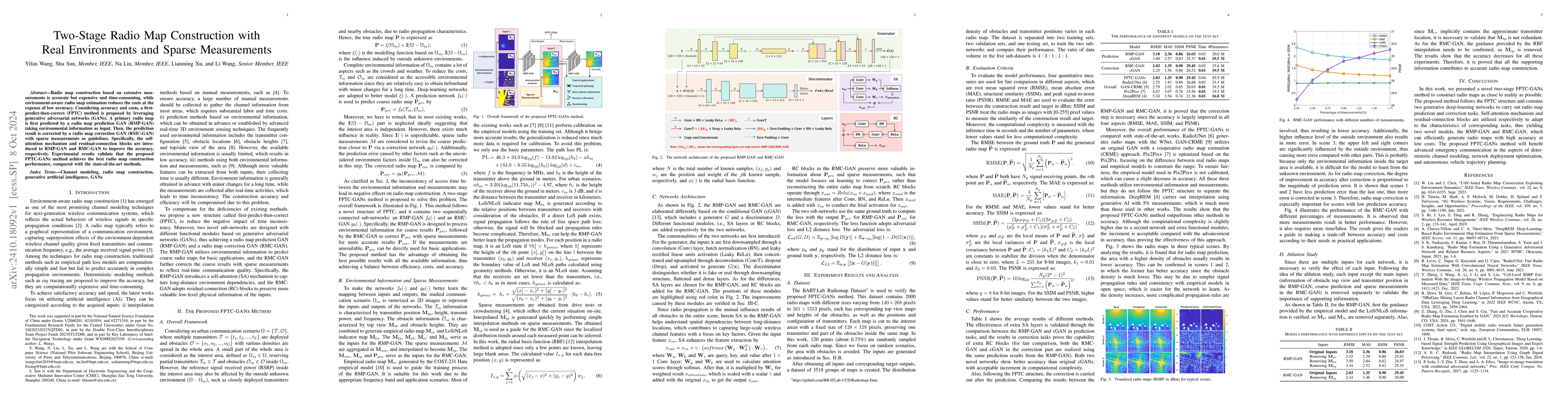
Radio map construction based on extensive measurements is accurate but expensive and time-consuming, while environment-aware radio map estimation reduces the costs at the expense of low accuracy. Cons...
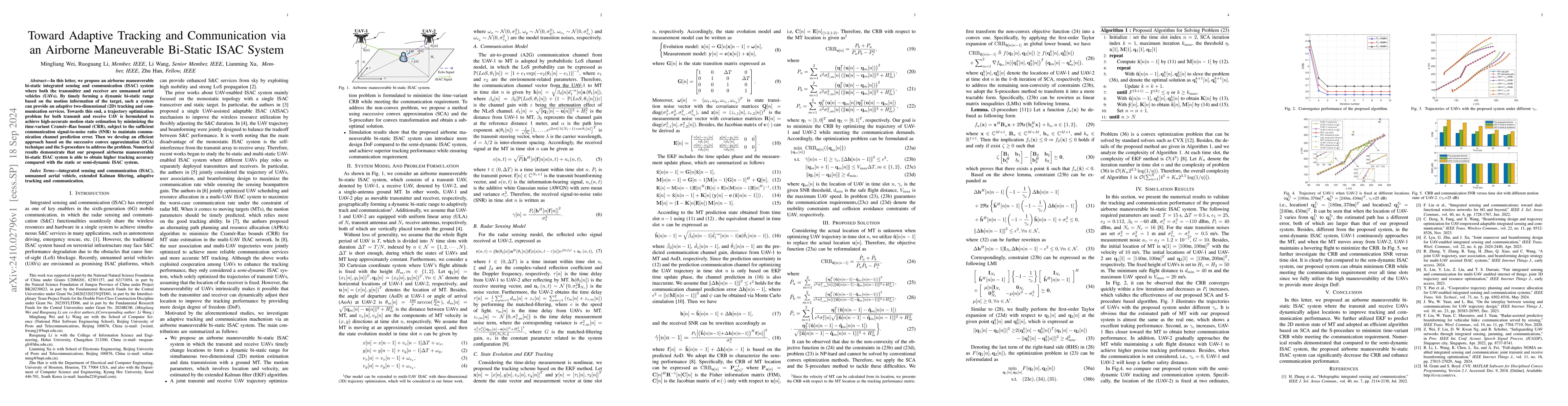
In this letter, we propose an airborne maneuverable bi-static integrated sensing and communication system where both the transmitter and receiver are unmanned aerial vehicles. By timely forming a dyna...
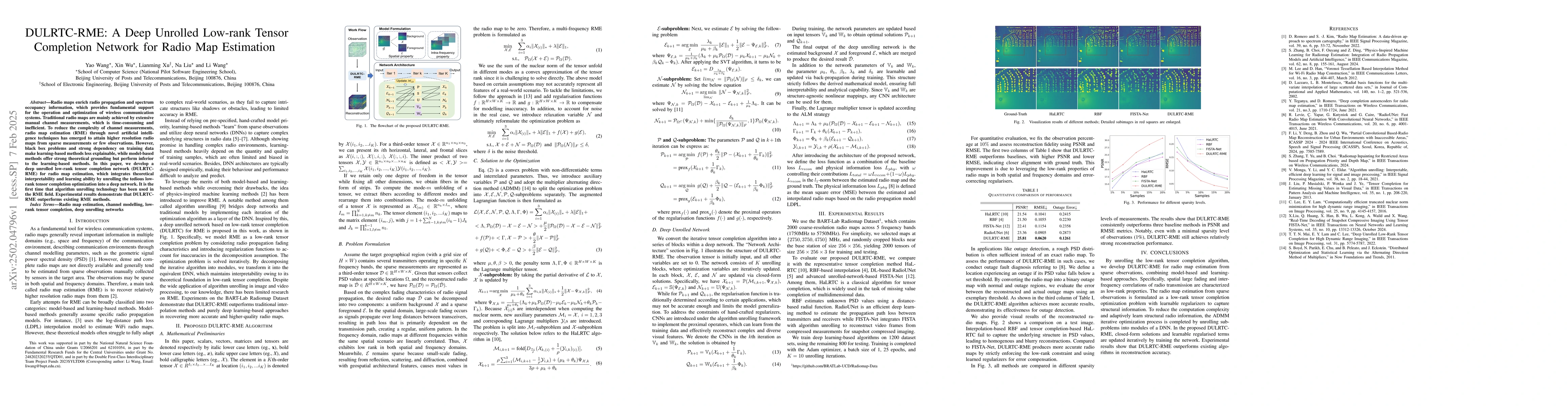
Radio maps enrich radio propagation and spectrum occupancy information, which provides fundamental support for the operation and optimization of wireless communication systems. Traditional radio maps ...
Distributed DNN inference is becoming increasingly important as the demand for intelligent services at the network edge grows. By leveraging the power of distributed computing, edge devices can perfor...
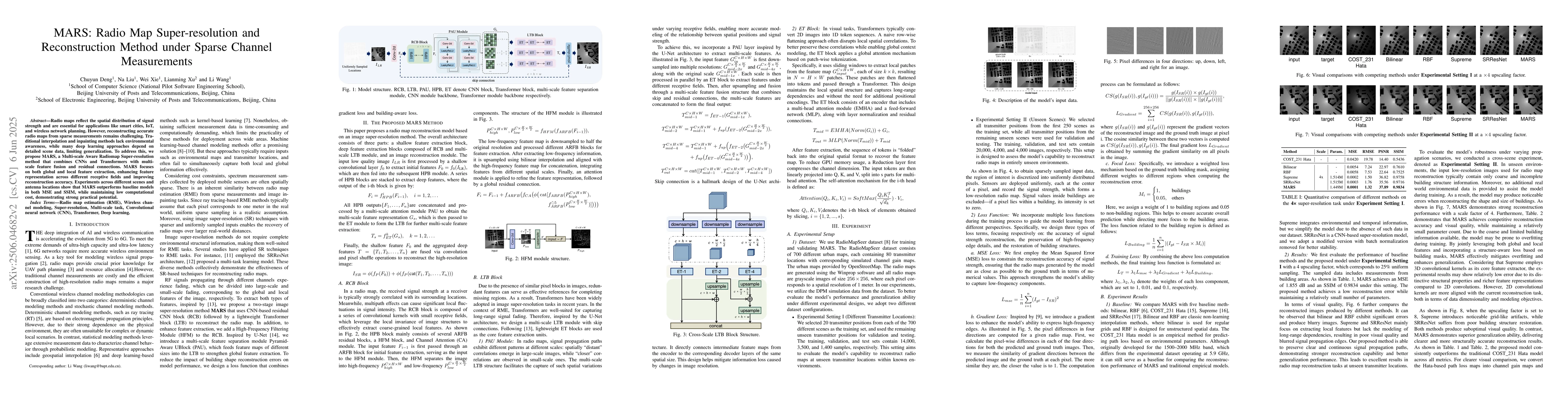
Radio maps reflect the spatial distribution of signal strength and are essential for applications like smart cities, IoT, and wireless network planning. However, reconstructing accurate radio maps fro...
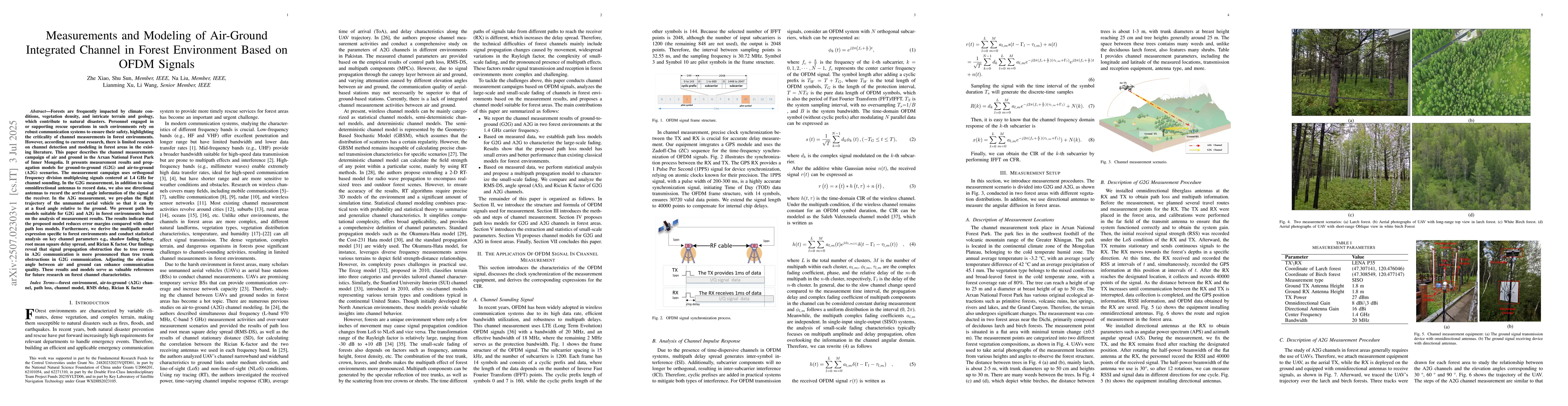
Forests are frequently impacted by climate conditions, vegetation density, and intricate terrain and geology, which contribute to natural disasters. Personnel engaged in or supporting rescue operation...
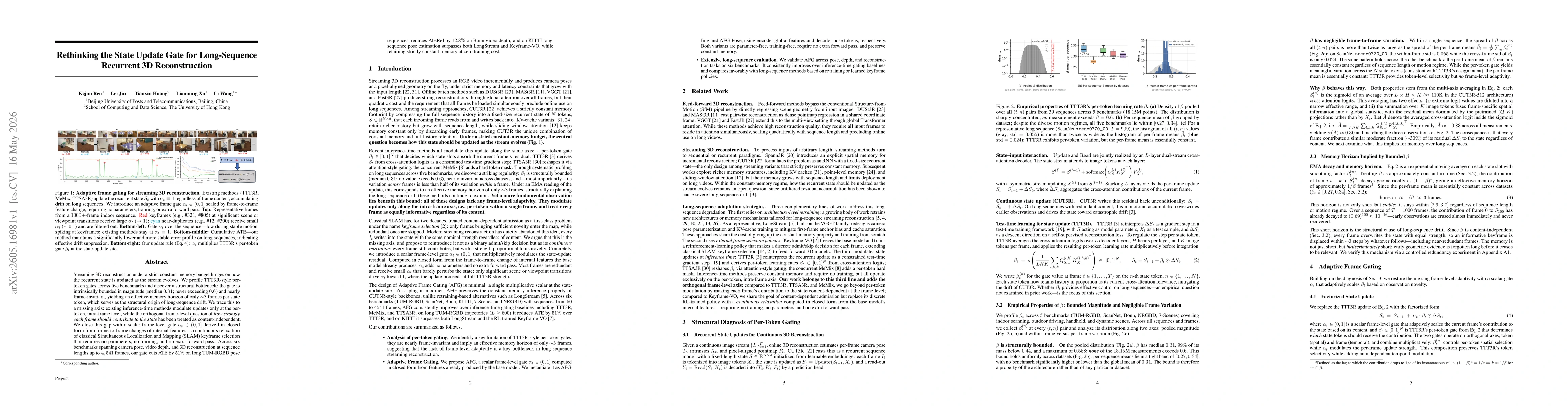
Streaming 3D reconstruction under a strict constant-memory budget hinges on how the recurrent state is updated as the stream evolves. We profile TTT3R-style per-token gates across five benchmarks and ...