Academic Profile
Statistics
Similar Authors
Papers on arXiv
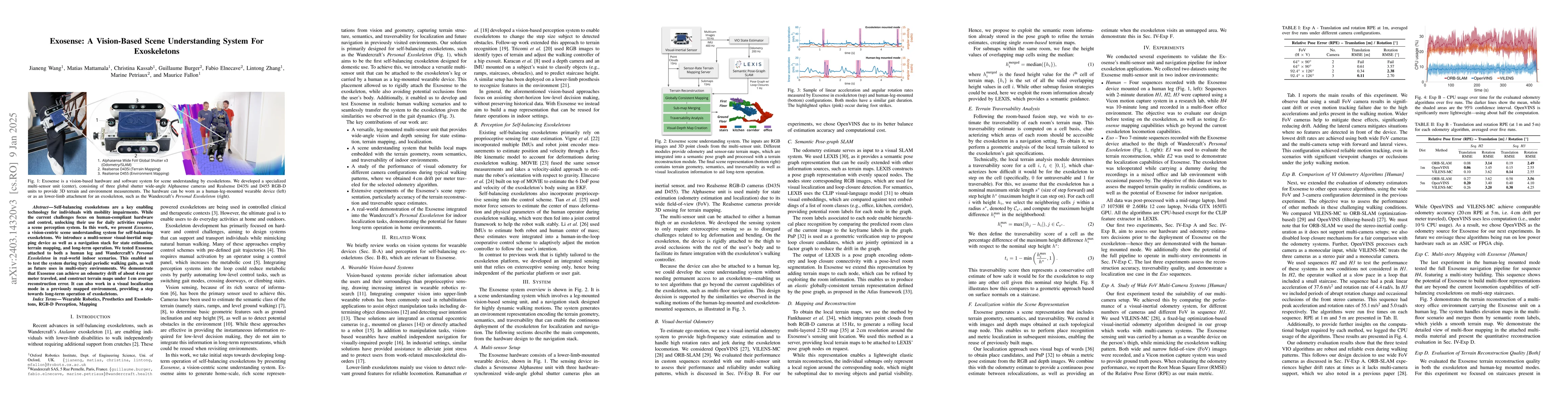
Exoskeletons for daily use by those with mobility impairments are being developed. They will require accurate and robust scene understanding systems. Current research has used vision to identify imm...
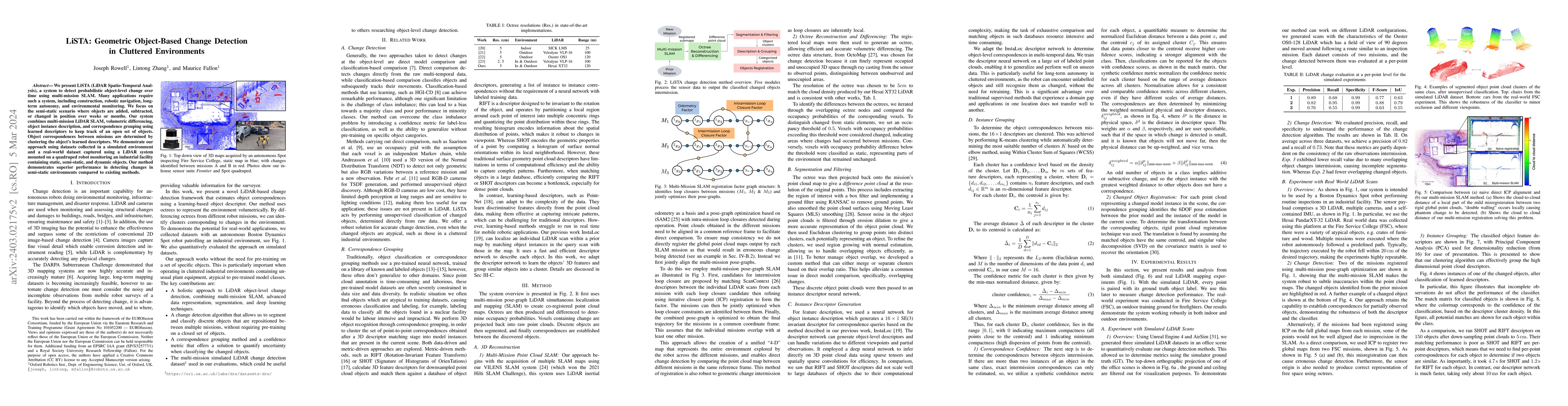
We present LiSTA (LiDAR Spatio-Temporal Analysis), a system to detect probabilistic object-level change over time using multi-mission SLAM. Many applications require such a system, including constru...
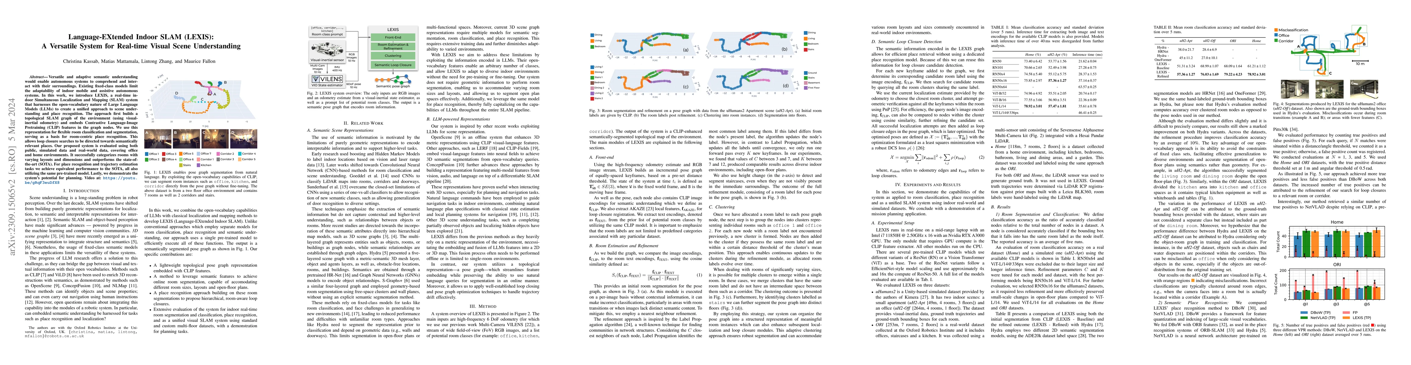
Versatile and adaptive semantic understanding would enable autonomous systems to comprehend and interact with their surroundings. Existing fixed-class models limit the adaptability of indoor mobile ...
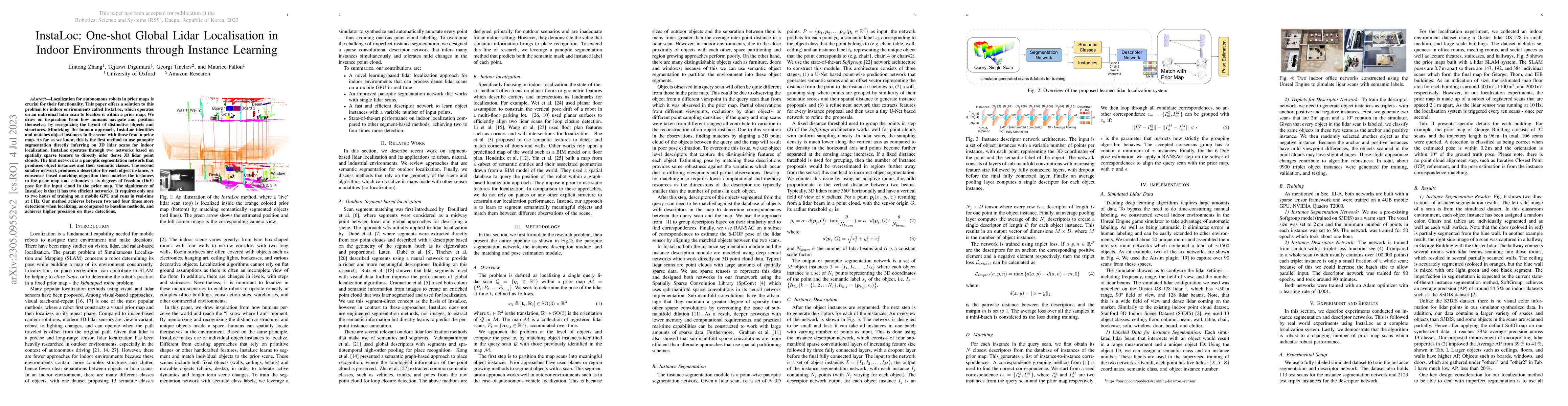
Localization for autonomous robots in prior maps is crucial for their functionality. This paper offers a solution to this problem for indoor environments called InstaLoc, which operates on an indivi...
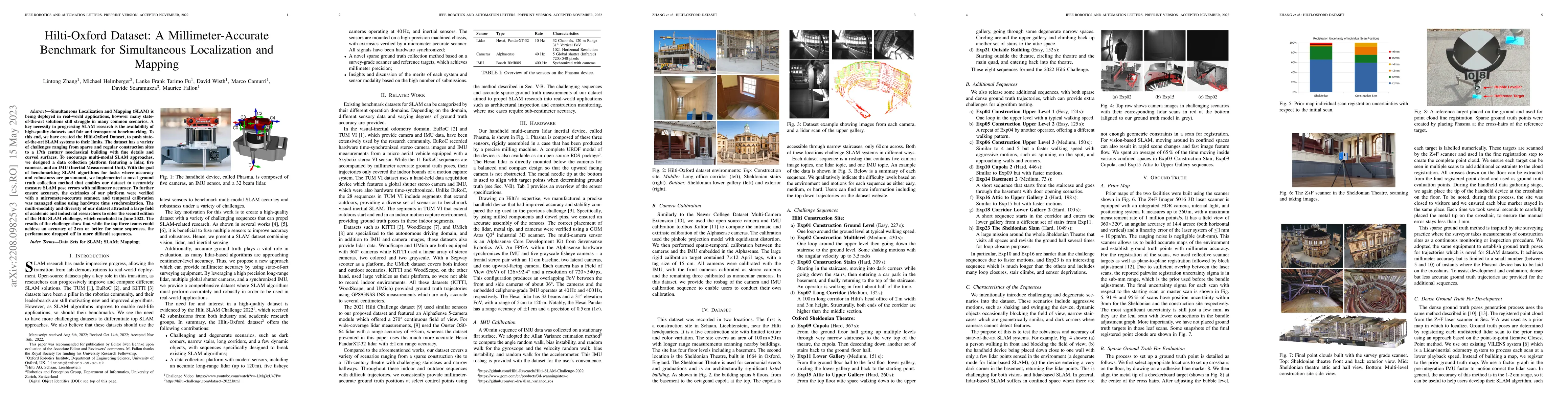
Simultaneous Localization and Mapping (SLAM) is being deployed in real-world applications, however many state-of-the-art solutions still struggle in many common scenarios. A key necessity in progres...
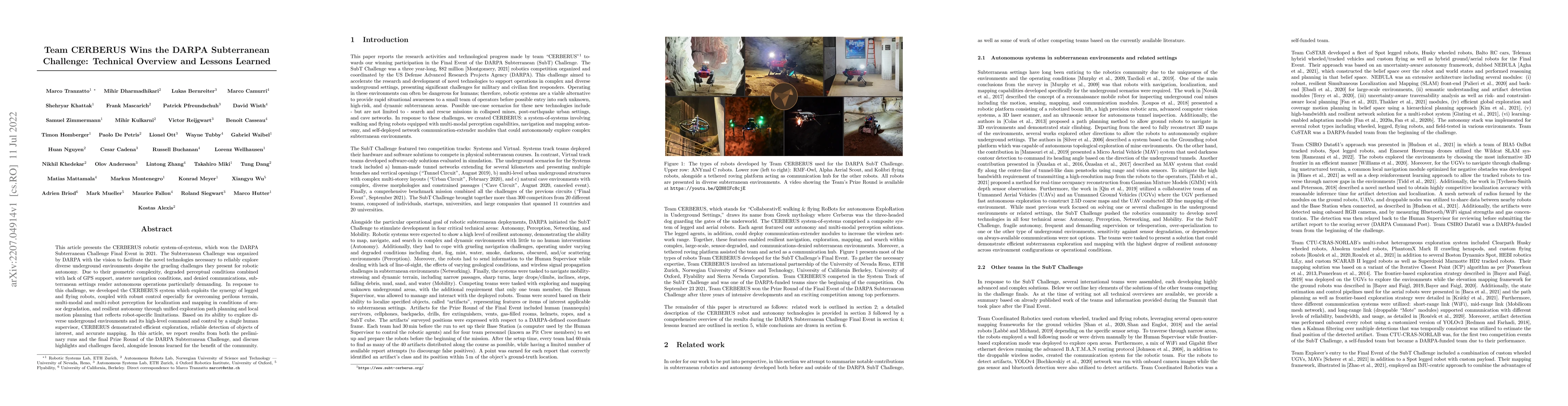
This article presents the CERBERUS robotic system-of-systems, which won the DARPA Subterranean Challenge Final Event in 2021. The Subterranean Challenge was organized by DARPA with the vision to fac...
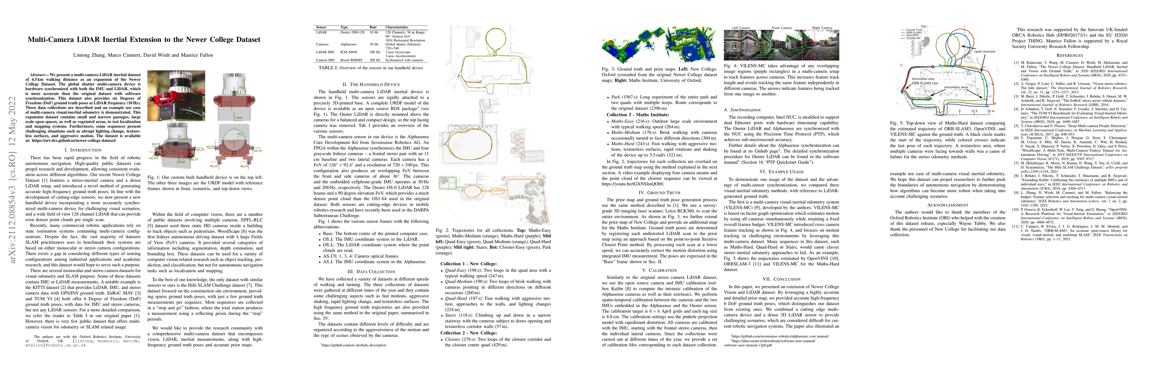
We present a multi-camera LiDAR inertial dataset of 4.5 km walking distance as an expansion of the Newer College Dataset. The global shutter multi-camera device is hardware synchronized with both th...
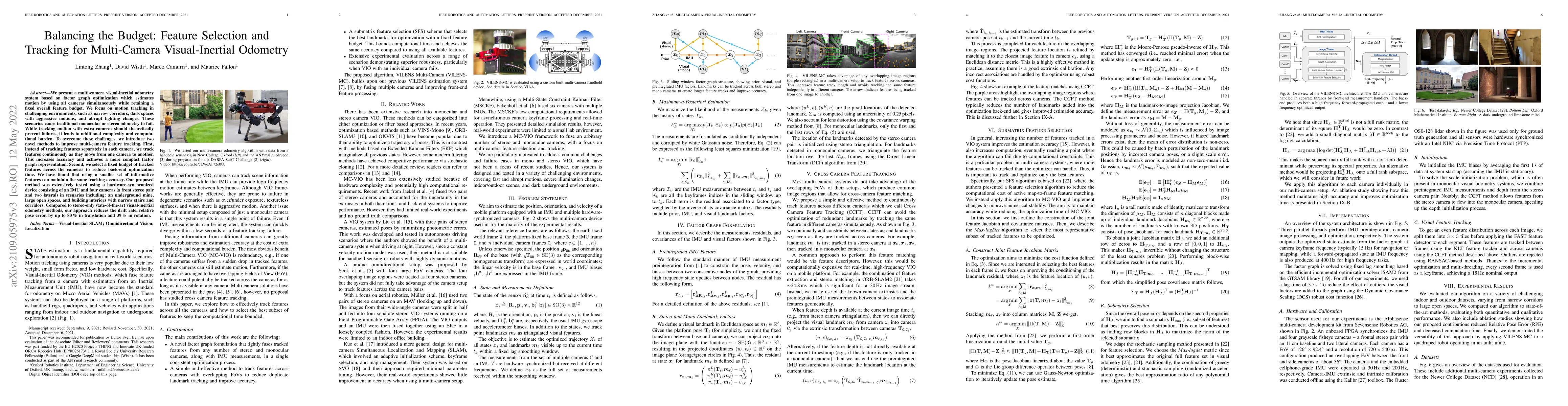
We present a multi-camera visual-inertial odometry system based on factor graph optimization which estimates motion by using all cameras simultaneously while retaining a fixed overall feature budget...
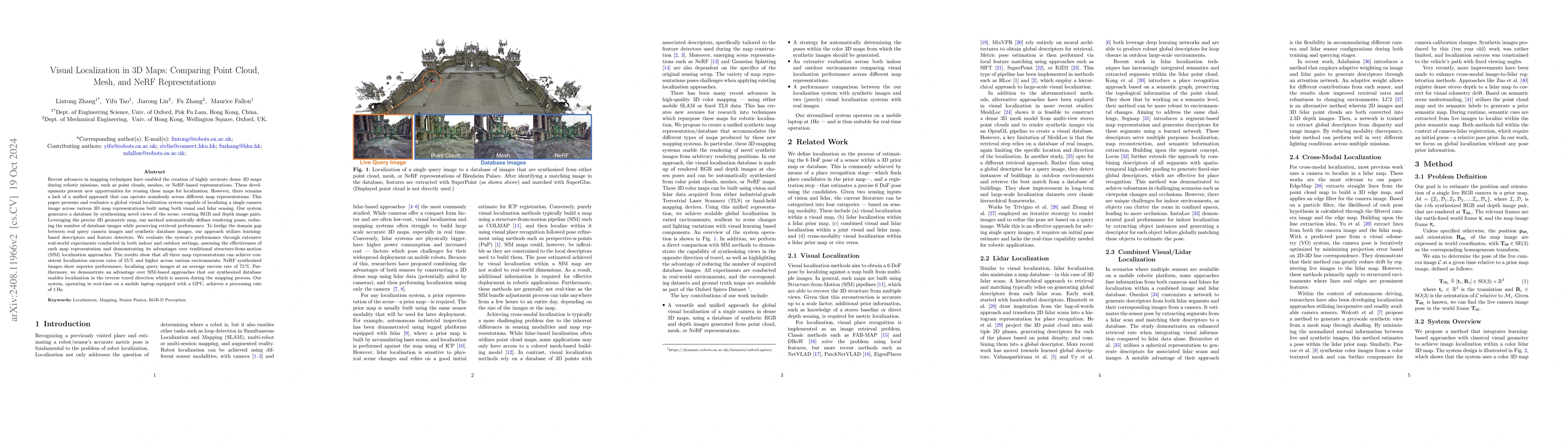
This paper introduces and assesses a cross-modal global visual localization system that can localize camera images within a color 3D map representation built using both visual and lidar sensing. We pr...
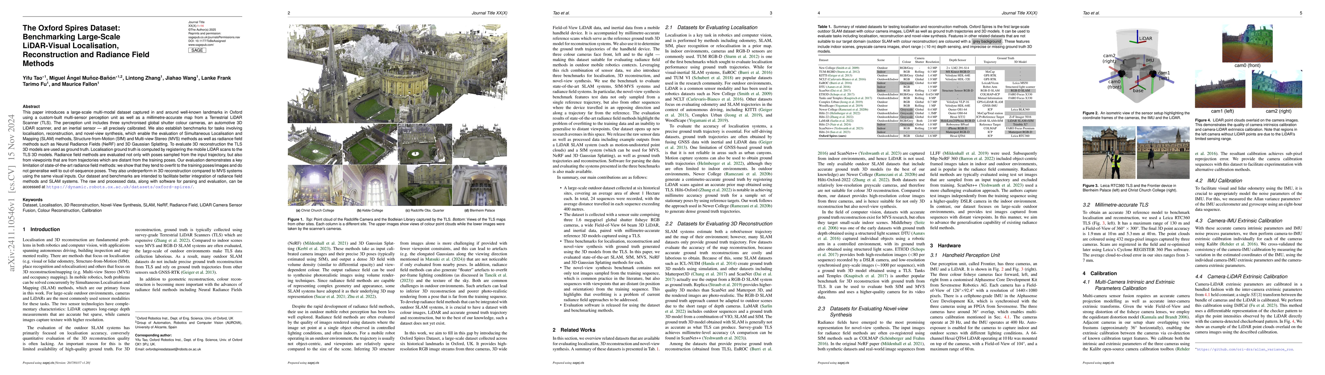
This paper introduces a large-scale multi-modal dataset captured in and around well-known landmarks in Oxford using a custom-built multi-sensor perception unit as well as a millimetre-accurate map fro...
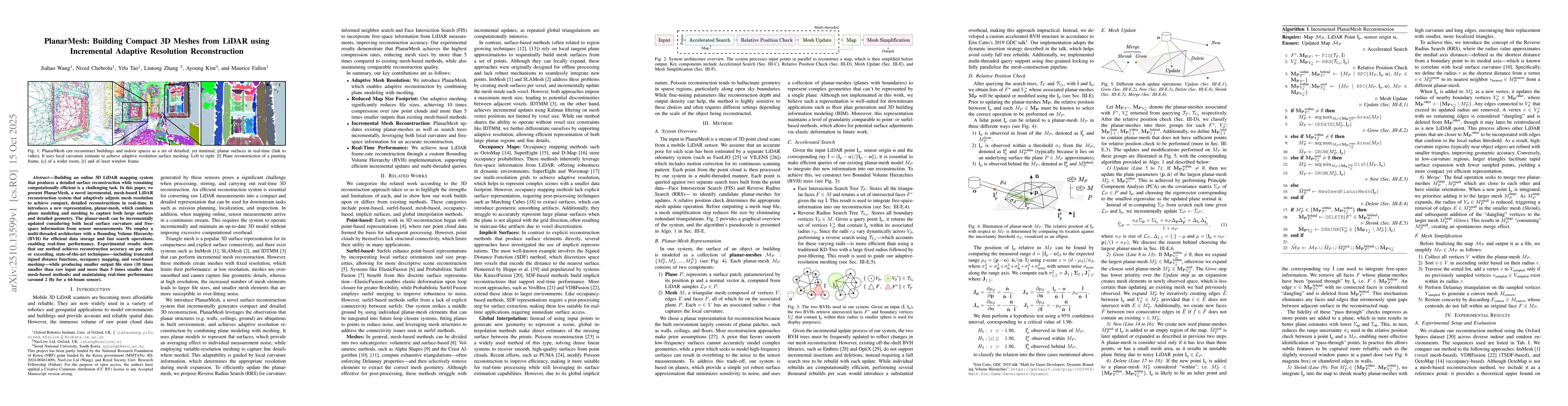
Building an online 3D LiDAR mapping system that produces a detailed surface reconstruction while remaining computationally efficient is a challenging task. In this paper, we present PlanarMesh, a nove...
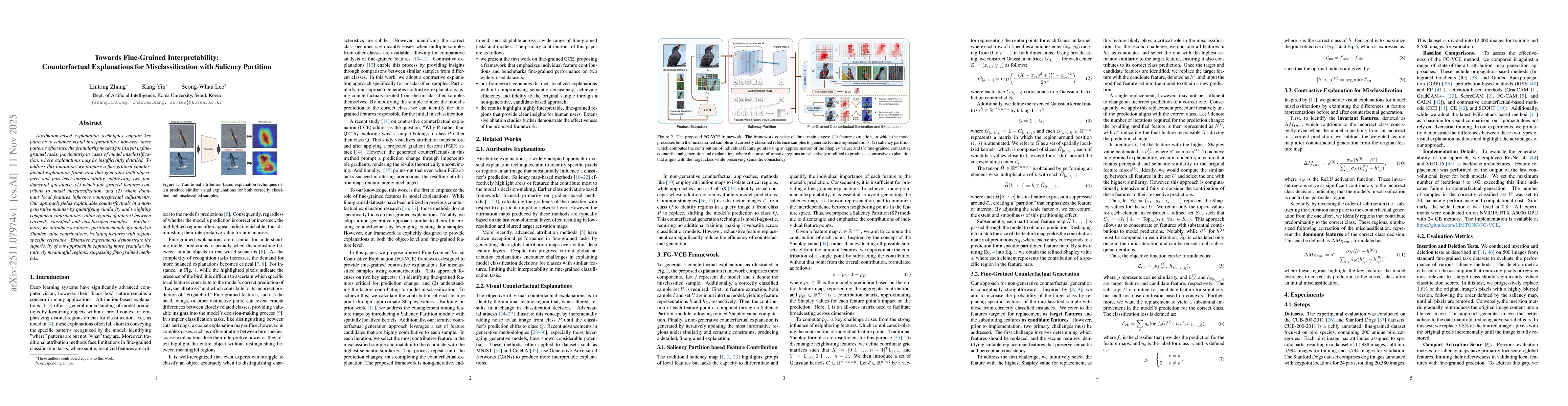
Attribution-based explanation techniques capture key patterns to enhance visual interpretability; however, these patterns often lack the granularity needed for insight in fine-grained tasks, particula...
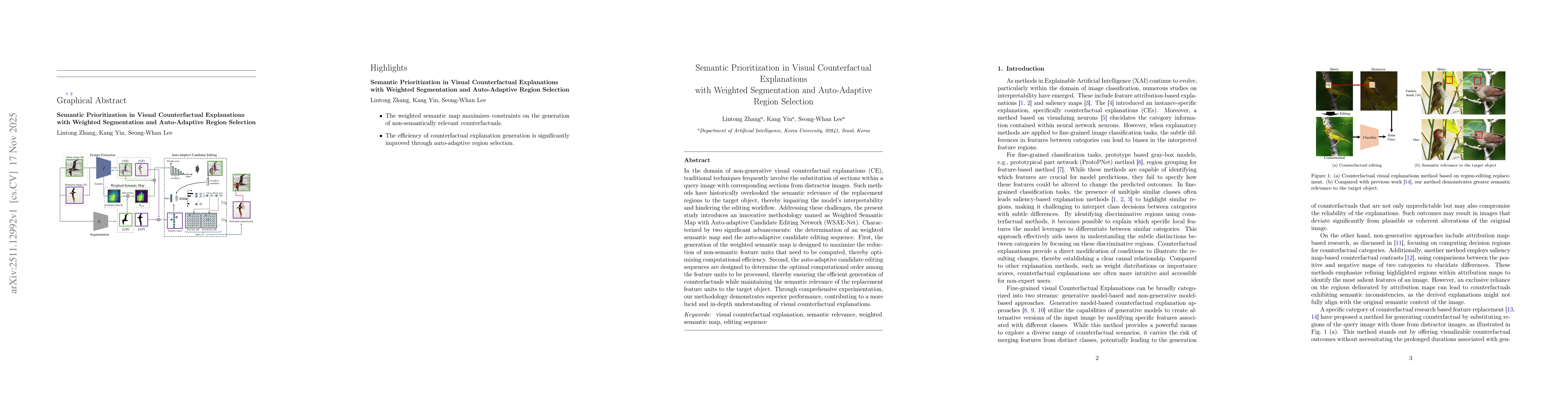
In the domain of non-generative visual counterfactual explanations (CE), traditional techniques frequently involve the substitution of sections within a query image with corresponding sections from di...