Academic Profile
Statistics
Similar Authors
Papers on arXiv
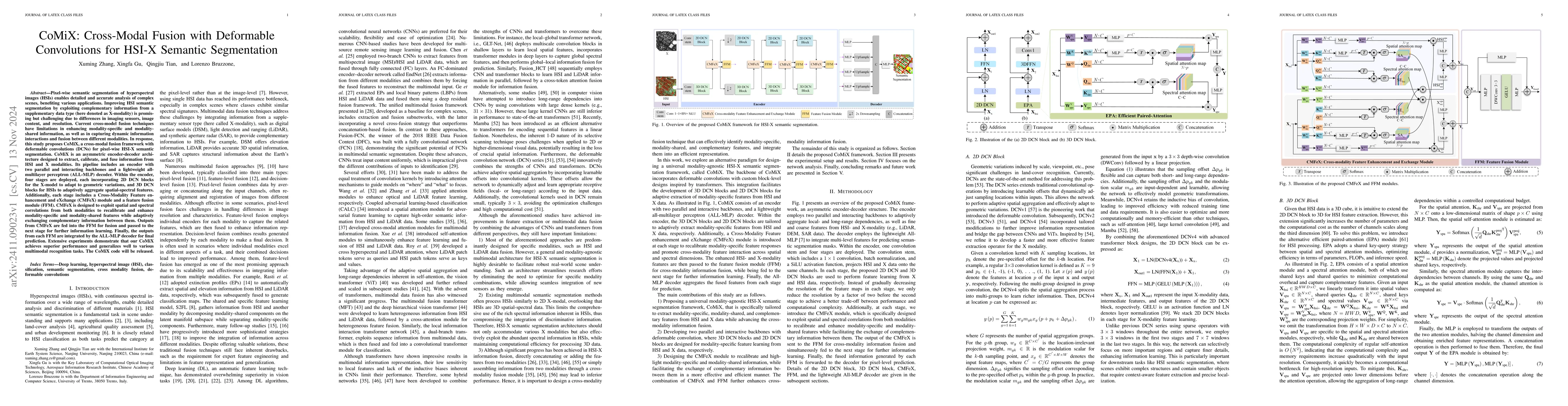
Hyperspectral image (HSI) classification has recently reached its performance bottleneck. Multimodal data fusion is emerging as a promising approach to overcome this bottleneck by providing rich compl...
Spatiotemporal fusion aims to improve both the spatial and temporal resolution of remote sensing images, thus facilitating time-series analysis at a fine spatial scale. However, there are several im...
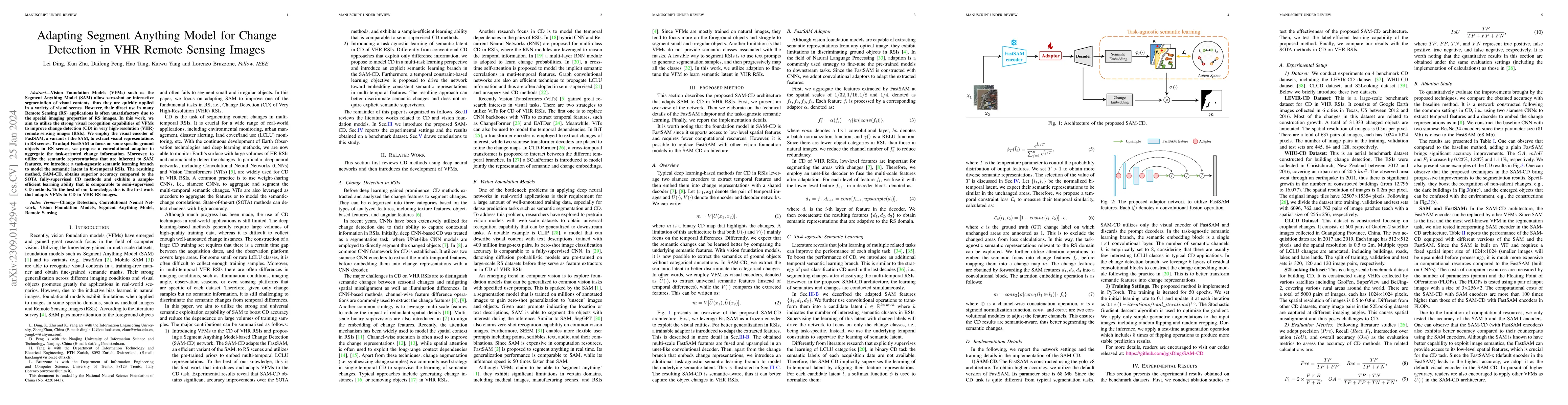
Vision Foundation Models (VFMs) such as the Segment Anything Model (SAM) allow zero-shot or interactive segmentation of visual contents, thus they are quickly applied in a variety of visual scenes. ...
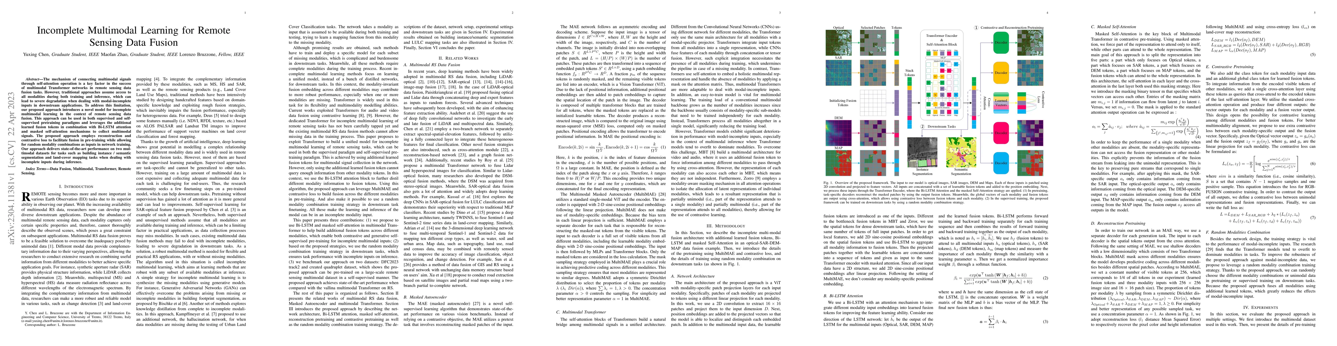
The mechanism of connecting multimodal signals through self-attention operation is a key factor in the success of multimodal Transformer networks in remote sensing data fusion tasks. However, tradit...
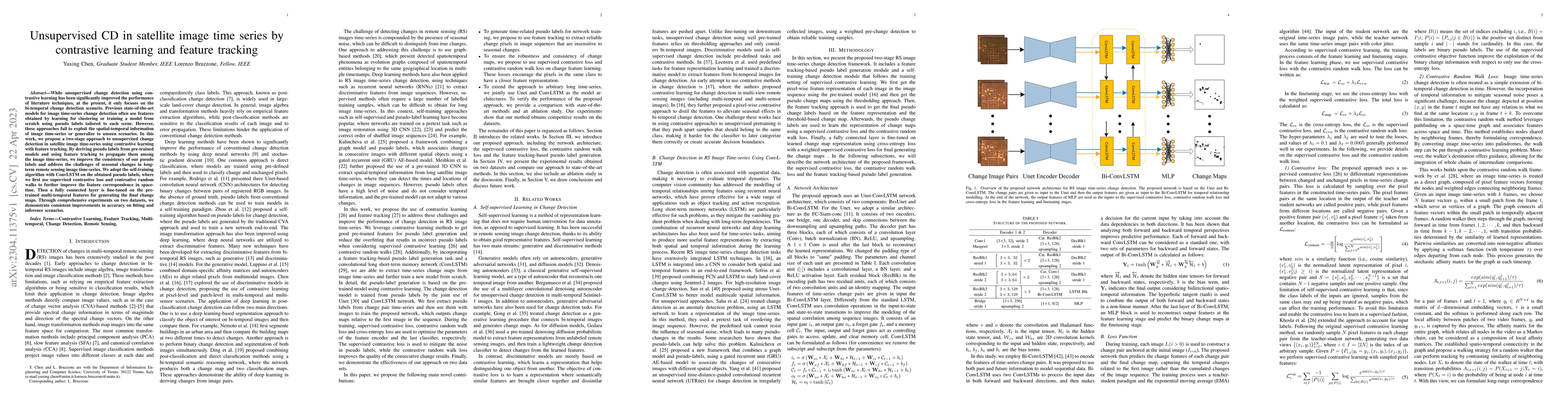
While unsupervised change detection using contrastive learning has been significantly improved the performance of literature techniques, at present, it only focuses on the bi-temporal change detecti...
ESA's Jupiter Icy Moons Explorer (JUICE) will provide a detailed investigation of the Jovian system in the 2030s, combining a suite of state-of-the-art instruments with an orbital tour tailored to m...
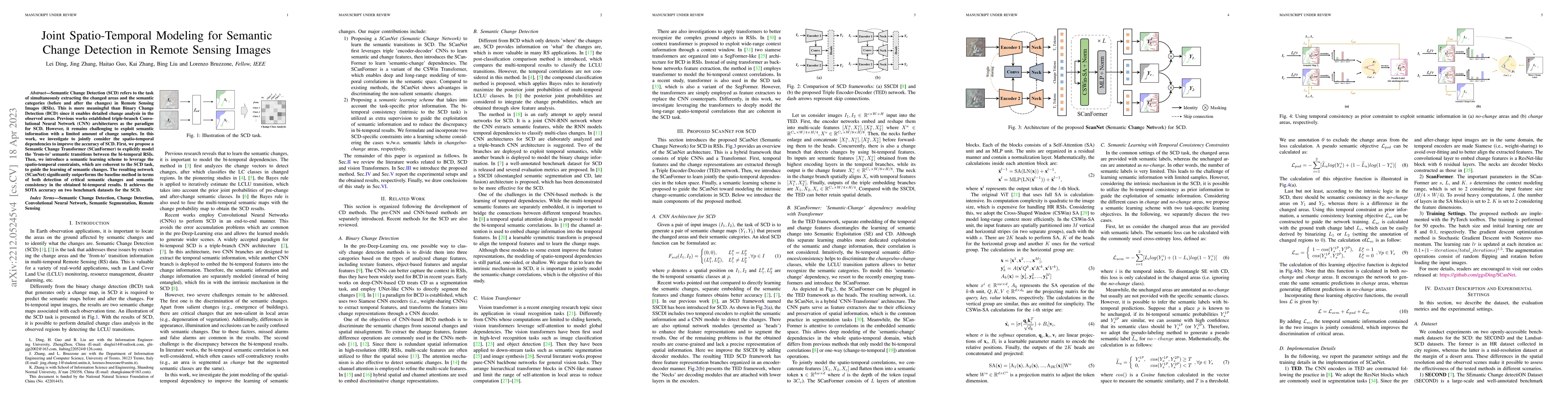
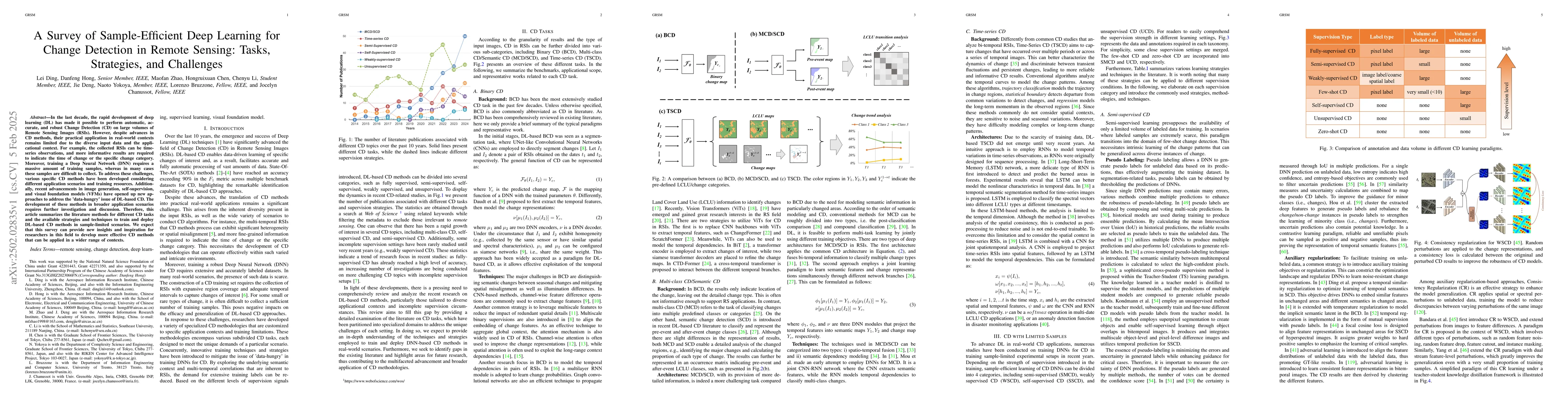
Semantic Change Detection (SCD) refers to the task of simultaneously extracting the changed areas and the semantic categories (before and after the changes) in Remote Sensing Images (RSIs). This is ...
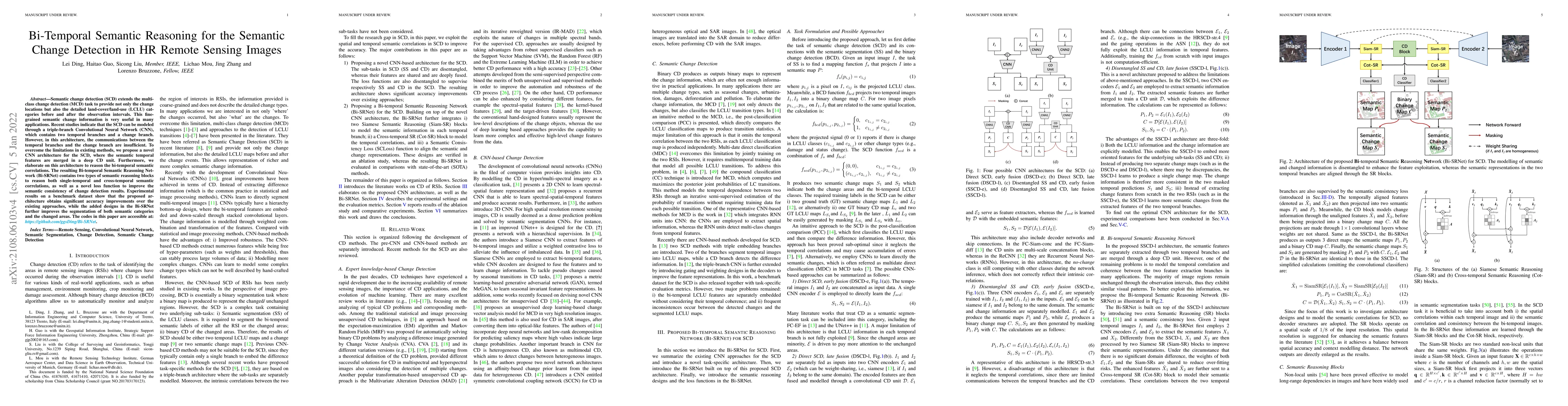
Semantic change detection (SCD) extends the multi-class change detection (MCD) task to provide not only the change locations but also the detailed land-cover/land-use (LCLU) categories before and af...
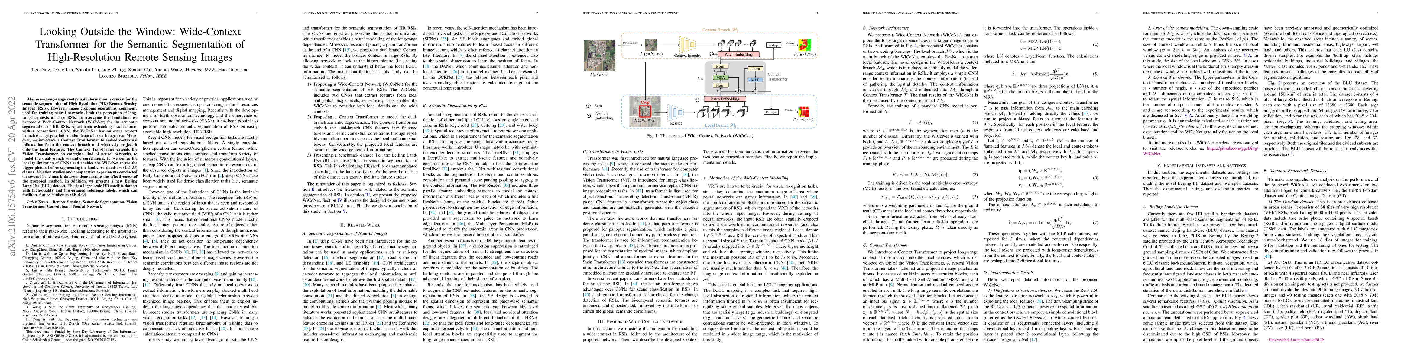
Long-range contextual information is crucial for the semantic segmentation of High-Resolution (HR) Remote Sensing Images (RSIs). However, image cropping operations, commonly used for training neural...
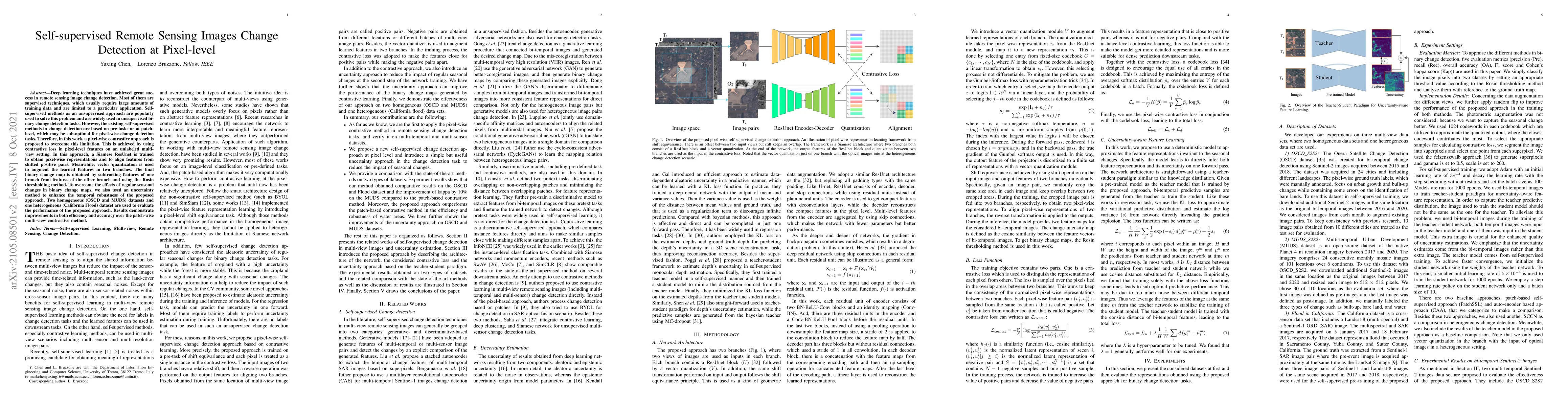
Deep learning techniques have achieved great success in remote sensing image change detection. Most of them are supervised techniques, which usually require large amounts of training data and are li...
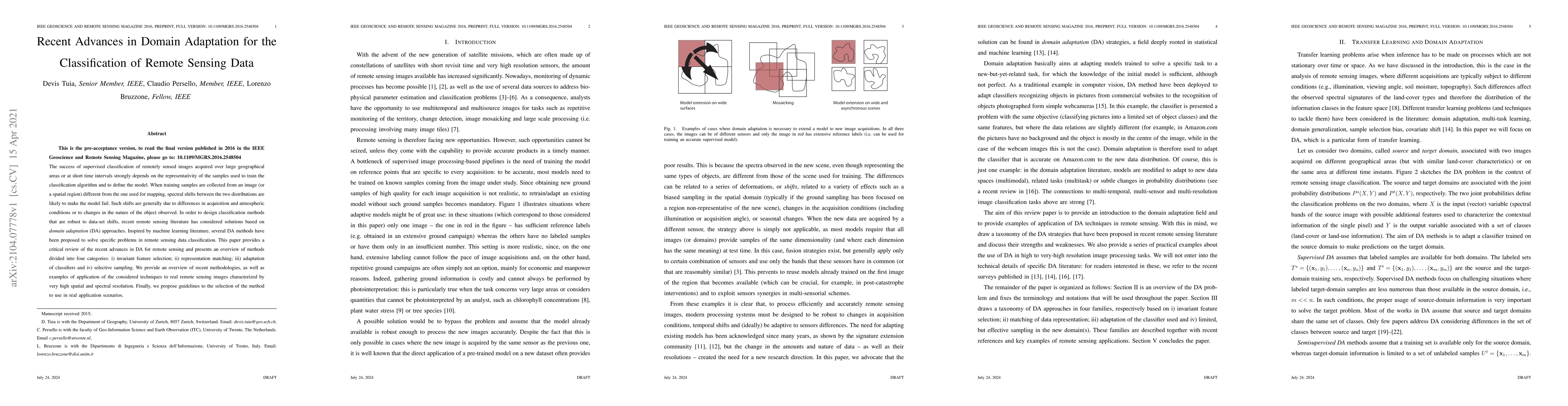
The success of supervised classification of remotely sensed images acquired over large geographical areas or at short time intervals strongly depends on the representativity of the samples used to t...
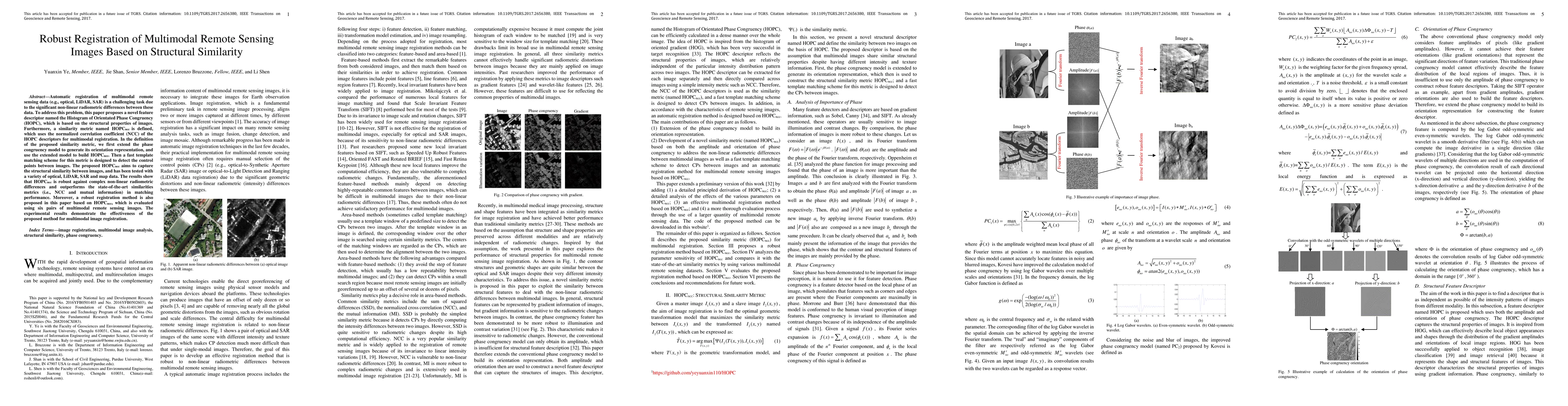
Automatic registration of multimodal remote sensing data (e.g., optical, LiDAR, SAR) is a challenging task due to the significant non-linear radiometric differences between these data. To address th...
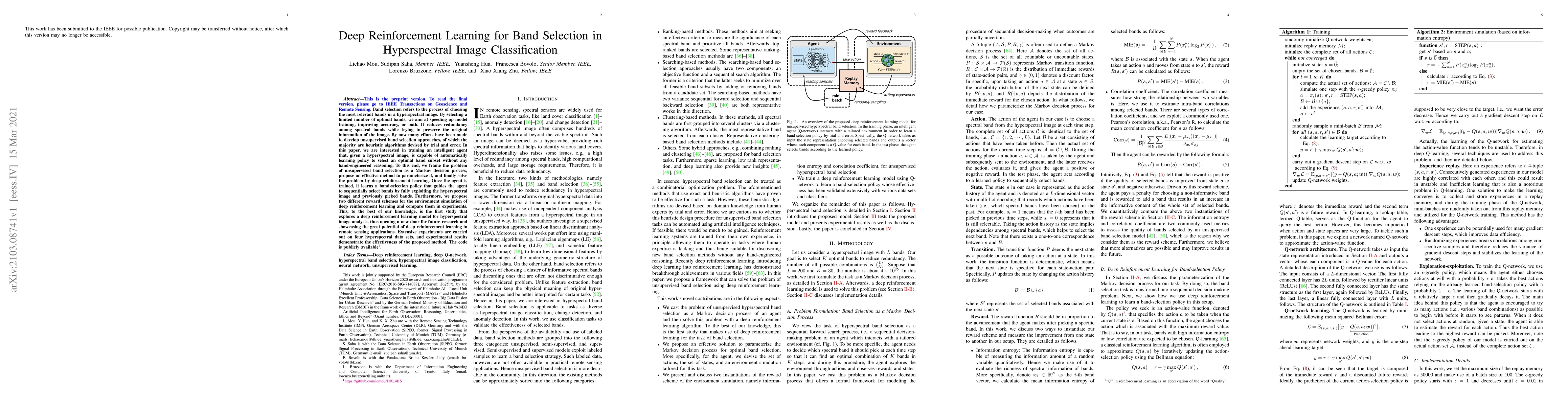
Band selection refers to the process of choosing the most relevant bands in a hyperspectral image. By selecting a limited number of optimal bands, we aim at speeding up model training, improving acc...
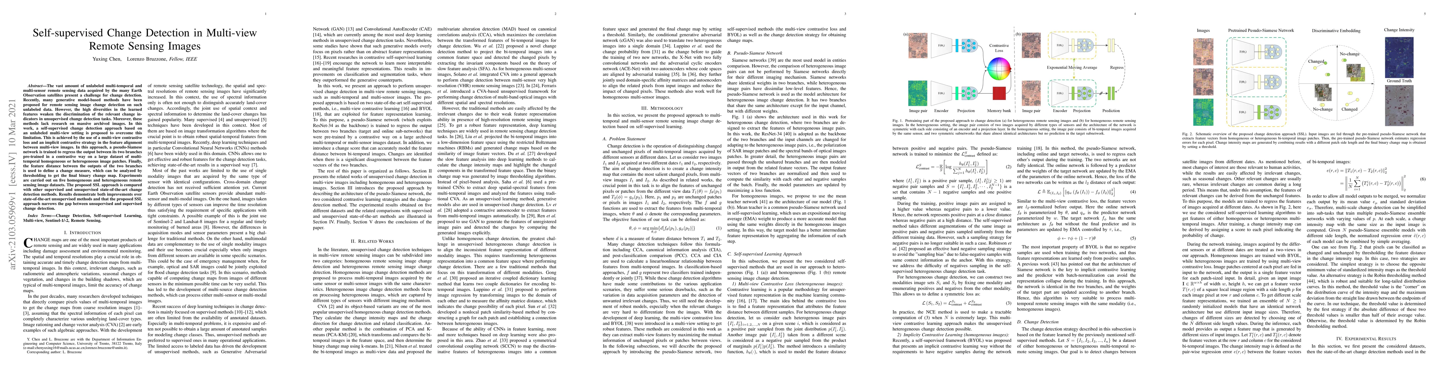
The vast amount of unlabeled multi-temporal and multi-sensor remote sensing data acquired by the many Earth Observation satellites present a challenge for change detection. Recently, many generative...
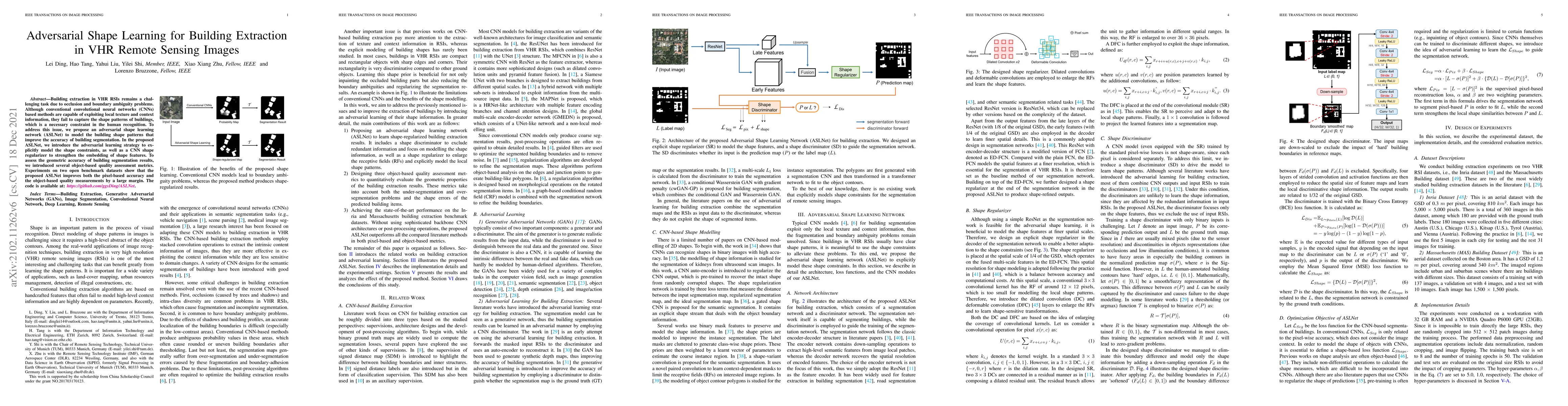
Building extraction in VHR RSIs remains a challenging task due to occlusion and boundary ambiguity problems. Although conventional convolutional neural networks (CNNs) based methods are capable of e...
Impact craters, as "lunar fossils", are the most dominant lunar surface features and occupy most of the Moon's surface. Their formation and evolution record the history of the Solar System. Sixty ye...
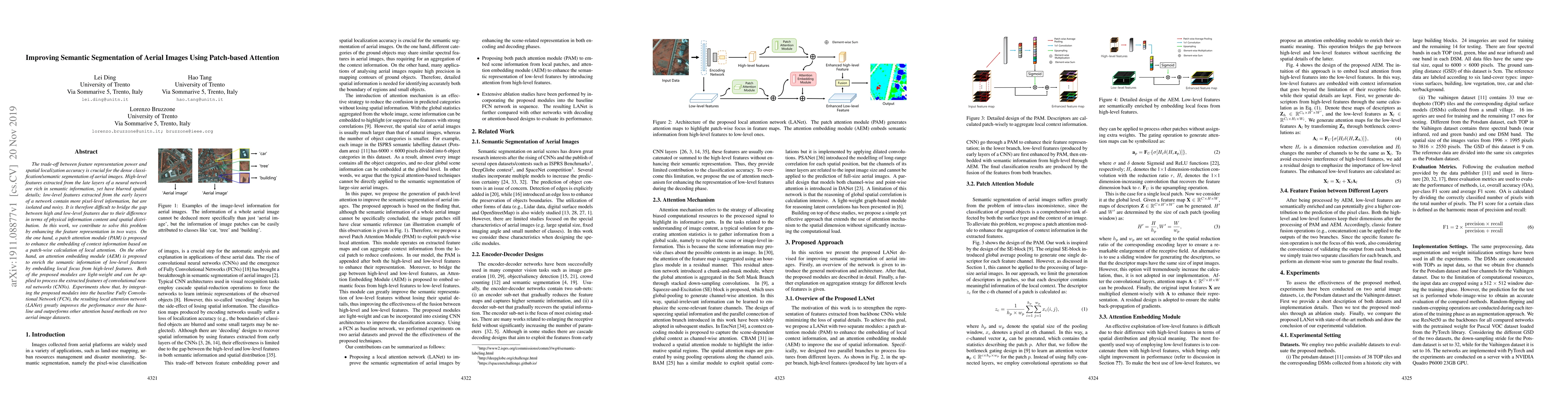
The trade-off between feature representation power and spatial localization accuracy is crucial for the dense classification/semantic segmentation of aerial images. High-level features extracted fro...
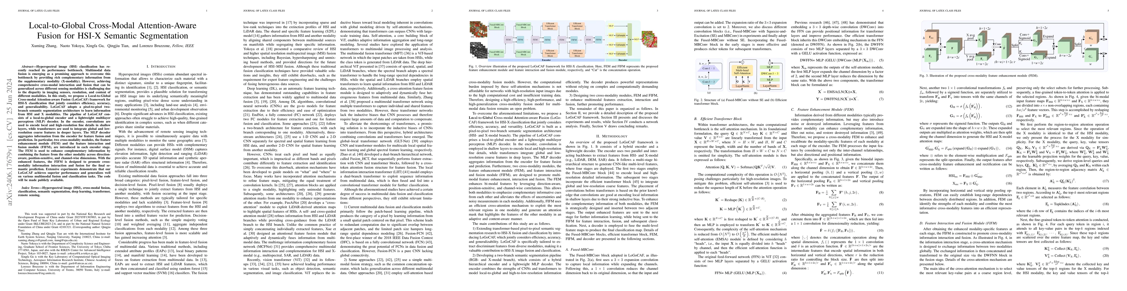
Improving hyperspectral image (HSI) semantic segmentation by exploiting complementary information from a supplementary data type (referred to X-modality) is promising but challenging due to difference...
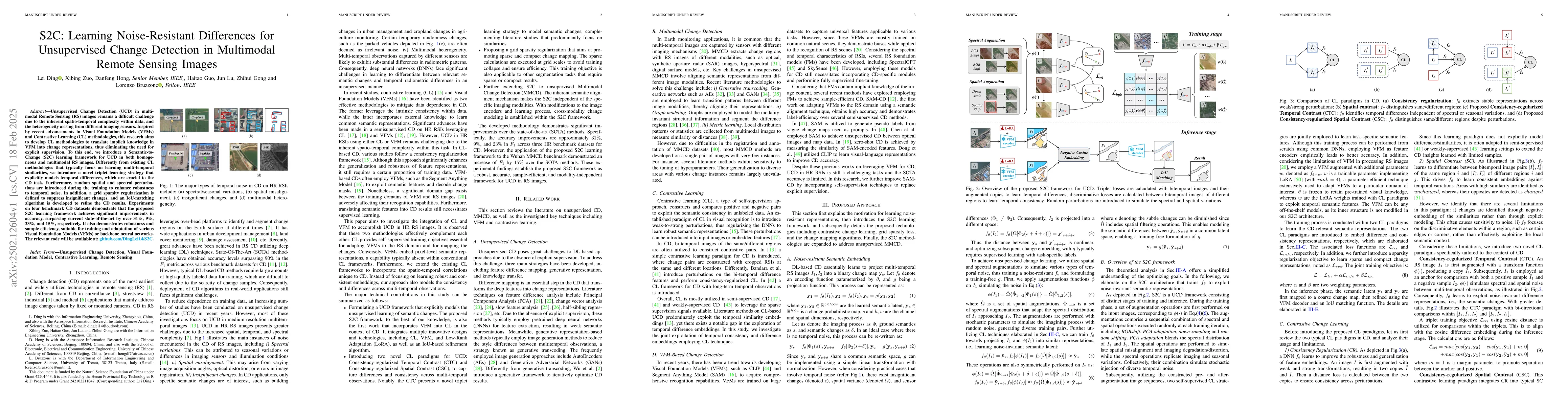
Unsupervised Change Detection (UCD) in multimodal Remote Sensing (RS) images remains a difficult challenge due to the inherent spatio-temporal complexity within data, and the heterogeneity arising fro...
In the last decade, the rapid development of deep learning (DL) has made it possible to perform automatic, accurate, and robust Change Detection (CD) on large volumes of Remote Sensing Images (RSIs). ...
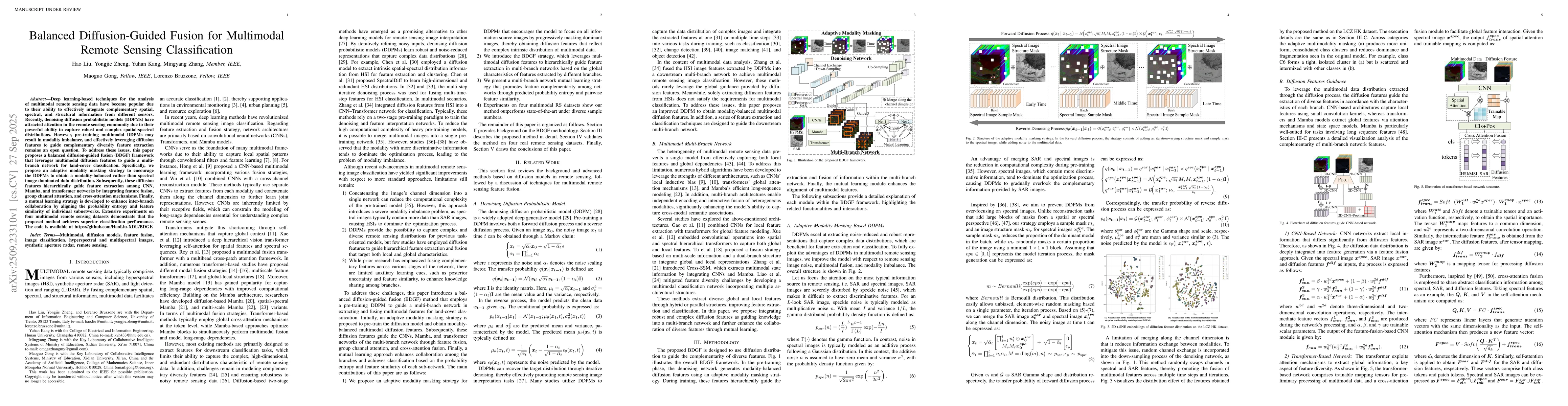
Deep learning-based techniques for the analysis of multimodal remote sensing data have become popular due to their ability to effectively integrate complementary spatial, spectral, and structural info...
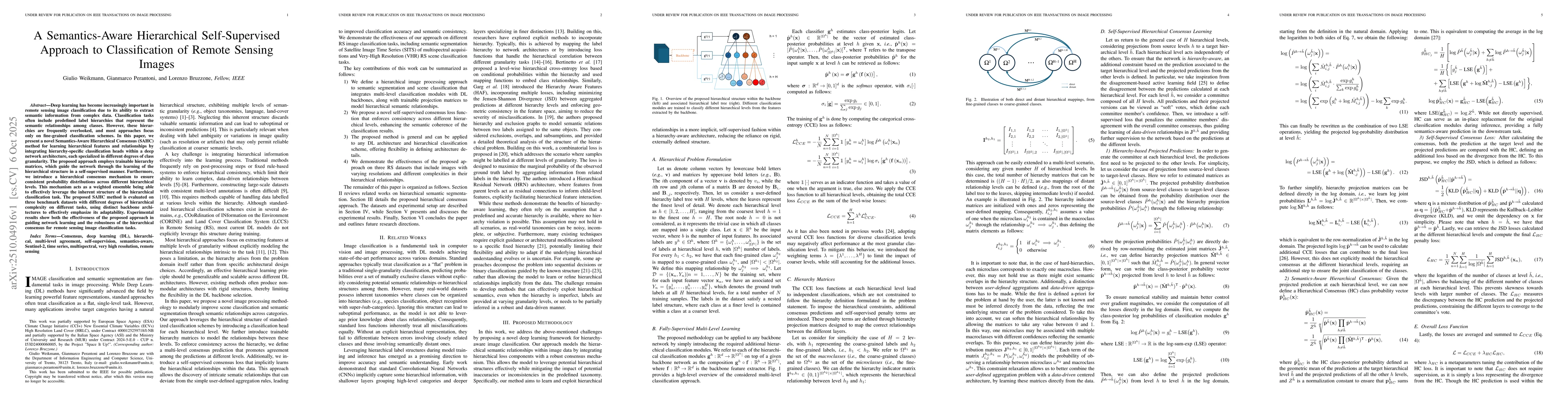
Deep learning has become increasingly important in remote sensing image classification due to its ability to extract semantic information from complex data. Classification tasks often include predefin...
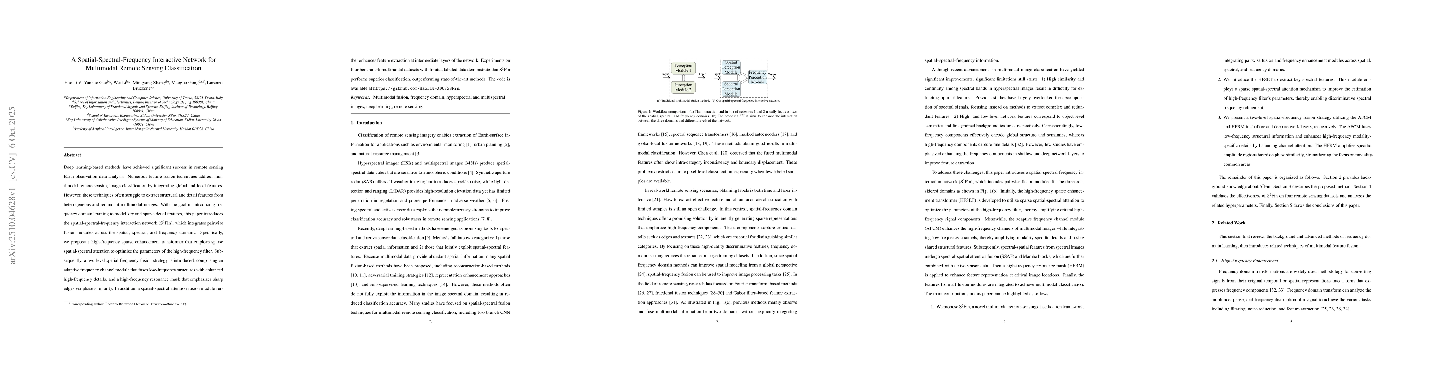
Deep learning-based methods have achieved significant success in remote sensing Earth observation data analysis. Numerous feature fusion techniques address multimodal remote sensing image classificati...
Deep learning has gained broad interest in remote sensing image scene classification thanks to the effectiveness of deep neural networks in extracting the semantics from complex data. However, deep ne...
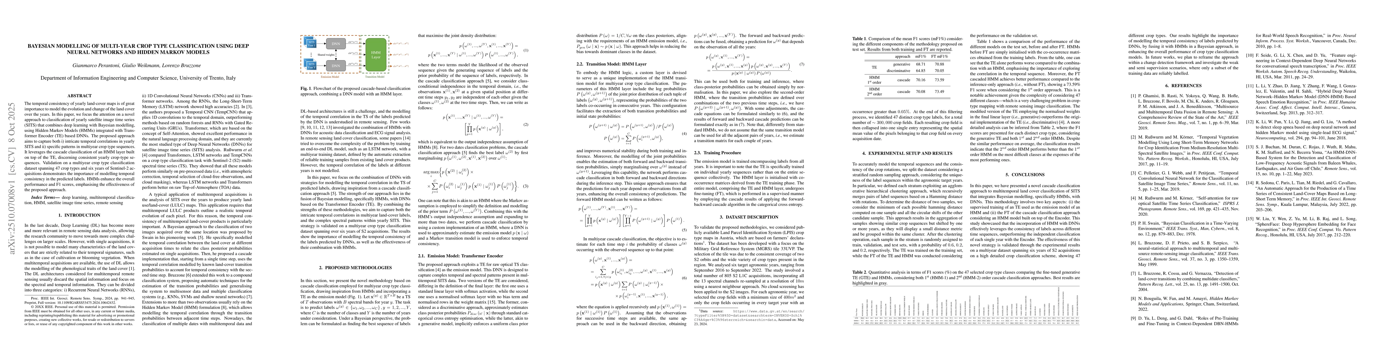
The temporal consistency of yearly land-cover maps is of great importance to model the evolution and change of the land cover over the years. In this paper, we focus the attention on a novel approach ...
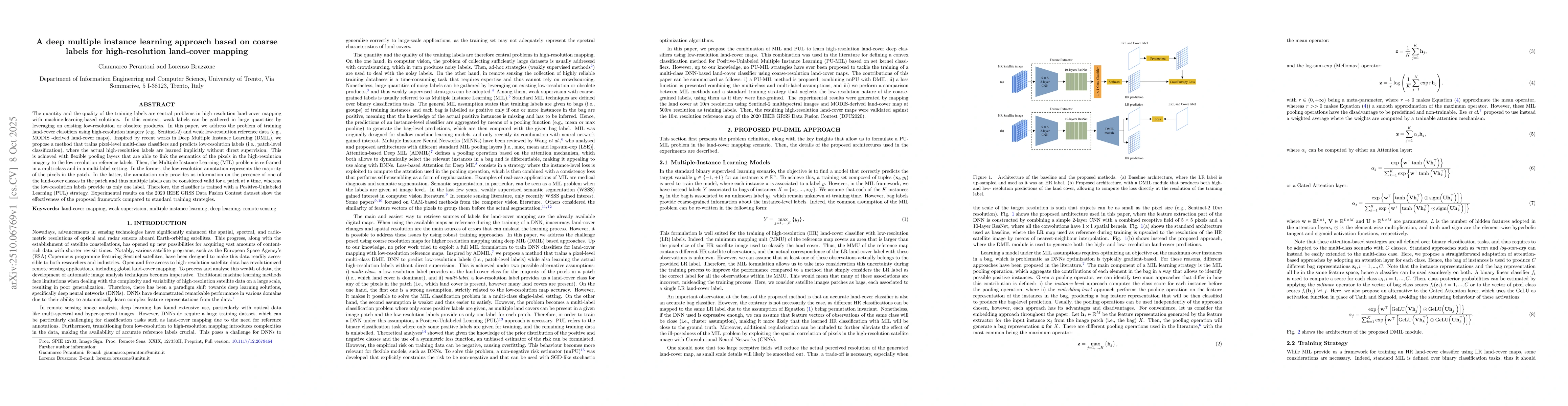
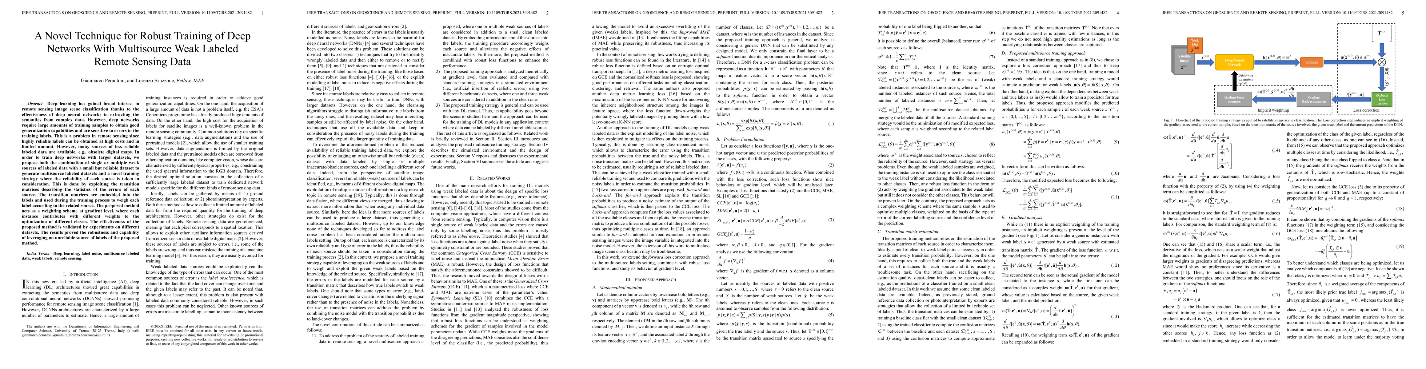
The quantity and the quality of the training labels are central problems in high-resolution land-cover mapping with machine-learning-based solutions. In this context, weak labels can be gathered in la...

The introduction of new generation hyperspectral satellite sensors, combined with advancements in deep learning methodologies, has significantly enhanced the ability to discriminate detailed land-cove...
Multi-label classification (MLC) offers a more comprehensive semantic understanding of Remote Sensing (RS) imagery compared to traditional single-label classification (SLC). However, obtaining complet...
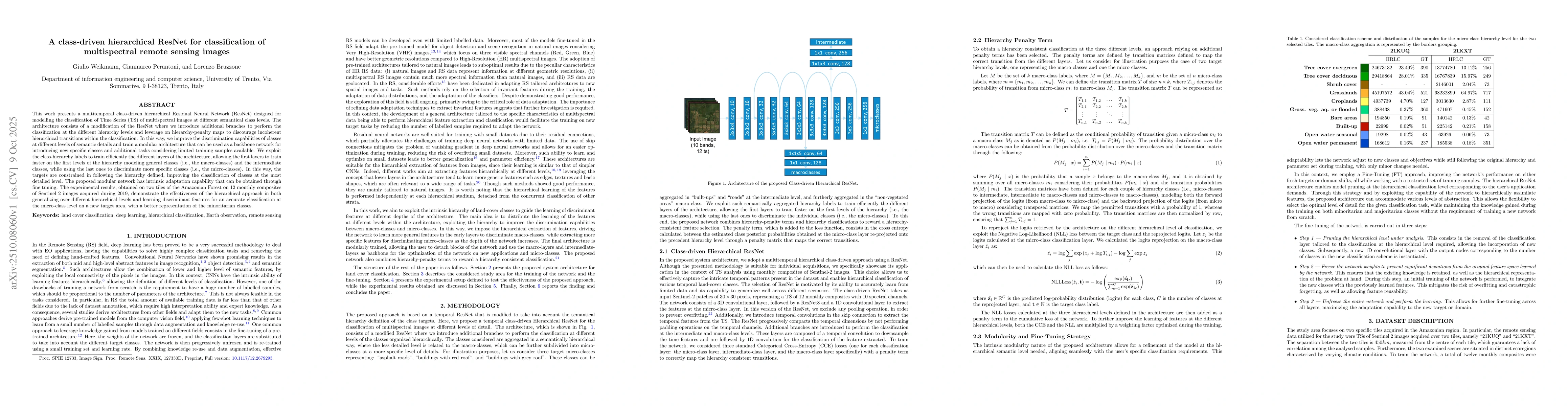
This work presents a multitemporal class-driven hierarchical Residual Neural Network (ResNet) designed for modelling the classification of Time Series (TS) of multispectral images at different semanti...
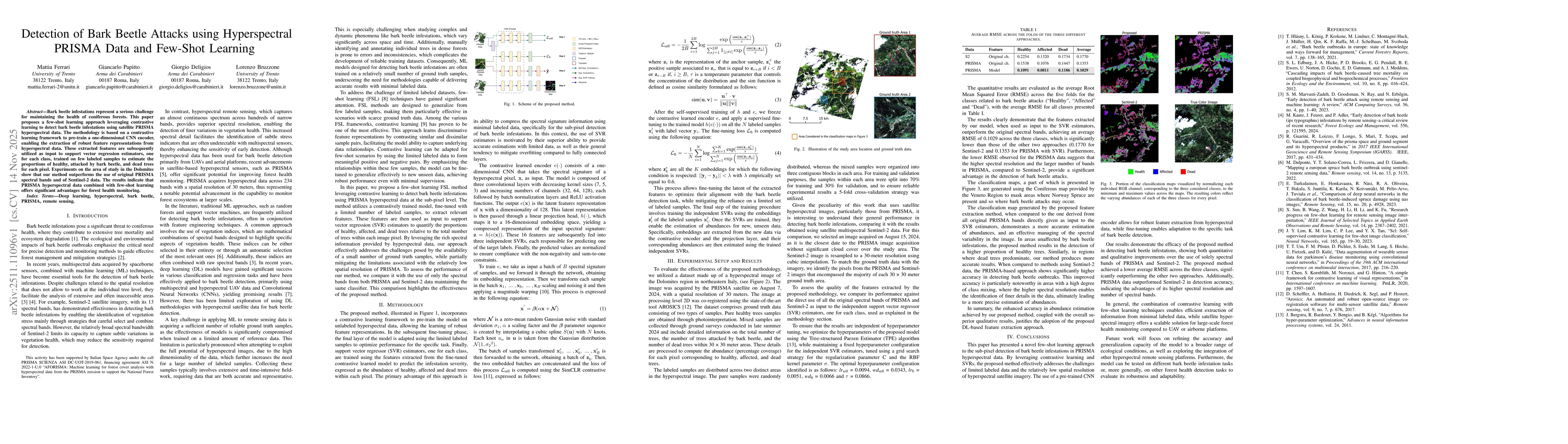
Bark beetle infestations represent a serious challenge for maintaining the health of coniferous forests. This paper proposes a few-shot learning approach leveraging contrastive learning to detect bark...
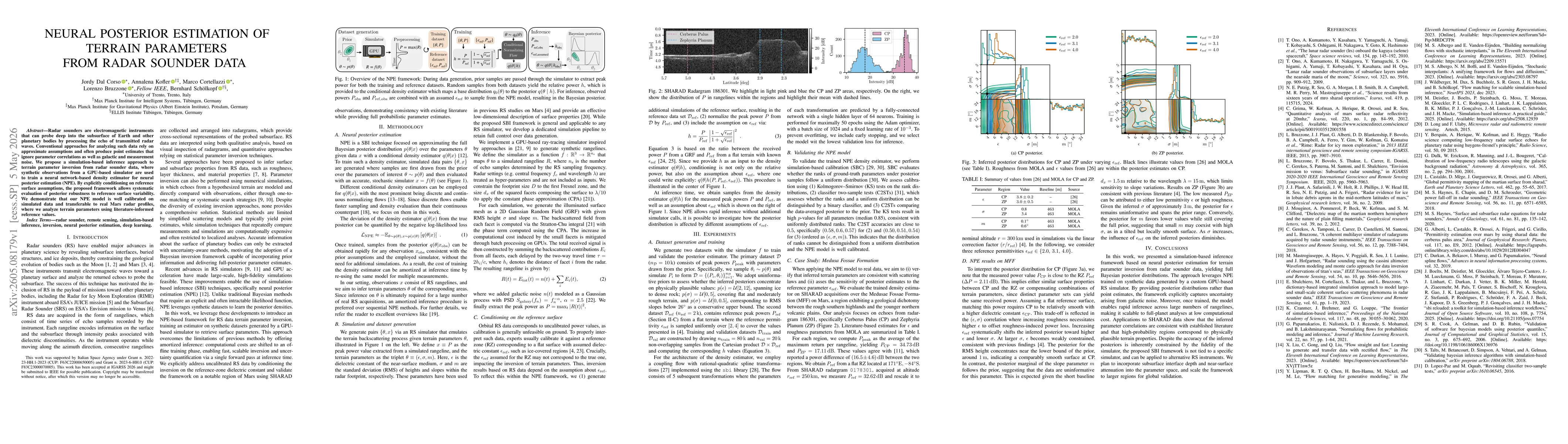
Radar sounders are electromagnetic instruments that can probe deep into the subsurface of Earth and other planetary bodies by processing the echo of transmitted radar waves. Conventional approaches fo...