Academic Profile
Statistics
Similar Authors
Papers on arXiv
Synthetic Aperture Radar (SAR) imagery is the primary data type used for sea ice mapping due to its spatio-temporal coverage and the ability to detect sea ice independent of cloud and lighting condi...
We present FastNet version 1.0, a data-driven medium range numerical weather prediction (NWP) model based on a Graph Neural Network architecture, developed jointly between the Alan Turing Institute an...
Machine learning weather prediction (MLWP) models have demonstrated remarkable potential in delivering accurate forecasts at significantly reduced computational cost compared to traditional numerical ...
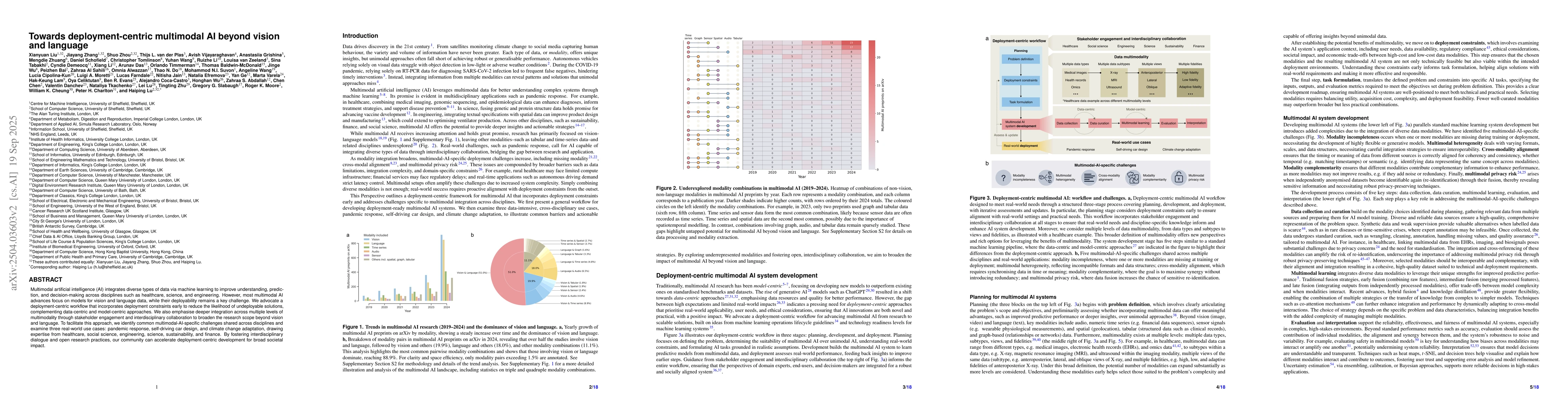
Multimodal artificial intelligence (AI) integrates diverse types of data via machine learning to improve understanding, prediction, and decision-making across disciplines such as healthcare, science, ...
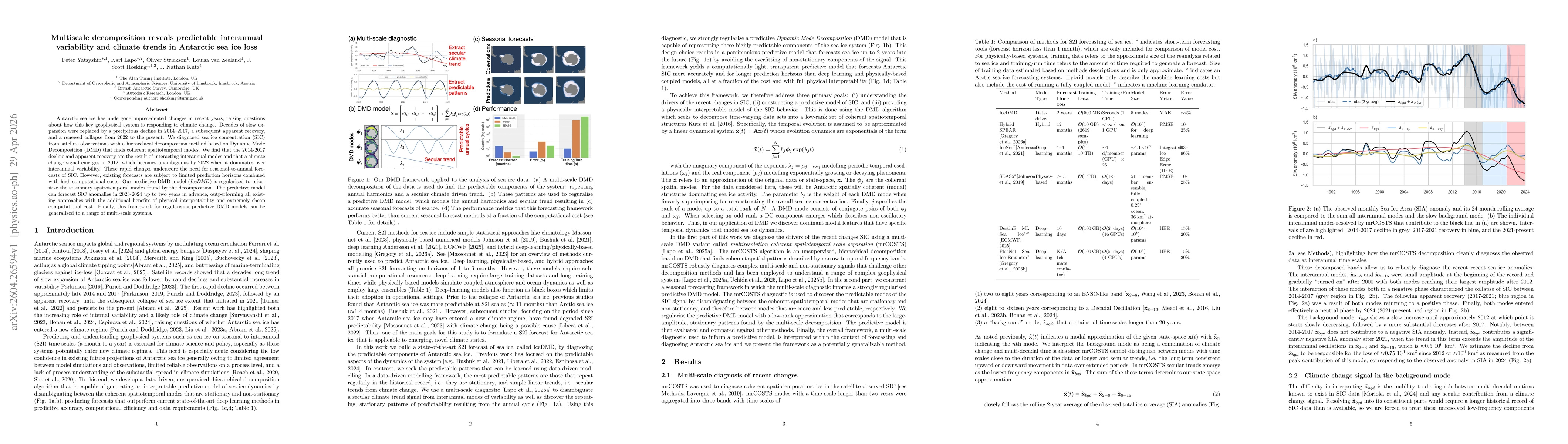
Antarctic sea ice has undergone unprecedented changes in recent years, raising questions about how this key geophysical system is responding to climate change. Decades of slow expansion were replaced ...