Academic Profile
Statistics
Similar Authors
Papers on arXiv
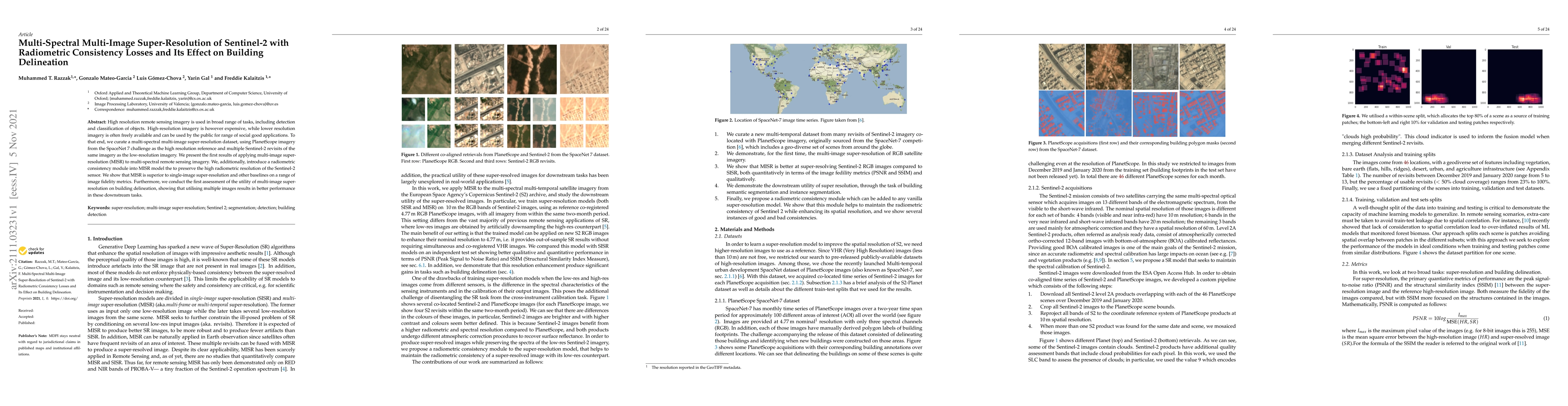
High resolution remote sensing imagery is used in broad range of tasks, including detection and classification of objects. High-resolution imagery is however expensive, while lower resolution imager...
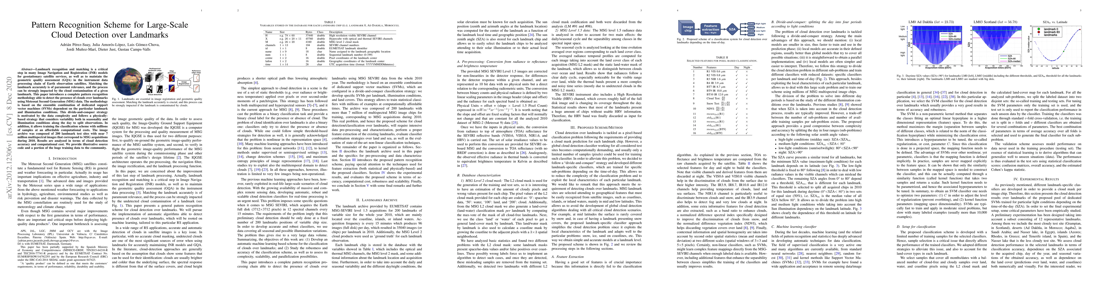
Landmark recognition and matching is a critical step in many Image Navigation and Registration (INR) models for geostationary satellite services, as well as to maintain the geometric quality assessm...
Satellite remote sensing has been widely used in the last decades for agricultural applications, {both for assessing vegetation condition and for subsequent yield prediction.} Existing remote sensin...
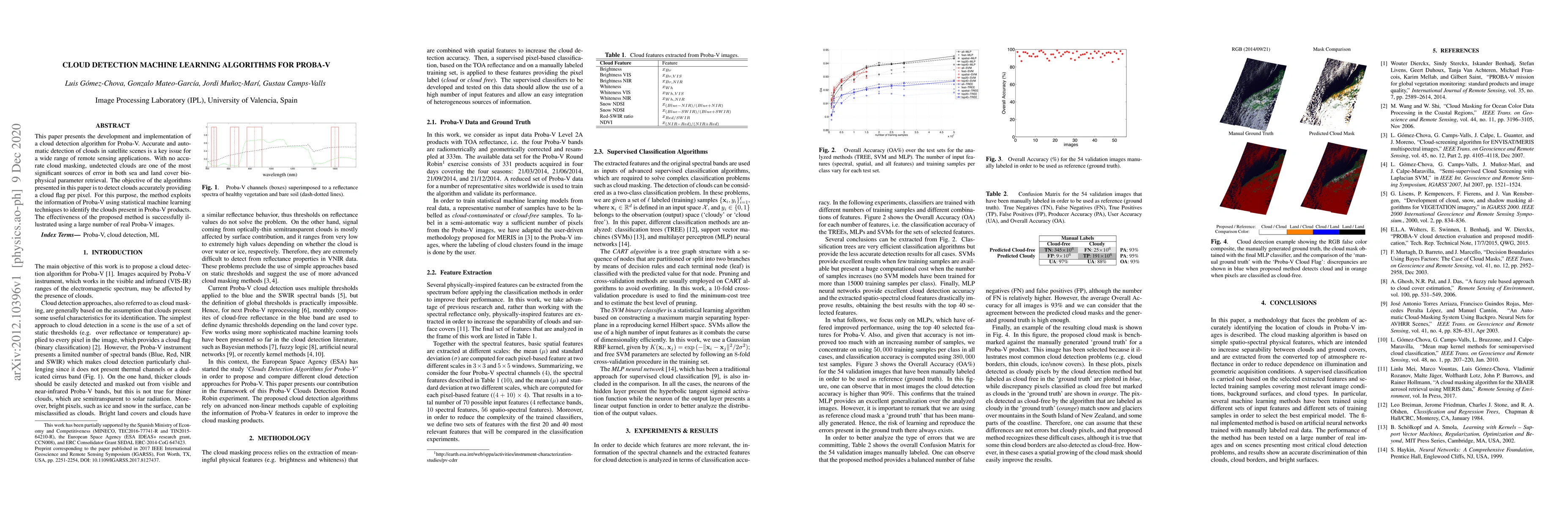
This paper presents the development and implementation of a cloud detection algorithm for Proba-V. Accurate and automatic detection of clouds in satellite scenes is a key issue for a wide range of r...
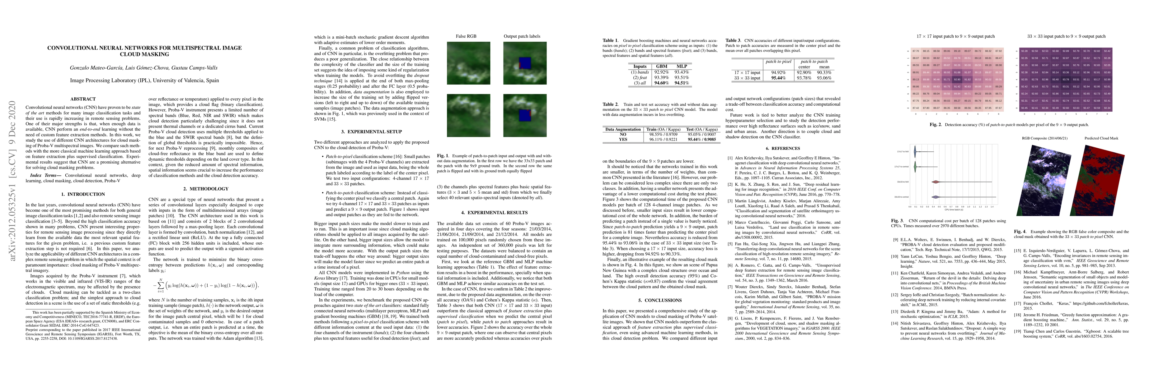
Convolutional neural networks (CNN) have proven to be state of the art methods for many image classification tasks and their use is rapidly increasing in remote sensing problems. One of their major ...
Dealing with land cover classification of the new image sources has also turned to be a complex problem requiring large amount of memory and processing time. In order to cope with these problems, st...
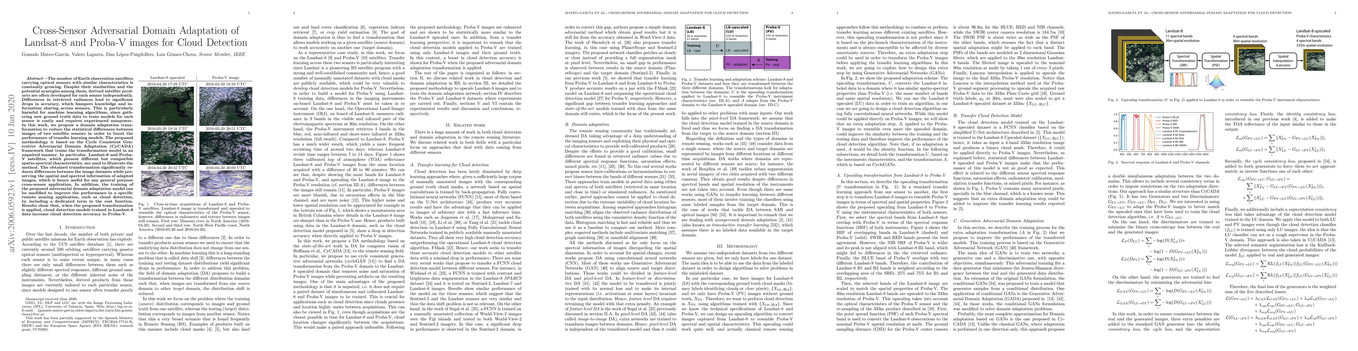
The number of Earth observation satellites carrying optical sensors with similar characteristics is constantly growing. Despite their similarities and the potential synergies among them, derived sat...
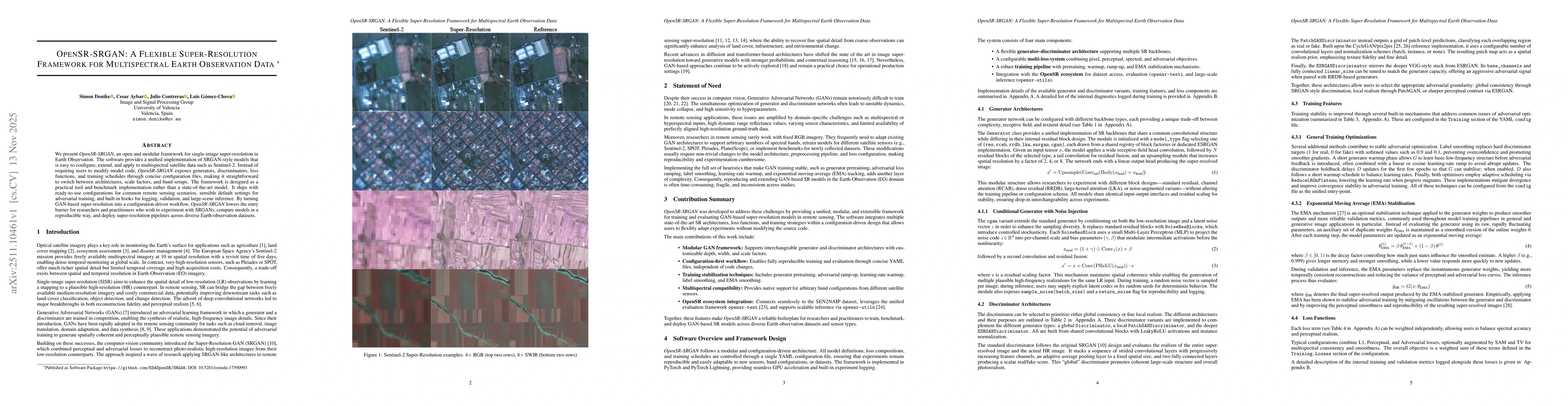
We present OpenSR-SRGAN, an open and modular framework for single-image super-resolution in Earth Observation. The software provides a unified implementation of SRGAN-style models that is easy to conf...
Earth observation (EO) is essential to understanding the Earth system, enabling the transformation of planetary properties into measurable variables that can be analysed, compared, and modelled. In re...