Academic Profile
Statistics
Similar Authors
Papers on arXiv
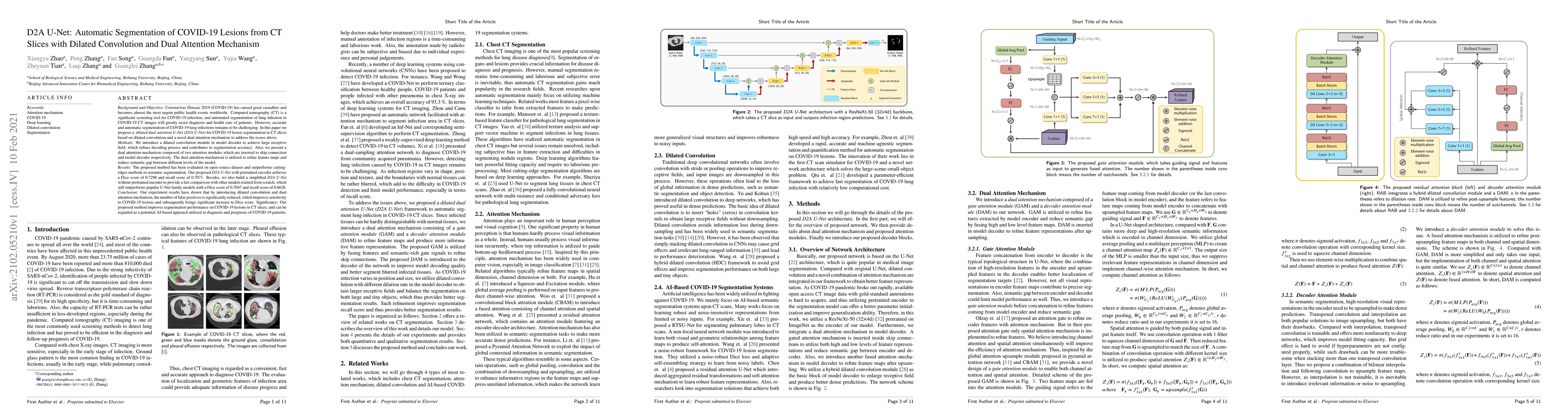
Coronavirus Disease 2019 (COVID-19) has caused great casualties and becomes almost the most urgent public health events worldwide. Computed tomography (CT) is a significant screening tool for COVID-...
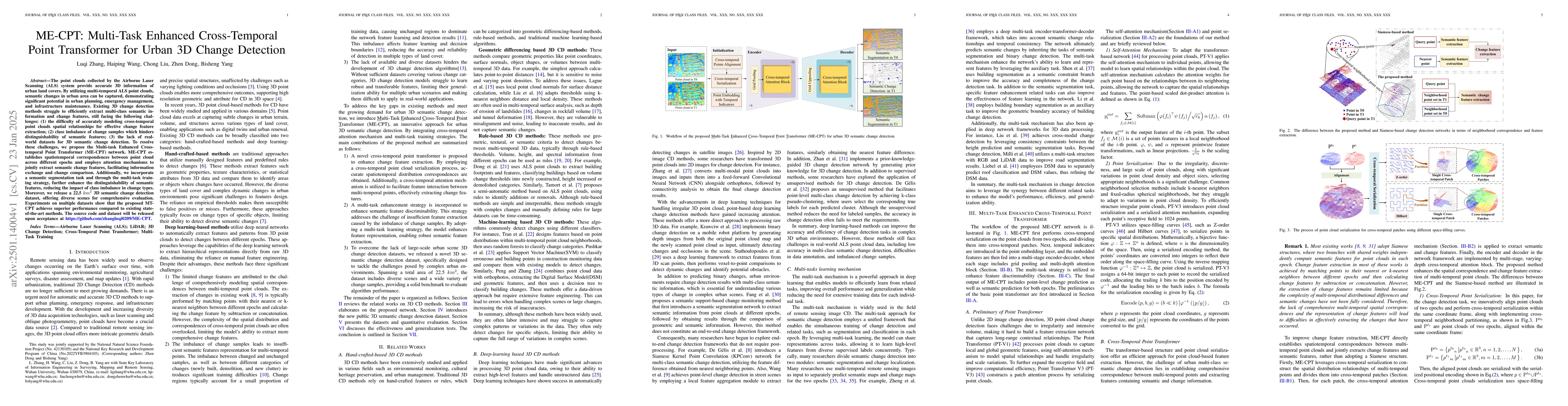
The point clouds collected by the Airborne Laser Scanning (ALS) system provide accurate 3D information of urban land covers. By utilizing multi-temporal ALS point clouds, semantic changes in urban are...
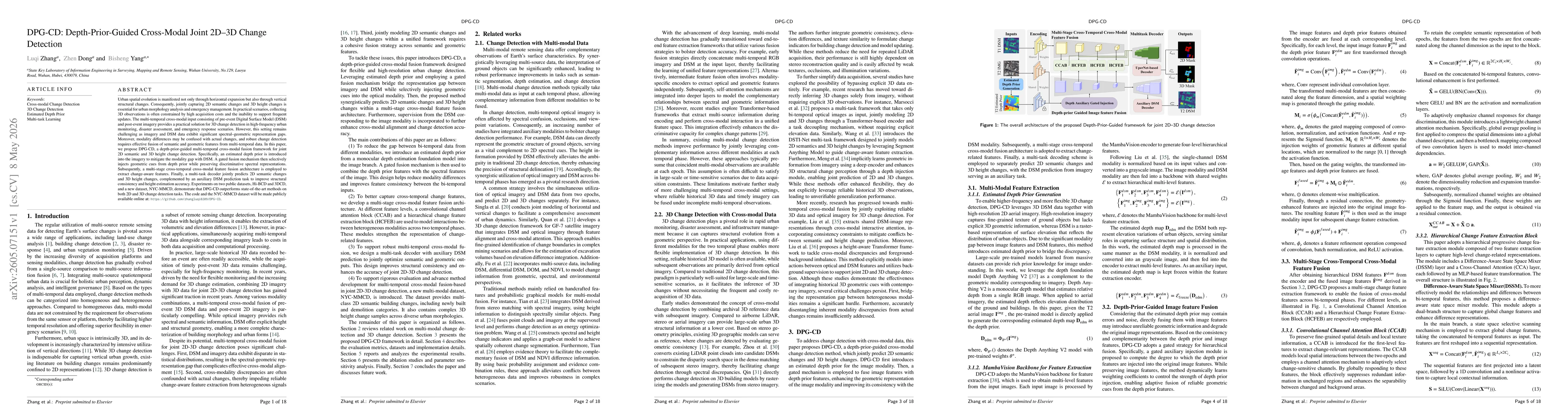
Urban spatial evolution is manifested not only through horizontal expansion but also through vertical structural changes. Consequently, jointly capturing 2D semantic changes and 3D height changes is e...