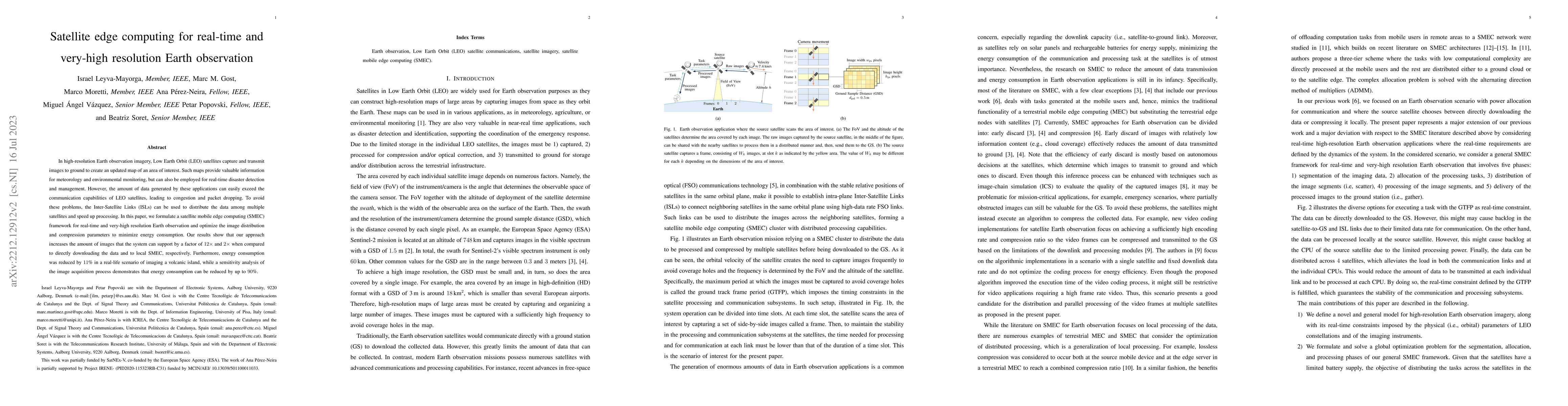
1
arXiv Papers
3
Total Publications
Profile
Academic Profile
Metrics
Statistics
1
arXiv Papers
3
Total Publications
Network
Similar Authors
Publications
Papers on arXiv
arXiv
Satellite edge computing for real-time and very-high resolution Earth
observation
In real-time and high-resolution Earth observation imagery, Low Earth Orbit (LEO) satellites capture images that are subsequently transmitted to ground to create an updated map of an area of interes...