Academic Profile
Statistics
Similar Authors
Papers on arXiv
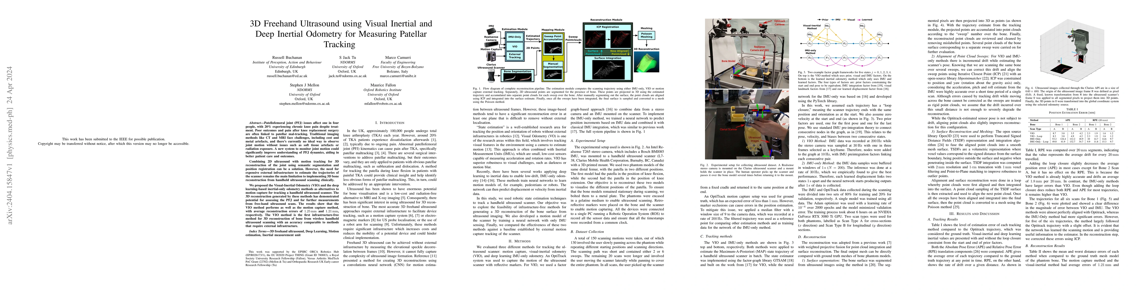
Patellofemoral joint (PFJ) issues affect one in four people, with 20% experiencing chronic knee pain despite treatment. Poor outcomes and pain after knee replacement surgery are often linked to pate...
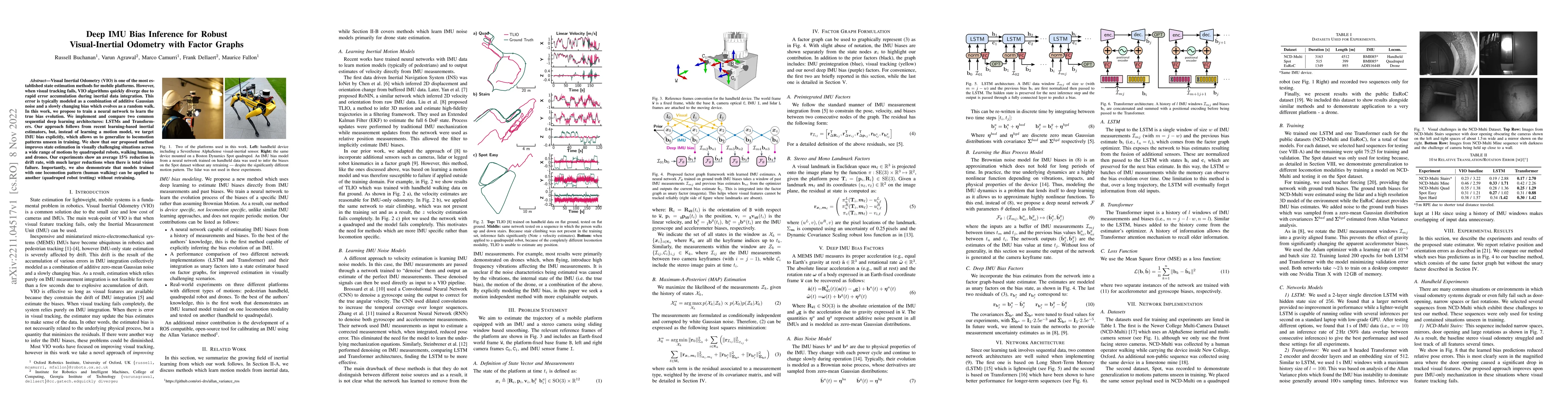
Visual Inertial Odometry (VIO) is one of the most established state estimation methods for mobile platforms. However, when visual tracking fails, VIO algorithms quickly diverge due to rapid error ac...
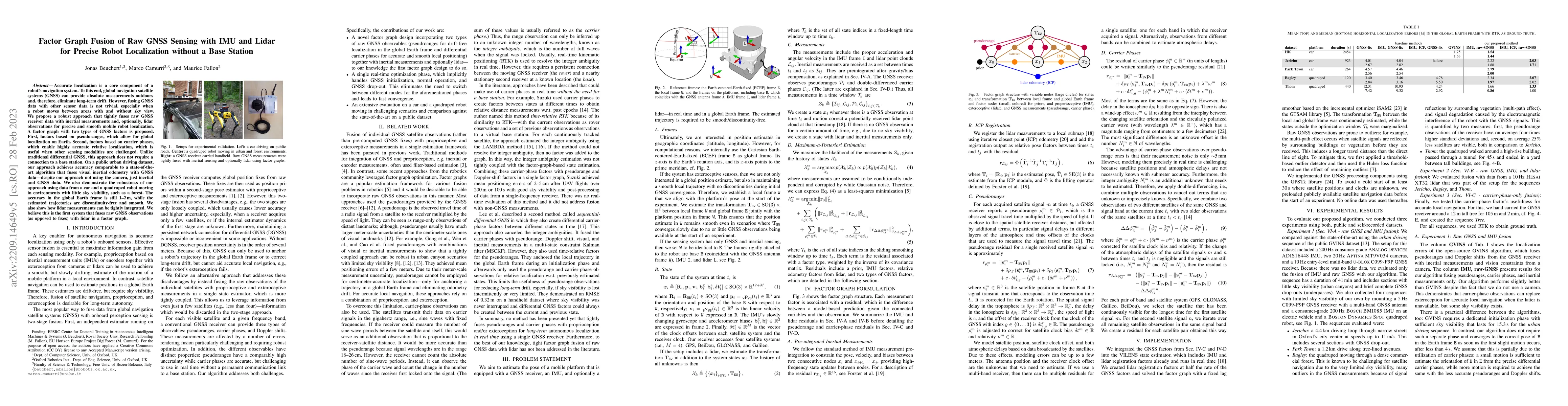
Accurate localization is a core component of a robot's navigation system. To this end, global navigation satellite systems (GNSS) can provide absolute measurements outdoors and, therefore, eliminate...
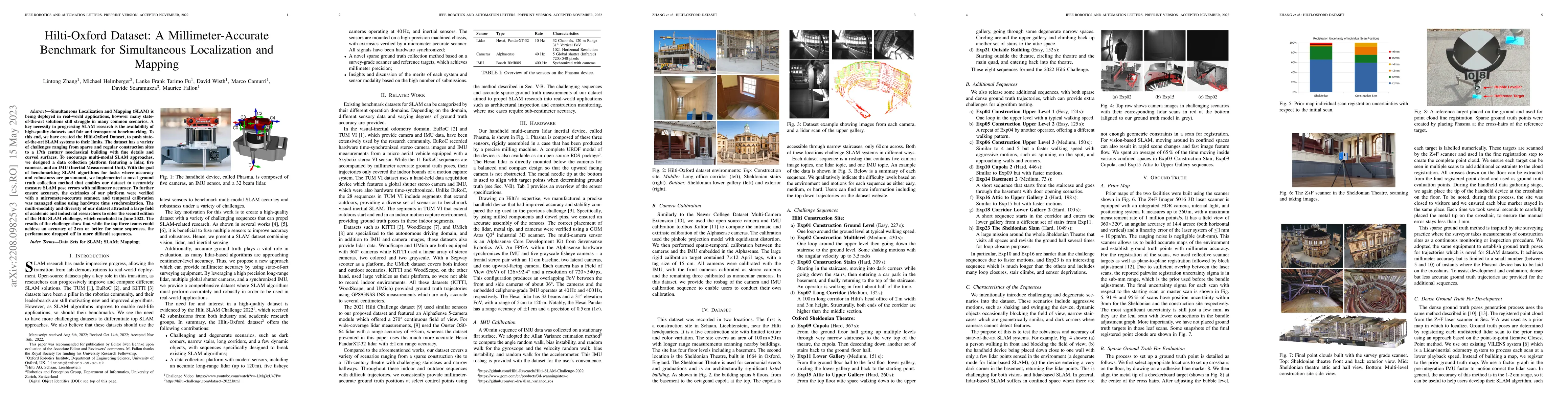
Simultaneous Localization and Mapping (SLAM) is being deployed in real-world applications, however many state-of-the-art solutions still struggle in many common scenarios. A key necessity in progres...
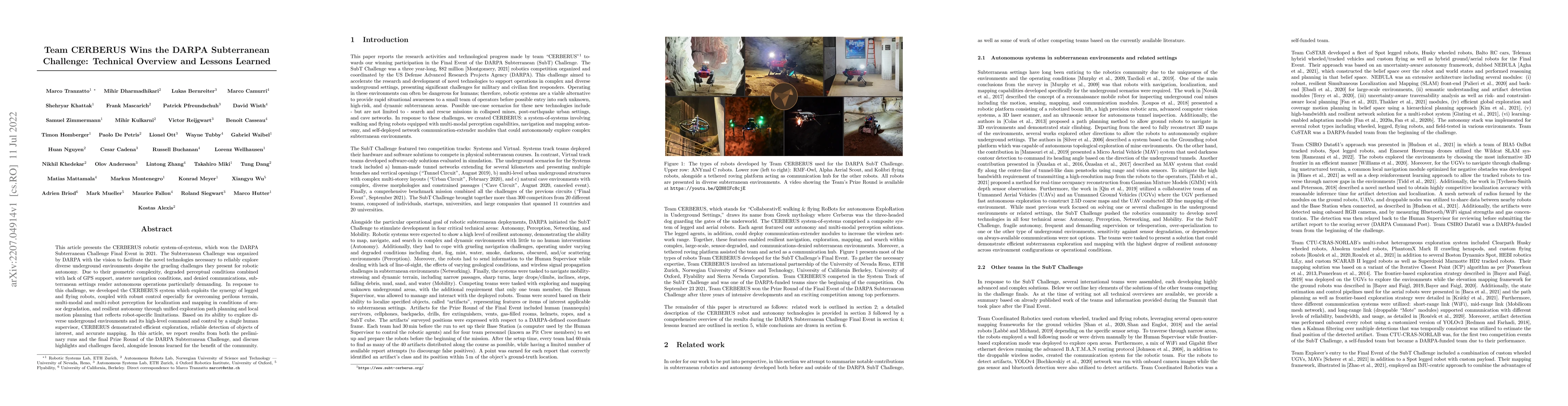
This article presents the CERBERUS robotic system-of-systems, which won the DARPA Subterranean Challenge Final Event in 2021. The Subterranean Challenge was organized by DARPA with the vision to fac...
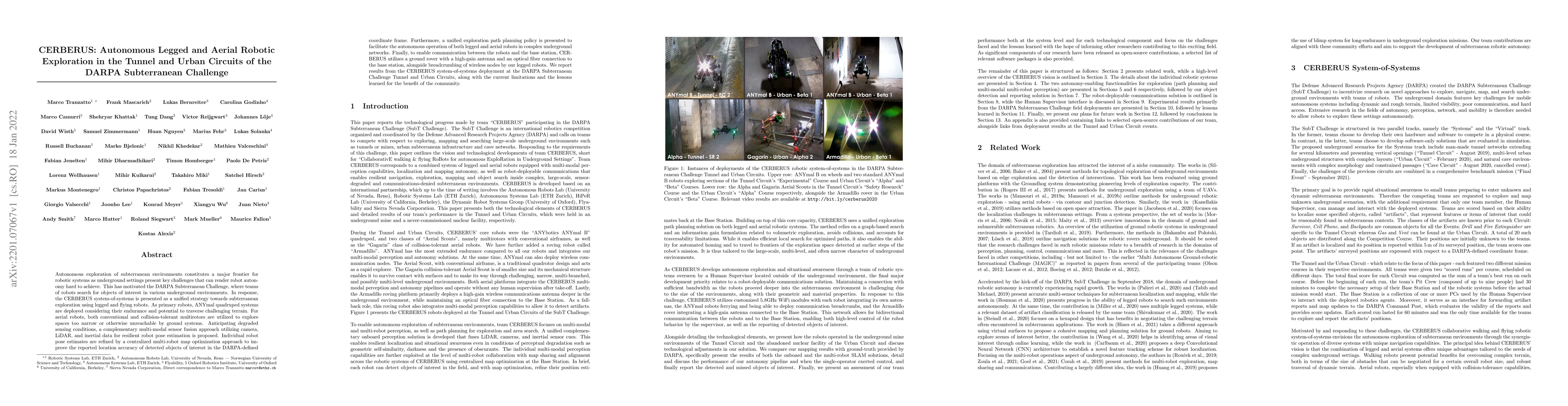
Autonomous exploration of subterranean environments constitutes a major frontier for robotic systems as underground settings present key challenges that can render robot autonomy hard to achieve. Th...
We present a multi-camera LiDAR inertial dataset of 4.5 km walking distance as an expansion of the Newer College Dataset. The global shutter multi-camera device is hardware synchronized with both th...
This paper introduces a novel proprioceptive state estimator for legged robots based on a learned displacement measurement from IMU data. Recent research in pedestrian tracking has shown that motion...
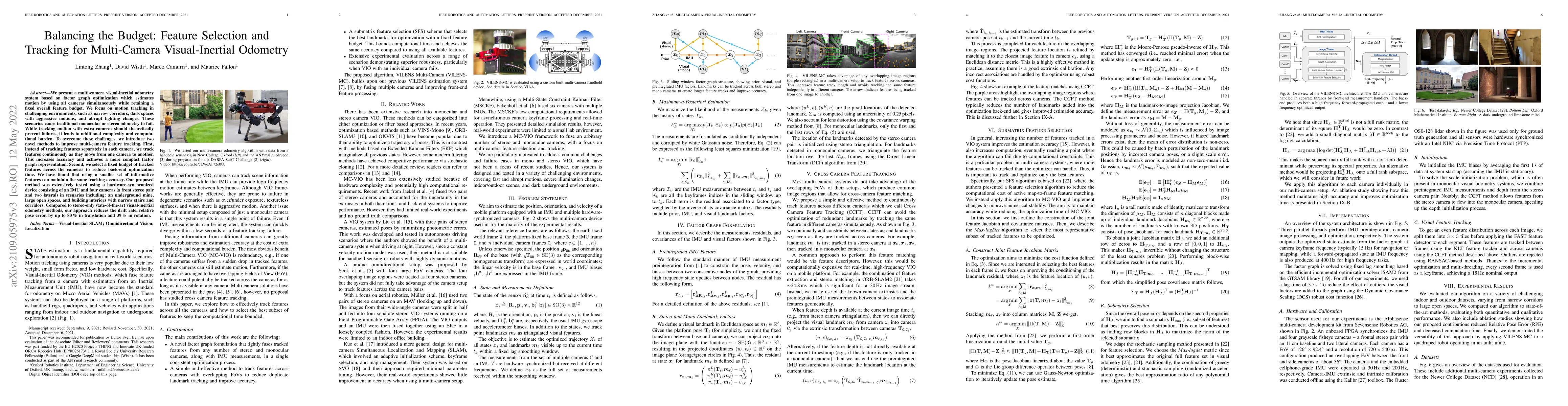
We present a multi-camera visual-inertial odometry system based on factor graph optimization which estimates motion by using all cameras simultaneously while retaining a fixed overall feature budget...
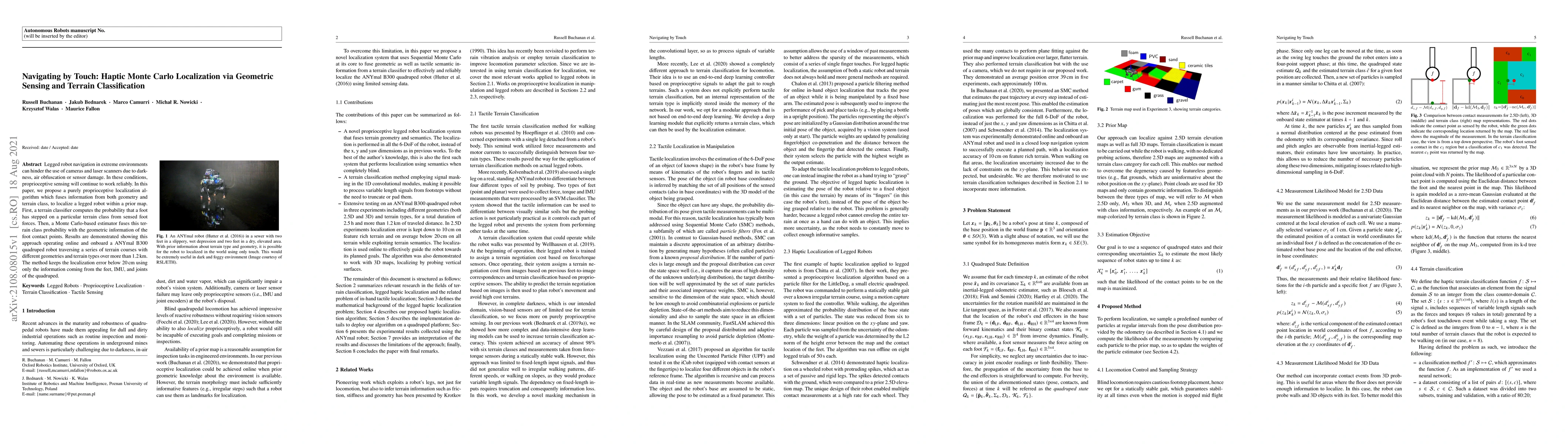
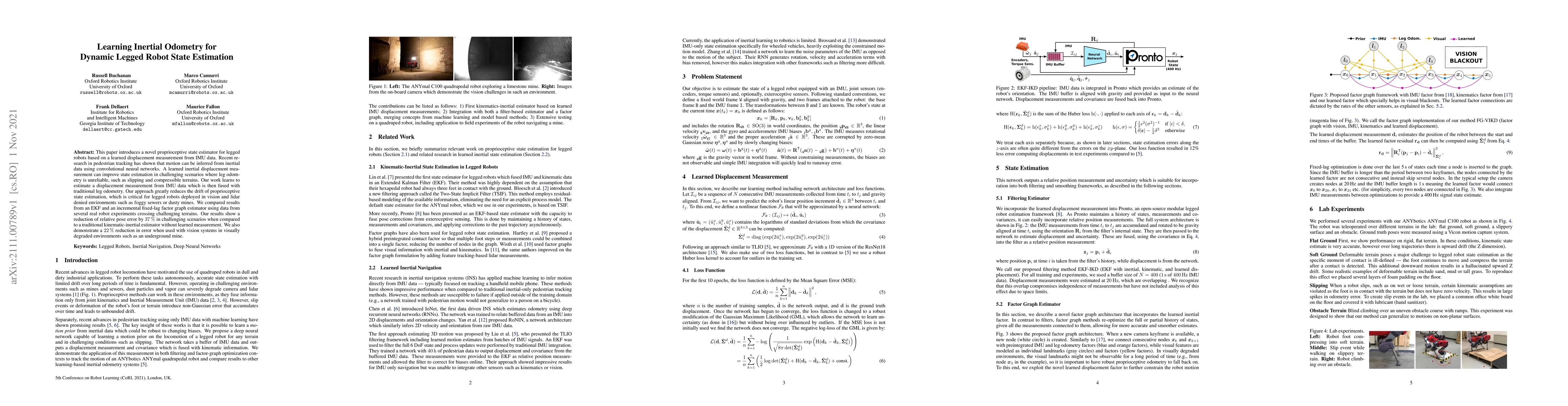
Legged robot navigation in extreme environments can hinder the use of cameras and laser scanners due to darkness, air obfuscation or sensor damage. In these conditions, proprioceptive sensing will c...
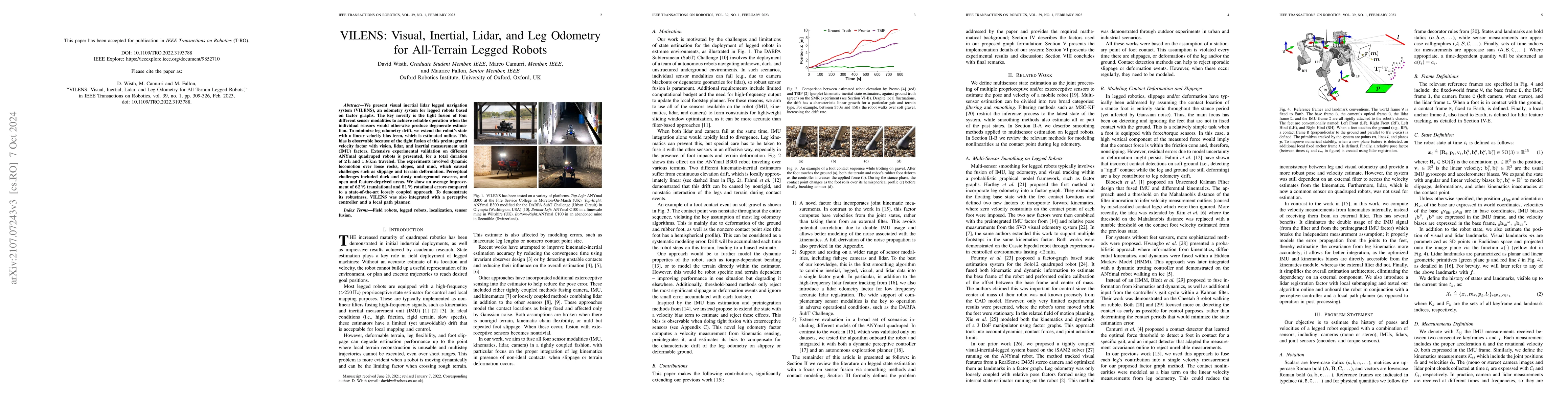
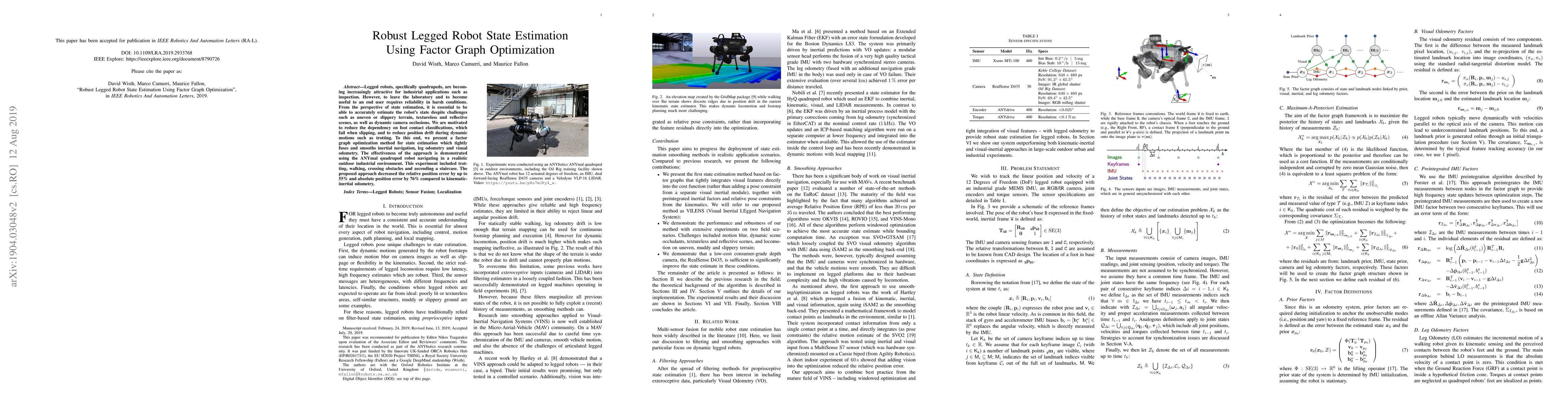
We present VILENS (Visual Inertial Lidar Legged Navigation System), an odometry system for legged robots based on factor graphs. The key novelty is the tight fusion of four different sensor modaliti...
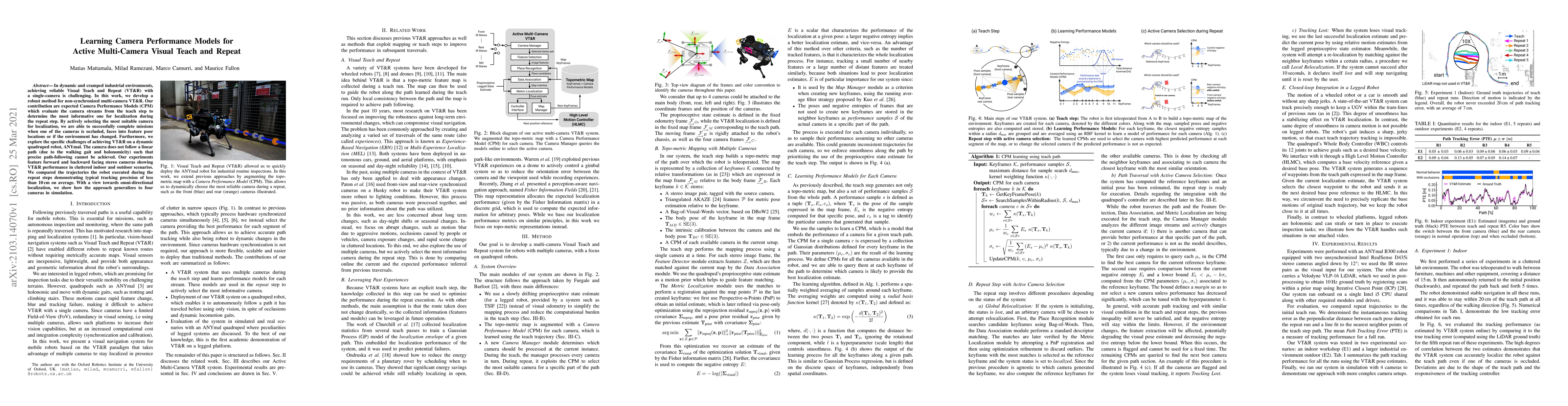
In dynamic and cramped industrial environments, achieving reliable Visual Teach and Repeat (VT&R) with a single-camera is challenging. In this work, we develop a robust method for non-synchronized m...
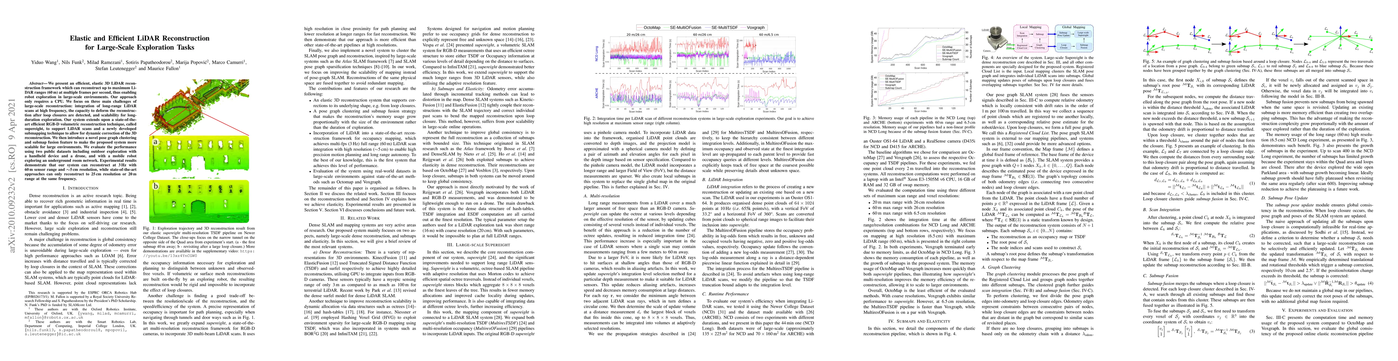
We present an efficient, elastic 3D LiDAR reconstruction framework which can reconstruct up to maximum LiDAR ranges (60 m) at multiple frames per second, thus enabling robot exploration in large-sca...
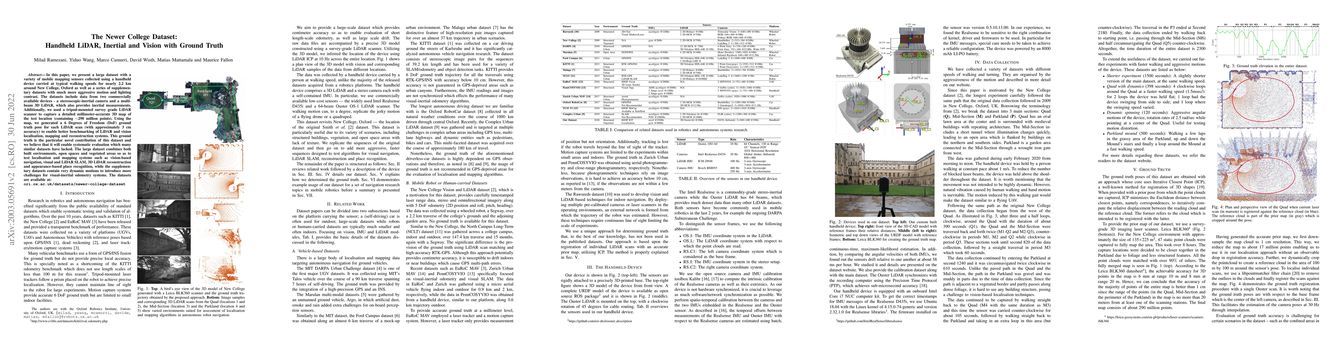
In this paper we present a large dataset with a variety of mobile mapping sensors collected using a handheld device carried at typical walking speeds for nearly 2.2 km through New College, Oxford. T...
Legged robots, specifically quadrupeds, are becoming increasingly attractive for industrial applications such as inspection. However, to leave the laboratory and to become useful to an end user requ...
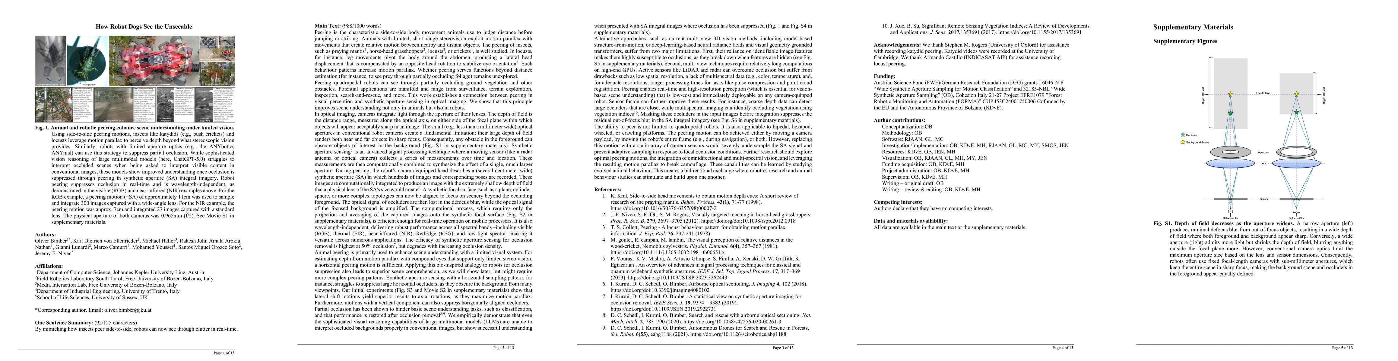
Peering, a side-to-side motion used by animals to estimate distance through motion parallax, offers a powerful bio-inspired strategy to overcome a fundamental limitation in robotic vision: partial occ...
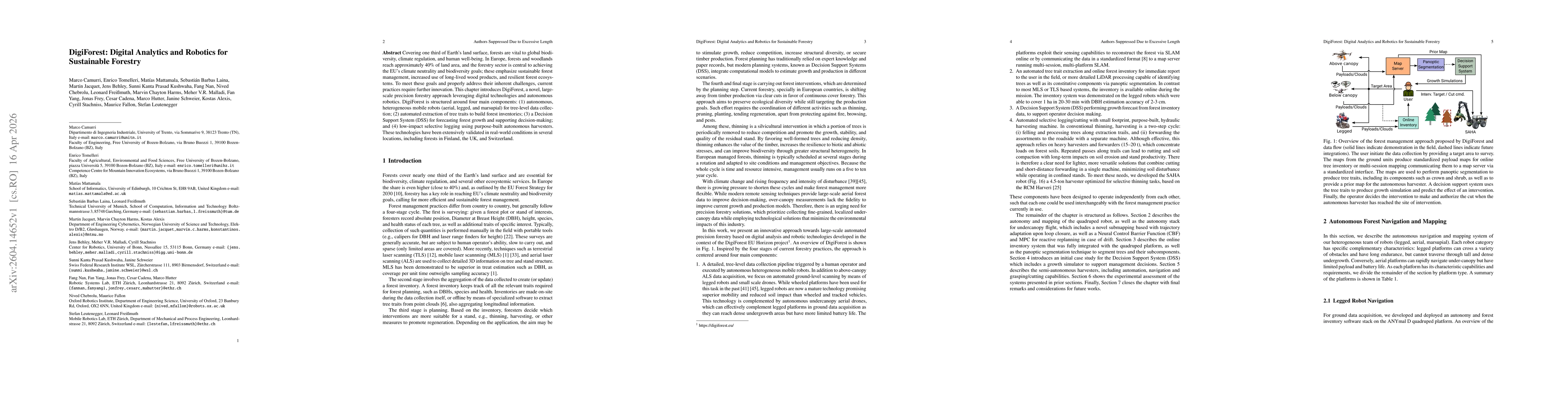
Covering one third of Earth's land surface, forests are vital to global biodiversity, climate regulation, and human well-being. In Europe, forests and woodlands reach approximately 40% of land area, a...
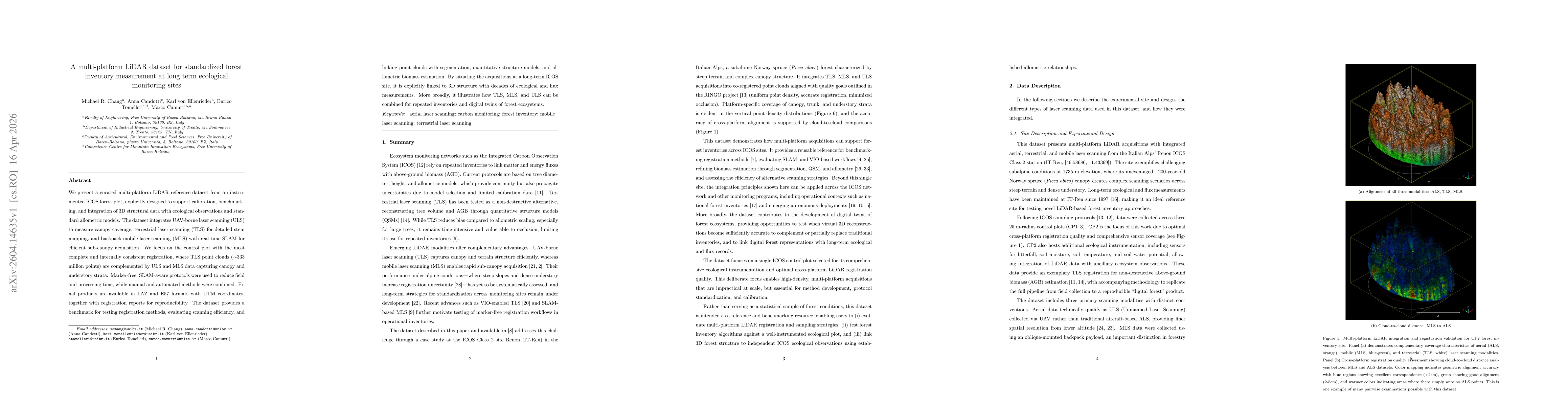
We present a curated multi-platform LiDAR reference dataset from an instrumented ICOS forest plot, explicitly designed to support calibration, benchmarking, and integration of 3D structural data with ...
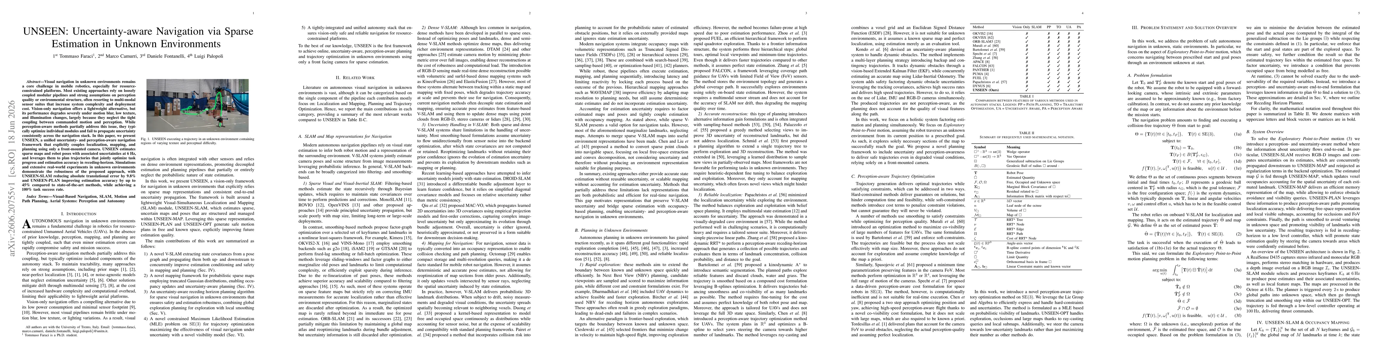
Visual navigation in unknown environments remains a core challenge in mobile robotics, especially for resource-constrained platforms. Most existing approaches rely on loosely coupled modular pipelines...