Academic Profile
Statistics
Similar Authors
Papers on arXiv
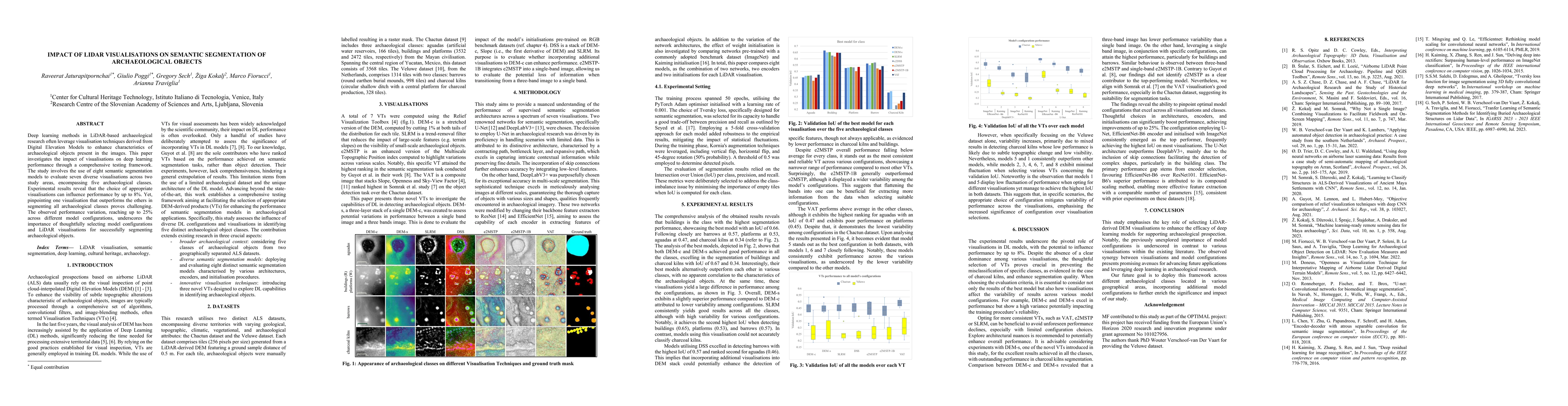
Deep learning methods in LiDAR-based archaeological research often leverage visualisation techniques derived from Digital Elevation Models to enhance characteristics of archaeological objects presen...
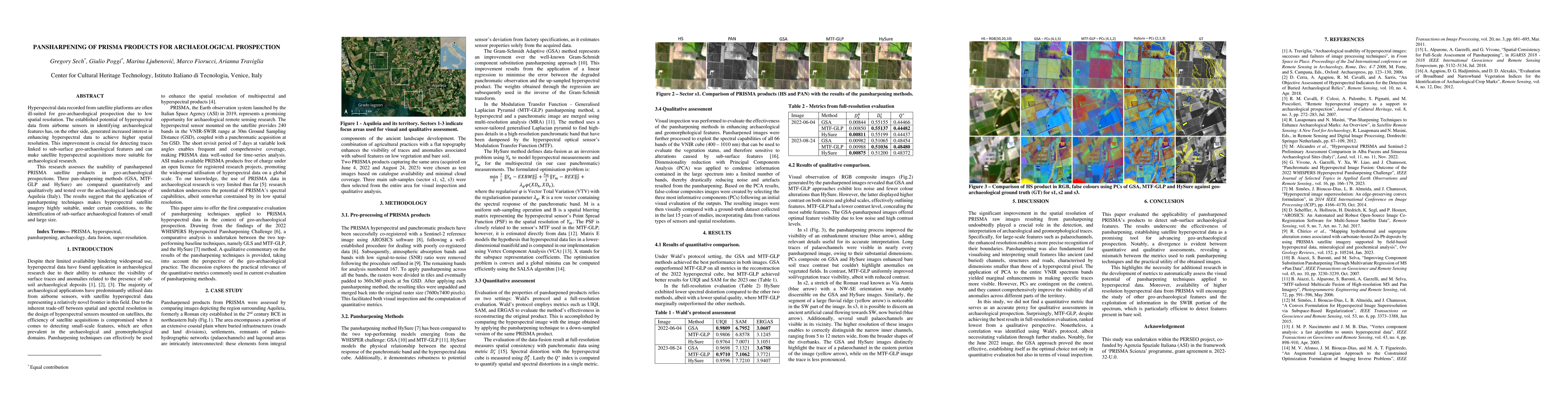
Hyperspectral data recorded from satellite platforms are often ill-suited for geo-archaeological prospection due to low spatial resolution. The established potential of hyperspectral data from airbo...
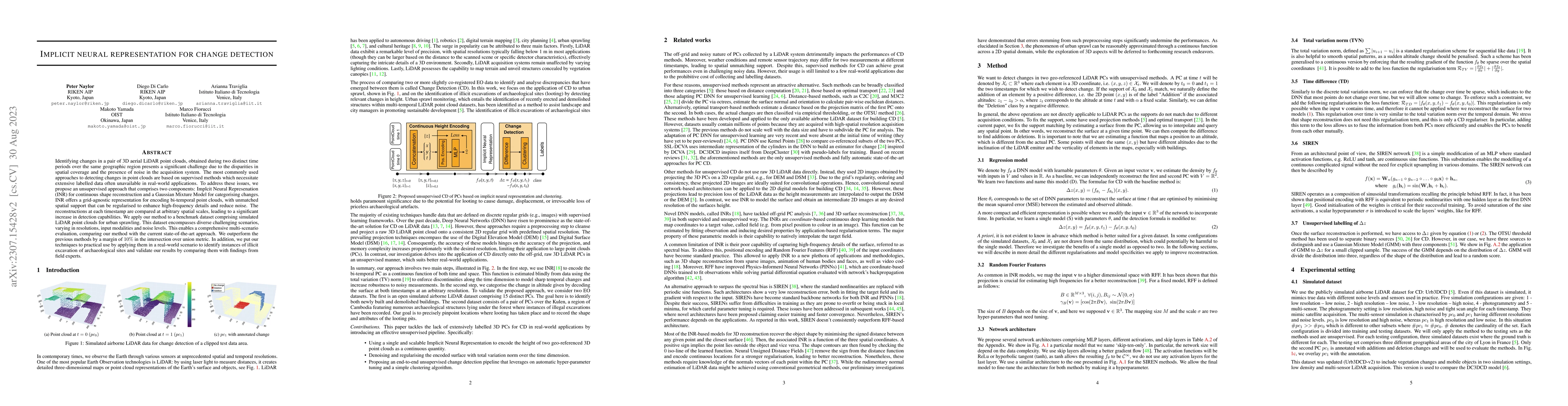
Identifying changes in a pair of 3D aerial LiDAR point clouds, obtained during two distinct time periods over the same geographic region presents a significant challenge due to the disparities in sp...
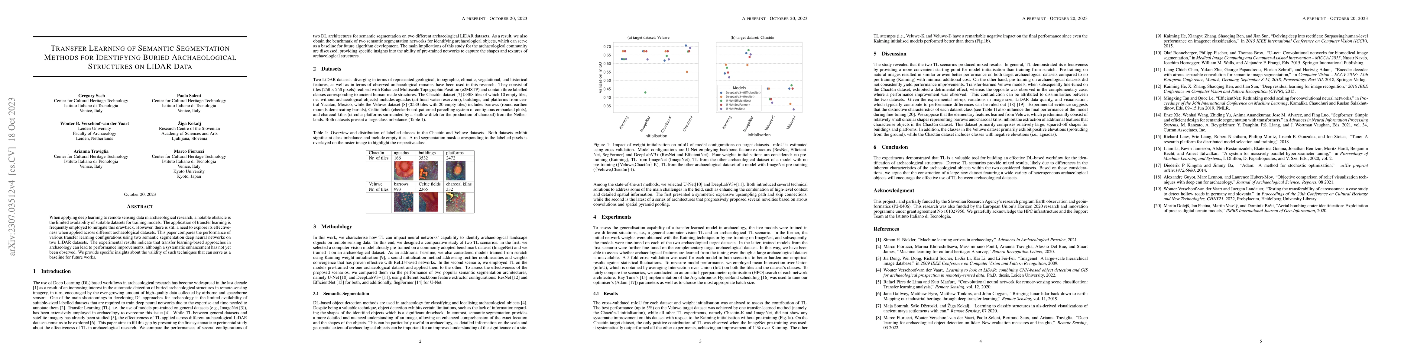
When applying deep learning to remote sensing data in archaeological research, a notable obstacle is the limited availability of suitable datasets for training models. The application of transfer le...
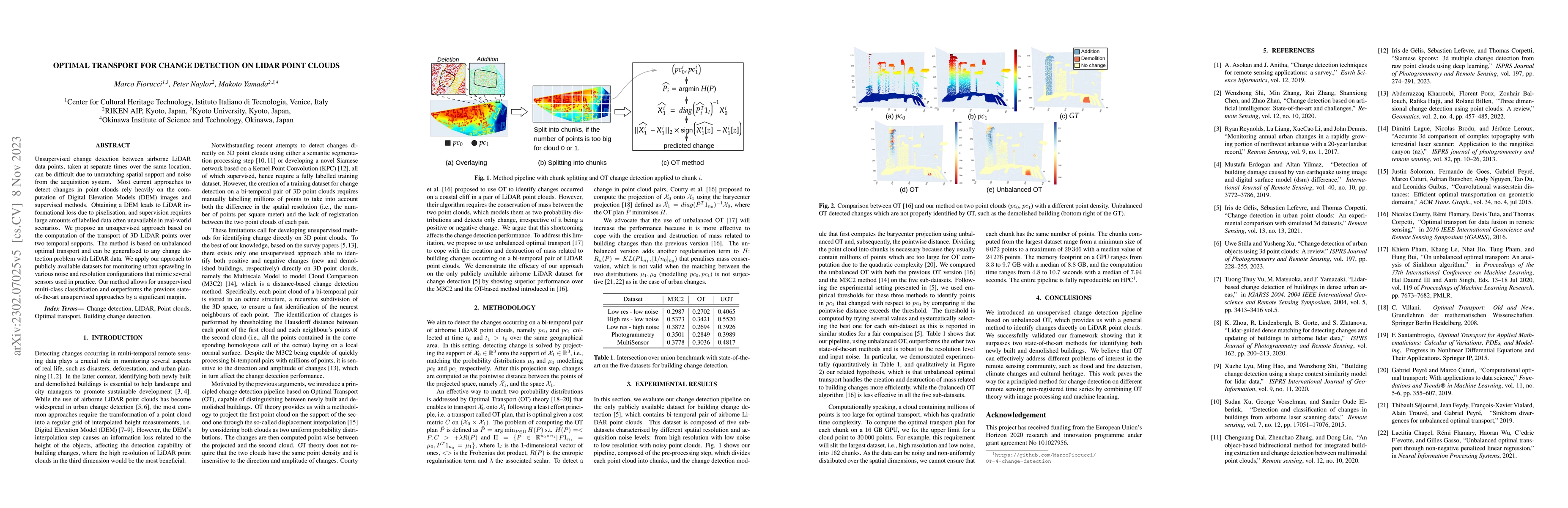
Unsupervised change detection between airborne LiDAR data points, taken at separate times over the same location, can be difficult due to unmatching spatial support and noise from the acquisition sy...
Recent years are characterized by an unprecedented quantity of available network data which are produced at an astonishing rate by an heterogeneous variety of interconnected sensors and devices. Thi...
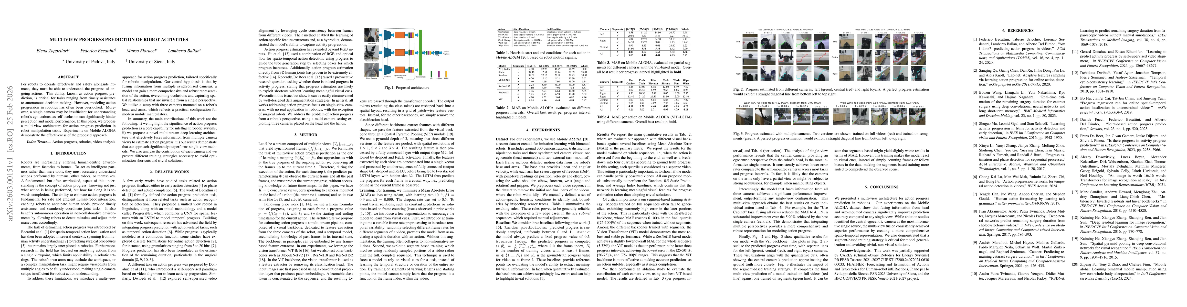
For robots to operate effectively and safely alongside humans, they must be able to understand the progress of ongoing actions. This ability, known as action progress prediction, is critical for tasks...
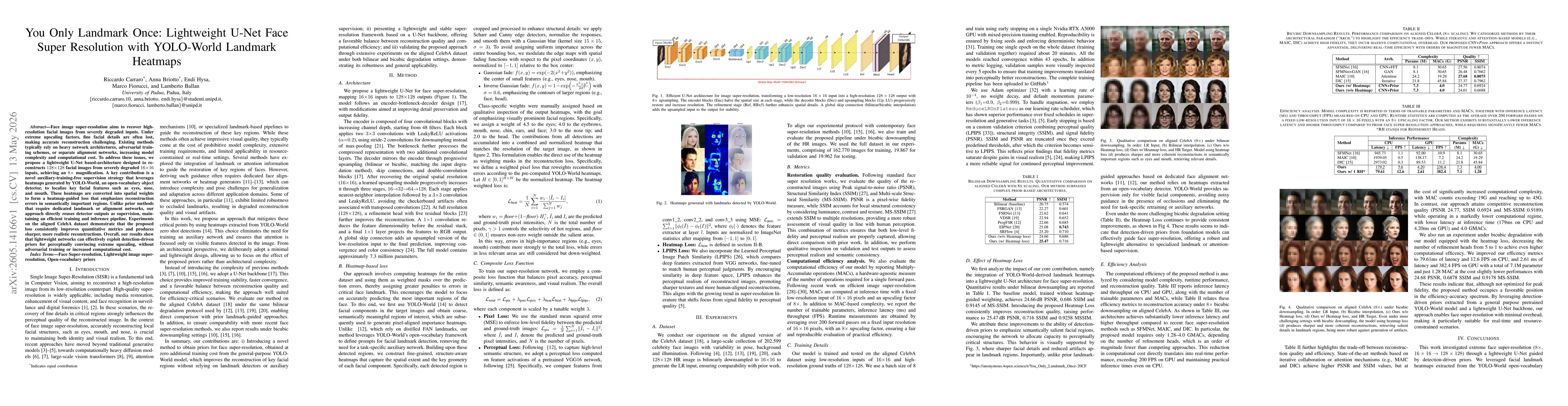
Face image super-resolution aims to recover high-resolution facial images from severely degraded inputs. Under extreme upscaling factors, fine facial details are often lost, making accurate reconstruc...