Academic Profile
Statistics
Similar Authors
Papers on arXiv
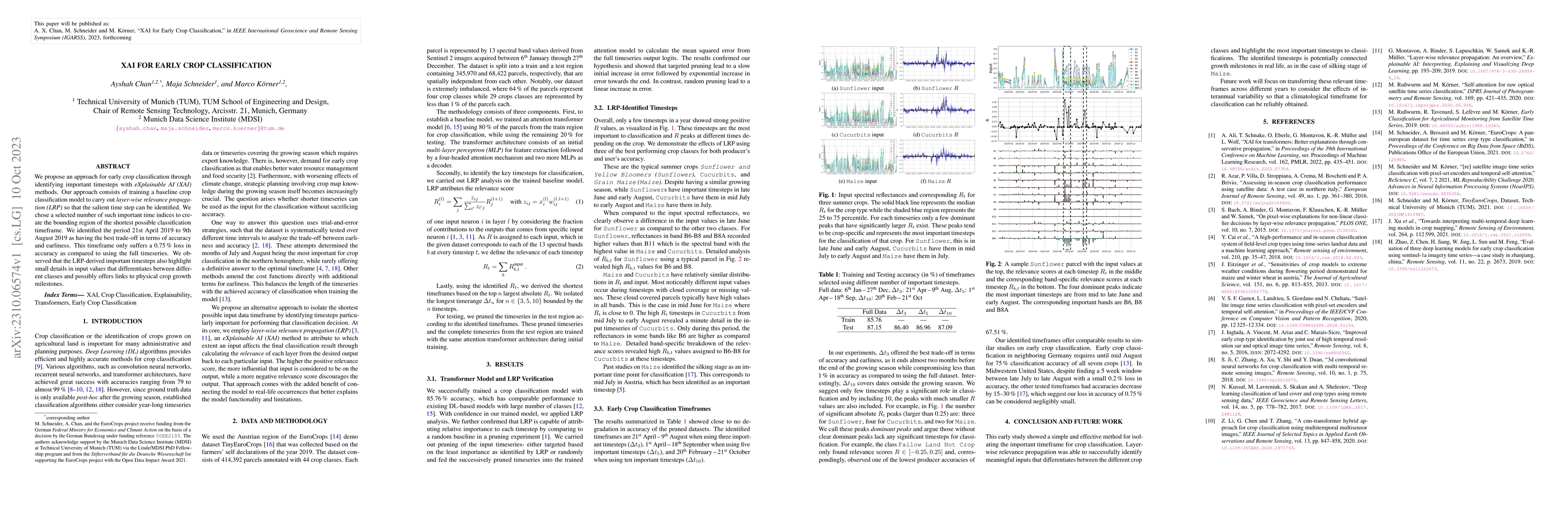
We propose an approach for early crop classification through identifying important timesteps with eXplainable AI (XAI) methods. Our approach consists of training a baseline crop classification model...
With leaps in machine learning techniques and their applicationon Earth observation challenges has unlocked unprecedented performance across the domain. While the further development of these method...
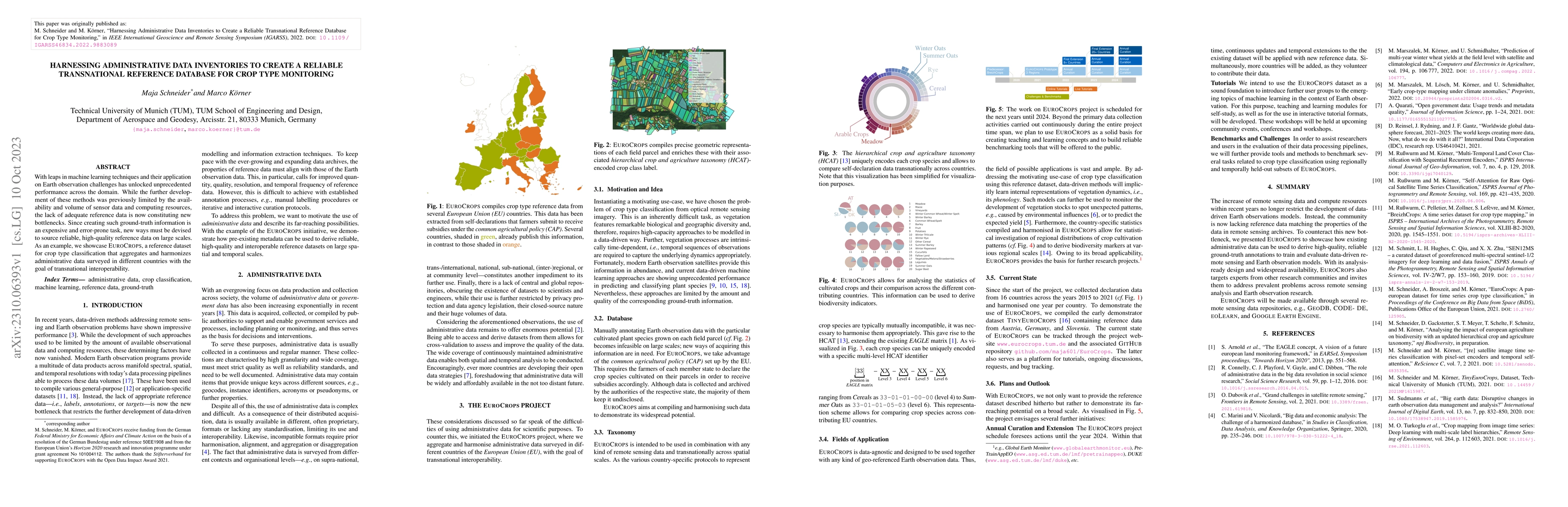
EuroCrops contains geo-referenced polygons of agricultural croplands from 16 countries of the European Union (EU) as well as information on the respective crop species grown there. These semantic an...
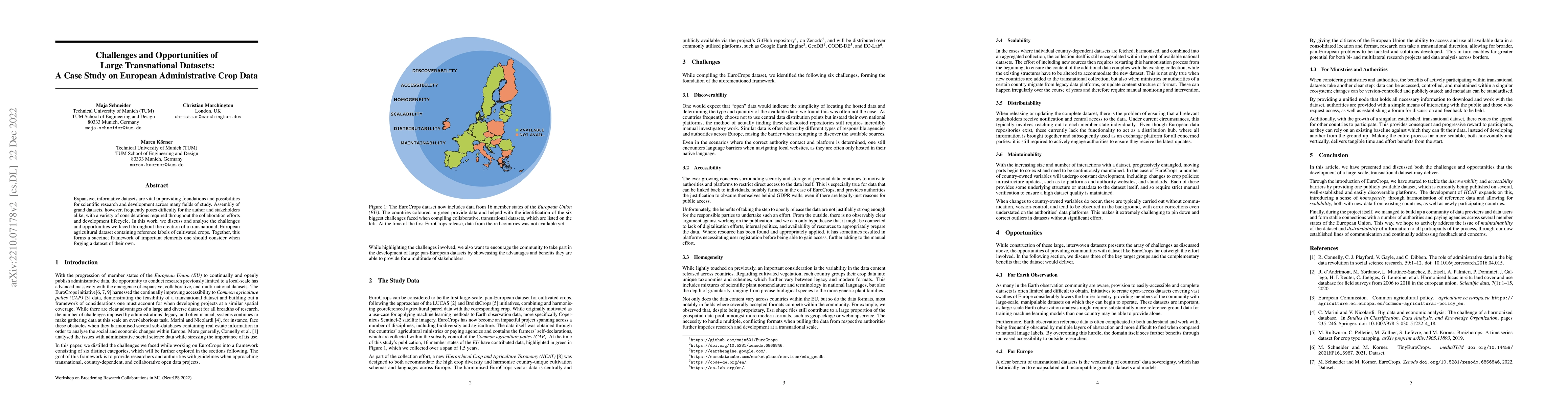
Expansive, informative datasets are vital in providing foundations and possibilities for scientific research and development across many fields of study. Assembly of grand datasets, however, frequen...
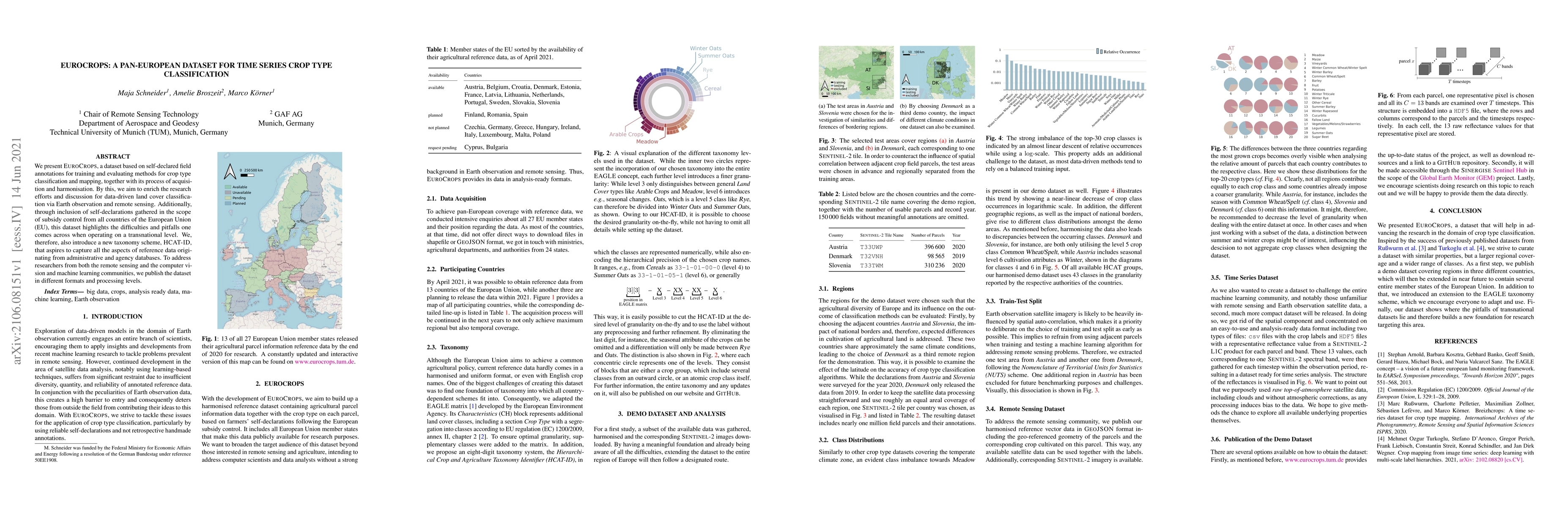
We present EuroCrops, a dataset based on self-declared field annotations for training and evaluating methods for crop type classification and mapping, together with its process of acquisition and ha...
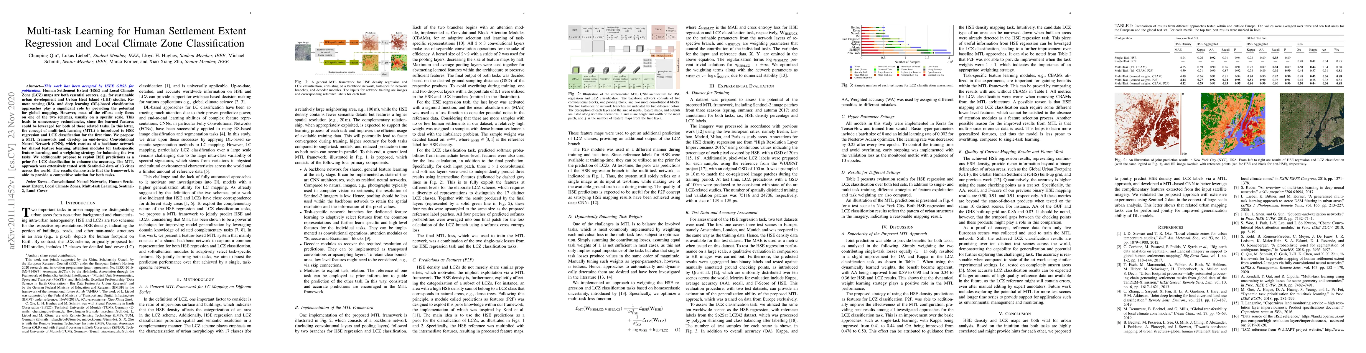
Human Settlement Extent (HSE) and Local Climate Zone (LCZ) maps are both essential sources, e.g., for sustainable urban development and Urban Heat Island (UHI) studies. Remote sensing (RS)- and deep...
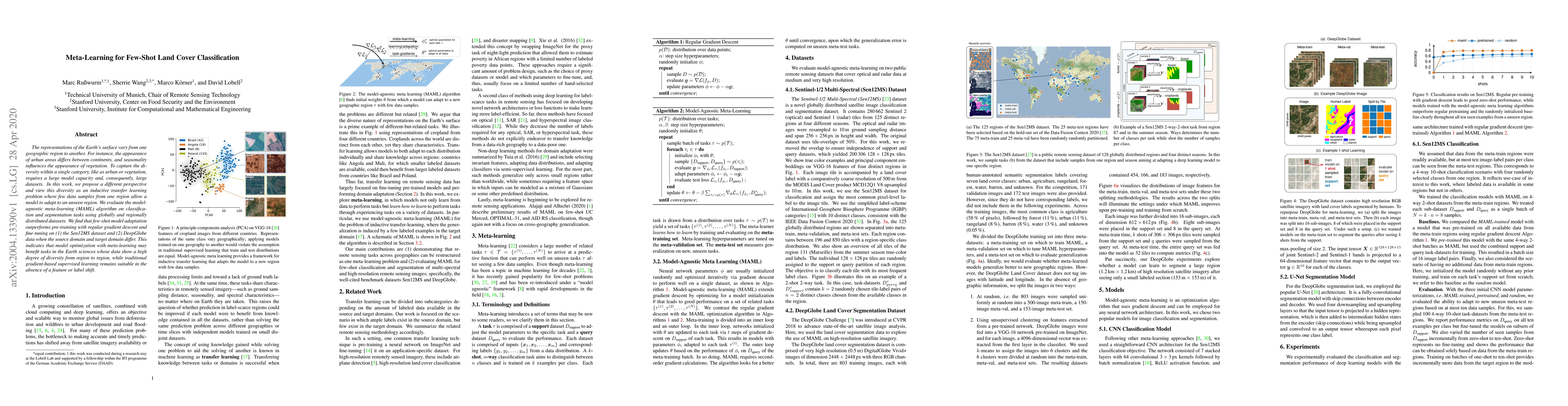
The representations of the Earth's surface vary from one geographic region to another. For instance, the appearance of urban areas differs between continents, and seasonality influences the appearan...
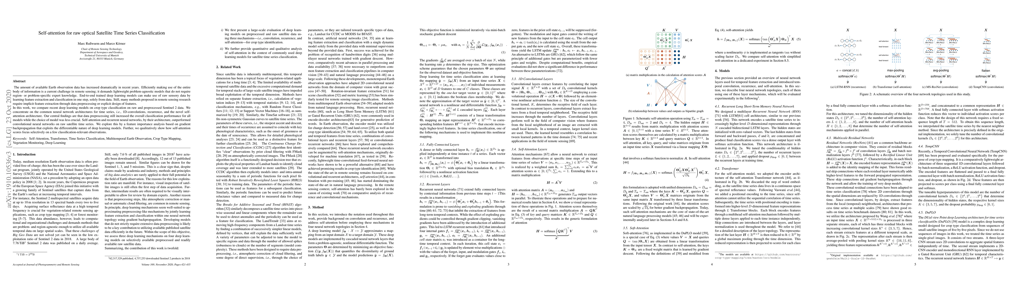
The amount of available Earth observation data has increased dramatically in the recent years. Efficiently making use of the entire body information is a current challenge in remote sensing and dema...
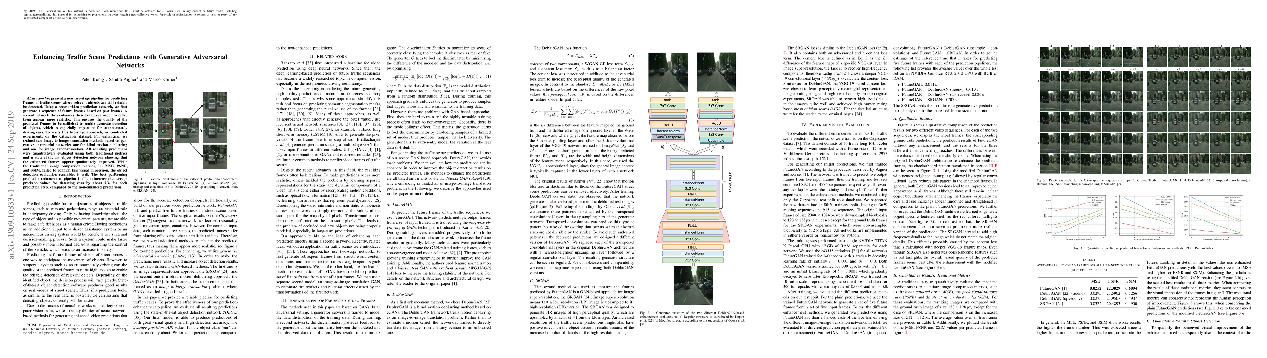
We present a new two-stage pipeline for predicting frames of traffic scenes where relevant objects can still reliably be detected. Using a recent video prediction network, we first generate a sequen...
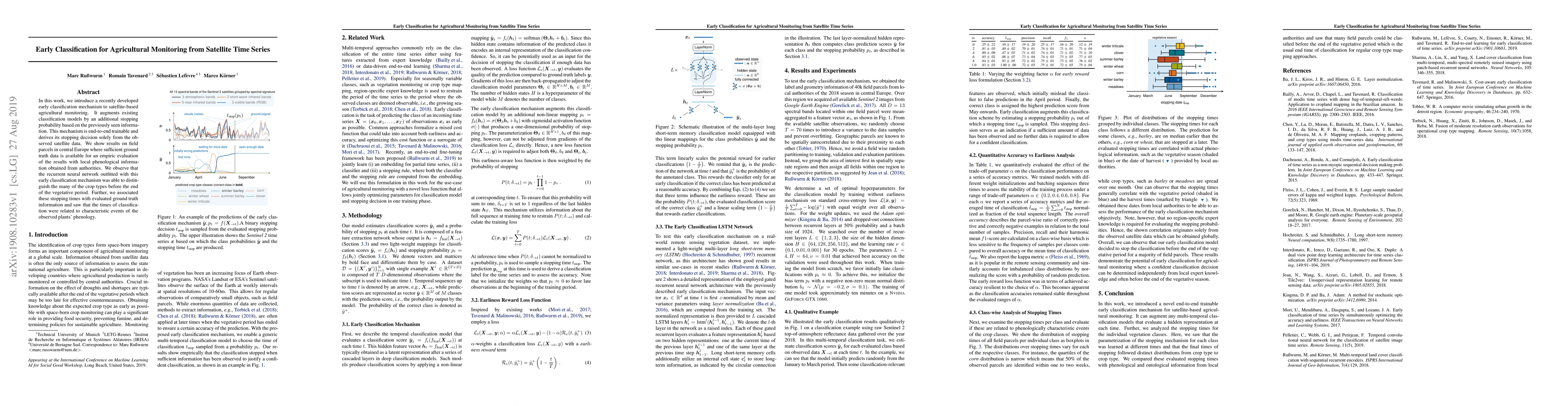
In this work, we introduce a recently developed early classification mechanism to satellite-based agricultural monitoring. It augments existing classification models by an additional stopping probab...
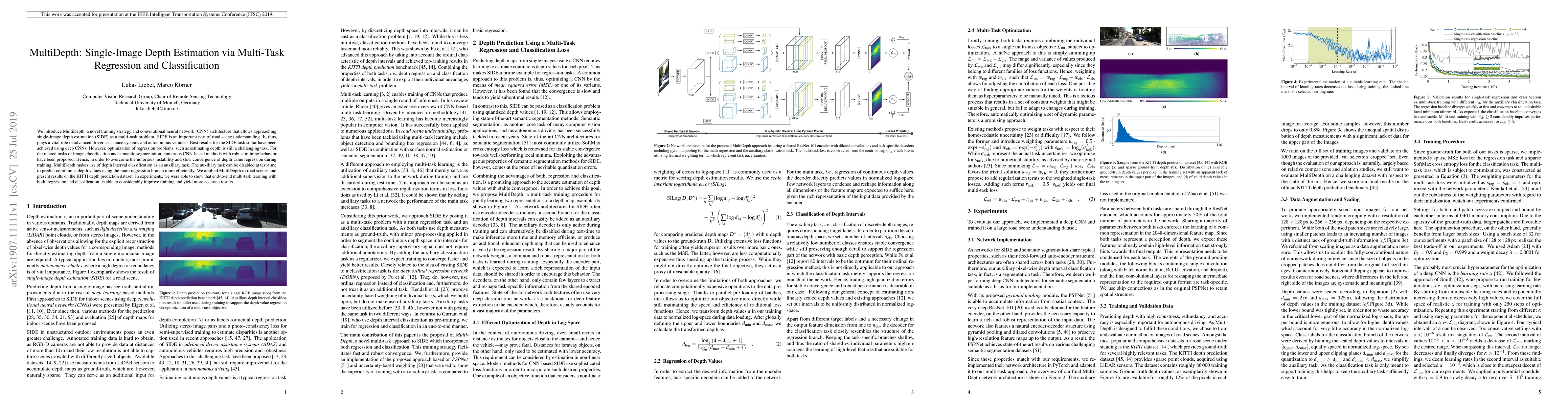
We introduce MultiDepth, a novel training strategy and convolutional neural network (CNN) architecture that allows approaching single-image depth estimation (SIDE) as a multi-task problem. SIDE is a...
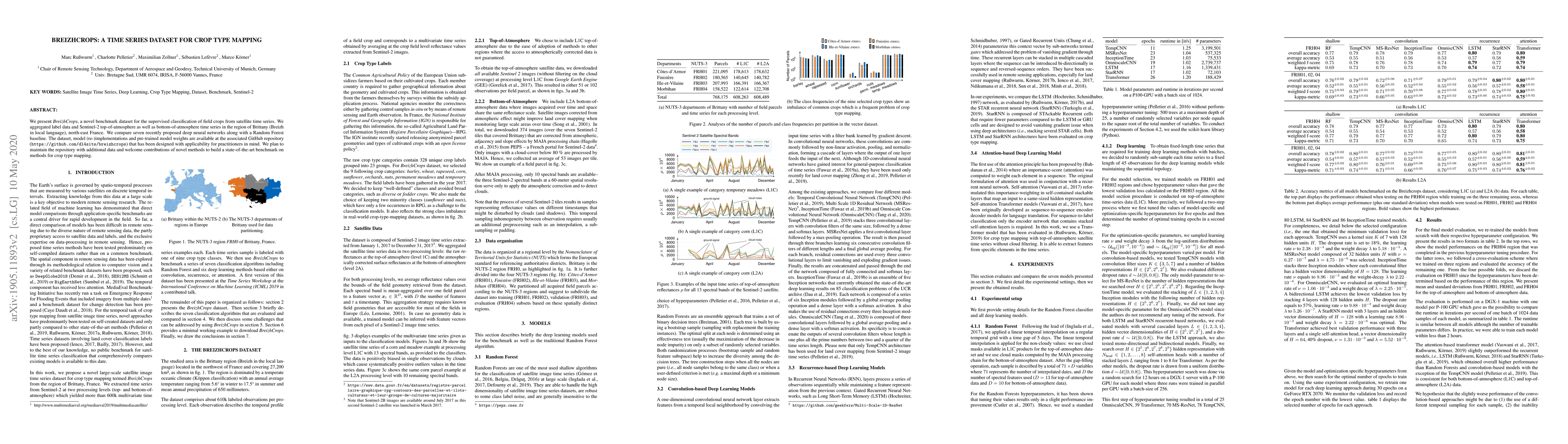
We present Breizhcrops, a novel benchmark dataset for the supervised classification of field crops from satellite time series. We aggregated label data and Sentinel-2 top-of-atmosphere as well as bo...
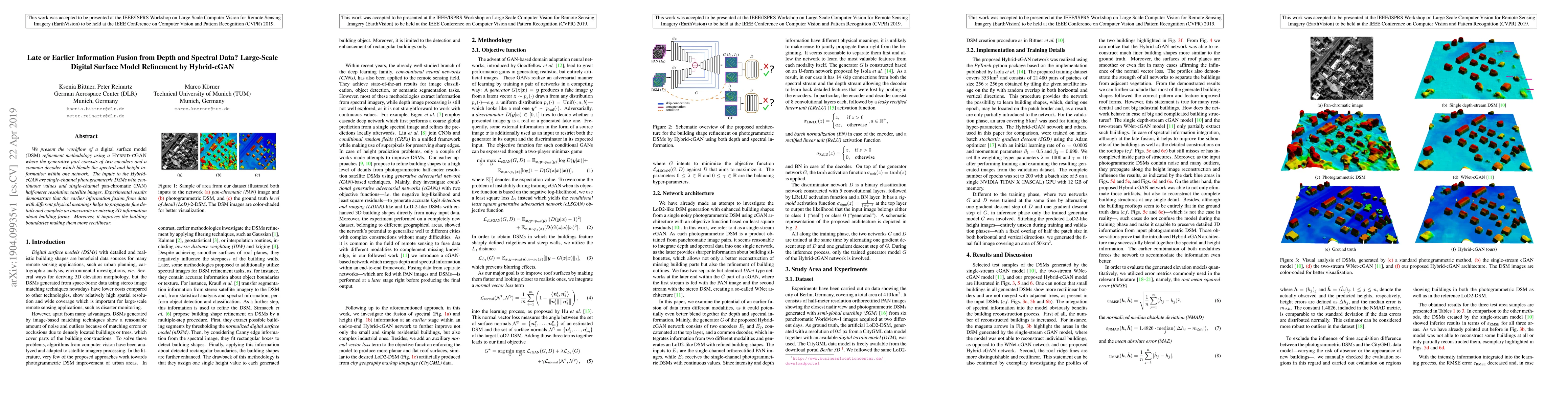
We present the workflow of a DSM refinement methodology using a Hybrid-cGAN where the generative part consists of two encoders and a common decoder which blends the spectral and height information w...
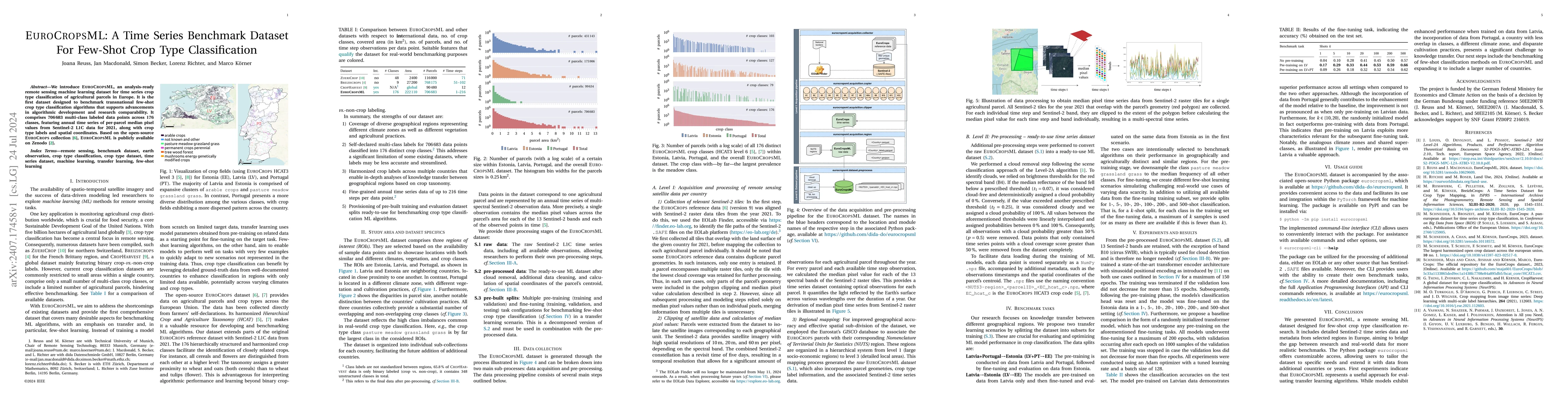
We introduce EuroCropsML, an analysis-ready remote sensing machine learning dataset for time series crop type classification of agricultural parcels in Europe. It is the first dataset designed to benc...
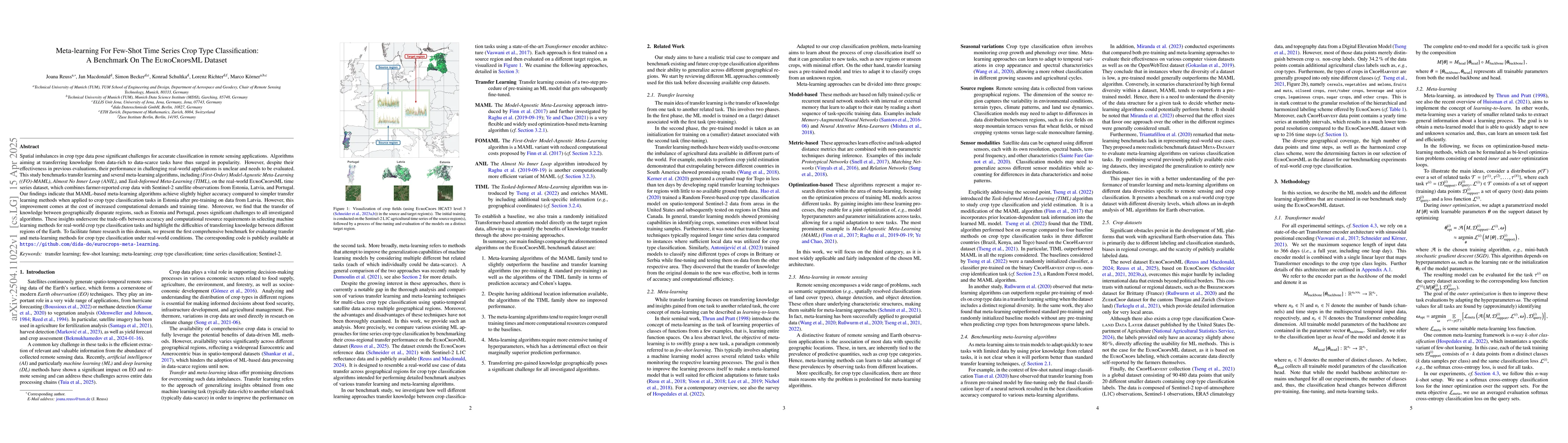
Spatial imbalances in crop type data pose significant challenges for accurate classification in remote sensing applications. Algorithms aiming at transferring knowledge from data-rich to data-scarce t...
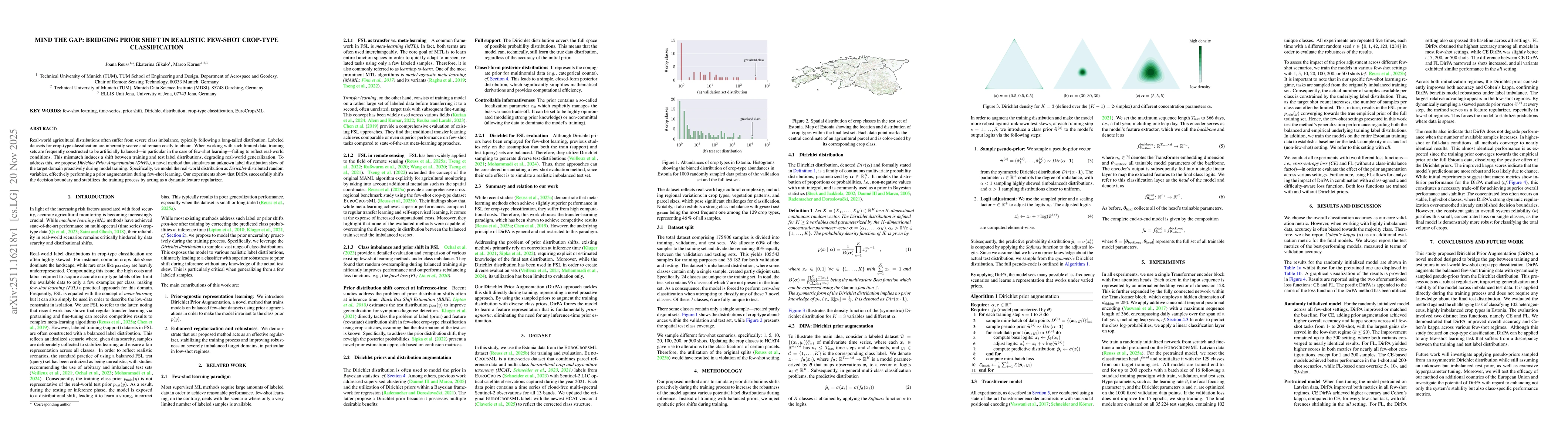
Real-world agricultural distributions often suffer from severe class imbalance, typically following a long-tailed distribution. Labeled datasets for crop-type classification are inherently scarce and ...
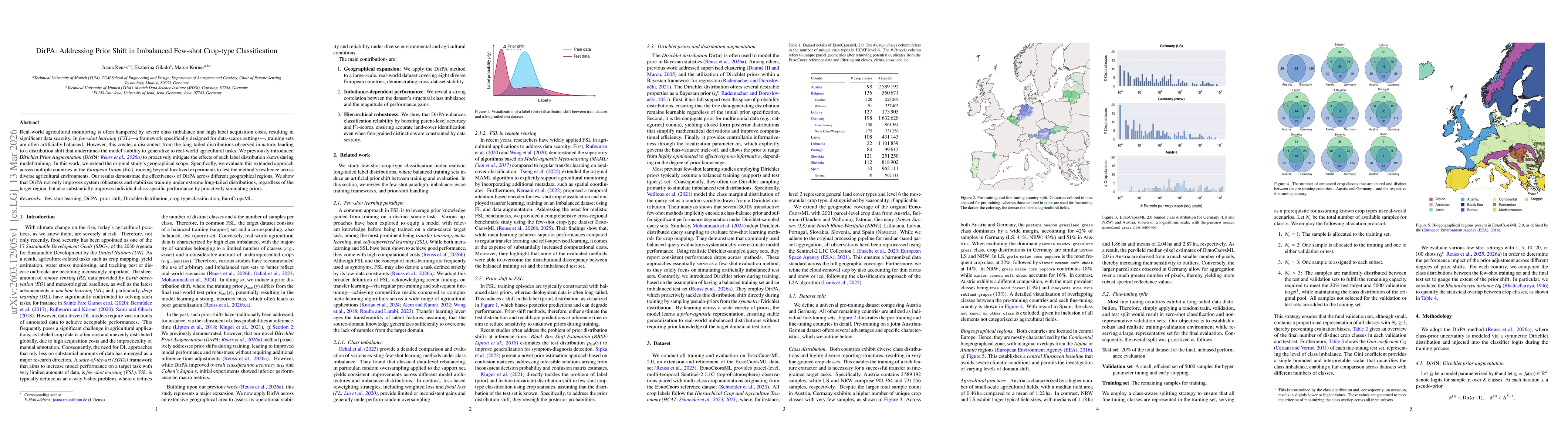
Real-world agricultural monitoring is often hampered by severe class imbalance and high label acquisition costs, resulting in significant data scarcity. In few-shot learning (FSL) -- a framework speci...
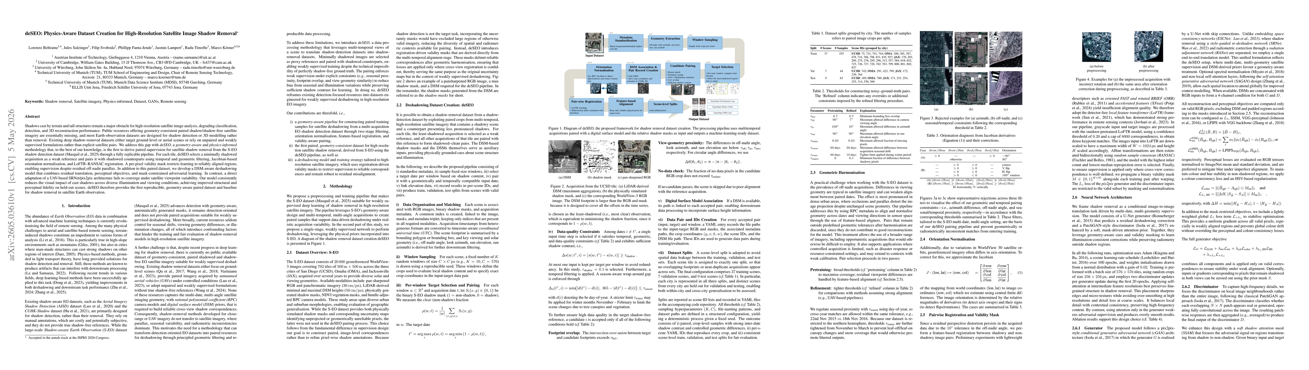
Shadows cast by terrain and tall structures remain a major obstacle for high-resolution satellite image analysis, degrading classification, detection, and 3D reconstruction performance. Public resourc...