ArxivLens
M
Researcher

Maribel Hernández-Rosales

5 papers on arXiv

5 arXiv Papers
14 Total Publications
Profile

Academic Profile

Name M. Hernández-Rosales
Total Papers 14
Scholar Profile View on Semantic Scholar
Metrics

Statistics

5 arXiv Papers
14 Total Publications
Publications

Papers on arXiv

Thumbnail for Human mobility patterns in Mexico City and their links with
  socioeconomic variables during the COVID-19 pandemic
arXiv
Human mobility patterns in Mexico City and their links with socioeconomic variables during the COVID-19 pandemic

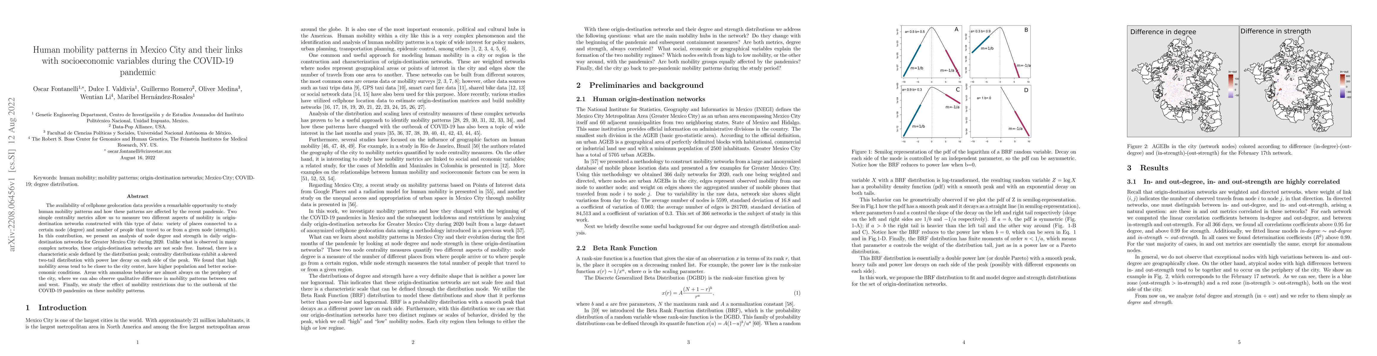
The availability of cellphone geolocation data provides a remarkable opportunity to study human mobility patterns and how these patterns are affected by the recent pandemic. Two simple centrality me...

Thumbnail for Intermunicipal Travel Networks of Mexico (2020-2021)
arXiv
Intermunicipal Travel Networks of Mexico (2020-2021)

We present a collection of networks that describe the travel patterns between municipalities in Mexico between 2020 and 2021. Using anonymized mobile device geo-location data we constructed directed...

Thumbnail for The Contact and Mobility Networks of Mexico City
arXiv
The Contact and Mobility Networks of Mexico City

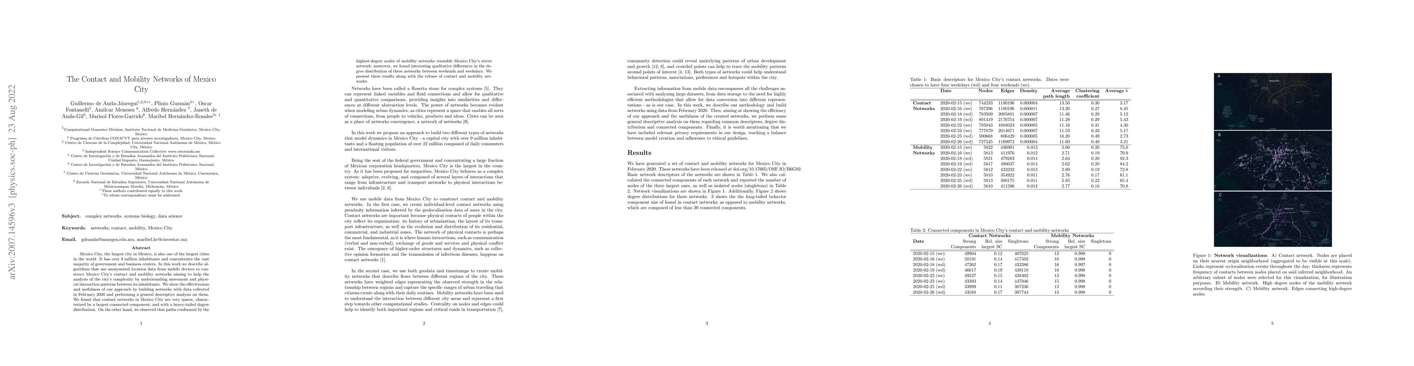
Mexico City, the largest city in Mexico, is also one of the largest cities in the world. It has over 9 million inhabitants and concentrates the vast majority of government and business centers. In t...

Thumbnail for The Path-Label Reconciliation (PLR) Dissimilarity Measure for Gene Trees
arXiv
The Path-Label Reconciliation (PLR) Dissimilarity Measure for Gene Trees

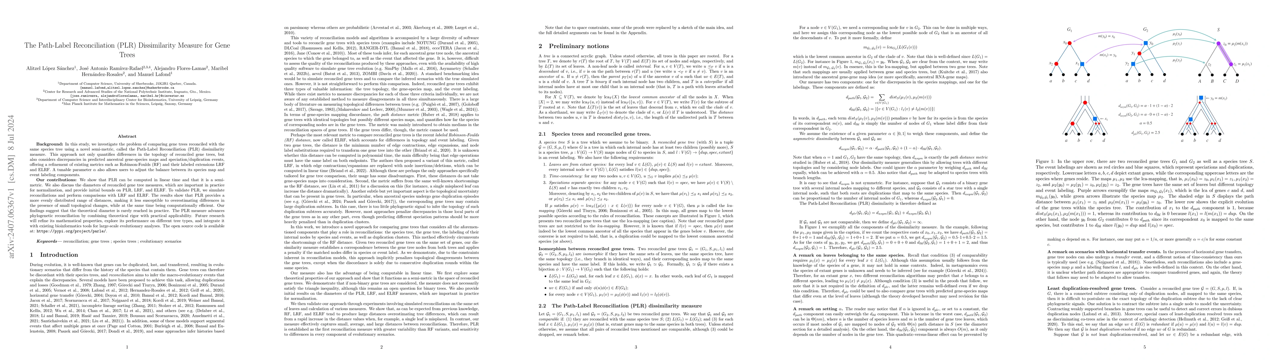
In this study, we investigate the problem of comparing gene trees reconciled with the same species tree using a novel semi-metric, called the Path-Label Reconciliation (PLR) dissimilarity measure. Thi...

Thumbnail for One country, multiple portraits: representativeness in GPS-based mobility data is source-specific and spatially dependent
arXiv
One country, multiple portraits: representativeness in GPS-based mobility data is source-specific and spatially dependent

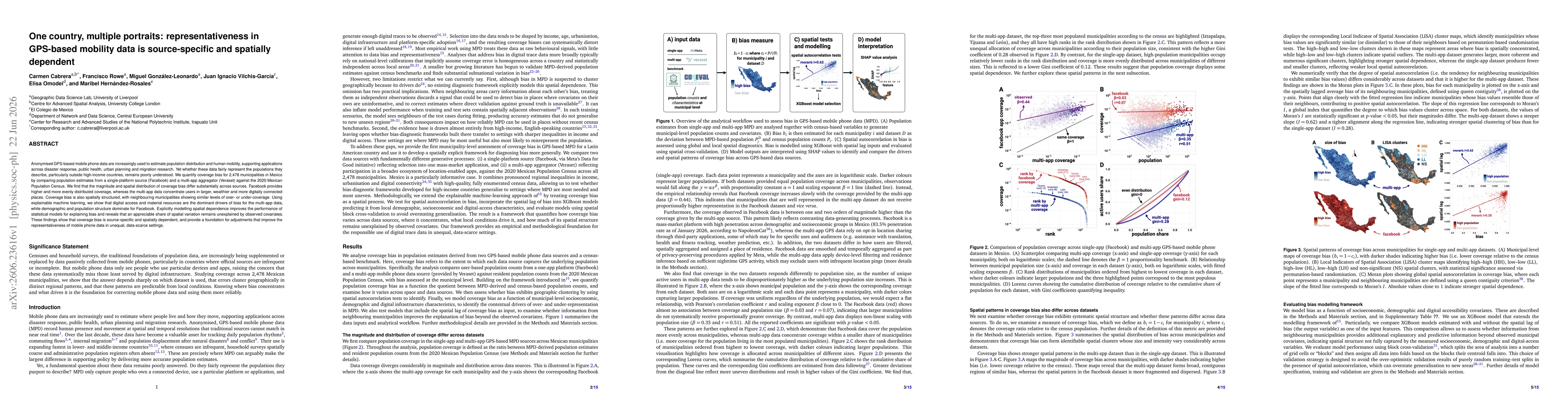
Anonymised GPS-based mobile phone data are increasingly used to estimate population distribution and human mobility, supporting applications across disaster response, public health, urban planning and...

This website uses cookies to ensure you get the best experience. Learn more