Academic Profile
Statistics
Similar Authors
Papers on arXiv
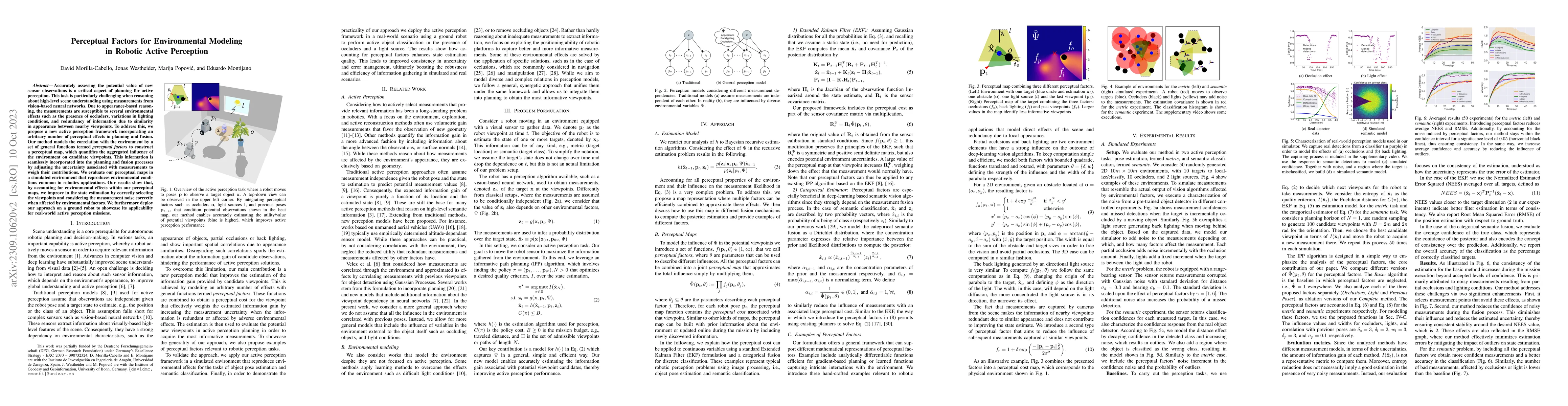
Accurately assessing the potential value of new sensor observations is a critical aspect of planning for active perception. This task is particularly challenging when reasoning about high-level scen...
In robotic applications, a key requirement for safe and efficient motion planning is the ability to map obstacle-free space in unknown, cluttered 3D environments. However, commodity-grade RGB-D came...
We present an efficient, elastic 3D LiDAR reconstruction framework which can reconstruct up to maximum LiDAR ranges (60 m) at multiple frames per second, thus enabling robot exploration in large-sca...
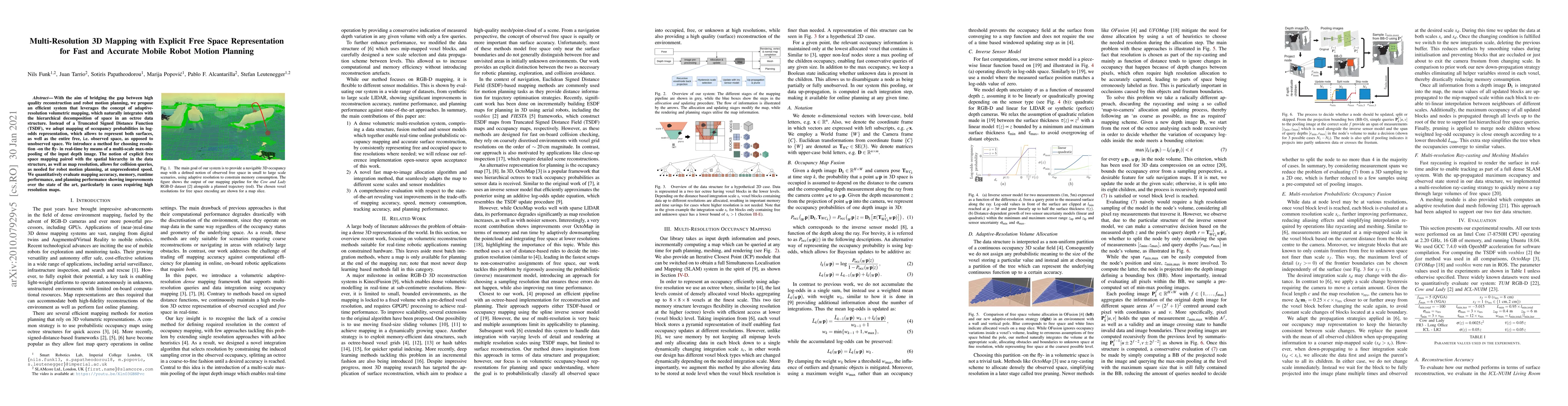
With the aim of bridging the gap between high quality reconstruction and mobile robot motion planning, we propose an efficient system that leverages the concept of adaptive-resolution volumetric map...
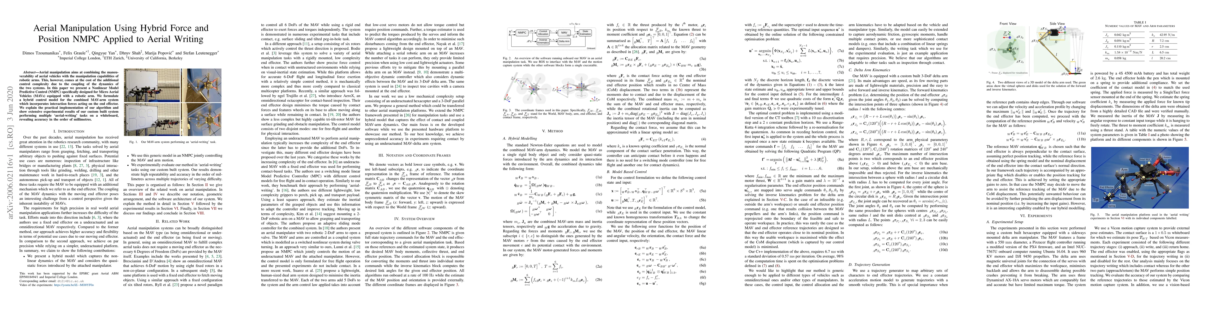
Aerial manipulation aims at combining the manoeuvrability of aerial vehicles with the manipulation capabilities of robotic arms. This, however, comes at the cost of the additional control complexity...
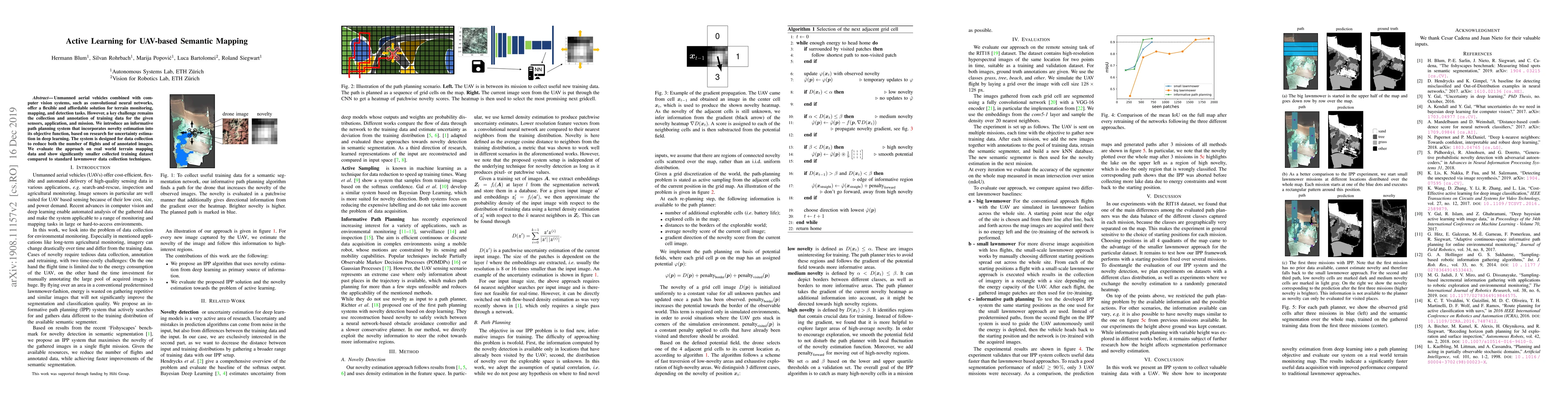
Unmanned aerial vehicles combined with computer vision systems, such as convolutional neural networks, offer a flexible and affordable solution for terrain monitoring, mapping, and detection tasks. ...
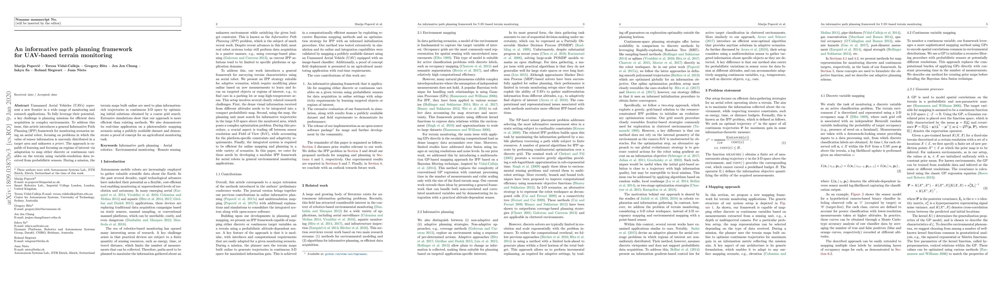
Unmanned Aerial Vehicles (UAVs) represent a new frontier in a wide range of monitoring and research applications. To fully leverage their potential, a key challenge is planning missions for efficien...
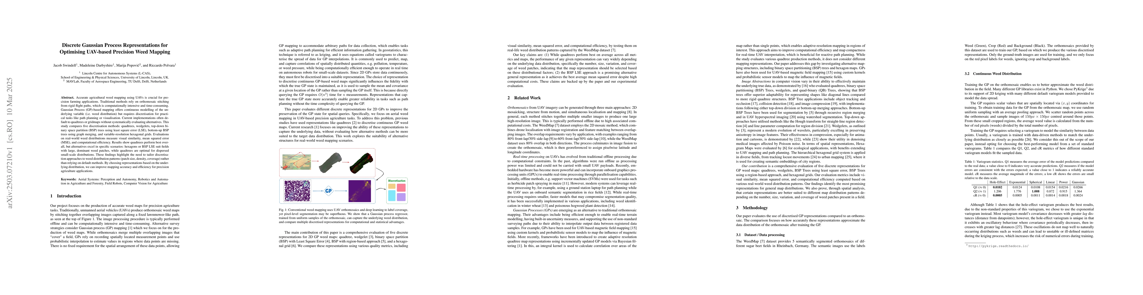
Accurate agricultural weed mapping using UAVs is crucial for precision farming applications. Traditional methods rely on orthomosaic stitching from rigid flight paths, which is computationally intensi...
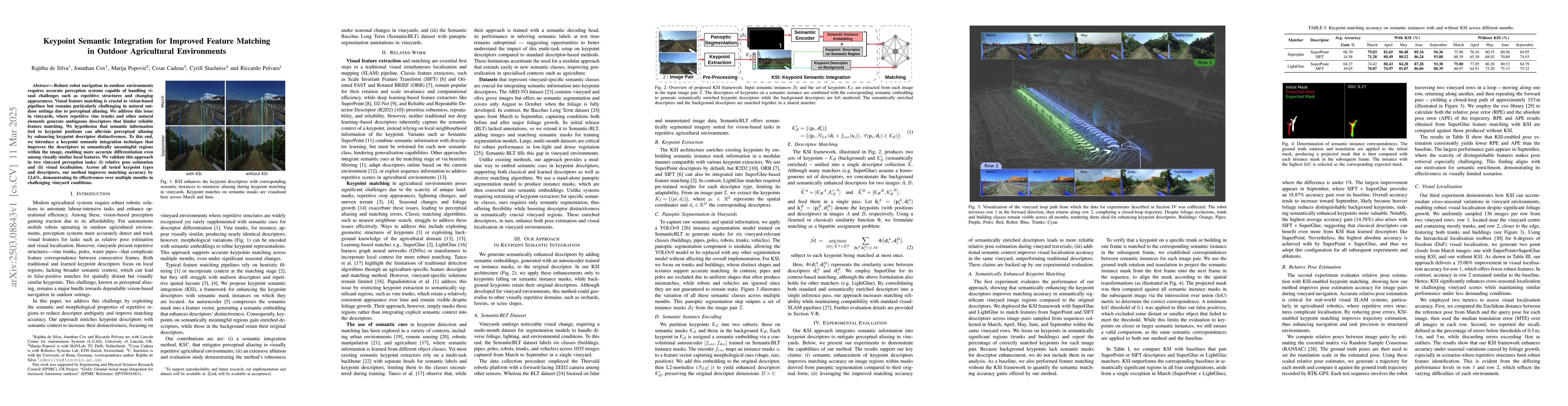
Robust robot navigation in outdoor environments requires accurate perception systems capable of handling visual challenges such as repetitive structures and changing appearances. Visual feature matchi...
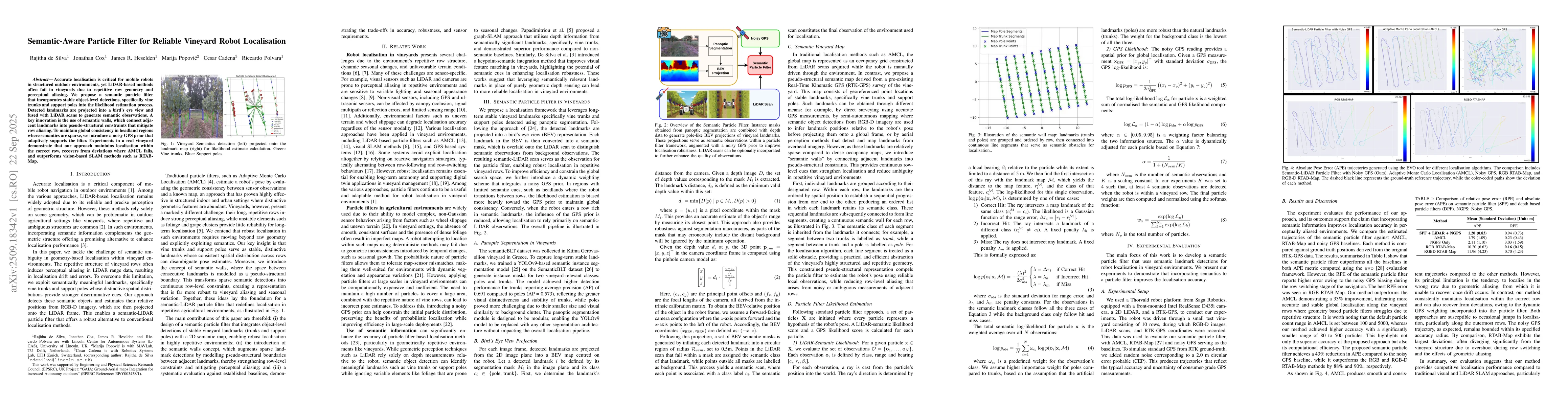
Accurate localisation is critical for mobile robots in structured outdoor environments, yet LiDAR-based methods often fail in vineyards due to repetitive row geometry and perceptual aliasing. We propo...
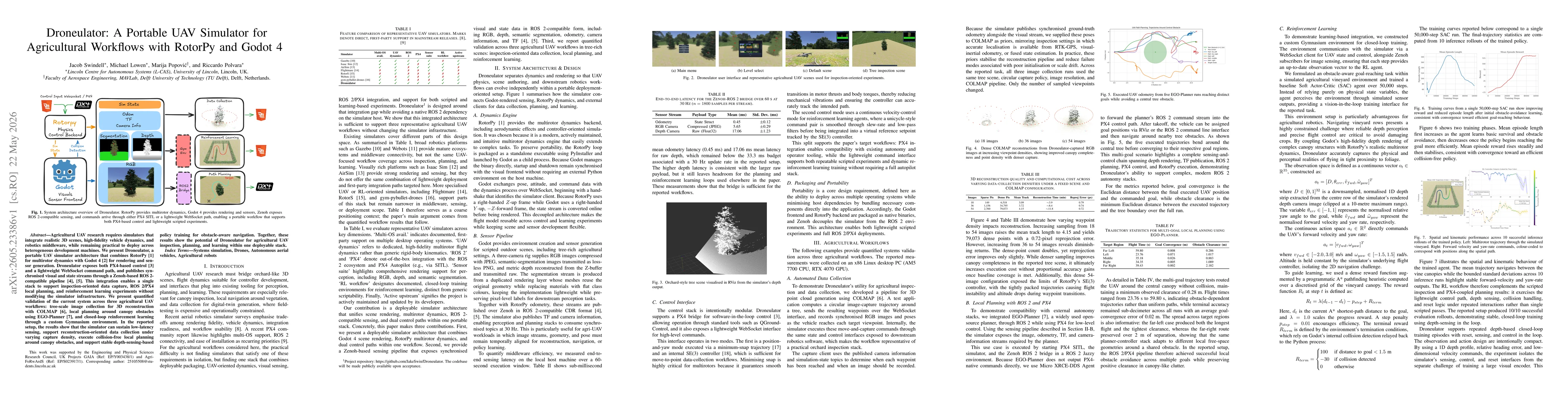
Agricultural UAV research requires simulators that integrate realistic 3D scenes, high-fidelity vehicle dynamics, and robotics middleware, while remaining practical to deploy across heterogeneous deve...
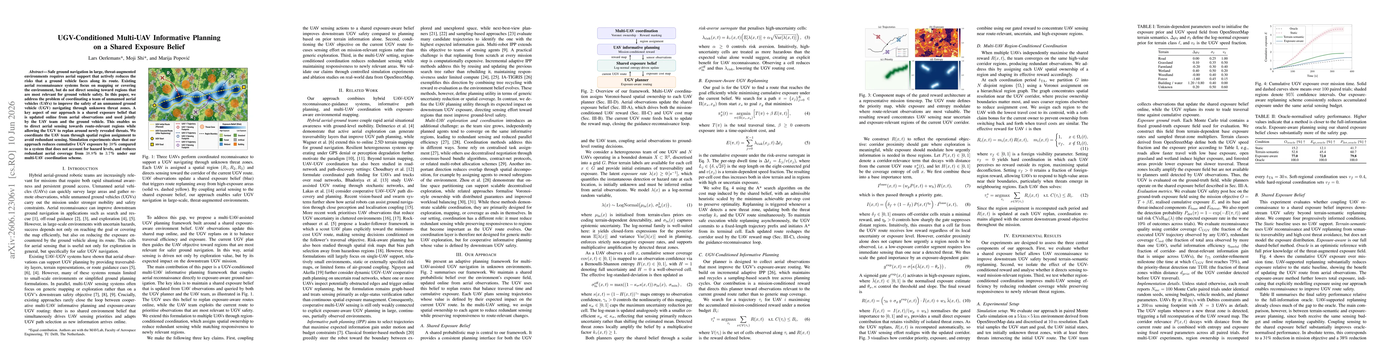
Safe ground navigation in large, threat-augmented environments requires aerial support that actively reduces the risks that a ground vehicle faces along its route. Existing aerial reconnaissance syste...