2
arXiv Papers
5
Total Publications
Profile
Academic Profile
Metrics
Statistics
2
arXiv Papers
5
Total Publications
Network
Similar Authors
Publications
Papers on arXiv
arXiv
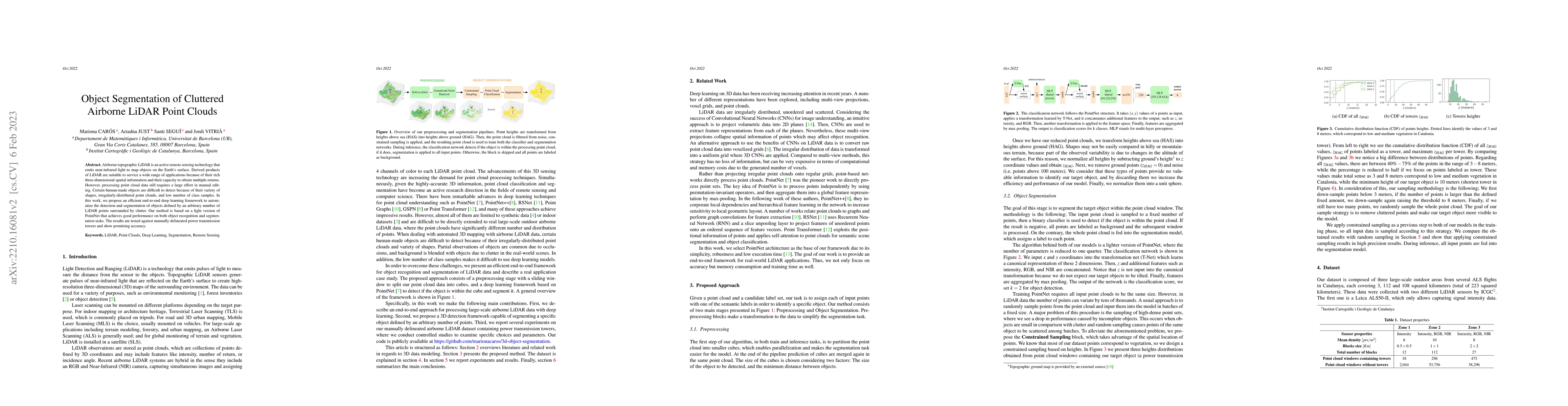
Object Segmentation of Cluttered Airborne LiDAR Point Clouds
Airborne topographic LiDAR is an active remote sensing technology that emits near-infrared light to map objects on the Earth's surface. Derived products of LiDAR are suitable to service a wide range...
arXiv
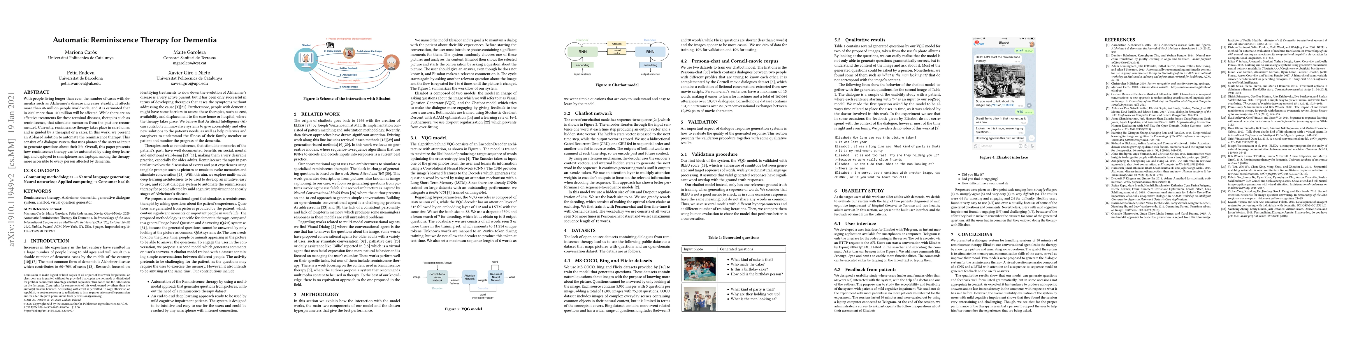
Automatic Reminiscence Therapy for Dementia
With people living longer than ever, the number of cases with dementia such as Alzheimer's disease increases steadily. It affects more than 46 million people worldwide, and it is estimated that in 2...