Marius Hauglin

6 papers on arXiv

Academic Profile

Name: M. Hauglin
Total Papers: 38

Statistics

arXiv Papers 6
Total Publications 38

Papers on arXiv

Thumbnail for Assessing and mitigating systematic errors in forest attribute maps
  utilizing harvester and airborne laser scanning data

Assessing and mitigating systematic errors in forest attribute maps utilizing harvester and airborne laser scanning data

Cut-to-length harvesters collect useful information for modeling relationships between forest attributes and airborne laser scanning (ALS) data. However, harvesters operate in mature forests, which ...

Thumbnail for Prediction of butt rot volume in Norway spruce forest stands using
  harvester, remotely sensed and environmental data

Prediction of butt rot volume in Norway spruce forest stands using harvester, remotely sensed and environmental data

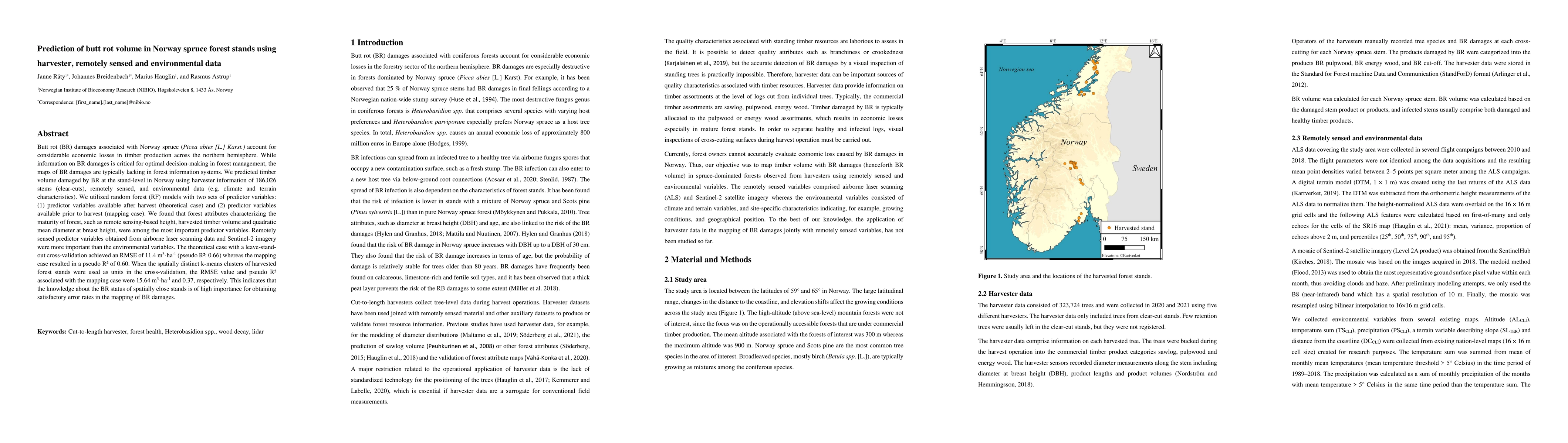
Butt rot (BR) damages associated with Norway spruce (Picea abies [L.] Karst.) account for considerable economic losses in timber production across the northern hemisphere. While information on BR da...

Thumbnail for Above-ground biomass change estimation using national forest inventory
  data with Sentinel-2 and Landsat 8

Above-ground biomass change estimation using national forest inventory data with Sentinel-2 and Landsat 8

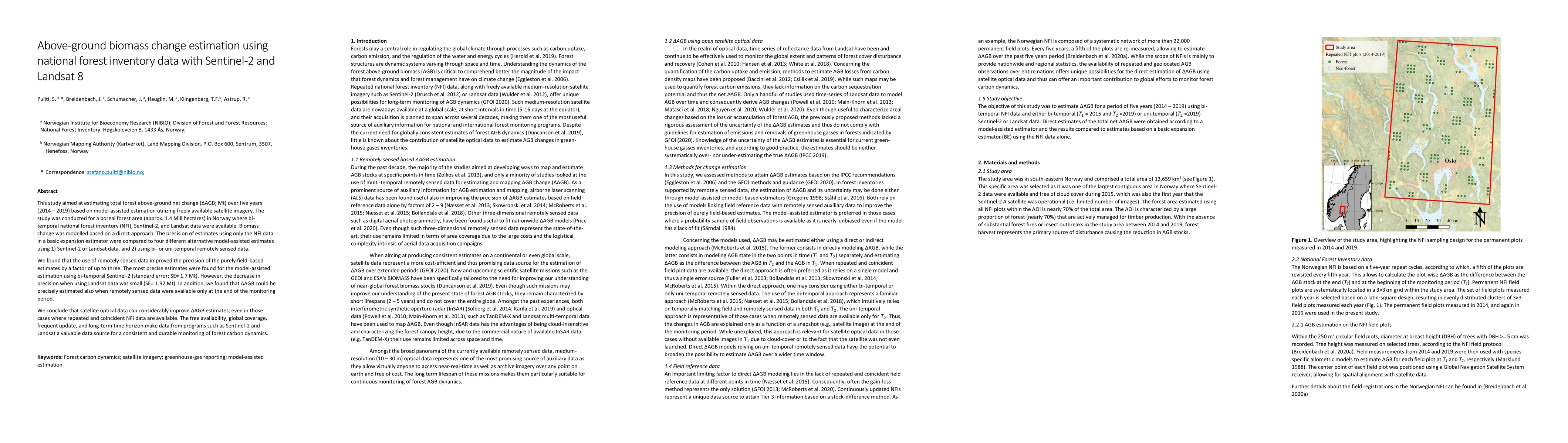
This study aimed at estimating total forest above-ground net change (Delta AGB, Mt) over five years (2014-2019) based on model-assisted estimation utilizing freely available satellite imagery. The s...

Thumbnail for Mapping forest age using National Forest Inventory, airborne laser
  scanning, and Sentinel-2 data

Mapping forest age using National Forest Inventory, airborne laser scanning, and Sentinel-2 data

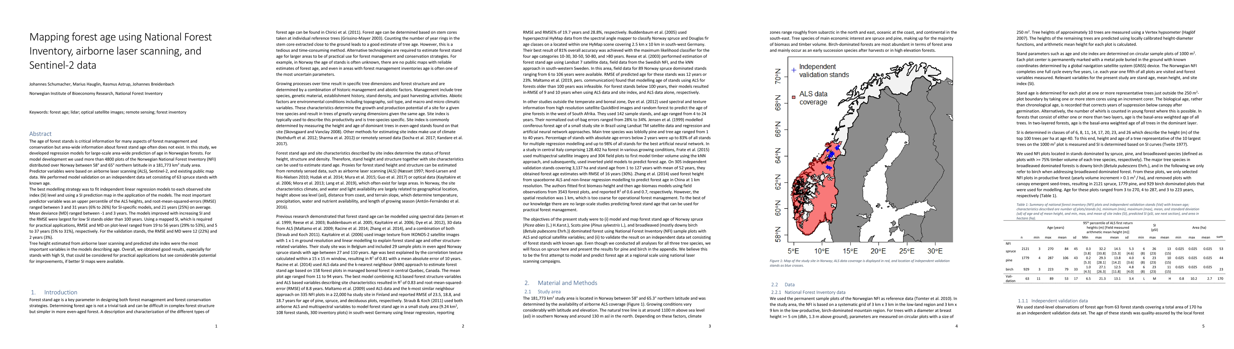
The age of forest stands is critical information for many aspects of forest management and conservation but area-wide information about forest stand age often does not exist. In this study, we devel...

Thumbnail for National mapping and estimation of forest area by dominant tree species
  using Sentinel-2 data

National mapping and estimation of forest area by dominant tree species using Sentinel-2 data

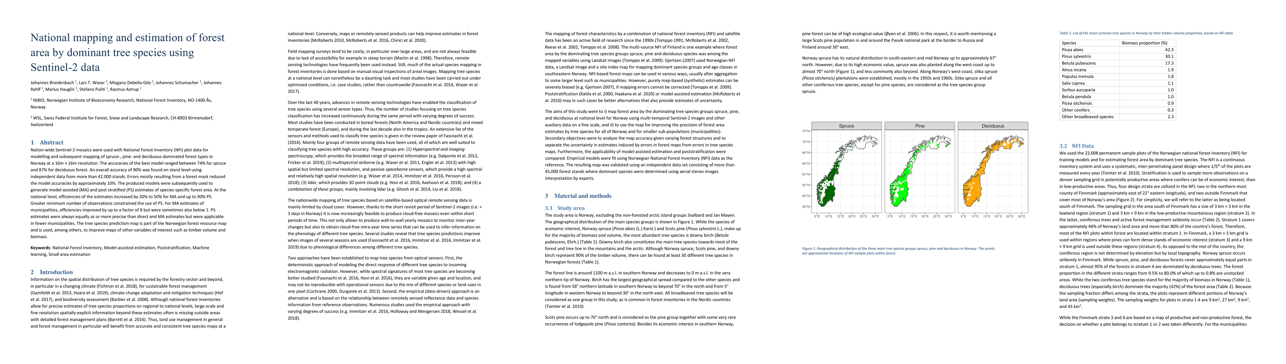
Nation-wide Sentinel-2 mosaics were used with National Forest Inventory (NFI) data for modelling and subsequent mapping of spruce, pine and deciduous forest in Norway in 16 m $\times$ 16 m resolutio...

Thumbnail for Pan-European fuel map server: an open-geodata portal for supporting fire
  risk assessment

Pan-European fuel map server: an open-geodata portal for supporting fire risk assessment

Canopy fuels and surface fuel models, topographic features and other canopy attributes such as stand height and canopy cover, provide the necessary spatial datasets required by various fire behaviour ...

This website uses cookies to ensure you get the best experience. Learn more