Academic Profile
Statistics
Similar Authors
Papers on arXiv
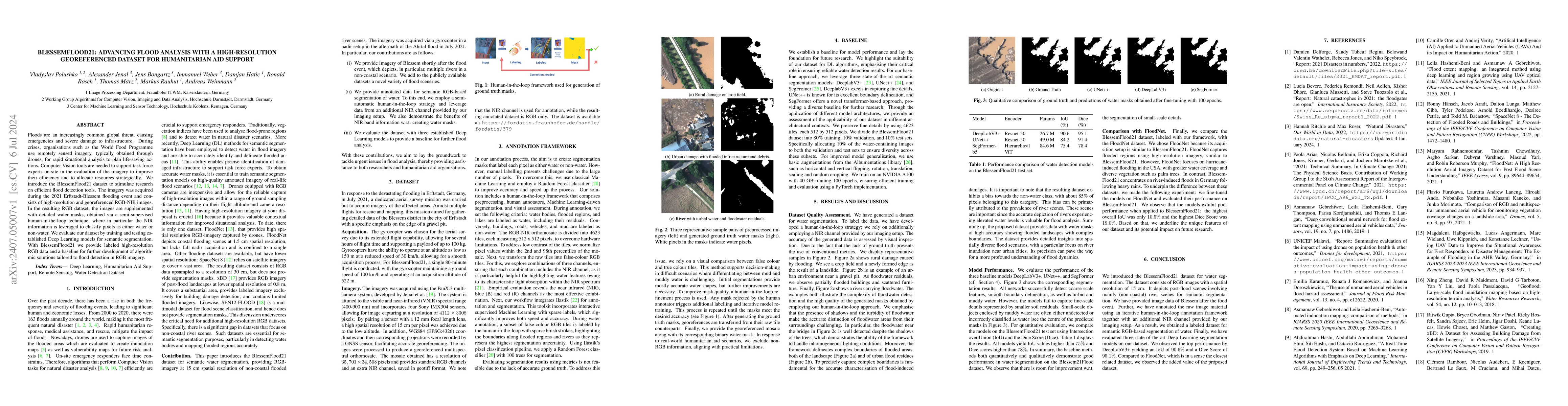
Floods are an increasingly common global threat, causing emergencies and severe damage to infrastructure. During crises, organisations such as the World Food Programme use remotely sensed imagery, typ...
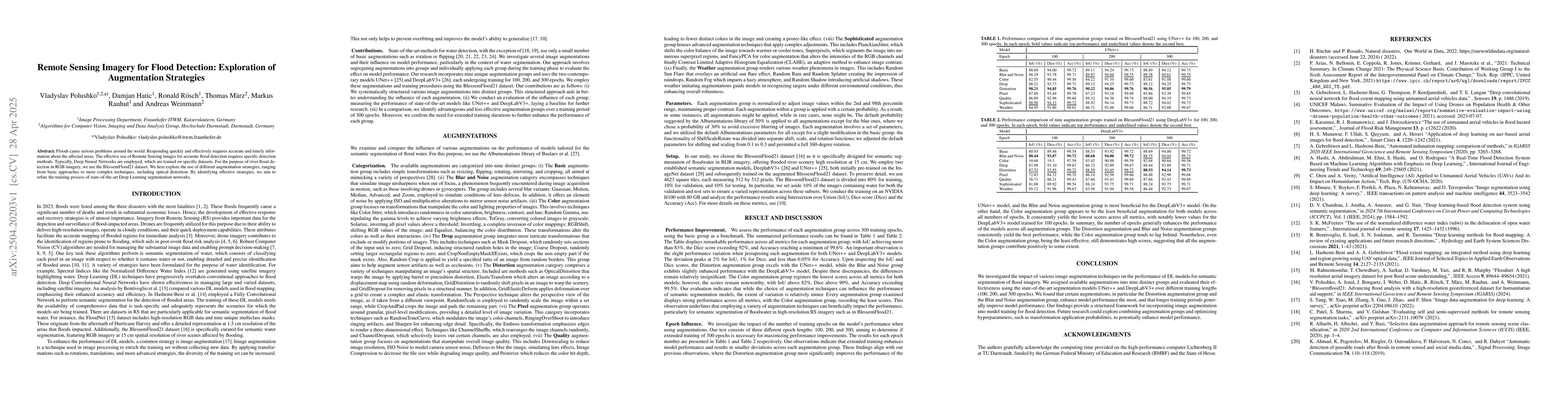
Floods cause serious problems around the world. Responding quickly and effectively requires accurate and timely information about the affected areas. The effective use of Remote Sensing images for acc...
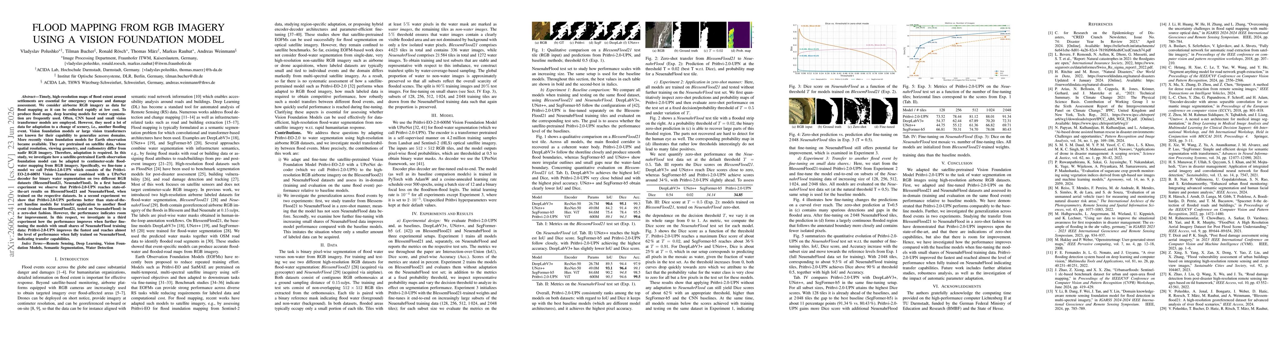
Timely, high-resolution maps of flood extent around settlements are essential for emergency response and damage assessment. We consider airborne RGB imagery for flood mapping as it can be collected ra...