2
arXiv Papers
60
Total Publications
Profile
Academic Profile
Metrics
Statistics
2
arXiv Papers
60
Total Publications
Network
Similar Authors
Publications
Papers on arXiv
arXiv
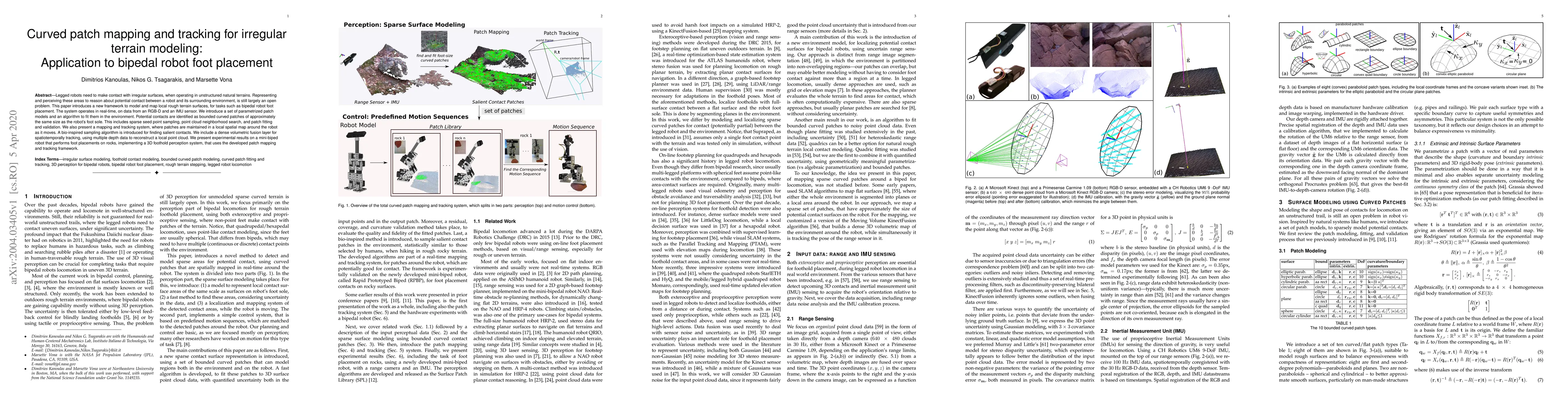
Curved patch mapping and tracking for irregular terrain modeling:
Application to bipedal robot foot placement
Legged robots need to make contact with irregular surfaces, when operating in unstructured natural terrains. Representing and perceiving these areas to reason about potential contact between a robot...

arXiv
The Landform Contextual Mesh: Automatically Fusing Surface and Orbital
Terrain for Mars 2020
The Landform contextual mesh fuses 2D and 3D data from up to thousands of Mars 2020 rover images, along with orbital elevation and color maps from Mars Reconnaissance Orbiter, into an interactive 3D t...